Kolhapur district
Kolhapur district is in Maharashtra state. The city of Kolhapur is the district headquarters. As of 2011, the district had population of 3,876,001, of which 33% were urban.
Kolhapur district | |
|---|---|
District of Maharashtra | |
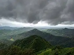 Bhuibawada Ghat | |
 Location of Kolhapur district in Maharashtra | |
| Country | |
| State | Maharashtra |
| Division | Pune Division |
| Headquarters | Kolhapur |
| Tehsils | 1. Gadhinglaj, 2. Karveer, 3. Bhudargad, 4. Panhala, 5. Kagal, 6. Shirol, 7. Hatkanangale, 8. Ajara, 9. Chandgad, 10. Gaganbawada, 11. Radhanagari, 12. Shahuwadi |
| Government | |
| • Lok Sabha constituencies | 1. Kolhapur, 2. Hatkanangle (shared with Sangli District), based on (Election Commission website) |
| Area | |
| • Total | 7,685 km2 (2,967 sq mi) |
| Population (2011) | |
| • Total | 3,876,001 |
| • Density | 500/km2 (1,300/sq mi) |
| • Urban | 32% |
| Demographics | |
| • Literacy | 89% |
| Time zone | UTC+05:30 (IST) |
| Major highways | NH-4, NH-204 |
| Average annual precipitation | 1035 mm |
| Website | kolhapur |
Demographics
According to the 2011 census Kolhapur district has a population of 3,876,001. This gives it a ranking of 65th in India (out of a total of 640). The district has a population density of 504 inhabitants per square kilometre (1,310/sq mi). Its population growth over the decade 2001-2011 was 9.96%. Kolhapur has a sex ratio of 953 females for every 1000 males.
At the time of the 2011 Census of India, 89.16% of the population in the district spoke Marathi, 3.84% Hindi, 2.70% Urdu and 2.00% Kannada as their first language.[1]
The district has three centres of tourism, the Mahalaxmi temple and karveer peeth jagadguru shankaracharya math in the city of Kolhapur and Jyotiba temple in Wadi ratnagiri.[2]
| Year | Pop. | ±% p.a. |
|---|---|---|
| 1901 | 872,720 | — |
| 1911 | 792,681 | −0.96% |
| 1921 | 794,673 | +0.03% |
| 1931 | 908,317 | +1.35% |
| 1941 | 1,039,279 | +1.36% |
| 1951 | 1,267,609 | +2.01% |
| 1961 | 1,552,636 | +2.05% |
| 1971 | 2,001,973 | +2.57% |
| 1981 | 2,457,095 | +2.07% |
| 1991 | 2,989,507 | +1.98% |
| 2001 | 3,523,162 | +1.66% |
| 2011 | 3,876,001 | +0.96% |
| source:[3] | ||
Educational Institutions
The Kolhapur district has a good number of educational institutions that provide a range of educational programs - from KG to PG and beyond. The district has Shivaji University located in the city of Kolhapur. The university provides various master and Ph.D. level programs. Shivaji University covers three districts - Kolhapur, Sangli and Satara under its jurisdiction. Apart from the university, Kolhapur district has a number of other renowned educational institutions like CSIBER-Chhatrapati Shahu Institute of Business Education and Research, Rajaram College Kolhapur, Swami Vivekanand College Kolhapur, D. Y. Patil College of Engineering and Technology, Chhatrapati Shahu Maharaj Government Medical College, Mouni Vidyapeeth, KIT College of Engineering Kolhapur, etc. Kolhapur District is enriched in terms of the availability of quality education of all kinds.
Administration and Divisions
| Name of Division (Headquarter) | Sr. No. | Districts | Administration | Sub-Division | Taluka | Source |
|---|---|---|---|---|---|---|
| Pune Division HQ=Pune Districts=5 SubDivisions=31 Talukas=64 |
1. | Kolhapur District | HQ-Kolhapur Sub-Divisions-6 Taluka-12 |
Panhala | District website | |
| Ichalkaranji | ||||||
| Karvir | ||||||
| Radhanagari | ||||||
| Bhudargad | ||||||
| Gadhinglaj | ||||||
See also
References
- 2011 Census of India, Population By Mother Tongue
- "AAI proposal to acquire 11ha land for airport soon: MP - Times of India". The Times of India. Retrieved 2017-09-19.
- Decadal Variation In Population Since 1901
External links
| Wikimedia Commons has media related to Kolhapur district. |
Places adjacent to Kolhapur district | ||||||||||
|---|---|---|---|---|---|---|---|---|---|---|
| ||||||||||
| Topics | |||||||||||||
|---|---|---|---|---|---|---|---|---|---|---|---|---|---|
| Regions | |||||||||||||
| Divisions and Districts |
| ||||||||||||
| Million-plus cities in Maharashtra | |||||||||||||
| Other cities with municipal corporations | |||||||||||||
Portal:India | |||||||||||||
Kolhapur district topics | |||||
|---|---|---|---|---|---|
| History | | ||||
| Geography | |||||
| Cities and towns | |||||
| Transport | |||||
| Visitor attractions | |||||
| Culture | |||||
| Education | |||||
| Lok Sabha constituencies | |||||
| Vidhan Sabha constituencies |
| ||||
| Taluka/Tehsil | |||||
| Stadiums | |||||
‡ This constituency also has portions in Sangli district
| |||||