List of Category A listed buildings in the Old Town, Edinburgh
This is a list of Category A listed buildings in the Old Town of Edinburgh, Scotland.
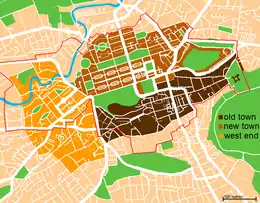
The Old Town, shown in dark brown
For the main list, see List of Category A listed buildings in Edinburgh.
Boundaries
The Old Town is defined here as the area around the Royal Mile, shown in dark brown on the map to the right. As well as the Royal Mile, it encompasses the Grassmarket, Cowgate, and Canongate areas, along with a number of areas with predominantly more modern construction.
- to the north, the southern edge of Princes Street Gardens, Waterloo Place and Regent Road
- This excludes the lower parts of the Mound, with a boundary running approximately along Market Street. This omits Princes Street Gardens and Waverley Station, as well as the Balmoral Hotel and the old Post Office building at the north end of North Bridge. However, other structures on the southern side of Waterloo Place/Regent Road are included.
- to the west, Lothian Road
- The north-western boundary point is the junction of Lothian Road and King's Stables Road, with all structures east of Lothian Road included. The boundary runs south along Lothian Road to its junction with Lauriston Place at Tollcross. The southwestern corner – between Lauriston Place and East Fountainbridge, up to Lady Lawson Road – is considered the Old Town for the purposes of this list, but is not included in the UNESCO "Edinburgh Old and New Towns" World Heritage Site listing.
- to the east, Holyrood and the Queen's Park
- The northeastern limit is Regent Road Park, at the junction of Regent Road and the southern end of Easter Road. The eastern boundary runs down Abbeyhill to the Palace of Holyroodhouse – which is included in the Old Town – to the southeastern limit, approximately at the new Scottish Parliament building.
- to the south, Lauriston Place, South College Street, Drummond Street, and Holyrood Road
- From the southeastern limit, the boundary runs west along Holyrood Road to the junction with the Pleasance, moves south slightly, and again runs west along Drummond Street and South College Street, along the southern edge of the Old College building. The boundary then follows Lothian Street, Teviot Place, and Lauriston Place to its junction at Tollcross. The Lauriston Place boundary means that the Old Town includes George Heriot's and the College of Art, but does not include the old Royal Infirmary site.
Listed buildings
| Name | Location | Date Listed | Grid Ref. [note 1] | Geo-coordinates | Notes | LB Number [note 2] | Image |
|---|---|---|---|---|---|---|---|
| Edinburgh City Chambers | 253 High Street | 14 December 1970 | 55°57′01″N 3°11′25″W | 17597 | 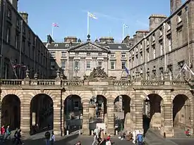
| ||
| Trinity College Church Apse | Chalmer's Close (between High Street and Jeffrey Street) | 14 December 1970 | 55°57′04″N 3°11′08″W | 25747 | 
| ||
| Kirk of the Canongate | 14 December 1970 | 55°57′06″N 3°10′46″W | 26823 | 
| |||
| Greyfriars Kirk | Greyfriars Place | 14 December 1970 | 55°56′48″N 3°11′32″W | 27018 | 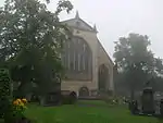
| ||
| Greyfriars Kirkyard | Greyfriars Place | 14 December 1970 | 55°56′45″N 3°11′32″W | 27029 | 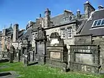
| ||
| Magdalene Chapel | 41 Cowgate | 14 December 1970 | 55°56′53″N 3°11′33″W | 27110 | 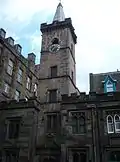
| ||
| St Giles' Cathedral | High Street | 14 December 1970 | 55°56′58″N 3°11′27″W | 27381 | 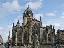
| ||
| The Hub Festival Centre | 348–350 Castlehill | 14 December 1970 | 55°56′56″N 3°11′43″W | 27542 | 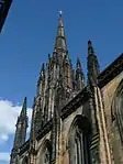
| ||
| General Assembly Hall of the Church of Scotland | The Mound | 14 December 1970 | 55°56′58″N 3°11′43″W | 27689 | .jpg.webp)
| ||
| Tron Kirk | High Street | 14 December 1970 | 55°57′00″N 3°11′16″W | 27552 | 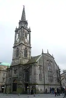
| ||
| Canongate Tolbooth | 163 Canongate | 14 December 1970 | 55°57′06″N 3°10′48″W | Now used by The People's Story Museum | 27582 | 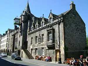
| |
| The Supreme Courts of Scotland | Parliament Square | 14 December 1970 | 55°56′56″N 3°11′25″W | 27699 | 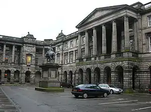
| ||
| Parliament Hall | Parliament Square | 14 December 1970 | 55°56′56″N 3°11′27″W | 27704 | 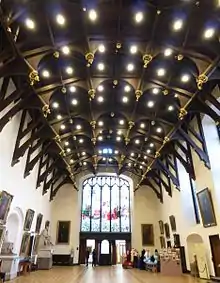
| ||
| Signet Library | Parliament Square | 14 December 1970 | 55°56′57″N 3°11′30″W | 27709 | 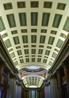
| ||
| District Courts (Formerly Police Chambers) | 1 and 1A Parliament Square | 14 December 1970 | 55°56′58″N 3°11′23″W | 27714 | 
| ||
| National Museum of Scotland | 44 Chambers Street | 14 December 1970 | 55°56′49″N 3°11′22″W | 27748 | 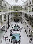
| ||
| St Andrew's House | Regent Road | 14 December 1970 | 55°57′13″N 3°11′02″W | 27756 | 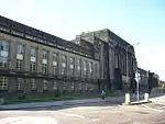
| ||
| St Cecilia's Hall | Cowgate | 14 December 1970 | 55°56′56″N 3°11′11″W | 27760 | 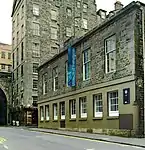
| ||
| Usher Hall | Cambridge Street | 14 December 1970 | 55°56′51″N 3°12′18″W | 27780 | 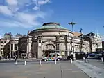
| ||
| Alexander and Bucephalus Statue | High Street, City Chambers Courtyard | 14 December 1970 | 55°57′00″N 3°11′25″W | 27855 | 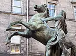
| ||
| Mercat Cross | High Street | 14 December 1970 | 55°56′59″N 3°11′25″W | 27792 | 
| ||
| Memorial to Walter Francis, 5th Duke of Buccleuch and 7th Duke of Queensberry | High Street | 14 December 1970 | 55°56′58″N 3°11′30″W | 27844 | 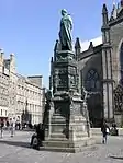
| ||
| Bowfoot Well | West Bow | 21 April 1969 | 55°56′53″N 3°11′40″W | 27893 | 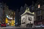
| ||
| Greyfriars Bobby Fountain | George IV Bridge | 29 April 1977 | 55°56′49″N 3°11′29″W | 27899 | 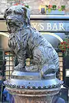
| ||
| George IV Bridge | 14 December 1970 | 55°56′54″N 3°11′31″W | 27942 | 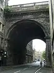
| |||
| Netherbow Wellhead | High Street | 14 December 1970 | 55°57′02″N 3°11′07″W | 27901 | 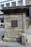
| ||
| Edinburgh College of Art | Lauriston Place | 14 December 1970 | 55°56′45″N 3°11′59″W | 27974 | 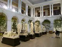
| ||
| King's Bridge | King's Stables Road | 14 December 1970 | 55°56′51″N 3°12′06″W | 27943 | .jpg.webp)
| ||
| Regent Bridge | Over Calton Road | 19 April 1966 | 55°57′13″N 3°11′14″W | 27945 | 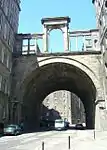
| ||
| George Heriot's School, Main Building | Lauriston Place | 25 July 1966 | 55°56′45″N 3°11′41″W | 27980 | 
| ||
| Old College, University of Edinburgh | South Bridge | 14 December 1970 | 55°56′51″N 3°11′12″W | 27989 | 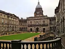
| ||
| Bastion of Flodden Wall, and Telfer Wall (Section) | The Vennel | 14 December 1970 | 55°56′46″N 3°11′49″W | 28006 | 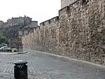
| ||
| Batteries, including Argyle, Dury's, Forewall, Half-Moon, and Western Defences | Edinburgh Castle | 14 December 1970 | 55°56′54″N 3°11′56″W | 28010 | 
| ||
| Esplanade | Edinburgh Castle | 14 December 1970 | 55°56′55″N 3°11′51″W | 28011 | 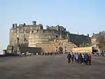
| ||
| Palace of Holyroodhouse | Holyroodhouse | 14 December 1970 | 55°57′10″N 3°10′20″W | 28022 | 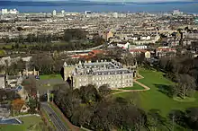
| ||
| Fountain in Forecourt | Palace of Holyroodhouse | 14 December 1970 | 55°57′09″N 3°10′23″W | 28024 | 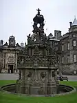
| ||
| Queen Mary's Bath House | Holyroodhouse, Abbeyhill | 14 December 1970 | 55°57′13″N 3°10′27″W | 28028 | 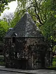
| ||
| 28 and 30 Croft-An-Righ (Croft and Righ House) | Holyroodhouse | 14 December 1970 | 55°57′15″N 3°10′17″W | 28029 | 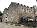
| ||
| Sundial, North Garden | Holyroodhouse | 14 December 1970 | 55°57′13″N 3°10′23″W | 28030 | 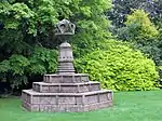
| ||
| Double Tree Hotel (Before 2014 this was the Point Hotel) | 28–36 Bread Street | 1 June 1979 | 55°56′44″N 3°12′13″W | 28347 | 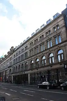
| ||
| 36–42 Candlemaker Row | 14 December 1970 | 55°56′49″N 3°11′30″W | Including Candlemakers' Hall | 28416 | 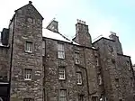
| ||
| Russell House | 3 Canongate | 14 December 1970 | 55°57′10″N 3°10′30″W | 28426 | 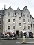
| ||
| Reid's Court, Canongate Manse | 95 Canongate | 14 December 1970 | 55°57′08″N 3°10′39″W | 28429 | 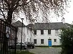
| ||
| Panmure House (Little Lochend Close) | 115 Canongate | 14 December 1970 | 55°57′08″N 3°10′42″W | 28431 |
| ||
| 167 and 169 Canongate | 14 December 1970 | 55°57′05″N 3°10′49″W | 28433 | 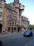
| |||
| Queensberry House | 64 Canongate | 14 December 1970 | 55°57′07″N 3°10′34″W | 28440 | 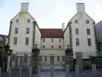
| ||
| Huntly House | 142 and 146 Canongate | 14 December 1970 | 55°57′05″N 3°10′46″W | Occupied by the Museum of Edinburgh | 28445 | 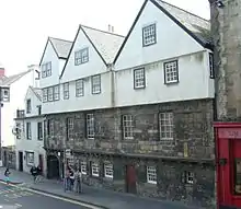
| |
| Acheson House | 140 Canongate | 14 October 1970 | 55°57′04″N 3°10′45″W | 28446 | 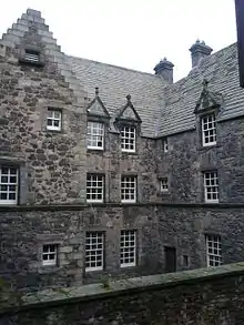
| ||
| Moray House | 174 Canongate | 14 December 1970 | 55°57′04″N 3°10′50″W | 28449 | 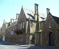
| ||
| 3, 4, 5, 6 and 6B Chessel's Court (S Block) including St Saviour's Child Garden | Canongate | 14 December 1970 | 55°57′01″N 3°10′59″W | 28454 | 
| ||
| Outlook Tower | 549 Castlehill | 14 December 1970 | 55°57′00″N 3°11′38″W | 28488 | 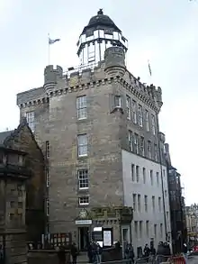
| ||
| Boswell's Court | 352 Castlehill | 14 December 1970 | 55°56′56″N 3°11′44″W | 28489 | 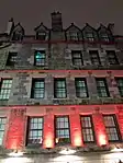
| ||
| Cannonball House | 356 Castlehill and 2 Castle Wynd North | 14 December 1970 | 55°56′56″N 3°11′46″W | 28491 | 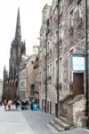
| ||
| 139 Cowgate, Former Tailor's Hall | 14 December 1970 | 55°56′53″N 3°11′24″W | 28595 |
| |||
| Library for Solicitors in the Supreme Courts of Scotland | 94–114 Cowgate | 12 December 1974 | 55°56′55″N 3°11′26″W | 28600 | 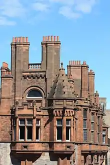
| ||
| 98 Grassmarket | 21 April 1969 | 55°56′53″N 3°11′41″W | 28943 | .jpg.webp)
| |||
| John Knox House | 45 High Street | 14 December 1970 | 55°57′02″N 3°11′06″W | 29033 | 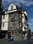
| ||
| Moubray House | 51–55 High Street | 14 December 1970 | 55°57′02″N 3°11′07″W | 29034 | 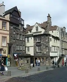
| ||
| 197–207 High Street including 1–14 Fleshmarket Close | 14 December 1970 | 55°57′01″N 3°11′19″W | 29045 | 
| |||
| 209–213 High Street including 1–6 Jackson's Close | 14 December 1970 | 55°57′01″N 3°11′20″W | 29046 |
| |||
| 215–219 High Street | 14 December 1970 | 55°57′01″N 3°11′20″W | 29047 |
| |||
| 221–231 High Street | 14 December 1970 | 55°57′00″N 3°11′21″W | 29048 |
| |||
| 233–243 High Street | 14 December 1970 | 55°57′00″N 3°11′22″W | 29049 |
| |||
| 343–363 High Street and 2–8 Advocate's Close | 14 December 1970 | 55°56′59″N 3°11′29″W | 29050 | 
| |||
| 367–381 High Street | 14 December 1970 | 55°56′59″N 3°11′30″W | 29052 | 
| |||
| Adam Bothwell's House | High Street, 3 Advocate's Close | 14 December 1970 | 55°57′00″N 3°11′30″W | 29053 |
| ||
| Lord Reid Building | High Street, New Assembly Close | 14 December 1970 | 55°56′58″N 3°11′19″W | 29069 |
| ||
| 435 Lawnmarket, including Deacon Brodie's Tavern | 14 December 1970 | 55°56′59″N 3°11′35″W | 29227 | 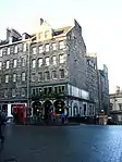
| |||
| Lady Stair's House | Lady Stair's Close, Lawnmarket | 14 December 1970 | 55°56′59″N 3°11′37″W | 29231 | 
| ||
| Gladstone's Land | 481 and 483 Lawnmarket | 14 December 1970 | 55°56′58″N 3°11′38″W | 29233 | 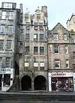
| ||
| 491–495 Lawnmarket | 14 December 1970 | 55°56′58″N 3°11′38″W | 29234 |
| |||
| Milne's Court, including Edward Salveson Hall and Philip Henman Hall | 513–521 Lawnmarket | 14 December 1970 | 55°56′57″N 3°11′40″W | 29237 | 
| ||
| 302–310 Lawnmarket, including Buchanan's Close and Brodie's Close | 14 December 1970 | 55°56′57″N 3°11′35″W | 29239 |
| |||
| 312–320 Lawnmarket, including Fisher's Close | 14 December 1970 | 55°56′57″N 3°11′37″W | 29240 |
| |||
| 322–328 Lawnmarket, including Riddles Court, Riddles Close and 5 and 6 Victoria Terrace | 14 December 1970 | 55°56′56″N 3°11′37″W | 29242 | 
| |||
| 89 West Bow | 21 April 1969 | 55°56′54″N 3°11′41″W | 29903 | 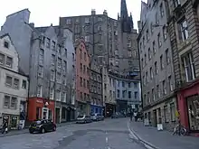
| |||
| 91 and 93 West Bow, including Crocket's Land | 21 April 1969 | 55°56′54″N 3°11′41″W | 29904 |
| |||
| 95–99 West Bow | 21 April 1969 | 55°56′54″N 3°11′41″W | 29905 |
| |||
| 101 and 103 West Bow | 21 April 1969 | 55°56′53″N 3°11′41″W | 29906 |
| |||
| Black Watch (South African War) Memorial | Bank Street (Corner Market Street) | 12 December 1974 | 55°57′00″N 3°11′40″W | 30034 | 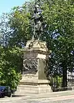
| ||
| North Bridge | 12 December 1974 | 55°57′06″N 3°11′17″W | 30035 | 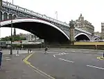
| |||
| Lauriston Place Fire Station | Lauriston Place | 13 August 1987 | 55°56′44″N 3°11′59″W | 30123 | 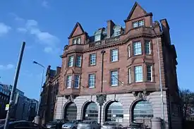
| ||
| 20–52 North Bridge, 175 and 177 High Street and 65–71 Cockburn Street | 12 December 1974 | 55°57′03″N 3°11′18″W | Including Scotsman Hotel, Scotsman Steps, Arcade, and Royal Mile Mansions | 30143 | 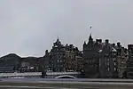
| ||
| 26–28 Castle Terrace | 14 December 1970 | 55°56′50″N 3°12′11″W | 47853 | 
| |||
| 29 Castle Terrace | 14 December 1970 | 55°56′50″N 3°12′09″W | 47854 |
| |||
| 30, 31 and 32 Castle Terrace | 14 December 1970 | 55°56′49″N 3°12′09″W | 47855 | 
| |||
| 33, 34 and 35 Castle Terrace | 14 December 1970 | 55°56′49″N 3°12′10″W | 47856 | 
| |||
| 36 Castle Terrace | 14 December 1970 | 55°56′48″N 3°12′10″W | 47857 | 
| |||
| Victoria Terrace, with steps leading from Victoria Street to Upper Bow | 29 March 2001 | 55°56′55″N 3°11′39″W | 47901 | 
| |||
| Edinburgh Castle, Foog's Gate | 14 December 1970 | 55°56′54″N 3°12′01″W | 48217 | 
| |||
| Edinburgh Castle, Gatehouse | 14 December 1970 | 55°56′55″N 3°11′55″W | 48218 | 
| |||
| Edinburgh Castle, Governor's House | 14 December 1970 | 55°56′55″N 3°12′04″W | 48219 | 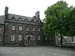
| |||
| Edinburgh Castle, Great Hall | 14 December 1970 | 55°56′53″N 3°12′00″W | 48220 | 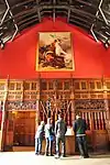
| |||
| Edinburgh Castle, New Barracks | 14 December 1970 | 55°56′54″N 3°12′05″W | 48224 | 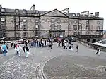
| |||
| Edinburgh Castle, Palace Block | 14 December 1970 | 55°56′53″N 3°11′58″W | 48226 | 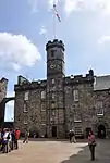
| |||
| Edinburgh Castle, Portcullis Gate and Argyle Tower | 14 December 1970 | 55°56′56″N 3°11′59″W | 48227 | 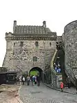
| |||
| Edinburgh Castle, St Margaret's Chapel | 14 December 1970 | 55°56′55″N 3°12′00″W | 48228 | 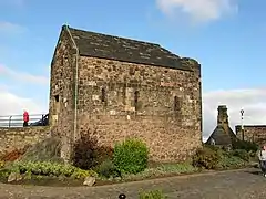
| |||
| Edinburgh Castle, Scottish National War Memorial | 14 December 1970 | 55°56′54″N 3°11′59″W | 48229 | 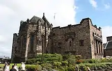
| |||
| Edinburgh Castle, United Services Museum | 14 December 1970 | 55°56′54″N 3°12′01″W | 48231 | 
| |||
| Edinburgh Castle, Vaults | 14 December 1970 | 55°56′54″N 3°12′01″W | 48232 | 
| |||
| South African War Memorial | North Bridge | 12 December 1974 | 55°57′06″N 3°11′17″W | 49067 | 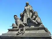
| ||
| 1 and 2 Chessel's Court | Canongate | 14 December 1970 | 55°57′03″N 3°10′59″W | 51171 | 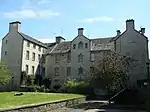
| ||
| Advocates' Library | Parliament Square, Old Town | 14 December 1970 | 55°56′56″N 3°11′30″W | 51179 | 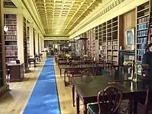
| ||
| Blackie House | North Bank Street and Wardrop's Court, Old Town | 14 December 1970 | 55°57′00″N 3°11′36″W | 51522 | 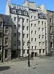
| ||
| Royal Lyceum Theatre | Grindlay Street | 12 December 1974 | 55°56′49″N 3°12′15″W | 30031 | 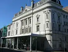
| ||
| 1–3 Ramsay Garden | 14 December 1970 | 55°56′58″N 3°11′47″W | 29593 | 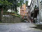
| |||
| 4–10 Ramsay Garden | 14 December 1970 | 55°56′58″N 3°11′47″W | 29594 | .jpg.webp)
| |||
| 11 and 12 Ramsay Garden | 14 December 1970 | 55°56′57″N 3°11′49″W | 29595 | 
| |||
| Patrick Geddes Hall (Part) | 1 Mound Place | 14 December 1970 | 55°56′59″N 3°11′45″W | 29379 | %252C_1_Mound_Place%252C_Edinburgh.jpg.webp)
| ||
| Patrick Geddes Hall (Part) | 2 Mound Place | 14 December 1970 | 55°56′59″N 3°11′45″W | 29380 | %252C_2_Mound_Place_(Mound_Place%252C_Lister_House)%252C_Edinburgh_(1).jpg.webp)
| ||
| 11, 12 and 13 North Bank Street | 14 December 1970 | 55°56′59″N 3°11′38″W | 29236 | 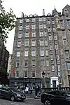
| |||
| Dolphin House | 3, 4 and 5 Hunter Square | 14 December 1970 | 55°56′59″N 3°11′18″W | 29123 | 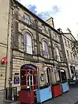
| ||
| Former Skinner's Hall | 2–4 New Skinner's Close | 14 December 1970 | 55°56′59″N 3°11′07″W | 28325 | 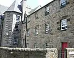
| ||
| Bank of Scotland | 11 Bank Street | 14 December 1970 | 55°57′01″N 3°11′35″W | 28263 | 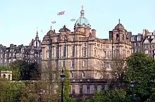
| ||
| 17–20 Bank | 14 December 1970 | 55°56′59″N 3°11′35″W | 28264 |
| |||
| 15 North Bank Street | 14 December 1970 | 55°56′59″N 3°11′40″W | 28265 | 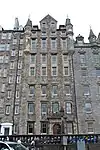
| |||
| 16 North Bank Street | 14 December 1970 | 55°56′59″N 3°11′40″W | 28266 | 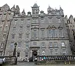
| |||
| Abbey Sanctuary | Abbey Strand | 14 December 1970 | 55°57′10″N 3°10′26″W | 28207 | 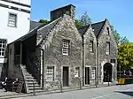
| ||
| Thompson's Court | Abbey Strand | 14 December 1970 | 55°57′10″N 3°10′27″W | 28208 | .jpg.webp)
| ||
| Sacred Heart Church (Roman Catholic) | 28 Lauriston Street | 14 December 1970 | 55°56′42″N 3°12′05″W | 27266 | 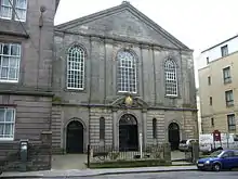
| ||
| Charles II Statue | Parliament Square | 14 December 1970 | 55°56′57″N 3°11′26″W | 27851 | 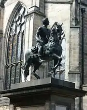
| ||
| Calton Old Burial Ground and Monuments | Regent Road | 19 April 1966 | 55°57′15″N 3°11′10″W | 27920 | 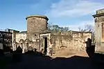
| ||
| 11–15 Cornwall Street | 14 December 1970 | 55°56′50″N 3°12′12″W | 47858 | 
| |||
| 13–16 Ramsay Garden | 14 December 1970 | 55°56′57″N 3°11′48″W | 48247 | 
| |||
| 1–6 India Buildings | Victoria Street | 14 December 1970 | 55°56′55″N 3°11′35″W | 29868 | 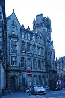
| ||
| Burns Monument | Regent Road | 19 April 1966 | 55°57′12″N 3°10′42″W | 27801 | 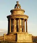
| ||
| 25 Castle Terrace and 17 Cornwall Street | 14 December 1970 | 55°56′50″N 3°12′12″W | 28485 | 
|
Notes
- Sometimes known as OSGB36, the grid reference (where provided) is based on the British national grid reference system used by the Ordnance Survey.
• "Guide to National Grid". Ordnance Survey. Retrieved 12 December 2007.
• "Get-a-map". Ordnance Survey. Retrieved 17 December 2007. - Historic Environment Scotland assign a unique alphanumeric identifier to each designated site in Scotland, for listed buildings this always begins with "LB", for example "LB12345".
References
External links
![]() Media related to Category A listed buildings in Edinburgh at Wikimedia Commons
Media related to Category A listed buildings in Edinburgh at Wikimedia Commons
This article is issued from Wikipedia. The text is licensed under Creative Commons - Attribution - Sharealike. Additional terms may apply for the media files.