List of Category A listed buildings in Edinburgh
This is a list of Category A listed buildings in Edinburgh, Scotland. This list contains all buildings outside the New Town and Old Town areas; those can be found at List of Category A listed buildings in the New Town, Edinburgh and List of Category A listed buildings in the Old Town, Edinburgh
In Scotland, the term listed building refers to a building or other structure officially designated as being of "special architectural or historic interest".[1] Category A structures are those considered to be "buildings of national or international importance, either architectural or historic, or fine little-altered examples of some particular period, style or building type."[2] Listing was begun by a provision in the Town and Country Planning (Scotland) Act 1947, and the current legislative basis for listing is the Planning (Listed Buildings and Conservation Areas) (Scotland) Act 1997.[3] The authority for listing rests with Historic Scotland, an executive agency of the Scottish Government, which inherited this role from the Scottish Development Department in 1991. Once listed, severe restrictions are imposed on the modifications allowed to a building's structure or its fittings. Listed building consent must be obtained from local authorities prior to any alteration to such a structure.[3] There are approximately 47,400 listed buildings in Scotland, of which around 8% (some 3,800) are Category A.[4]
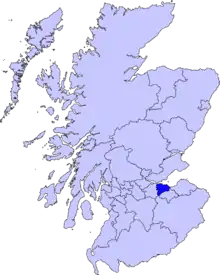
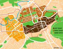
The council area of Edinburgh covers 264 square kilometres (102 sq mi), and has a population of just under 500,000. Edinburgh is centred on the medieval Old Town and the Georgian New Town. To the north is the historic port of Leith, on the shore of the Firth of Forth which is now built up from Cramond to Portobello. The modern city now extends south to the Pentland Hills. Edinburgh council area also includes a rural area to the west, containing several villages including South Queensferry, Kirkliston and Balerno.
There are over 4,500 listed buildings in Edinburgh,[5] of which around 900 are listed at category A. This is many more than any in other council area in Scotland, represents almost 25% of all category A listings in the country and is more than any other city in the world.[6] Buildings protected range from tiny St Margaret's Chapel, the oldest building in Edinburgh,[7] to the Forth Road Bridge, Scotland's longest suspension bridge, opened in 1964.[8]
Listed buildings
- For New Town buildings, see List of Category A listed buildings in the New Town, Edinburgh
- For Old Town buildings, see List of Category A listed buildings in the Old Town, Edinburgh
| Name | Location | Date Listed | Grid Ref. [note 1] | Geo-coordinates | Notes | LB Number [note 2] | Image |
|---|---|---|---|---|---|---|---|
| Dalmeny House | Dalmeny | 22 February 1971 | 55°59′17″N 3°20′05″W | William Wilkins, 1814–17. 2-storey Tudor Gothic country house. | 82 | 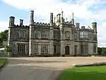
| |
| Dundas Castle | near South Queensferry | 22 February 1971 | 55°58′31″N 3°24′52″W | 5512 | 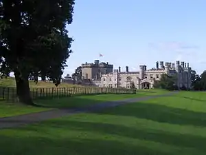
| ||
| Fountain Sundial | Dundas Castle, near South Queensferry | 22 February 1971 | 55°58′31″N 3°24′49″W | 5513 | 
| ||
| Barnbougle Castle | Dalmeny House, Dalmeny | 30 January 1981 | 55°59′31″N 3°20′06″W | James Maitland Wardrop (Wardrop and Reid), 1881, on site of and incorporating fabric from earlier castle | 5548 | 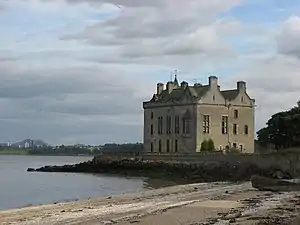
| |
| Sundials | Craigiehall, near Cramond | 30 January 1981 | 55°57′52″N 3°20′15″W | Two 17th-century sundials at Craigiehall | 5559 |
| |
| Dalmeny Kirk (St Cuthbert's) | Dalmeny | 22 February 1971 | 55°58′58″N 3°22′21″W | Church of Scotland. Listing includes kirkyard. | 5570 | 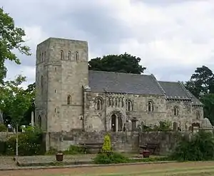
| |
| Baberton House | Baberton | 22 January 1971 | 55°54′33″N 3°17′45″W | 6129 |
| ||
| Currie Parish Church (St Kentigern's) | Currie | 22 January 1971 | 6139 | 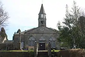
| |||
| Addistoun Dovecot | 22 January 1971 | 55°54′42″N 3°21′17″W | 26697 |
| |||
| Bavelaw Castle | South of Balerno | 22 January 1971 | 55°51′04″N 3°19′53″W | 26701 | 
| ||
| Barclay-Bruntsfield Church and Church Hall | 1 Wright's Houses, Bruntsfield | 14 December 1970 | 55°56′25″N 3°12′12″W | 26720 | 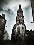
| ||
| 31 Bellfield Street | 14 December 1970 | 55°57′08″N 3°06′27″W | 26749 |
| |||
| Former Leith Central Station offices, including Central and Northern Bars | 7–23 Leith Walk and 2 – 22 Duke Street | 15 July 1983 | 55°58′13″N 3°10′18″W | 26781 | 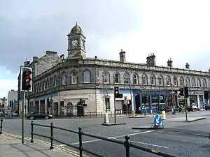
| ||
| Custom House | 67 Commercial Street, EH6 6LH | 14 December 1970 | 55°58′36″N 3°10′15″W | 26787 | 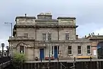
| ||
| Cockburn House (Cockburn Farm Dairy) | 1 Cockburn Farm | 22 January 1971 | 55°52′18″N 3°21′51″W | With boundary wall and sundials | 26792 |
| |
| 25 Bernard Street and 24 and 25 Maritime Street | 14 December 1970 | 55°58′32″N 3°10′04″W | 26809 | 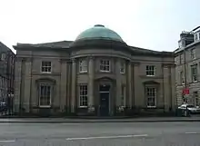
| |||
| Cluny Church Centre | 15 Braid Road | 14/12/1970 | Former South Morningside Free Church and Morningisde South Church | 26810 | 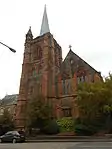
| ||
| 27–31 Bernard Street and 1 Seaport Street | 14 December 1970 | 55°58′32″N 3°10′05″W | 26821 |
| |||
| 72–98 Commercial Street | Leith | 9 January 1987 | 55°58′38″N 3°10′26″W | Incorporates Bond 42 and 63/1X2 and 64/1, 2, Gf and 1F), and 13–15 Dock Place with Gatepiers and Railings | 26825 | 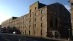
| |
| Bonnington House | near Wilkieston | 22 January 1971 | 55°54′24″N 3°25′23″W | 26826 |
| ||
| Merchiston Castle | Colinton Road | 14 July 1966 | 55°56′00″N 3°12′50″W | Now part of Napier University | 26828 | 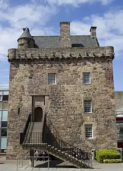
| |
| 102 Commercial Street, Bonds 46, 48 and 35 (Highland and Queen, West Warehouses) | Leith | 9 January 1987 | 55°58′39″N 3°10′31″W | 26838 |
| ||
| Bonnington Dovecot | Bonnington House, Bonnington | 22 January 1971 | 55°54′26″N 3°25′22″W | 26839 |
| ||
| St Michael's Parish Church | Slateford Road | 14 December 1970 | 55°56′12″N 3°13′38″W | 26846 | 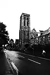
| ||
| Former Catholic Apostolic Church | Mansfield Place and East London Street | 22 September 1965 | 55°57′35″N 3°11′26″W | Latter Bellevue Reformed Baptist Church | 26849 | .jpg.webp)
| |
| Bonnington Sundial | Bonnington House, Bonnington | 13 January 1975 | 55°54′24″N 3°25′25″W | 26853 |
| ||
| Carlowrie House | 30 January 1981 | 55°57′20″N 3°22′33″W | 26879 |
| |||
| Corstorphine Old Parish Church | Corstorphine High Street | 14 December 1970 | 55°56′29″N 3°16′55″W | 26888 | 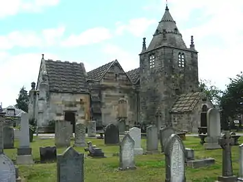
| ||
| Clifton Hall | Newbridge | 30 January 1981 | 55°55′23″N 3°25′35″W | Currently occupied by Clifton Hall School | 26891 | 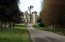
| |
| Haymarket Station Entrance and Office Block | Haymarket Terrace | 27 October 1964 | 55°56′44″N 3°13′06″W | 26901 | _Railway_Station_02.JPG.webp)
| ||
| Cramond Parish Church | 18 Cramond Glebe Road, Cramond | 14 December 1970 | 55°58′40″N 3°18′00″W | 26912 | 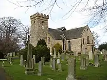
| ||
| Duddingston Parish Church | Old Church Lane, Duddingston | 14 December 1970 | 55°56′28″N 3°08′56″W | 26924 | 
| ||
| Craigiehall Temple | Craigiehall, near Cramond | 14 July 1966 | 55°57′36″N 3°19′50″W | 26928 |
| ||
| 19 Smith's Place | 14 December 1970 | 55°58′01″N 3°10′23″W | 26934 | 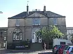
| |||
| Dalmahoy Bridge | Dalmahoy Estate | 22 January 1971 | 55°54′26″N 3°22′02″W | Crosses the Gogar Burn | 26940 |
| |
| Dovecot | Ravelrig Estate, 527 Lanark Road West | 26 October 1994 | 55°53′09″N 3°20′39″W | 27014 |
| ||
| Dalmahoy House | 22 January 1971 | 55°54′14″N 3°22′10″W | 27021 | 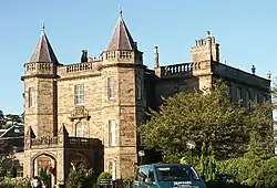
| |||
| St John The Evangelist (Roman Catholic Church) | 35 Brighton Place | 14 December 1970 | 55°57′06″N 3°06′55″W | 27046 |
| ||
| Donaldson's Warehouse | 3 Carpet Lane and 42 The Shore | 12 December 1974 | 55°58′33″N 3°10′09″W | 27078 |
| ||
| Liberton Parish Church | Kirkgate, Liberton | 14 December 1970 | 55°54′48″N 3°09′39″W | 27090 | 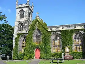
| ||
| Castle Gogar | Glasgow Road | 14 July 1966 | 55°56′32″N 3°20′20″W | 27092 |
| ||
| North Leith Parish Church | 51 Madeira Street, Leith. EH6 4AX | 14 December 1970 | 55°58′33″N 3°10′59″W | 27134 | 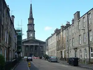
| ||
| 1 and 2 Lockharton Gardens | 14 December 1970 | 55°55′35″N 3°13′56″W | 27137 |
| |||
| Former Corn Exchange | 29-31A and 35 Constitution Street | 14 December 1970 | 55°58′33″N 3°09′58″W | 27140 |
| ||
| Exchange Buildings | 37–43 Constitution Street | 14 December 1970 | 55°58′30″N 3°10′00″W | 27147 | 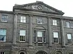
| ||
| Dovecot | Malleny Estate, Balerno | 22 January 1971 | 55°53′05″N 3°20′11″W | 27153 |
| ||
| Malleny House | Balerno | 22 January 1971 | 55°53′09″N 3°20′15″W | 27172 | 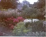
| ||
| Queens Hall | South Clerk Street | 14 December 1970 | 55°56′28″N 3°10′54″W | 27176 | .jpg.webp)
| ||
| Methodist Chapel | Nicolson Square | 14 December 1970 | 55°56′44″N 3°11′10″W | 27185 |
| ||
| Craigentinny Marbles | 3C Craigentinny Crescent | 14 December 1970 | 55°57′26″N 3°08′14″W | Mausoleum of William Henry Miller, MP | 27191 | 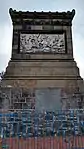
| |
| Restalrig Parish Church | Restalrig | 14 December 1970 | 55°57′28″N 3°08′58″W | 27250 | 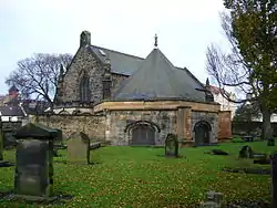
| ||
| St Peter's Church (Roman Catholic) | 77 Falcon Avenue | 14 December 1970 | 55°55′50″N 3°12′22″W | 27257 | 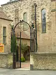
| ||
| Lammerburn | 10 Napier Road | 14 December 1970 | 55°56′00″N 3°12′58″W | 27279 |
| ||
| Former William Ramsay Technical Institute | 90–102(Even Nos) Inchview Terrace, Portobello Road | 26 August 1989 | 55°57′26″N 3°07′28″W | 27288 |
| ||
| Gogar Bank House | Gogar Station Road | 8 March 1994 | 55°55′28″N 3°19′22″W | 27292 |
| ||
| St Anne's Parish Church | St John's Road, Corstorphine | 14 December 1970 | 55°56′32″N 3°16′24″W | 27297 | 
| ||
| Astley Ainslie Hospital, North and South Lodges | Grange | 14 December 1970 | 55°55′43″N 3°12′04″W | 27310 | 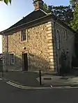
| ||
| Hatton Estate, South Terrace Wall with Pavilions and Bath-House | near Ratho | 22 January 1971 | 55°54′15″N 3°23′43″W | 27334 |
| ||
| Hatton Estate, East Avenue Gates | near Ratho | 22 January 1971 | 55°54′22″N 3°22′43″W | 27341 |
| ||
| 92 Constitution Street | 14 December 1970 | 55°58′26″N 3°10′05″W | 27344 |
| |||
| St Cuthbert's Episcopal Church | Westgarth Avenue | 14 December 1970 | 55°54′27″N 3°15′13″W | 27353 |
| ||
| Bowmont Tower | 39 and 41 Greenhill Gardens | 14 December 1970 | 55°55′58″N 3°12′20″W | 27366 | 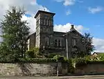
| ||
| St. Georges West Church (Church of Scotland) | Shandwick Place | 14 December 1970 | 55°56′58″N 3°12′38″W | 27367 | 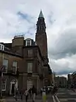
| ||
| North Gate Lodge, Riccarton Estate | Heriot Watt University, Riccarton | 13 January 1975 | 55°55′01″N 3°19′16″W | 27369 |
| ||
| Quayside Mills (McGregor & Co) | 3–9 Quayside Street, EH6 6EJ | 14 December 1970 | 55°58′32″N 3°10′27″W | Incorporating Former Manse, Remains of St Ninian's Church, Tenement, Granary and Mill | 27395 |
| |
| Hermitage of Braid | Off Braid Road | 14 July 1966 | 55°55′12″N 3°12′03″W | 27407 | 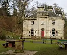
| ||
| Ingliston House | Ingliston | 22 January 1971 | 55°56′25″N 3°22′18″W | Headquarters of the Royal Highland and Agricultural Society of Scotland | 27436 |
| |
| Shieldaig | 24 Hermitage Drive | 14 December 1970 | 55°55′14″N 3°12′05″W | 27440 |
| ||
| Cathedral Church of St. Mary (Episcopal) | Palmerston Place | 14 December 1970 | 55°56′54″N 3°13′00″W | 27441 | 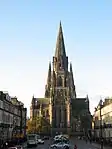
| ||
| The Vaults | Leith | 14 December 1970 | 55°58′26″N 3°10′21″W | Occupied by the Scotch Malt Whisky Society | 27446 |
| |
| Walpole Hall and Song School, St Mary's Cathedral | Chester Street and Palmerston Place | 14 December 1970 | 55°56′57″N 3°13′01″W | 27448 | 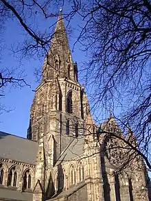
| ||
| Stables and Gardener's House, Ingliston House | Ingliston | 8 March 1994 | 55°56′28″N 3°22′11″W | 27451 |
| ||
| Kirkliston Parish Church | High Street, Kirkliston | 22 February 1971 | 55°57′16″N 3°24′12″W | 27457 | 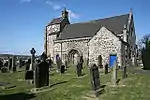
| ||
| South Leith Parish Church | 1 and 2 Kirkgate | 14 December 1970 | 55°58′19″N 3°10′14″W | 27466 | .jpg.webp)
| ||
| St Michael and All Saints Church (Episcopal) | 28 Brougham Street | 14 December 1970 | 55°56′36″N 3°12′05″W | 27489 | 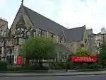
| ||
| St Peter's Church (Episcopal) | 16 Lutton Place, Newington | 14 December 1970 | 55°56′24″N 3°10′44″W | 27514 | .JPG.webp)
| ||
| Newliston House | Kirkliston | 22 February 1971 | 55°56′48″N 3°25′31″W | 27578 | 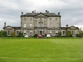
| ||
| Coach House and Stables and Home Farm, Newliston House | Kirkliston | 22 February 1971 | 55°56′43″N 3°25′31″W | 27588 |
| ||
| Drumsheugh Baths | 5 Belford Road, Hawthornbank Lane | 14 December 1970 | 55°57′08″N 3°12′59″W | 27621 | 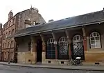
| ||
| Ratho Hall | 22 January 1971 | 55°55′27″N 3°23′09″W | 27647 |
| |||
| Pilrig Dalmeny Church (Church of Scotland) | Leith Walk | 12 December 1974 | 55°57′50″N 3°10′41″W | 27649 | 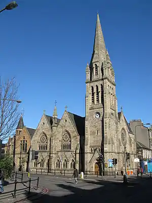
| ||
| King's Theatre | 2 Leven Street | 14 December 1970 | 55°56′31″N 3°12′10″W | 27656 | 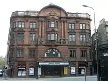
| ||
| Ratho Park | Ratho | 22 January 1971 | 55°55′24″N 3°21′41″W | 27661 | 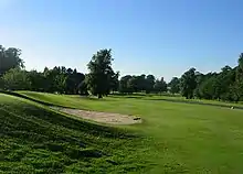
| ||
| Ratho Kirk (St Mary's Church) | Baird Road, Ratho | 22 January 1971 | 55°55′28″N 3°22′49″W | 27685 | 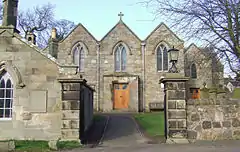
| ||
| Craig House | Craiglockart Hill | 28 August 1979 | 55°55′17″N 3°13′36″W | 27736 | 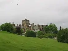
| ||
| Royal Observatory | Blackford Hill | 14 December 1970 | 55°55′23″N 3°11′16″W | 27740 | 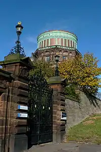
| ||
| Surgeon's Hall | Nicolson Street | 14 December 1970 | 55°56′48″N 3°11′06″W | 27772 | 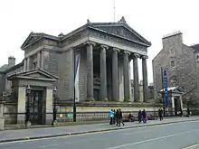
| ||
| Almond Aqueduct | West of Ratho | 22 February 1971 | 55°55′13″N 3°26′02″W | 27793 | 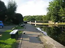
| ||
| Trinity House | 99 New Kirkgate | 14 December 1970 | 55°58′20″N 3°10′17″W | 27834 | 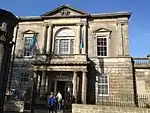
| ||
| Pilrig House | 30 Pilrig House Close | 14 July 1966 | 55°58′10″N 3°10′53″W | 27841 | 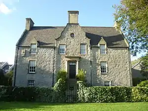
| ||
| William Gladstone Memorial | Coates Crescent and Shandwick Place | 14 December 1970 | 55°56′55″N 3°12′44″W | 27856 | 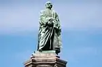
| ||
| Leith Police Station | 29–41 Queen Charlotte Street | 14 December 1970 | 55°58′25″N 3°10′03″W | Former Town Hall | 27857 | %252C_Edinburgh.jpg.webp)
| |
| 2nd Viscount Melville Monument | Melville Crescent | 14 December 1970 | 55°56′59″N 3°12′50″W | 27866 | 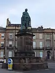
| ||
| Leith Signal Tower | 1 and 2 Shore and 2 Tower Street | 14 December 1970 | 55°58′39″N 3°10′08″W | 27884 | 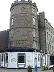
| ||
| 36 and 37 Shore and 59–61 Bernard Street | 14 December 1970 | 55°58′34″N 3°10′10″W | 27890 |
| |||
| St Bernard's Well | Off St Bernard's Bridge | 14 December 1970 | 55°57′19″N 3°12′41″W | 27905 | 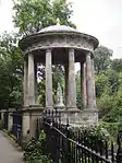
| ||
| Large Palm House | Botanical Gardens | 14 December 1970 | 55°58′01″N 3°12′30″W | 27914 | 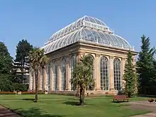
| ||
| Lamb's House | 19 Water Street | 14 December 1970 | 55°58′31″N 3°10′11″W | 27915 | 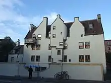
| ||
| Memorial to Sir Charles Linnaeus | Botanical Gardens | 14 December 1970 | 55°58′01″N 3°12′27″W | 27916 | 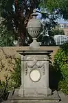
| ||
| Dean Cemetery | Dean Path, Queensferry Road | 15 June 1965 | 55°57′03″N 3°13′22″W | 27924 | 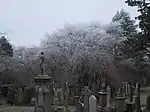
| ||
| Warriston Cemetery | Warriston Road | 16 July 1992 | 55°58′05″N 3°11′53″W | 27937 | 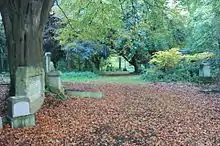
| ||
| Cramond Old Bridge | Brae Park Road | 14 December 1970 | 55°57′55″N 3°18′58″W | 27940 | 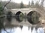
| ||
| Dean Bridge | Queensferry Road | 15 June 1965 | 55°57′11″N 3°12′52″W | 27941 | 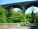
| ||
| Stewart's Melville College (Former Daniel Stewart's College) | 3 Queensferry Road | 15 June 1965 | 55°57′17″N 3°13′36″W | Includes Art Room, North Gatelodge, Boundary Walls and Gates | 27967 | 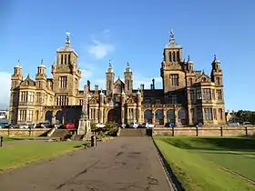
| |
| Dean Gallery (Former Dean Orphanage) | 73 Belford Road | 15 June 1965 | 55°57′07″N 3°13′27″W | 27969 | 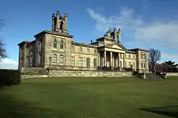
| ||
| Donaldson's Hospital (School For The Deaf) | 1B West Coates | 25 February 1965 | 55°56′50″N 3°13′33″W | Includes Chapel, Fountain, Steps and Balustrades to Terraces, Pavilions, Boundary Wall, Piers, Railings, Gatepiers, Gates, East Lodge (1C West Coates) & West Lodge (1A West Coates) | 27971 | 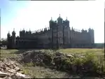
| |
| Edinburgh Academy | 48 Henderson Row | 14 December 1970 | 55°57′39″N 3°12′16″W | 27973 | 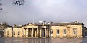
| ||
| Fettes College | Carrington Road | 27 October 1965 | 55°57′50″N 3°13′35″W | 27975 | 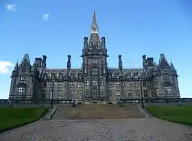
| ||
| Scottish National Gallery of Modern Art | 75 Belford Road | 15 June 1965 | 55°57′04″N 3°13′31″W | Former John Watson's School, including N and S Gate Lodges, Piers and Gates | 27982 | 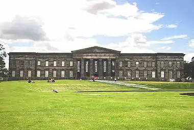
| |
| New Building, University of Edinburgh | 22–23 Teviot Place | 14 July 1966 | 55°56′41″N 3°11′26″W | 27992 | 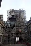
| ||
| McEwan Hall | 15 Bristo Square | 14 July 1966 | 55°56′43″N 3°11′23″W | 27993 | 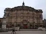
| ||
| Reid School of Music, University of Edinburgh | Teviot Row | 14 July 1966 | 55°56′42″N 3°11′21″W | 27995 | 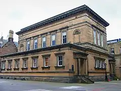
| ||
| Lauriston Castle | Cramond Road South | 14 July 1966 | 55°58′16″N 3°16′43″W | 28019 | 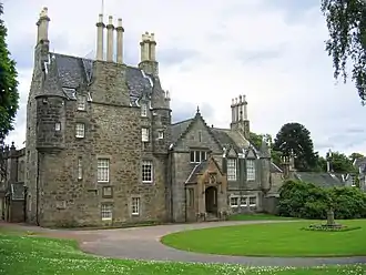
| ||
| Liberton Tower | Liberton Drive | 14 July 1966 | 55°54′52″N 3°10′39″W | 28021 | 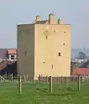
| ||
| Beechwood House (Murrayfield Hospital) | 122 Corstorphine Road | 14 July 1966 | 55°56′38″N 3°15′52″W | 28031 | 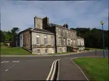
| ||
| Belmont House | Belmont Drive | 14 July 1966 | 55°56′50″N 3°15′07″W | 28032 |
| ||
| Bonaly Tower | 65 Bonaly Road | 14 December 1970 | 55°53′51″N 3°15′34″W | 28033 | 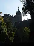
| ||
| Brunstane House | 31, 33 Brunstane Road South | 14 December 1970 | 55°56′24″N 3°05′38″W | 28034 |
| ||
| Caroline Park House and Royston House | 5 Caroline Park | 14 July 1966 | 55°58′54″N 3°14′28″W | 28040 |
| ||
| Merchiston Castle School | Colinton Road | 14 July 1966 | 55°54′43″N 3°15′20″W | 28042 | 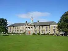
| ||
| Old Craig House | Craiglockart Hill | 14 December 1970 | 55°55′22″N 3°13′35″W | 28046 | 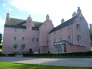
| ||
| The Drum with Sundial | Gilmerton | 14 July 1966 | 55°54′31″N 3°07′13″W | 28052 |
| ||
| Drylaw House | Off Groathill Road North | 27 October 1965 | 55°57′52″N 3°15′11″W | 28060 |
| ||
| Duddingston House | 14 July 1966 | 55°56′21″N 3°08′13″W | 28065 | 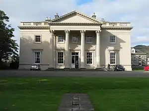
| |||
| Duddingston House Temple | Duddingston Golf Course | 14 July 1966 | 55°56′33″N 3°08′11″W | 28068 |
| ||
| Easter Coates House | 32 Manor Place | 14 December 1970 | 55°56′56″N 3°13′00″W | Formerly Old Coates House | 28070 | 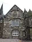
| |
| Inch House | Glenallan Drive, Old Dalkeith Road, and Gilmerton Road | 14 July 1966 | 55°55′30″N 3°09′32″W | 28078 |
| ||
| Former Kingston Clinic | 80–84 Kingston Avenue | 12 December 1974 | 55°55′10″N 3°09′04″W | 28082 |
| ||
| Liberton House | Liberton Drive | 14 July 1966 | 55°54′41″N 3°10′22″W | 28086 |
| ||
| Marionville | 232 Marionville Road | 14 December 1970 | 55°57′32″N 3°09′15″W | 28089 |
| ||
| Morton House | 19 Winton Loan | 14 July 1966 | 55°53′50″N 3°11′38″W | 28092 |
| ||
| Morton House Belvedere | 19 Winton Loan | 14 July 1966 | 55°53′46″N 3°11′34″W | 28094 |
| ||
| Mortonhall House | 47 and 49 Mortonhall Gate | 14 July 1966 | 55°54′10″N 3°10′55″W | 28096 | 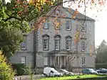
| ||
| Muirhouse | 36 Marine Drive | 14 July 1966 | 55°58′42″N 3°15′57″W | 28099 |
| ||
| Murrayfield House | 66 Murrayfield Avenue | 14 July 1966 | 55°56′57″N 3°14′25″W | 28100 | 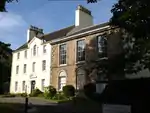
| ||
| Peffermill House | Peffermill Road | 14 July 1966 | 55°55′57″N 3°08′56″W | 28106 |
| ||
| Prestonfield House Hotel | 71 Priestfield Road | 14 July 1966 | 55°56′12″N 3°09′26″W | 28107 | 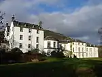
| ||
| Former Stables, Prestonfield House | 71 Priestfield Road | 14 July 1966 | 55°56′14″N 3°09′31″W | 28108 |
| ||
| Ravelston House, Mary Erskine School | Ravelston Dykes Road | 14 July 1966 | 55°57′10″N 3°15′15″W | 28110 | 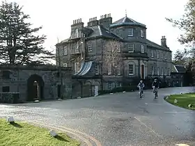
| ||
| Ravelston Tower (Old Ravelston House) | Ravelston Dykes Road | 14 July 1966 | 55°57′08″N 3°15′22″W | 28113 |
| ||
| Roseburn House | 68 Roseburn Street | 14 July 1966 | 55°56′35″N 3°14′13″W | 28120 |
| ||
| Stenhouse Mill (House) | Stenhouse Mill Lane and Crescent | 14 December 1970 | 55°55′46″N 3°15′20″W | 28125 | 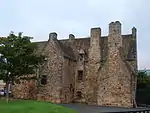
| ||
| Dovecot | 2 Dovecot Road, Corstorphine | 14 December 1970 | 55°56′20″N 3°16′53″W | 28135 | 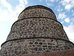
| ||
| Inch Dovecot | Gilmerton Road | 14 July 1966 | 55°55′23″N 3°09′52″W | 28140 |
| ||
| Liberton House Dovecot | Liberton Drive | 14 July 1966 | 55°54′43″N 3°10′19″W | 28141 |
| ||
| Redhall House Dovecote | Craiglockhart Drive South | 14 July 1966 | 55°55′11″N 3°14′56″W | 28145 |
| ||
| Former Bell's Mills Granary | Belford Road | 15 June 1965 | 55°57′01″N 3°13′20″W | 28149 |
| ||
| 1, 3 Alva Street, 12,13,14 Queensferry Street | 14 December 1970 | 55°57′02″N 3°12′35″W | 28235 |
| |||
| 5–25 Alva Street | 14 December 1970 | 55°57′02″N 3°12′36″W | 28236 |
| |||
| 27, 29, 31 Alva Street | 14 December 1970 | 55°56′59″N 3°12′39″W | 28237 |
| |||
| 2, 4 Alva Street, 15, 17 Queensferry Street | 14 December 1970 | 55°57′03″N 3°12′36″W | 28238 |
| |||
| 6–26 Alva Street | 14 December 1970 | 55°57′02″N 3°12′37″W | 28239 |
| |||
| 28, 30, 32 Alva Street | 14 December 1970 | 55°57′01″N 3°12′40″W | 28240 |
| |||
| 3–13 Ann Street | 25 February 1965 | 55°57′24″N 3°12′50″W | 28241 | 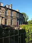
| |||
| 15–41 Ann Street | 25 February 1965 | 55°57′22″N 3°12′48″W | 28242 |
| |||
| 43 Ann Street | 25 February 1965 | 55°57′21″N 3°12′46″W | 28243 |
| |||
| 45, 47 Ann Street | 25 February 1965 | 55°57′21″N 3°12′45″W | 28244 | 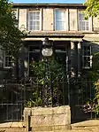
| |||
| 4–14 Ann Street | 25 February 1965 | 55°57′25″N 3°12′48″W | 28246 |
| |||
| 16–42 Ann Street | 25 February 1965 | 55°57′23″N 3°12′45″W | 28247 | 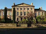
| |||
| 44 Ann Street | 25 February 1965 | 55°57′22″N 3°12′44″W | 28248 |
| |||
| 46, 48 Ann Street | 25 February 1965 | 55°57′22″N 3°12′44″W | 28249 |
| |||
| 1–22 Atholl Crescent | 14 December 1970 | 55°56′52″N 3°12′42″W | 28260 | 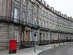
| |||
| 1–13 Atholl Place | 14 December 1970 | 55°56′51″N 3°12′50″W | 28261 |
| |||
| 1–8 Baxter's Place | 14 December 1970 | 55°57′27″N 3°11′04″W | 28279 | 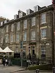
| |||
| 1–3 Bellevue Terrace | 25 November 1965 | 55°57′41″N 3°11′35″W | 28291 |
| |||
| 4-11A Bellevue Terrace | 25 November 1965 | 55°57′41″N 3°11′36″W | 28292 |
| |||
| 13, 15 Bell's Brae | 14 December 1970 | 55°57′08″N 3°12′58″W | Formerly Old Tollbooth or Cathedral Mission | 28293 | 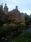
| ||
| 23 and 25 Blacket Place | 14 December 1970 | 55°56′08″N 3°10′24″W | 28306 |
| |||
| Boswall House | 19 Boswall Road | 14 December 1970 | 55°58′47″N 3°12′41″W | 28338 |
| ||
| 7-17A Brunswick Street | 21 April 1966 | 55°57′32″N 3°10′47″W | 28371 | 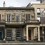
| |||
| 17–19 Buccleuch Place | 14 December 1970 | 55°56′33″N 3°11′14″W | 28387 | 
| |||
| 3–13 Carlton Street | 12 August 1965 | 55°57′26″N 3°12′38″W | 28457 |
| |||
| 4–16 Carlton Street | 12 August 1965 | 55°57′25″N 3°12′39″W | 28459 |
| |||
| 7–21 Claremont Crescent | 25 November 1965 | 55°57′50″N 3°11′30″W | 28524 |
| |||
| 1–41 East Claremont Street | 25 November 1965 | 55°57′41″N 3°11′35″W | 28533 |
| |||
| 43–49 East Claremont Street | 25 November 1965 | 55°57′44″N 3°11′33″W | 28534 |
| |||
| 1–22 Clarendon Crescent and 1, 1A Oxford Terrace | 15 June 1965 | 55°57′15″N 3°12′52″W | 28544 |
| |||
| 1–11 Coates Crescent | 14 December 1970 | 55°56′57″N 3°12′41″W | 28563 | 
| |||
| 12–22 Coates Crescent | 14 December 1970 | 55°56′55″N 3°12′47″W | 28564 | 
| |||
| 1, 2, 3, Riverside and 10,11,12,13,14 and 15 Cramond Village | 14 December 1970 | 55°58′48″N 3°18′02″W | 28606 |
| |||
| St Leonard's Hall | 18 Holyrood Park Road | 12 December 1974 | 55°56′24″N 3°10′16″W | 28619 | 
| ||
| Salisbury Green | Dalkeith Road | 14 December 1970 | 55°56′17″N 3°10′17″W | 28620 |
| ||
| Arthur Lodge | 60 Dalkeith Road | 14 December 1970 | 55°56′17″N 3°10′23″W | 28622 |
| ||
| 3–23 Danube Street | 12 August 1965 | 55°57′25″N 3°12′43″W | 28630 | 
| |||
| 4-34A Danube Street | 12 August 1965 | 55°57′23″N 3°12′43″W | 28631 | 
| |||
| 2-6A Dean Terrace | 27 October 1965 | 55°57′28″N 3°12′34″W | 28642 |
| |||
| 11-15A Dean Terrace | 27 October 1965 | 55°57′27″N 3°12′37″W | 28644 |
| |||
| 16–21 Dean Terrace | 27 October 1965 | 55°57′24″N 3°12′41″W | 28645 | 
| |||
| 1A Upper Dean Terrace | 27 October 1965 | 55°57′23″N 3°12′42″W | 28646 |
| |||
| 1–6 Upper Dean Terrace | 27 October 1965 | 55°57′22″N 3°12′42″W | 28647 | 
| |||
| Deanhaugh Street 2–10 | 27 October 1965 | 55°57′29″N 3°12′34″W | 28650 |
| |||
| Deanhaugh Street 12–36 | 27 October 1965 | 55°57′30″N 3°12′35″W | 28651 |
| |||
| 1–23 Elm Row | 16 December 1965 | 55°57′30″N 3°11′01″W | 28734 | 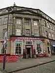
| |||
| 1–13 Eton Terrace | 12 August 1965 | 55°57′15″N 3°12′51″W | 28737 |
| |||
| 14 Eton Terrace | 12 August 1965 | 55°57′19″N 3°12′48″W | 28738 |
| |||
| 158–164 Fountainbridge | 14 December 1970 | 55°56′34″N 3°12′40″W | 28778 |
| |||
| 1-25A Gardner's Crescent | 14 December 1970 | 55°56′45″N 3°12′38″W | 28797 | 
| |||
| 16 and 17 George Square | 14 December 1970 | 55°56′38″N 3°11′27″W | 28809 | 
| |||
| 18 George Square | 14 December 1970 | 55°56′38″N 3°11′26″W | 28810 |
| |||
| 21 George Square | 14 December 1970 | 55°56′37″N 3°11′26″W | 28813 | 
| |||
| 22 George Square | 14 December 1970 | 55°56′37″N 3°11′26″W | 28814 | 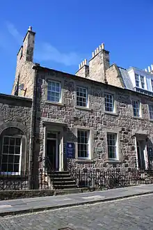
| |||
| 23A and 23B George Square | 14 December 1970 | 55°56′36″N 3°11′26″W | 28815 | 
| |||
| 23 George Square | 14 December 1970 | 55°56′36″N 3°11′26″W | 28816 | 
| |||
| 24 George Square | 14 December 1970 | 55°56′36″N 3°11′26″W | 28817 | 
| |||
| 25 George Square | 14 December 1970 | 55°56′35″N 3°11′25″W | 28818 | 
| |||
| 26 George Square | 14 December 1970 | 55°56′35″N 3°11′25″W | 28819 | 
| |||
| 27 George Square | 14 December 1970 | 55°56′35″N 3°11′25″W | 28820 | 
| |||
| 28 George Square | 14 December 1970 | 55°56′34″N 3°11′25″W | 28821 |
| |||
| 29 George Square | 14 December 1970 | 55°56′34″N 3°11′25″W | 28822 | 
| |||
| 55 George Square | 14 December 1970 | 55°56′38″N 3°11′14″W | 28823 | 
| |||
| 56 George Square | 14 December 1970 | 55°56′39″N 3°11′14″W | 28824 |
| |||
| 57 and 58 George Square | 14 December 1970 | 55°56′39″N 3°11′14″W | 28825 | 
| |||
| 59 George Square | 14 December 1970 | 55°56′39″N 3°11′14″W | 28826 | 
| |||
| 60 George Square | 14 December 1970 | 55°56′40″N 3°11′15″W | 28827 | 
| |||
| 1–8 Haddington Place | 19 April 1966 | 55°57′34″N 3°11′02″W | 28983 | 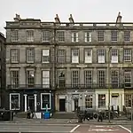
| |||
| 17A-27A Haddington Place | 19 April 1966 | 55°57′37″N 3°10′58″W | 28984 | 
| |||
| 28-32A Haddington Place | 19 April 1966 | 55°57′38″N 3°10′56″W | 28985 | 
| |||
| 1-7A Hillside Crescent | 16 December 1965 | 55°57′29″N 3°10′51″W | 29084 | 
| |||
| 11 Hillside Crescent | 29 November 1988 | 55°57′30″N 3°10′44″W | 29085 |
| |||
| 7,7A, 8 and 8A Hopetoun Crescent | 25 November 1965 | 55°57′41″N 3°11′05″W | 29098 |
| |||
| 17 and 18 Hopetoun Crescent | 25 November 1965 | 55°57′43″N 3°11′00″W | 29099 |
| |||
| 5–32 Howard Place | 25 November 1965 | 55°57′50″N 3°12′05″W | 29103 |
| |||
| 5 and 6 Inverleith Row | 27 October 1965 | 55°57′53″N 3°12′11″W | 29155 |
| |||
| 8 Inverleith Row | 27 October 1965 | 55°57′54″N 3°12′13″W | 29157 |
| |||
| 1 and 2 Laverockbank Road | 14 December 1970 | 55°58′37″N 3°12′02″W | 29220 |
| |||
| 4, 5, 6 Melville Crescent, 43 Melville Street, 19 Walker Street | 14 December 1970 | 55°57′00″N 3°11′36″W | 29230 | 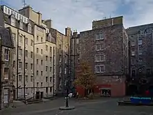
| |||
| Learmonth House | 25 Learmonth Terrace | 14 December 1970 | 55°57′20″N 3°13′15″W | 29248 |
| ||
| 1–11 Leopold Place | 16 December 1965 | 55°57′29″N 3°11′02″W | 29257 | 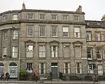
| |||
| 12–21 Leopold Place | 16 December 1965 | 55°57′29″N 3°10′53″W | 29258 |
| |||
| 3–22 Lynedoch Place | 14 December 1970 | 55°57′06″N 3°12′47″W | 29275 | 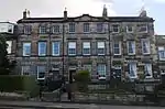
| |||
| 3–17 Manor Place | 14 December 1970 | 55°56′53″N 3°12′51″W | 29296 |
| |||
| 19–29 Manor Place | 14 December 1970 | 55°56′55″N 3°12′53″W | 29297 |
| |||
| 35–47 Manor Place | 14 December 1970 | 55°56′57″N 3°12′56″W | 29298 | 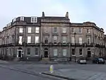
| |||
| 1, 2, 3 Melville Crescent | 14 December 1970 | 55°56′59″N 3°12′53″W | 29319 | 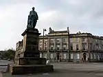
| |||
| 4–6 Melville Crescent | 14 December 1970 | 55°57′00″N 3°12′49″W | 29320 |
| |||
| 7, 8, 9 Melville Crescent | 14 December 1970 | 55°56′58″N 3°12′48″W | 29321 | 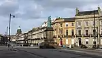
| |||
| 10, 11, 12 Melville Crescent | 14 December 1970 | 55°56′57″N 3°12′50″W | 29322 |
| |||
| 1–41 Melville Street | 14 December 1970 | 55°57′04″N 3°12′41″W | 29324 | 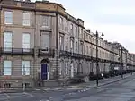
| |||
| 47–61 Melville Street | 14 December 1970 | 55°56′56″N 3°12′53″W | 29325 | 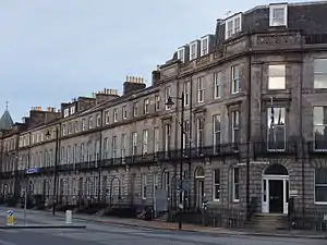
| |||
| 2–24 Melville Street | 14 December 1970 | 55°57′02″N 3°12′41″W | 29326 | 
| |||
| 28–40 Melville Street | 14 December 1970 | 55°57′00″N 3°12′46″W | 29327 | 
| |||
| 46–60 Melville Street | 14 December 1970 | 55°56′57″N 3°12′52″W | 29328 | 
| |||
| 2–12 Middleby Street | 14 December 1970 | 55°56′04″N 3°10′32″W | 29334 |
| |||
| 1–3 Middlefield and 15 Spey Street | 25 April 1965 | 55°57′48″N 3°10′46″W | 29335 |
| |||
| 2–12 Oxford Terrace | 12 August 1965 | 55°57′20″N 3°12′57″W | 29471 |
| |||
| Stonehouse | 1 Pentland Road | 14 December 1978 | 55°54′32″N 3°15′51″W | 29486 |
| ||
| 1 Pilrig Place and 2–6 Pilrig Street | 25 November 1965 | 55°57′49″N 3°10′43″W | 29493 |
| |||
| Waldorf Astoria Edinburgh - The Caledonian | 4 Lothian Road | 20 February 1985 | 55°56′58″N 3°12′26″W | including piers, railings and former screen entrance to Station | 29524 | .jpg.webp)
| |
| Dean Park House (Stewart's Melville Boarding House) | 7 Queensferry Road | 14 December 1970 | 55°57′16″N 3°13′46″W | Including Former Coach House | 29575 |
| |
| 2-9A Randolph Cliff | 14 December 1970 | 55°57′08″N 3°12′47″W | 29599 | .jpg.webp)
| |||
| Melvin House | 3 Rothesay Terrace | 14 December 1970 | 55°57′05″N 3°13′00″W | 29668 | 
| ||
| Rutland Hotel and Bar | 1 Rutland Place | 14 December 1970 | 55°57′00″N 3°12′28″W | 29685 |
| ||
| 1 Rutland Square | 14 December 1970 | 55°56′56″N 3°12′30″W | 29686 | 
| |||
| 2–4 Rutland Square | 14 December 1970 | 55°56′56″N 3°12′30″W | 29687 | 
| |||
| 5–11 Rutland Square | 14 December 1970 | 55°56′55″N 3°12′31″W | 29688 | 
| |||
| 12–22 Rutland Square | 14 December 1970 | 55°56′54″N 3°12′35″W | 29689 | 
| |||
| 23–29 Rutland Square | 14 December 1970 | 55°56′56″N 3°12′35″W | 29690 | 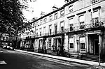
| |||
| 30 and 31 Rutland Square | 14 December 1970 | 55°56′57″N 3°12′33″W | 29691 |
| |||
| 32 Rutland Square | 14 December 1970 | 55°56′57″N 3°12′32″W | 29692 | 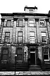
| |||
| 3–35 St Bernard's Crescent | 27 October 1965 | 55°57′28″N 3°12′41″W | 29712 | 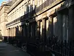
| |||
| 2 St Bernard's Crescent | 27 October 1965 | 55°57′26″N 3°12′41″W | 29713 |
| |||
| 4-10A St Bernard's Crescent | 27 October 1965 | 55°57′26″N 3°12′43″W | 29714 | 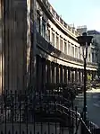
| |||
| 14 St Bernard's Crescent | 27 October 1965 | 55°57′26″N 3°12′46″W | 29716 |
| |||
| 1–15 Saxe Coburg Place | 14 December 1970 | 55°57′36″N 3°12′30″W | 29763 |
| |||
| 23–32 Saxe Coburg Place | 14 December 1970 | 55°57′39″N 3°12′32″W | 29766 |
| |||
| Sir William Fraser Homes | 52 Spylaw Bank Road | 14 December 1970 | 55°54′33″N 3°15′48″W | 29821 |
| ||
| 3, 5, 7, 9 Walker Street | 14 December 1970 | 55°56′56″N 3°12′45″W | 29878 |
| |||
| 11, 13, 15 Walker Street | 14 December 1970 | 55°56′58″N 3°12′47″W | 29879 | 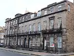
| |||
| 21, 23, 25, 27 Walker Street | 14 December 1970 | 55°57′01″N 3°12′52″W | 29880 |
| |||
| 4, 6, 8, 10 Walker Street | 14 December 1970 | 55°56′55″N 3°12′47″W | 29881 |
| |||
| 12, 14, 16 Walker Street | 14 December 1970 | 55°56′57″N 3°12′49″W | 29882 |
| |||
| 22, 24, 26, 28 Walker Street | 14 December 1970 | 55°57′00″N 3°12′54″W | 29883 |
| |||
| 1–4 Warriston Crescent | 25 November 1965 | 55°57′48″N 3°12′01″W | 29893 |
| |||
| 5–33 Warriston Crescent | 25 November 1965 | 55°57′50″N 3°12′00″W | 29894 |
| |||
| 1–54 Well Court | Dean Path and Damside | 15 June 1965 | 55°57′08″N 3°13′04″W | Including Woodbarn Hall and Clock Tower | 29900 | 
| |
| 5–29 Windsor Street | 16 December 1965 | 55°57′29″N 3°10′55″W | 29942 |
| |||
| 6–26 Windsor Street | 16 December 1965 | 55°57′30″N 3°10′57″W | 29944 |
| |||
| Allermuir | 15 Woodhall Road | 14 December 1970 | 55°54′23″N 3°15′28″W | 29948 |
| ||
| Grange House | 22 York Road | 14 December 1970 | 55°58′40″N 3°12′11″W | 29997 |
| ||
| Gothic House | 24 York Road | 14 December 1970 | 55°58′41″N 3°12′10″W | 29998 |
| ||
| Reid Memorial Church | West Savile Terrace and Blackford Avenue | 12 December 1974 | 55°55′35″N 3°11′03″W | 30015 | 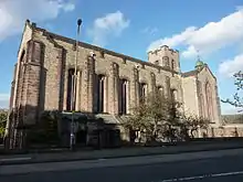
| ||
| Former Odeon Cinema (New Victoria Cinema) | 7 Clerk Street | 12 December 1974 | 55°56′33″N 3°11′00″W | 30028 | 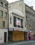
| ||
| Statue of George II | Royal Infirmary Forecourt, 1 Lauriston Place | 12 December 1974 | 55°56′41″N 3°11′35″W | 30033 |
| ||
| Gothic Cottage | 24 Russell Place | 12 December 1974 | 55°58′42″N 3°12′19″W | 30157 |
| ||
| Mid Pier | Granton Harbour | 28 November 1989 | 55°59′10″N 3°13′18″W | Including Slipways, Wharves and Lamp Standards | 30216 |
| |
| HMSO Store | 11 Bankhead Broadway, Sighthill Industrial Estate | 29 November 1990 | 55°55′27″N 3°17′46″W | 30250 |
| ||
| Balnagowan | 13–17 Murrayfield Drive | 29 November 1990 | 55°56′50″N 3°14′41″W | 30251 | 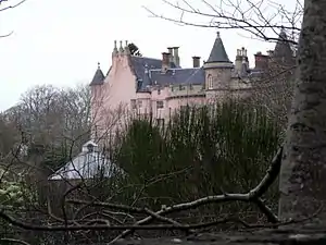
| ||
| 1–48 Ravelston Garden | 17 May 1991 | 55°57′07″N 3°14′51″W | 30264 |
| |||
| 99 Dalkeith Road, Marchhall Place and Marchhall Crescent | 24 September 1991 | 55°56′11″N 3°10′11″W | Including 2 Marchhall Place and Priestfield Parish Church | 30267 |
| ||
| Former Edinburgh Royal Infirmary, Main Block | Lauriston Place | 31 May 1994 | 55°56′40″N 3°11′34″W | Including Linked Original Ward Pavilions | 30306 | 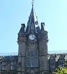
| |
| Grange Park House, Formerly Egremont | 38 Dick Place | 14 December 1970 | 55°55′57″N 3°11′22″W | 30365 |
| ||
| 46A Dick Place | 29 April 1988 | 55°55′57″N 3°11′23″W | 30367 |
| |||
| 48 and 50 Dick Place | 14 December 1970 | 55°55′58″N 3°11′26″W | 30368 | 
| |||
| 1–12 Bruntsfield Crescent | Bruntsfield | 15 April 1991 | 55°56′10″N 3°12′11″W | 30498 |
| ||
| East Morningside House | 3 and 5 Clinton Road | 14 December 1970 | 55°55′58″N 3°12′11″W | including Dovecot, Gatepiers, Garden and Boundary Walls | 30499 |
| |
| Avallon | 2 & 2A Clinton Road | 12 December 1974 | 55°55′55″N 3°12′05″W | including Lodge | 30501 |
| |
| Roman Catholic Archiepiscopal Chapel | 42 Greenhill Gardens | 14 December 1970 | 55°55′57″N 3°12′17″W | 30521 |
| ||
| James Gillespie's High School, Bruntsfield House | Marchmont | 14 July 1966 | 55°56′12″N 3°11′58″W | 30530 |
| ||
| 31 Mortonhall Road | 14 December 1970 | 55°55′38″N 3°11′39″W | 30577 |
| |||
| 33 Mortonhall Road | 14 December 1970 | 55°55′38″N 3°11′40″W | 30578 |
| |||
| 35 Mortonhall Road | 14 December 1970 | 55°55′38″N 3°11′41″W | 30579 |
| |||
| 14 Oswald Road | 14 December 1970 | 55°55′38″N 3°11′38″W | 30589 | 
| |||
| Gillis College RC Chapel | Whitehouse Loan | 14 December 1970 | 55°56′05″N 3°12′02″W | 30664 | 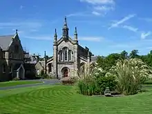
| ||
| Forth Bridge | 18 June 1973 | 55°59′54″N 3°23′15″W | 40370 | 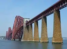
| |||
| Black Castle | High Street, South Queensferry | 22 February 1971 | 55°59′23″N 3°23′42″W | 40386 | 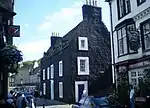
| ||
| Plewlands House | Hopetoun Road, South Queensferry | 22 February 1971 | 55°59′26″N 3°23′52″W | 40389 | 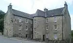
| ||
| The Priory Church of St. Mary of Mount Carmel | Hopetoun Road, South Queensferry | 22 February 1971 | 55°59′27″N 3°23′54″W | 40391 | 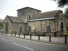
| ||
| Tolbooth | West Terrace, South Queensferry | 22 February 1971 | 55°59′25″N 3°23′49″W | 40411 |
| ||
| Royal Commonwealth Pool | Dalkeith Road | 29 March 1996 | 55°56′21″N 3°10′22″W | 43148 | 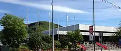
| ||
| Mortonhall Crematorium | Howdenhall Road | 15 April 1996 | 55°54′09″N 3°10′13″W | 43242 | 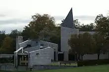
| ||
| Craigiehall | 22 February 1971 | 55°57′52″N 3°20′11″W | 45432 | 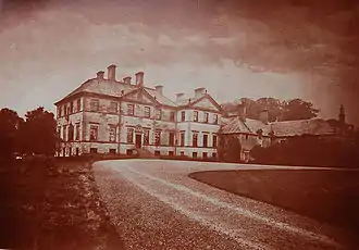
| |||
| Craigiehall, Walled Garden, including Gatepiers | 26 March 1998 | 55°57′55″N 3°20′09″W | 45433 |
| |||
| Dundas Castle Keep | near South Queensferry | 22 February 1971 | 55°58′31″N 3°24′54″W | 45474 |
| ||
| 22 Claremont Crescent | 25 November 1965 | 55°57′51″N 3°11′27″W | 45936 |
| |||
| 51–77 East Claremont Street | 25 November 1965 | 55°57′44″N 3°11′32″W | 45940 |
| |||
| 79–85 East Claremont Street | 25 November 1965 | 55°57′46″N 3°11′31″W | 45941 |
| |||
| 19 George Square | 14 December 1970 | 55°56′37″N 3°11′26″W | 47583 |
| |||
| 20 George Square | 14 December 1970 | 55°56′37″N 3°11′26″W | 47584 | 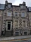
| |||
| Forth Road Bridge with Approach Ramps and Piers | 21 March 2001 | 56°00′06″N 3°24′15″W | 47778 | 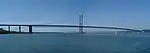
| |||
| Robin Chapel | Thistle Foundation Estate, Niddrie | 14 June 2002 | 55°55′53″N 3°07′50″W | 48686 | 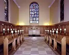
| ||
| Craigsbank Parish Church (Church of Scotland) | Craigs Bank | 13 November 2002 | 55°56′37″N 3°17′49″W | With hall, including former church | 48977 | .jpg.webp)
| |
| 11–17 Annandale Street | 19 April 1966 | 55°57′35″N 3°11′03″W | 49144 |
| |||
| Royal Botanic Garden, 1967 Greenhouse | Inverleith | 4 June 2003 | 55°57′59″N 3°12′29″W | 49216 | 
| ||
| 25 Bridge Road | 19 November 2003 | 55°54′26″N 3°15′33″W | 49552 |
| |||
| Laverockdale House | Dreghorn Loan | 14 July 1966 | 55°54′09″N 3°15′05″W | 49562 |
| ||
| Fettes College, Sundial | Inverleith | 20 January 2004 | 55°57′50″N 3°13′39″W | 49628 | .jpg.webp)
| ||
| 4–9 Brunton Place | 29 April 1977 | 55°57′28″N 3°10′29″W | 49744 |
| |||
| University of Edinburgh, Pollock Halls of Residence | Holyrood Park Road | 17 January 2006 | 55°56′17″N 3°10′13″W | 50187 | 
| ||
| David Hume Tower (Block A) and Lecture Block (Block B), University of Edinburgh | George Square | 17 January 2006 | 55°56′36″N 3°11′12″W | 50189 | 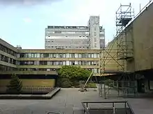
| ||
| University of Edinburgh, Main Library | George Square | 17 January 2006 | 55°56′34″N 3°11′20″W | 50191 | 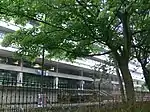
| ||
| Scottish Widows Fund and Life Assurance Society Head Office | Dalkeith Road | 3 March 2006 | 55°56′25″N 3°10′28″W | 50213 | 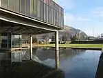
|
Notes
- Sometimes known as OSGB36, the grid reference (where provided) is based on the British national grid reference system used by the Ordnance Survey.
• "Guide to National Grid". Ordnance Survey. Retrieved 12 December 2007.
• "Get-a-map". Ordnance Survey. Retrieved 17 December 2007. - Historic Environment Scotland assign a unique alphanumeric identifier to each designated site in Scotland, for listed buildings this always begins with "LB", for example "LB12345".
References
- Guide to the Protection of Scotland's Listed Buildings (PDF). Historic Scotland. 2009. p. 4. ISBN 978-1-84917-013-0. Retrieved 5 May 2010.
- "What is Listing?". Historic Scotland. Retrieved 5 May 2010.
- Scottish Historic Environment Policy (PDF). Historic Scotland. October 2008. pp. 24–25. ISBN 978-1-84917-002-4. Retrieved 5 May 2010.
- Guide to the Protection of Scotland’s Listed Buildings, p. 17.
- "Edinburgh – World Heritage Site". VisitScotland. Archived from the original on 22 February 2013. Retrieved 23 August 2013.
- Searle, Adrian (2015). So you think you know Scotland?. Glasgow, UK: Freight Books. p. 22. ISBN 978-1908754-90-5.
- "Edinburgh Castle, St Margaret's Chapel". Historic Scotland. Retrieved 23 August 2013.
- "Forth Road Bridge". Historic Scotland. Retrieved 23 August 2013.
External links
![]() Media related to Category A listed buildings in Edinburgh at Wikimedia Commons
Media related to Category A listed buildings in Edinburgh at Wikimedia Commons