List of Category A listed buildings in Dumfries and Galloway
This is a list of Category A listed buildings in Dumfries and Galloway, Scotland.
In Scotland, the term listed building refers to a building or other structure officially designated as being of "special architectural or historic interest".[1] Category A structures are those considered to be "buildings of national or international importance, either architectural or historic, or fine little-altered examples of some particular period, style or building type."[2] Listing was begun by a provision in the Town and Country Planning (Scotland) Act 1947, and the current legislative basis for listing is the Planning (Listed Buildings and Conservation Areas) (Scotland) Act 1997.[3] The authority for listing rests with Historic Scotland, an executive agency of the Scottish Government, which inherited this role from the Scottish Development Department in 1991. Once listed, severe restrictions are imposed on the modifications allowed to a building's structure or its fittings. Listed building consent must be obtained from local authorities prior to any alteration to such a structure.[3] There are approximately 47,400 listed buildings in Scotland, of which around 8% (some 3,800) are Category A.[4]
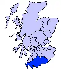
The council area of Dumfries and Galloway covers 6,426 square kilometres (2,481 sq mi), and has a population of around 148,600. There are 224 Category A listed buildings in the area.
Listed buildings
| Name | Location | Date Listed | Grid Ref. [note 1] | Geo-coordinates | Notes | LB Number [note 2] | Image |
|---|---|---|---|---|---|---|---|
| Rusco Tower | Gatehouse of Fleet | NX5842060419 | 54°55′06″N 4°12′38″W | Early-16th-century tower house[5] | 3299 | 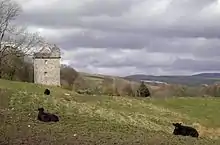
| |
| Ardwall House | Anwoth | NX5813454737 | 54°52′02″N 4°12′44″W | 18th-century country house[6] | 3302 | 
| |
| Anwoth Old Church, Gordon Tomb and Churchyard | Anwoth | NX5827356209 | 54°52′50″N 4°12′38″W | Ruins of 17th-century church, and early Renaissance monument to the Gordon family, circa 1620[7] | 3309 | 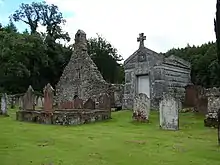
| |
| Barscobe Castle | Balmaclellan | NX6596780640 | 55°06′07″N 4°06′08″W | 17th-century L-plan tower house, with later additions[8] | 3310 | 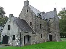
| |
| Ironmacannie Mill | Ironmacannie, Balmaclellan | NX6672175330 | 55°03′16″N 4°05′17″W | 18th- and 19th-century grain mill, with much surviving machinery[9] | 3315 | 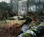
| |
| Ken Bridge | New Galloway, carrying the A712 over the Water of Ken | NX6404878357 | 55°04′52″N 4°07′52″W | Five-arch granite bridge by John Rennie, 1821[10] | 3316 | 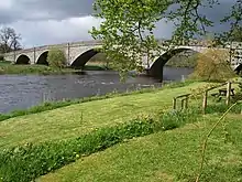
| |
| Millhouse Bridge [note 3] | Millhousebridge, over the River Annan | NY1047185524 | 55°09′21″N 3°24′24″W[note 4]) | 30 metres (98 ft) single-span stone arch bridge[11][12] | 9954 3324, 9954 |
| |
| Old Tollbar Cottage | Dinwoodie, Johnstonebridge | NY1043090151 | 55°11′51″N 3°24′31″W | Toll house of 1822 by Thomas Telford[13] | 3327 | 
| |
| Jardine Hall Stable Block | Millhousebridge | NY1005387855 | 55°10′36″N 3°24′50″W | Large quadrangular stable block of 1825, possibly by James Gillespie Graham; Jardine Hall demolished 1964 [14] | 3340 |
| |
| Jardine Hall, Walled Garden and Gateways | Millhousebridge | NY0991587866 | 55°10′37″N 3°24′58″W | Gardens of circa 1820, possibly by James Gillespie Graham; Jardine Hall demolished 1964 [15] | 3341 |
| |
| Buittle Bridge, (also known as Craignair Bridge) | Dalbeattie, carrying the A711 over the Urr Water | NX8224960655 | 54°55′36″N 3°50′20″W | Single-arch stone bridge built 1797[16] | 3364 | 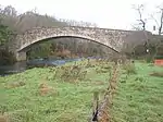
| |
| Rammerscales House | Hightae, Lochmaben | NY0819577642 | 55°05′05″N 3°26′23″W | Palladian mansion of circa 1760[17] | 3378 | 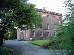
| |
| Corseyard Farm | Borgue | NX5910148585 | 54°48′44″N 4°11′39″W | Italianate model dairy steading, built 1914 with elaborate finishes[18] | 3381 | 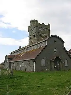
| |
| Orchardton Tower | Palnackie | NX8169655126 | 54°52′37″N 3°50′43″W | 15th-century cylindrical tower, the only one known in Scotland[19] | 3387 | 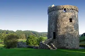
| |
| Borgue Old House | Borgue | NX6334348209 | 54°48′36″N 4°07′40″W | Roofless house of 17th century[20] | 3393 | 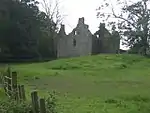
| |
| Plunton Castle | Borgue | NX6049550736 | 54°49′55″N 4°10′24″W | Roofless mid-16th-century L-plan tower house[21] | 3403 | 
| |
| Threave Castle | Castle Douglas, on an island in the River Dee | NX7392062281 | 54°56′21″N 3°58′11″W | Later 14th-century stronghold of the Black Douglases[22] | 3408 | 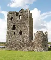
| |
| Hensol House | Parton | NX6756069835 | 55°00′19″N 4°04′20″W | Country house of 1822 by Robert Lugar[23] | 3415 | 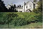
| |
| Hensol House, The Lainshaw Sundial | Parton | NX6758469806 | 55°00′19″N 4°04′19″W | Later 17th-century sundial, moved here from Lainshaw estate in Ayrshire[24] | 3416 |
| |
| Shillahill Bridge | Carries the A709 over the River Annan between Lochmaben and Lockerbie | NY1061980703 | 55°06′45″N 3°24′10″W | Mid-19th-century five-arch bridge[25] | 3453 | 
| |
| Dalton Old Parish Churchyard | Dalton | NY1143073979 | 55°03′09″N 3°23′17″W | Walled churchyard with 18th-20th century tombstones and monuments[26] | 3455 | .jpg.webp)
| |
| Denbie House | Dalton | NY1110172955 | 55°02′35″N 3°23′34″W | Early-19th-century country house[27] | 3469 |
| |
| Denbie, Dovecot | Dalton | NY1089773062 | 55°02′39″N 3°23′46″W | Octagonal dovecote dated 1775[28] | 3470 |
| |
| Bonshaw Tower and House | Kirtlebridge | NY2425672068 | 55°02′14″N 3°11′12″W | Mid-16th-century tower house with 1770 country house and later additions[29] | 3489 | 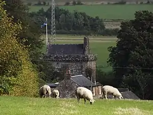
| |
| Brydekirk Bridge | Brydekirk over the River Annan | NY1865970549 | 55°01′22″N 3°16′26″W | Three-arch road bridge of 1817[30] | 3494 | 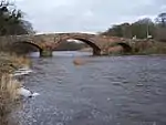
| |
| Gilnockie Bridge | Hollows, Canonbie, over the River Esk | NY3857878172 | 55°05′39″N 2°57′50″W | Two-arch stone bridge built 1793[31] | 3504 | .jpg.webp)
| |
| Byreburnfoot Bridge and Embankment | Hollows, Canonbie, over the Byre Burn | NY3902277971 | 55°05′33″N 2°57′25″W | Single-span stone bridge of 1850[32] | 3520 |
| |
| Hollows or Gilnockie Tower | Hollows, Canonbie | NY3823178559 | 55°05′51″N 2°58′10″W | 16th-century tower house, restored in 1980; unusual beacon tower[33] | 3527 | 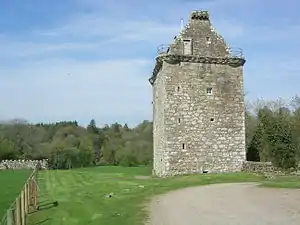
| |
| Cruck-framed building | Priorslynn, Canonbie | NY3936275836 | 55°04′24″N 2°57′04″W | Later 18th-century clay-walled and cruck-framed agricultural building[34] | 3531 |
| |
| Riddings Junction Viaduct [note 5] | Rowanburn, over Liddel Water | NY4108475634 | 55°04′18″N 2°55′27″W[note 6]) | Nine-arch railway viaduct built 1864, now disused[35] | 3533 | 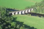
| |
| Tarrasfoot Tile Works | Tarrasfoot, Canonbie | NY3806180952 | 55°07′09″N 2°58′22″W | 19th- and early-20th-century tile works, now disused[36] | 3535 |
| |
| Hoddom Castle | Brydekirk | NY1560972966 | 55°02′38″N 3°19′20″W | 16th-century tower house with 17th- and 19th-century additions[37] | 3558 | 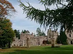
| |
| Repentance Tower | Hoddom Castle, Brydekirk | NY1549672246 | 55°02′15″N 3°19′26″W | 16th-century tower house[38] | 3570 | 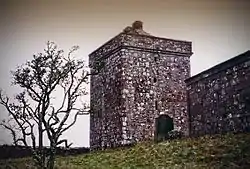
| |
| Kinmount House | Cummertrees | NY1402568696 | 55°00′19″N 3°20′45″W | Country house of 1820, by Robert Smirke[39] | 3582 | 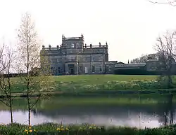
| |
| Earlstoun Castle | Earlstoun, St John's Town of Dalry | NX6126884022 | 55°07′52″N 4°10′39″W | L-plan tower-house, circa 1700[40] | 3624 |
| |
| Grennan Mill | St John's Town of Dalry | NX6433580326 | 55°05′55″N 4°07′40″W | 18th- and 19th-century water mill with intact machinery[41] | 3625 |
| |
| Crossmichael Parish Church | Crossmichael | NX7297766985 | 54°58′52″N 3°59′11″W | Church of 1751 with 16th- or 17th-century tower[42] | 3698 | 
| |
| Crossmichael Church, Gordon Memorial | Crossmichael | NX7299466978 | 54°58′52″N 3°59′10″W | 18th-century classical burial enclosure[43] | 3699 |
| |
| Glenlochar Bridge | Glenlochar | NX7320664512 | 54°57′33″N 3°58′54″W | Five-arch stone bridge circa 1797[44] | 3706 |
| |
| Greenlaw House | Castle Douglas | NX7541364412 | 54°57′31″N 3°56′50″W | 18th-century classical villa, gutted by fire in the 1980s[45] | 3708 |
| |
| Southwick Home Farm | Caulkerbush, Southerness | NX9366756930 | 54°53′45″N 3°39′34″W | Large, well-preserved 19th-century steading and water mill[46] | 3723 | 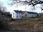
| |
| Stapleton Tower | Dornock | NY2347168871 | 55°00′31″N 3°11′53″W | 16th-century tower house[47] | 3782 | 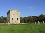
| |
| Dornock House, old farmhouse and steading | Dornock | NY2315865990 | 54°58′57″N 3°12′08″W | 18th-century farmstead complex[48] | 3792 |
| |
| Caerlaverock Castle | Caerlaverock | NY0254865638 | 54°58′33″N 3°31′27″W | Substantial remains of late-13th-century moated castle[49] | 3799 | 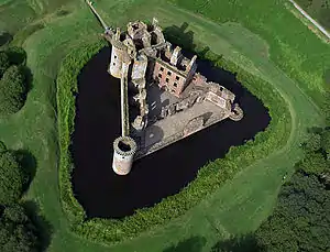
| |
| Ladyfield West (formerly Hannayfield) | Dumfries | NX9780174401 | 55°03′13″N 3°36′05″W | Villa of 1830 by Walter Newall[50] | 3829 |
| |
| Crichton Royal Hospital, Crichton Hall | The Crichton, Dumfries | NX9810274396 | 55°03′13″N 3°35′48″W | Hospital building by William Burn, opened 1839 with later additions[51] | 3839 |
| |
| Durisdeer Parish Church and Queensberry Mausoleum | Durisdeer | NS8940703770 | 55°18′56″N 3°44′39″W | Church of 1720 by James Smith, adjacent mausoleum to Duke of Queensberry with sculpture by John Van Nost[52] | 3856 | 
| |
| Drumlanrig Castle | Carronbridge, Thornhill | NX8519099214 | 55°16′25″N 3°48′31″W | Courtyard castle remodelled 1689, probably to design of Robert Mylne[53] | 3886 | 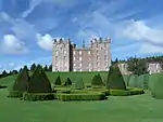
| |
| Wallacehall Assessment Centre (former Academy and Schoolhouse) | Closeburn | NX9025192409 | 55°12′49″N 3°43′35″W | 18th-century school house[54] | 3953 |
| |
| Auldgirth Bridge | Auldgirth | NX9116586353 | 55°09′34″N 3°42′35″W | Three-arch road bridge of 1782 by David Henderson[55] | 3966 | 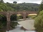
| |
| Dalgonar Bridge | Dunscore, over Cairn Water | NX8602984080 | 55°08′17″N 3°47′22″W | Single-arch stone bridge dated 1818[56] | 4227 |
| |
| Dunscore Parish Church | Dunscore | NX8666184340 | 55°08′25″N 3°46′47″W | Gothic church of 1824 by James Thomson of Dumfries[57] | 4230 | 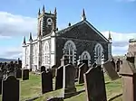
| |
| Ellisland Farm | Auldgirth | NX9298783850 | 55°08′15″N 3°40′49″W | 1788 farm built for the poet Robert Burns, now a museum[58] | 4232 | 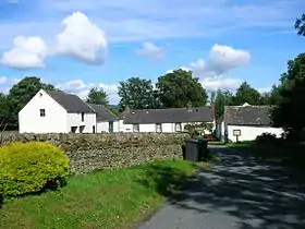
| |
| Crichton Farm | The Crichton, Dumfries | NX9833473772 | 55°02′53″N 3°35′34″W | Extensive industrial farm complex, built 1893[59] | 6693 |
| |
| Crichton Memorial Church | The Crichton, Dumfries | NX9825174093 | 55°03′03″N 3°35′39″W | Large Gothic church of 1897, by Sydney Mitchell and Wilson[60] | 6695 | 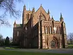
| |
| Hills Tower | Cargenbridge | NX9122472666 | 55°02′12″N 3°42′13″W | 16th-century tower house and 18th-century house[61] | 9715 | 
| |
| Duchess Bridge | Langholm Lodge, over the River Esk, Langholm | NY3559385239 | 55°09′26″N 3°00′44″W | Cast-iron bridge built 1813, probably the earliest existing iron bridge in Scotland[62] | 9734 | 
| |
| Knocknalling Barn | Knocknalling, St John's Town of Dalry | NX5964584846 | 55°08′17″N 4°12′12″W | Mid-19th-century stone barn with triangular vents[63] | 9746 |
| |
| Milnholm Farmhouse and Steading | Langholm | NY3551687288 | 55°10′32″N 3°00′50″W | Later 19th-century farm and steading[64] | 9763 |
| |
| Skipper's Bridge (A7 Over River Esk) | Langholm, carrying the A7 over the River Esk | NY3706683400 | 55°08′27″N 2°59′20″W | Three-arch road bridge of circa 1700[65] | 9764 | 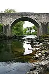
| |
| Mossknowe House | Kirkpatrick Fleming | NY2810369766 | 55°01′02″N 3°07′33″W | Palladian mansion of unusual composition, dated 1767[66] | 9799 |
| |
| Springkell House | Eaglesfield | NY2550775184 | 55°03′56″N 3°10′05″W | Palladian mansion dated 1734[67] | 9805 |
| |
| Wyseby, former stables with dovecot | Kirtlebridge | NY2409972480 | 55°02′28″N 3°11′21″W | Mid-18th-century stables and early 19th century dovecot[68] | 9808 |
| |
| Graham of Mossknowe burial enclosure | Kirkpatrick Fleming Parish Churchyard, Kirkpatrick Fleming | NY2763770091 | 55°01′12″N 3°08′00″W | Later 17th-century Renaissance burial enclosure[69] | 9813 |
| |
| Douglas Mausoleum, near to Kelton Parish Church | Kelton | NX7587560348 | 54°55′20″N 3°56′18″W | Pyramidal mausoleum, built circa 1820 for James Douglas [70] | 9835 | 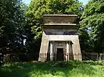
| |
| Gelston Castle | Gelston, Castle Douglas | NX7772158343 | 54°54′17″N 3°54′31″W | Country house in Adam castellated style, 1805, attributed to Richard Crichton, now derelict[71] | 9836 | .jpg.webp)
| |
| Old Bridge of Dee | Bridge of Dee, Castle Douglas, over the River Dee | NX7343159958 | 54°55′06″N 3°58′34″W | 18th-century four-arch bridge[72] | 9838 | .jpg.webp)
| |
| Craigielands House | Beattock | NT0764401561 | 55°17′58″N 3°27′22″W | Greek-revival villa by William Burn, 1817[73] | 9842 |
| |
| Cally Palace Hotel, formerly Cally House | Gatehouse of Fleet | NX5998254946 | 54°52′11″N 4°11′00″W | Classically detailed country house, built 1765 by Robert Mylne[74] | 9854 | 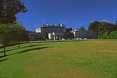
| |
| Girthon Old Kirk churchyard | Girthon, Gatehouse of Fleet | NX6055053379 | 54°51′21″N 4°10′26″W | 17th-century churchyard[75] | 9859 | 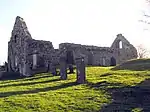
| |
| Raehills House | St Ann's, Johnstonebridge | NY0637594336 | 55°14′04″N 3°28′26″W | 18th-century mansion by Alexander Stevens, remodelled in 1834 by William Burn[76] | 9898 | 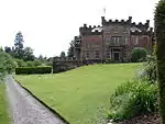
| |
| The Old Brig Inn | Beattock | NT0775402830 | 55°18′39″N 3°27′18″W | Coaching inn of 1821 by Thomas Telford[77] | 9908 | 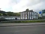
| |
| Hutton and Corrie Parish Church | Boreland | NY1704890833 | 55°12′17″N 3°18′18″W | Early-18th-century church[78] | 9911 | 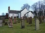
| |
| Corsewall Lighthouse | Corsewall Point, Stranraer | NW9807572614 | 55°00′25″N 5°09′33″W | Lighthouse and keeper's house 1815 by Robert Stevenson, 1889 additions by David Alan Stevenson[79] | 9923 | 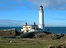
| |
| Kinnel Bridge | Lochmaben, B7020 over Kinnel Water | NY0894085010 | 55°09′04″N 3°25′50″W | 18th-century three-arch road bridge, widened in the 19th century[80] | 9950 | 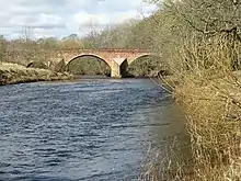
| |
| Spedlins Tower | Millhousebridge | NY0976787553 | 55°10′26″N 3°25′06″W | 15th-century tower house, remodelled circa 1605, and restored in the 1980s[81] | 9965 | .jpg.webp)
| |
| Elshieshields Tower | Elshieshields, Lochmaben | NY0688885034 | 55°09′03″N 3°27′45″W | 16th-century L-plan tower house and early-18th-century house[82] | 9970 |
| |
| Halleaths Former Stables | Halleaths, Lochmaben | NY0973582323 | 55°07′37″N 3°25′02″W | Large stable court dated 1843, in the style of Walter Newall[83] | 9971 |
| |
| Hoddom Bridge | Hoddom, Brydekirk, over River Annan | NY1636272716 | 55°02′31″N 3°18′37″W | 18th-century three-arch stone bridge[84] | 10026 | 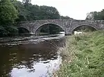
| |
| Shortrig Windmill Tower, Horsemill and Steading | Shortrigg, Ecclefechan | NY1614374371 | 55°03′24″N 3°18′51″W | 18th-century windmill, early-19th-century horse-mill, and 18th-19th-century courtyard steading[85] | 10041 |
| |
| Arched House including Carlyle's Birthplace | Ecclefechan High Street | NY1934574582 | 55°03′33″N 3°15′51″W | 18th-century pair of houses, including the birthplace of writer Thomas Carlyle[86] | 10065 | 
| |
| Kirkcowan Parish Church | Kirkcowan | NX3273960968 | 54°54′55″N 4°36′40″W | Gothic church built 1834[87] | 10066 | 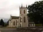
| |
| Craichlaw House | Craighlaw, Kirkcowan | NX3063661091 | 54°54′57″N 4°38′38″W | 16th-century tower house and adjoining 19th-century Baronial mansion by Wardrop and Brown[88] | 10076 |
| |
| Barholm Castle | Barholm, Gatehouse of Fleet | NX5207352959 | 54°50′58″N 4°18′20″W | 17th-century L-plan tower house, restored in the early 21st century[89] | 10093 | 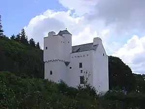
| |
| Carsluith Castle | Carsluith, Gatehouse of Fleet | NX4946454151 | 54°51′34″N 4°20′48″W | Late-15th-century tower house with later additions [90] | 10104 | 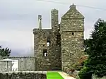
| |
| Baldoon Castle Gatepiers | Bladnoch, Wigtown | NX4257453624 | 54°51′09″N 4°27′13″W | Mid-17th-century Renaissance gatepiers[91] | 10109 | 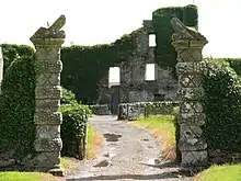
| |
| Old Place of Monreith, or Dowies | Monreith, Glasserton | NX3811943013 | 54°45′21″N 4°31′02″W | Early-17th-century tower house of unusual plan, restored in the 19th century and in the 1980s[92] | 10123 | 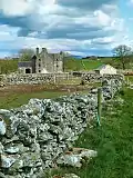
| |
| Ravenstone Castle | Drumjin, Whithorn | NX4092044181 | 54°46′02″N 4°28′27″W | 16th-century L-plan tower house with later additions, now derelict[93] | 10133 | 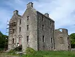
| |
| Glasserton Parish Church | Glasserton | NX4212138087 | 54°42′47″N 4°27′08″W | 18th-century church, with 19th-century tower and session house[94] | 10137 | 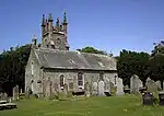
| |
| Craigcaffie Tower | Craigcaffie, Stranraer | NX0886364124 | 54°56′06″N 4°59′06″W | 16th-century tower house, restored in 1983[95] | 10164 | 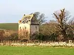
| |
| Lochryan House | Cairnryan | NX0640268772 | 54°58′33″N 5°01′36″W | Early-18th-century mansion with 19th-century alterations[96] | 10168 | .jpg.webp)
| |
| Lochinch Castle | Lochinch Estate, Castle Kennedy | NX1062261778 | 54°54′53″N 4°57′22″W | Baronial mansion by Brown and Wardrop, 1868[97] | 10179 | .jpg.webp)
| |
| Castle Kennedy | Lochinch Estate, Castle Kennedy | NX1104860936 | 54°54′26″N 4°56′56″W | Remains of early-17th-century tower house, burned down 1716[98] | 10181 | .jpg.webp)
| |
| Old Bridge of Urr Mill | Old Bridge of Urr, Kirkpatrick Durham | NX7765167700 | 54°59′20″N 3°54′49″W | Water mill with rare surviving timber-framed water wheel[99] | 10191 | 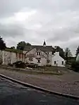
| |
| Fourmerkland Tower | Fourmerkland, Dumfries | NX9085680755 | 55°06′33″N 3°42′45″W | Late-16th-century tower house[100] | 10204 | 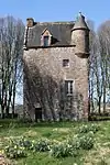
| |
| West Gallaberry Farm Steading and Horsemill | Kirkton, Locharbriggs | NX9641682622 | 55°07′38″N 3°37′34″W | Early-19th-century steading courtyard[101] | 10218 |
| |
| Blackwood House Former Stables | Auldgirth | NX9069387009 | 55°09′55″N 3°43′03″W | 18th-century stable courtyard with dovecot tower[102] | 10244 |
| |
| Capenoch House | Penpont | NX8434493811 | 55°13′30″N 3°49′11″W | Baronial mansion completed in 1868 by David Bryce[103] | 10247 |
| |
| Kilneiss House | Moniaive | NX7737191018 | 55°11′53″N 3°55′41″W | Arts and Crafts cottage by John James Burnet for the artist James Paterson[104] | 10298 |
| |
| Carnsalloch House | Kirkton, Locharbriggs | NX9709280300 | 55°06′23″N 3°36′52″W | Palladian mansion house dated 1759[105] | 10300 |
| |
| Carnsalloch Chapel at The Mount | Kirkton, Locharbriggs | NX9746780953 | 55°06′44″N 3°36′32″W | Small Gothic chapel by Edward Buckton Lamb circa 1850[106] | 10301 |
| |
| Carnsalloch Former Stables | Kirkton, Locharbriggs | NX9731880394 | 55°06′26″N 3°36′40″W | 18th-century classical stable courtyard[107] | 10303 |
| |
| Glenluiart House | Moniaive | NX7642890867 | 55°11′48″N 3°56′34″W | Arts and Crafts mansion of 1900 by William West Neve[108] | 10307 | 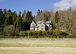
| |
| Glencairn Parish Church | Kirkland, Moniaive | NX8090690471 | 55°11′39″N 3°52′21″W | Gothic church built 1836[109] | 10312 | .jpg.webp)
| |
| Craigdarroch House | Moniaive | NX7414290903 | 55°11′47″N 3°58′44″W | Classical mansion, dated 1729, by William Adam[110] | 10340 | 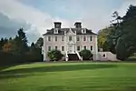
| |
| Ross Mains | Templand | NY0667488659 | 55°11′00″N 3°28′02″W | Early classical house, dated 1728, possibly by James Smith[111] | 10353 | 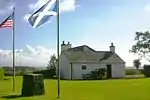
| |
| John Paul Jones' Cottage | Arbigland, Kirkbean | NX9876157150 | 54°53′56″N 3°34′49″W | 18th-century cottage, birthplace in 1747 of Admiral John Paul Jones[112] | 10397 |
| |
| Arbigland House | Arbigland, Kirkbean | NX9897957430 | 54°54′05″N 3°34′37″W | Mid-18th-century Classical mansion house, built for and probably by William Craik of Arbigland[113] | 10398 |
| |
| Southerness Lighthouse | Southerness | NX9774554282 | 54°52′22″N 3°35′42″W | Built in 1748 as a navigational marker, lighthouse built circa 1811, rebuilt by Walter Newall 1842-3[114] | 10415 | 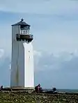
| |
| Shennanton House | Shennanton, Kirkcowan | NX3401664310 | 54°56′45″N 4°35′35″W | English vernacular country house of 1908 by Henry Edward Clifford[115] | 13106 |
| |
| Kirkdale Bridge | On the A75 between Gatehouse of Fleet and Creetown | NX5172853094 | 54°51′02″N 4°18′40″W | 1787 bridge designed by Robert Adam [116] | 13137 |
| |
| Kirkdale House and Sundial | Kirkdale, Gatehouse of Fleet | NX5147253288 | 54°51′08″N 4°18′54″W | 1787 country house by Robert Adam, now flats[117] | 13138 | 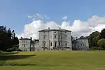
| |
| Kirkdale Kirk and Kirkdale Mausoleum | Kirkdale, Gatehouse of Fleet | NX5121354055 | 54°51′33″N 4°19′10″W | Ruins of 18th-century Old Kirk of Kirkdale and classical mausoleum dated 1787, probably by Robert Adam[118] | 13139 | .jpg.webp)
| |
| Kirkdale Steadings and Slaughterhouse | Kirkdale, Gatehouse of Fleet | NX5128453605 | 54°51′18″N 4°19′05″W | 1787 steading, probably by Robert Adam[119] | 13140 |
| |
| Lochnaw Castle | Leswalt, Stranraer | NW9913262825 | 54°55′11″N 5°08′09″W | 16th-century tower house and 17th-century L-plan range[120] | 13498 | 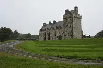
| |
| Lochnaw, Walled Garden | Leswalt, Stranraer | NW9885063069 | 54°55′18″N 5°08′25″W | Early-19th-century polygonal walled garden[121] | 13505 |
| |
| Logan House | Logan, Rhins of Galloway | NX0964542824 | 54°44′39″N 4°57′32″W | Classical mansion of 1702, remodelled 1952[122] | 13564 | .jpg.webp)
| |
| Logan Windmill | Logan, Rhins of Galloway | NX1151643792 | 54°45′13″N 4°55′50″W | Tower of 17th-century windmill[123] | 13570 | 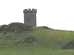
| |
| Mull of Galloway Lighthouse | Mull of Galloway | NX1569230398 | 54°38′06″N 4°51′26″W | Lighthouse and keeper's house by Robert Stevenson, 1828[124] | 13578 | 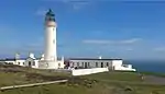
| |
| Old Parish Church of Kirkmaiden | Kirkmaiden, Rhins of Galloway | NX1245036920 | 54°41′32″N 4°54′42″W | 17th-century T-plan church[125] | 13581 | 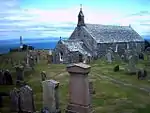
| |
| Kirkmadrine Church | Sandhead, Rhins of Galloway | NX0801448389 | 54°47′37″N 4°59′16″W | Late-19th-century mausoleum chapel[126] | 16739 | 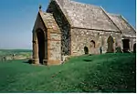
| |
| Portpatrick Old Parish Church | Portpatrick | NW9997654212 | 54°50′34″N 5°07′00″W | Remains of 17th-century church with earlier round tower, possibly a lighthouse[127] | 16743 | 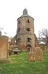
| |
| Isle Castle | Isle of Whithorn | NX4764836604 | 54°42′05″N 4°21′57″W | Small, 17th-century L-plan tower house[128] | 16751 | 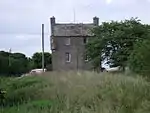
| |
| Castle of Park | Glenluce | NX1881457126 | 54°52′34″N 4°49′32″W | Late-16th-century L-plan tower house[129] | 16761 | 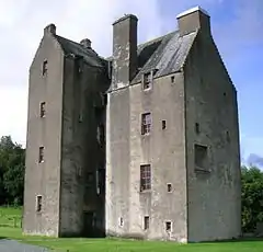
| |
| Haugh Bridge | Haugh of Urr, over Urr Water | NX8054365980 | 54°58′27″N 3°52′04″W | Two-arch stone bridge built 1763 as part of military road[130] | 16807 |
| |
| Archbank Farm, tall barn with waterwheel | Moffat | NT0909606785 | 55°20′48″N 3°26′06″W | Late-18th-century agricultural buildings[131] | 16847 |
| |
| Granton House | Moffat | NT0745809907 | 55°22′28″N 3°27′43″W | Small Greek Revival villa, circa 1830 by Walter Newall[132] | 16858 |
| |
| Heatheryhaugh | Moffat | NT0924606246 | 55°20′31″N 3°25′57″W | Early-19th-century Gothic Revival villa[133] | 16861 |
| |
| Cruggleton Church | Garlieston | NX4779642810 | 54°45′26″N 4°22′00″W | Remains of 12th-century church, rebuilt c. 1890 by 3rd Marquis of Bute[134] | 16875 | 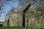
| |
| Galloway House | Garlieston | NX4784145273 | 54°46′45″N 4°22′02″W | 18th-century house by John Douglas, additions by William Burn and Robert Lorimer[135] | 16876 | 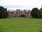
| |
| Castlemilk | Kettleholm, Lockerbie | NY1493777471 | 55°05′04″N 3°20′03″W | Scots Baronial mansion, 1865 by David Bryce[136] | 16888 |
| |
| Castlemilk, Driveway Bridge | Kettleholm, Lockerbie | NY1504777261 | 55°04′57″N 3°19′56″W | Scots Baronial bridge, 1865 by David Bryce[137] | 16890 |
| |
| Westerkirk Old Churchyard, Johnstone Mausoleum | Bentpath, Eskdale | NY3128690350 | 55°12′09″N 3°04′52″W | Classical mausoleum by Robert Adam, circa 1790. [138] | 16921 | 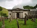
| |
| Bentpath Bridge | Bentpath, over River Esk, Eskdale | NY3116090248 | 55°12′06″N 3°04′59″W | Three-arch road bridge built circa 1736[139] | 16939 | 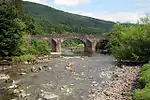
| |
| Barwhinnock House | Twynholm | NX6567954987 | 54°52′18″N 4°05′41″W | Early-19th-century Classical house[140] | 16989 |
| |
| Cumstoun House | Tongland | NX6832053319 | 54°51′26″N 4°03′10″W | Tudor Gothic house built 1829 by Thomas Hamilton[141] | 16993 | .jpg.webp)
| |
| Cumloden House | Minnigaff, Newton Stewart | NX4174367698 | 54°58′43″N 4°28′28″W | Gothic cottage house, circa 1820[142] | 17052 | 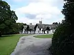
| |
| Garlies Castle | Minnigaff, Newton Stewart | NX4221769145 | 54°59′31″N 4°28′04″W | Remains of late-15th- or early-16th-century castle[143] | 17057 | .jpg.webp)
| |
| Dundrennan Abbey | Dundrennan | NX7494147506 | 54°48′24″N 3°56′50″W | Ruins of 12th-century Cistercian abbey[144] | 17072 | .JPG.webp)
| |
| Corsock House, Gates and Gatepiers | Corsock | NX7587475259 | 55°03′23″N 3°56′41″W | Large, mid-19th-century ornamental Gothic cast-iron gates[145] | 17094 | 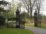
| |
| Argrennan House | Bridge of Dee, Castle Douglas | NX7146358085 | 54°54′03″N 4°00′22″W | 18th-century house, added to in the 19th century by James Gillespie Graham[146] | 17114 | 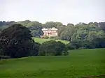
| |
| Old Tongland Bridge | Tongland, over River Dee | NX6969953655 | 54°51′38″N 4°01′54″W | Tongland, over River Dee[147] | 17123 |
| |
| Tongland Bridge | Tongland, over River Dee | NX6920053347 | 54°51′28″N 4°02′21″W | Single-arch stone bridge built 1808 by Thomas Telford and Alexander Nasmyth[148] | 17125 | 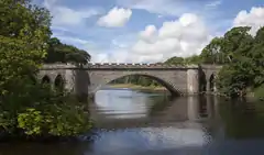
| |
| Tongland Hydro-Electric Power Station | Tongland | NX6951253559 | 54°51′35″N 4°02′04″W | Power station built 1934[149] | 17126 | 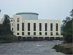
| |
| Torthorwald Cruck Cottage | Torthorwald | NY0326978477 | 55°05′29″N 3°31′02″W | 19th-century cruck-framed and thatched cottage[150] | 17157 | 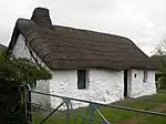
| |
| Wanlockhead Village Library | Wanlockhead | NS8738912987 | 55°23′52″N 3°46′47″W | Small village library, dated 1850[151] | 17192 | 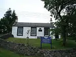
| |
| Goldielea Viaduct | Goldielea, Cargenbridge | NX9305073636 | 55°02′44″N 3°40′31″W | 18-arch former railway bridge opened 1859 as part of Castle Douglas to Dumfries railway[152] | 17201 | 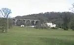
| |
| Kirkconnel House | Kirkconnel | NX9799068033 | 54°59′47″N 3°35′46″W | 16th-century house with later additions[153] | 17204 |
| |
| Terregles Estate Former Stables | Terregles | NX9315577637 | 55°04′54″N 3°40′31″W | Stable block probably by Sir Robert Smirke, circa 1831[154] | 17208 |
| |
| Tynron Parish Church | Tynron | NX8059093012 | 55°13′01″N 3°52′42″W | Gothic church by William Burn, built 1837[155] | 17222 | 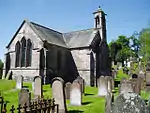
| |
| Amisfield Tower | Amisfield | NX9920383800 | 55°08′18″N 3°34′58″W | 16th-century tower house[156] | 17233 | 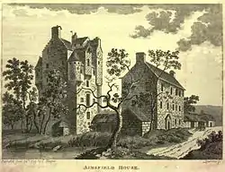
| |
| Tinwald House | Tinwald | NY0173580289 | 55°06′26″N 3°32′31″W | Classical mansion house by William Adam, dated 1740[157] | 17238 | 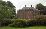
| |
| Tinwald House Cottages | Tinwald | NY0174380237 | 55°06′24″N 3°32′30″W | Service quarters probably by William Adam, circa 1740[158] | 17239 |
| |
| Tinwald House Farm Steading | Tinwald | NY0167680326 | 55°06′27″N 3°32′34″W | Steading probably by William Adam, circa 1740[159] | 17240 |
| |
| Comlongon Castle | Clarencefield, Ruthwell | 4/11/1971 | NY0794068950 | 55°00′24″N 3°26′27″W | 15th-century tower house and 1902 mansion house by James Barbour and J.M. Bowie[160] | 17245 | 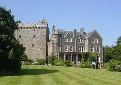
|
| Ruthwell Museum | Ruthwell | NY1018767387 | 54°59′35″N 3°24′19″W | Built circa 1760, former Henry Duncan Savings Bank opened 1810 as Scotland's first savings bank[161] | 17249 | 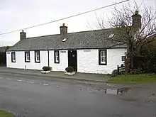
| |
| Nith Bridge | Thornhill, over River Nith | NX8708195480 | 55°14′26″N 3°46′39″W | Later 18th-century two-arch stone road bridge[162] | 17286 | _-_geograph.org.uk_-_533035.jpg.webp)
| |
| Drumlanrig Low Gardens House (Gardeners House) | Drumlanrig Estate | NX8576298206 | 55°15′53″N 3°47′57″W | Picturesque cottage by William Burn, circa 1831[163] | 17297 |
| |
| Sweetheart Abbey | New Abbey | NX9650666270 | 54°58′49″N 3°37′07″W | Remains of Cistercian abbey founded in 1273[164] | 17304 | 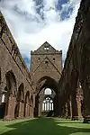
| |
| New Abbey Mill (Monksmill) | New Abbey | NX9622966249 | 54°58′48″N 3°37′23″W | Mid to late-18th-century water-mill, in working order[165] | 17323 | 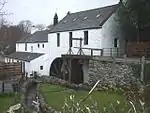
| |
| Thornhill Cross | Thornhill | NX8787995478 | 55°14′27″N 3°45′54″W | Mercat cross erected 1714, possibly by James Smith[166] | 17337 | 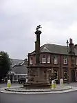
| |
| The Old House | New Abbey | NX9618566225 | 54°58′47″N 3°37′25″W | 17th-century house[167] | 17346 | 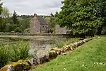
| |
| Monument to Henry Duncan | Mount Kedar, Mouswald | NY0718871551 | 55°01′47″N 3°27′13″W | Monument by James Raeburn, erected 1846 to the Rev. Henry Duncan (1774–1846)[168] | 17388 |
| |
| Sorbie Tower | Sorbie | NX4508947025 | 54°47′39″N 4°24′40″W | Late-16th-century tower house[169] | 19181 | 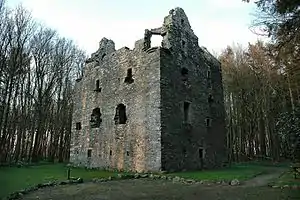
| |
| All Saints Episcopal Church | Challoch, Newton Stewart | NX3851767485 | 54°58′33″N 4°31′29″W | Gothic Revival church by William Habershon and Alfred Pite, built 1872[170] | 19190 | 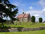
| |
| Tonderghie House | Isle of Whithorn | NX4430535670 | 54°41′31″N 4°25′02″W | Mid-18th-century country house[171] | 19248 | 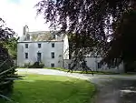
| |
| Tonderghie Steadings | Isle of Whithorn | NX4420535389 | 54°41′22″N 4°25′07″W | 19th-century steading with an almost complete horse-powered threshing machine[172] | 19249 |
| |
| Heron Monument | Monigaff Parish Churchyard, Minnigaff | NX4099066573 | 54°58′06″N 4°29′08″W | Classical monument of the Heron family, dated 1761[173] | 19313 |
| |
| Monreith House | Port William | NX3557742864 | 54°45′13″N 4°33′23″W | Classical mansion house by Alexander Stevens, built 1791 [174] | 19561 | 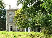
| |
| Old Place of Mochrum | Culshabbin, Mochrum | NX3080554053 | 54°51′09″N 4°38′13″W | Two 16th-century towers linked and restored in the later 19th-century[175] | 19570 | 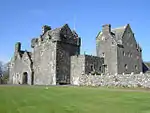
| |
| Annan Bridge | Annan, carrying the A75 over the River Annan | NY1910766585 | 54°59′14″N 3°15′57″W | Three-arch road bridge by Robert Stevenson, 1826[176] | 21061 | 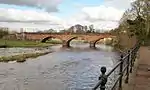
| |
| 27, 29 Bank Street | Annan | NY1933466461 | 54°59′10″N 3°15′44″W | Former British Linen Bank in the style of Walter Newall, circa 1840[177] | 21066 |
| |
| 5, 7, 9 High Street (Old Academy) | Annan | NY1916166537 | 54°59′13″N 3°15′53″W | Mid-18th-century town house, formerly the burgh academy[178] | 21086 | .jpg.webp)
| |
| Annan Old Parish Church | Annan, High Street | NY1958466612 | 54°59′15″N 3°15′30″W | Parish church with classical details, dated 1789[179] | 21106 | .jpg.webp)
| |
| Castle Douglas Cattle Mart | Castle Douglas | NX7681962564 | 54°56′33″N 3°55′28″W | Octagonal cattle market built 1900[180] | 22976 | 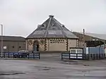
| |
| Lincluden Collegiate Church | Lincluden, Dumfries | NX9664077911 | 55°05′05″N 3°37′15″W | Ruins of 14th- or 15th-century church[181] | 26075 | 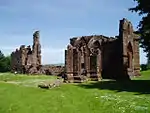
| |
| 5, 7, 9, 11 Bank Street | Dumfries | NX9713076011 | 55°04′04″N 3°36′45″W | Mid-18th-century town house, former home of Robert Burns[182] | 26083 |
| |
| Former Methodist Church | Dumfries, Buccleuch Street | NX9706976286 | 55°04′13″N 3°36′48″W | Classical church by Thomas Hunt, 1817[183] | 26102 | 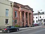
| |
| Robert Burns' House | Dumfries, Burns Street | NX9740675806 | 55°03′58″N 3°36′29″W | 18th-century house in which Robert Burns lived from 1793 until his death in 1796[184] | 26115 | 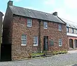
| |
| 25–37 Castle Street (odd numbers) | Dumfries | NX9706276295 | 55°04′13″N 3°36′49″W | Terrace of seven houses built circa 1830 to design by Robert Burn[185] | 26118 |
| |
| 41, 43, 45, 47 Castle Street | Dumfries | NX9698976395 | 55°04′17″N 3°36′53″W | Terrace built in the 1820s to design by Robert Burn [186] | 26120 |
| |
| 14-24 Castle Street (even numbers) | Dumfries | NX9710076299 | 55°04′14″N 3°36′47″W | Terrace built between 1806 and 1819 to design by Robert Burn[187] | 26122 |
| |
| 26, 28, 30 Castle Street | Dumfries | NX9702776398 | 55°04′17″N 3°36′51″W | Terrace built between 1806 and 1819 to design by Robert Burn[188] | 26123 |
| |
| Greyfriars Church | Dumfries | NX9712476302 | 55°04′14″N 3°36′45″W | Decorated Gothic style church by John Starforth, 1868[189] | 26126 | 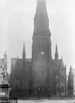
| |
| Dumfries Museum Observatory | Dumfries | NX9698775713 | 55°03′55″N 3°36′52″W | Late-18th-century windmill, remodelled by Walter Newall in 1836 as an observatory[190] | 26135 | .jpg.webp)
| |
| Queensberry Column | Dumfries, English Street | NX9723576149 | 55°04′09″N 3°36′39″W | Memorial column to 3rd Duke of Queensberry by Robert Adam, 1780[191] | 26173 | 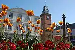
| |
| Midsteeple | Dumfries, High Street | NX9724076148 | 55°04′09″N 3°36′39″W | Town house and clock tower built 1707[192] | 26215 | 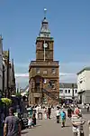
| |
| The Globe Inn | Dumfries, High Street | NX9730275974 | 55°04′03″N 3°36′35″W | Mid-18th-century inn[193] | 26230 | 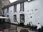
| |
| Former Trades Hall | Dumfries, Queensberry Square | NX9725176134 | 55°04′08″N 3°36′38″W | Classical hall by Thomas Boyd, 1804[194] | 26234 |
| |
| 29 Irish Street and 92 Whitesands | Dumfries | NX9722975838 | 55°03′59″N 3°36′39″W | Earlier 18th-century town house[195] | 26240 | 
| |
| 24 Nith Place | Dumfries | NX9732475858 | 55°04′00″N 3°36′34″W | Earlier 18th-century Baroque town house[196] | 26305 |
| |
| St Michael's Church | Dumfries, St Michael's Street | NX9755275692 | 55°03′54″N 3°36′21″W | Mid-18th-century church[197] | 26335 | 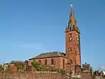
| |
| St Michael's Churchyard | Dumfries, St Michael Street | NX9754575699 | 55°03′55″N 3°36′21″W | 18th- and 19th-century monuments including Baroque Sharp of Hoddom monument[198] | 26336 | .jpg.webp)
| |
| St Michael's Churchyard, Burns' Mausoleum | Dumfries, St Michael Street | NX9760175690 | 55°03′54″N 3°36′18″W | Octagonal mausoleum of Robert Burns, by Thomas Hunt, 1815[199] | 26337 | 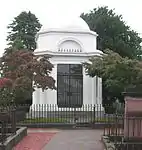
| |
| Devorgilla Bridge | Dumfries, over River Nith | NX9689076053 | 55°04′06″N 3°36′58″W | Medieval bridge, rebuilt many times[200] | 26354 | 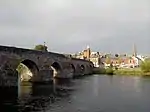
| |
| Blair House | Kirkcudbright, High Street | NX6816051070 | 54°50′13″N 4°03′16″W | Early-19th-century town house[201] | 36529 | 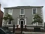
| |
| Broughton House | Kirkcudbright, High Street | NX6815151050 | 54°50′13″N 4°03′16″W | Mid-18th-century classical detached house[202] | 36530 | 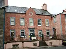
| |
| Kirkcudbright Tolbooth and Market Cross | Kirkcudbright, High Street | NX6806550896 | 54°50′08″N 4°03′21″W | 16th-century tolbooth and 17th-century mercat cross[203] | 36542 | 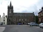
| |
| 66, 68, 70 High Street | Kirkcudbright | NX6808350883 | 54°50′07″N 4°03′20″W | 17th-century terraced houses[204] | 36545 |
| |
| 74 High Street and Cannon's Close | Kirkcudbright | NX6810150869 | 54°50′07″N 4°03′19″W | 17th-century terraced houses[205] | 36546 |
| |
| Langholm Parish Church | Langholm | NY3615084466 | 55°09′01″N 3°00′12″W | Large Gothic church by William Burn and David Bryce, 1843[206] | 37137 | 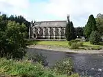
| |
| Lochmaben Parish Church | Lochmaben | NY0836582268 | 55°07′35″N 3°26′19″W | Gothic church built 1820, in the style of Walter Newall[207] | 37539 | 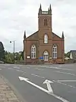
| |
| Lochmaben Tolbooth | Lochmaben | NY0818182576 | 55°07′44″N 3°26′30″W | 18th-century tolbooth with 19th-century additions by David Bryce[208] | 37541 |
| |
| Lockerbie Town Hall | Lockerbie | NY1369381645 | 55°07′18″N 3°21′17″W | Scots Baronial town hall by David Bryce, built from 1884[209] | 37579 | 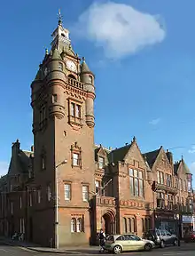
| |
| St Andrew's Parish Church | Moffat | NT0844305126 | 55°19′54″N 3°26′41″W | Gothic church by John Starforth, 1887[210] | 37881 | 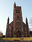
| |
| Moffat House Hotel | Moffat | NT0837005369 | 55°20′02″N 3°26′46″W | Substantial house by John Adam for the Earl of Hopetoun, 1762[211] | 37928 | 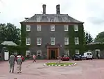
| |
| Sidmount Cottage | Moffat | NT0897105543 | 55°20′08″N 3°26′12″W | Villa dated 1836[212] | 37935 |
| |
| Penninghame Parish Church | Newton Stewart | NX4096565412 | 54°57′28″N 4°29′07″W | Gothic church by William Burn, 1838[213] | 38663 | 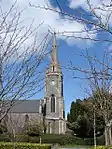
| |
| Cree Bridge | Newton Stewart, over River Cree | NX4115465653 | 54°57′36″N 4°28′57″W | Five-arch stone bridge, built 1813 by John Rennie[214] | 38667 | 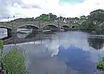
| |
| Douglas House, former Douglas School | Newton Stewart, King Street | NX4086266400 | 54°58′00″N 4°29′15″W | Former school of 1834, by John Henderson[215] | 38672 |
| |
| Sanquhar Tolbooth | Sanquhar | NS7809009913 | 55°22′05″N 3°55′30″W | Baroque tolbooth by William Adam, 1735[216] | 40540 | 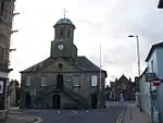
| |
| Stranraer Museum, formerly Old Town Hall | Stranraer, George Street | NX0594660834 | 54°54′16″N 5°01′42″W | 18th-century town hall with 19th-century extension[217] | 41745 | 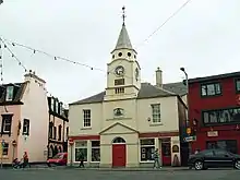
| |
| Stranraer Castle | Stranraer | NX0609060821 | 54°54′16″N 5°01′34″W | Early-16th-century L-plan tower house, remodelled in the 1980s[218] | 41765 | 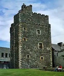
| |
| 53 George Street and entrance to Whithorn Priory | Whithorn | NX4454840251 | 54°43′59″N 4°24′57″W | Later 18th-century house with arched pend[219] | 42195 | 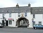
| |
| 55–57 (odd nos) George Street | Whithorn | NX4454040235 | 54°43′59″N 4°24′57″W | 18th-century houses[220] | 42196 |
| |
| 18 and 20 King Street | Stranraer | NX0581560903 | 54°54′18″N 5°01′49″W | Early-19th-century bakery and shop[221] | 45230 |
|
Notes
- Sometimes known as OSGB36, the grid reference (where provided) is based on the British national grid reference system used by the Ordnance Survey.
• "Guide to National Grid". Ordnance Survey. Retrieved 2007-12-12.
• "Get-a-map". Ordnance Survey. Retrieved 2007-12-17. - Historic Environment Scotland assign a unique alphanumeric identifier to each designated site in Scotland, for listed buildings this always begins with "LB", for example "LB12345".
- Listed twice
- Listed twice
- Also in England, listed at grade II*, Historic England. "Riddings Junction Viaduct (1268307)". National Heritage List for England. Retrieved 12 December 2014.
- Also in England, listed at grade II*, Historic England. "Riddings Junction Viaduct (1268307)". National Heritage List for England. Retrieved 12 December 2014.
- Also in England, listed at grade II*, Historic England. "Riddings Junction Viaduct (1268307)". National Heritage List for England. Retrieved 12 December 2014.
References
- Guide to the Protection of Scotland’s Listed Buildings (PDF). Historic Scotland. 2009. p. 4. ISBN 978-1-84917-013-0. Retrieved 2010-05-05.
- "What is Listing?". Historic Scotland. Retrieved 2010-05-05.
- Scottish Historic Environment Policy (PDF). Historic Scotland. October 2008. pp. 24–25. ISBN 978-1-84917-002-4. Retrieved 2010-05-05.
- Guide to the Protection of Scotland’s Listed Buildings, p. 17.
- "Rusco Tower: Listed Building Report". Historic Scotland.
- "Ardwall House: Listed Building Report". Historic Scotland.
- "Anwoth Old Church, Gordon Tomb And Churchyard: Listed Building Report". Historic Scotland.
- "Barscobe Castle: Listed Building Report". Historic Scotland.
- "Ironmacannie Mill: Listed Building Report". Historic Scotland.
- "Ken Bridge: Listed Building Report". Historic Scotland.
- "Millhousebridge Village, Millhouse Bridge: Listed Building Report". Historic Scotland.
- "Millhouse Bridge Village, Millhouse Bridge: Listed Building Report". Historic Scotland.
- "Old Tollbar Cottage At Dinwoodie: Listed Building Report". Historic Scotland.
- "Jardine Hall Stable Block: Listed Building Report". Historic Scotland.
- "Jardine Hall, Walled Garden And Gateways: Listed Building Report". Historic Scotland.
- "Buittle Bridge, Dalbeattie (Also Known As Craignair Bridge): Listed Building Report". Historic Scotland.
- "Rammerscales House: Listed Building Report". Historic Scotland.
- "Corseyard Farm And Boundary Walls: Listed Building Report". Historic Scotland.
- "Orchardton Tower: Listed Building Report". Historic Scotland.
- "Borgue Old House: Listed Building Report". Historic Scotland.
- "Plunton Castle: Listed Building Report". Historic Scotland.
- "Threave Castle: Listed Building Report". Historic Scotland.
- "Hensol House: Listed Building Report". Historic Scotland.
- "Hensol House, The Lainshaw Sundial: Listed Building Report". Historic Scotland.
- "Shillahill Bridge: Listed Building Report". Historic Scotland.
- "Dalton Village, Dalton Old Parish Church, Churchyard And Gatepiers: Listed Building Report". Historic Scotland.
- "Denbie House: Listed Building Report". Historic Scotland.
- "Denbie, Dovecot: Listed Building Report". Historic Scotland.
- "Bonshaw Tower And House And Courtyard Walls: Listed Building Report". Historic Scotland.
- "Brydekirk Village, Brydekirk Bridge: Listed Building Report". Historic Scotland.
- "Gilnockie Bridge (A7 Over River Esk): Listed Building Report". Historic Scotland.
- "Byreburnfoot Bridge And Embankment (A7 Over Byre Burn): Listed Building Report". Historic Scotland.
- "Hollows Or Gilnockie Tower: Listed Building Report". Historic Scotland.
- "Priorslynn, Cruck-Framed Building: Listed Building Report". Historic Scotland.
- "Riddings Junction Viaduct, Over Liddel Water: Listed Building Report". Historic Scotland.
- "Tarrasfoot Tile Works: Listed Building Report". Historic Scotland.
- "Hoddom Castle With Fosse Bridge And Driveway Bridge To South: Listed Building Report". Historic Scotland.
- "Repentance Tower: Listed Building Report". Historic Scotland.
- "Kinmount House And Conservatory, With Office Court And Gateways: Listed Building Report". Historic Scotland.
- "Earlstoun Castle: Listed Building Report". Historic Scotland.
- "Grennan Mill: Listed Building Report". Historic Scotland.
- "Crossmichael Parish Church And Churchyard (Church Of Scotland): Listed Building Report". Historic Scotland.
- "Crossmichael Church Gordon Memorial: Listed Building Report". Historic Scotland.
- "Glenlochar Bridge: Listed Building Report". Historic Scotland.
- "Greenlaw House: Listed Building Report". Historic Scotland.
- "Southwick Home Farm: Listed Building Report". Historic Scotland.
- "Stapleton Tower: Listed Building Report". Historic Scotland.
- "Dornock Village, Dornock House, Old Farmhouse And Steading, Including Detached Tall West Block: Listed Building Report". Historic Scotland.
- "Caerlaverock Castle And Arched Gateway To North East: Listed Building Report". Historic Scotland.
- "Ladyfield West (Formerly Hannayfield): Listed Building Report". Historic Scotland.
- "Crichton Royal Hospital Crichton Hall: Listed Building Report". Historic Scotland.
- "Durisdeer Village Durisdeer Parish Church, Queensberry Mausoleum, Former School/Vestry And Churchyard: Listed Building Report". Historic Scotland.
- "Drumlanrig Castle, Outbuildings And Pavilion Blocks Piers, Balustrades And Quadrant Walls And Garden Urns: Listed Building Report". Historic Scotland.
- "Wallacehall Assessment Centre (Former Academy And Schoolhouse): Listed Building Report". Historic Scotland.
- "Auldgirth Bridge: Listed Building Report". Historic Scotland.
- "Dalgonar Bridge Over Cairn Water: Listed Building Report". Historic Scotland.
- "Dunscore Village Dunscore Parish Church And Churchyard: Listed Building Report". Historic Scotland.
- "Ellisland Farmhouse And Steading: Listed Building Report". Historic Scotland.
- "The Crichton, Crichton Farm: Listed Building Report". Historic Scotland.
- "The Crichton, Crichton Memorial Church: Listed Building Report". Historic Scotland.
- "Hills Tower, Gatehouse And Courtyard Walls: Listed Building Report". Historic Scotland.
- "Langholm Lodge, Duchess Bridge (Over River Esk): Listed Building Report". Historic Scotland.
- "Knocknalling Barn: Listed Building Report". Historic Scotland.
- "Milnholm Farmhouse And Steading: Listed Building Report". Historic Scotland.
- "Skipper's Bridge (A7 Over River Esk): Listed Building Report". Historic Scotland.
- "Mossknowe House: Listed Building Report". Historic Scotland.
- "Springkell House: Listed Building Report". Historic Scotland.
- "Wyseby, Former Stables With Dovecot: Listed Building Report". Historic Scotland.
- "Kirkpatrick Fleming Parish Churchyard, Graham Of Mossknowe Burial Enclosure: Listed Building Report". Historic Scotland.
- "Douglas Mausoleum, Near To Kelton Parish Church, Railings And Gatepiers: Listed Building Report". Historic Scotland.
- "Gelston Castle: Listed Building Report". Historic Scotland.
- "Old Bridge Of Dee: Listed Building Report". Historic Scotland.
- "Craigielands House: Listed Building Report". Historic Scotland.
- "Cally Palace Hotel, Formerly Cally House: Listed Building Report". Historic Scotland.
- "Girthon Old Kirk And Churchyard: Listed Building Report". Historic Scotland.
- "Raehills House: Listed Building Report". Historic Scotland.
- "Beattock Village, The Old Brig Inn, Hotel And Outbuildings: Listed Building Report". Historic Scotland.
- "Boreland Village, Hutton And Corrie Parish Church, Churchyard And Gatepiers: Listed Building Report". Historic Scotland.
- "Corsewall Lighthouse, Lighthouse Keepers' Houses And Enclosure Walls: Listed Building Report". Historic Scotland.
- "Kinnel Bridge: Listed Building Report". Historic Scotland.
- "Spedlins Tower: Listed Building Report". Historic Scotland.
- "Elshieshields Tower And Adjoining House, Walled Garden, And Gatepiers At South: Listed Building Report". Historic Scotland.
- "Halleaths Former Stables (Houses And SSEB Stores And Workshops): Listed Building Report". Historic Scotland.
- "Hoddom Bridge: Listed Building Report". Historic Scotland.
- "Shortrig Windmill Tower, Horsemill And Steading Ranges: Listed Building Report". Historic Scotland.
- "Ecclefechan Village, High Street, Arched House Including Carlyle's Birthplace: Listed Building Report". Historic Scotland.
- "Kirkcowan Village, Kirkcowan Parish Church (C Of S) And Boundary Walls: Listed Building Report". Historic Scotland.
- "Craichlaw House: Listed Building Report". Historic Scotland.
- "Barholm Castle: Listed Building Report". Historic Scotland.
- "Carsluith Castle And Adjoining Steadings: Listed Building Report". Historic Scotland.
- "Baldoon Castle Gatepiers: Listed Building Report". Historic Scotland.
- "Old Place Of Monreith, Or Dowies, With Carriage House And Boundary Walls: Listed Building Report". Historic Scotland.
- "Ravenstone Castle: Listed Building Report". Historic Scotland.
- "Glasserton Parish Church Church Of Scotland Session House Churchyard Mausolea And Monuments: Listed Building Report". Historic Scotland.
- "Craigcaffie Tower: Listed Building Report". Historic Scotland.
- "Lochryan Estate, Lochryan House: Listed Building Report". Historic Scotland.
- "Lochinch Heritage Estate, Lochinch Castle Including Service Range, Bowling Alley, Boundary Walls And Gates: Listed Building Report". Historic Scotland.
- "Lochinch Heritage Estate, Castle Kennedy: Listed Building Report". Historic Scotland.
- "Old Bridge Of Urr Mill: Listed Building Report". Historic Scotland.
- "Fourmerkland Tower: Listed Building Report". Historic Scotland.
- "West Galloberry Farm Steading And Horsemill: Listed Building Report". Historic Scotland.
- "Blackwood House Former Stables: Listed Building Report". Historic Scotland.
- "Capenoch House: Listed Building Report". Historic Scotland.
- "Moniaive Village Kilneiss House: Listed Building Report". Historic Scotland.
- "Carnsalloch House: Listed Building Report". Historic Scotland.
- "Carnsalloch Chapel At The Mount: Listed Building Report". Historic Scotland.
- "Carnsalloch Former Stables: Listed Building Report". Historic Scotland.
- "Glenluiart House: Listed Building Report". Historic Scotland.
- "Kirkland Village Glencairn Parish Church: Listed Building Report". Historic Scotland.
- "Craigdarroch House: Listed Building Report". Historic Scotland.
- "Ross Mains: Listed Building Report". Historic Scotland.
- "Arbigland, John Paul Jones' Cottage With Kennels And Pump House: Listed Building Report". Historic Scotland.
- "Arbigland House: Listed Building Report". Historic Scotland.
- "Southerness Lighthouse: Listed Building Report". Historic Scotland.
- "Shennanton House: Listed Building Report". Historic Scotland.
- "Kirkdale Bridge: Listed Building Report". Historic Scotland.
- "Kirkdale House And Sundial: Listed Building Report". Historic Scotland.
- "Kirkdale Mausoleum And Kirkdale Kirk And Graveyard Walls: Listed Building Report". Historic Scotland.
- "Kirkdale Steadings And Slaughterhouse: Listed Building Report". Historic Scotland.
- "Lochnaw Castle, With Terrace, Gatepiers, Courtyard Walls, Bell, Monument And Pavilion: Listed Building Report". Historic Scotland.
- "Lochnaw, Walled Garden: Listed Building Report". Historic Scotland.
- "Logan House: Listed Building Report". Historic Scotland.
- "Logan Windmill: Listed Building Report". Historic Scotland.
- "Mull Of Galloway Lighthouse, Lighthouse Keepers' Houses And Boundary Walls: Listed Building Report". Historic Scotland.
- "Old Parish Church Of Kirkmaiden, With Graveyard, Graveyard Walls And Gatepiers: Listed Building Report". Historic Scotland.
- "Kirkmadrine Church Including Graveyard, Mctaggart Memorial, Boundary Walls, Gatepiers And Gates: Listed Building Report". Historic Scotland.
- "St Patrick Street, Old Parish Church: Listed Building Report". Historic Scotland.
- "Isle Of Whithorn, Isle Castle: Listed Building Report". Historic Scotland.
- "Castle Of Park: Listed Building Report". Historic Scotland.
- "Haugh Bridge, Bridge Over Urr Water, Near Haugh Of Urr: Listed Building Report". Historic Scotland.
- "Archbank Farm, Tall Barn With Waterwheel: Listed Building Report". Historic Scotland.
- "Granton House, Balustrade To South And Gatepiers: Listed Building Report". Historic Scotland.
- "Heatheryhaugh: Listed Building Report". Historic Scotland.
- "Cruggleton Church And Walled Burial Ground: Listed Building Report". Historic Scotland.
- "Galloway House And Park Walls: Listed Building Report". Historic Scotland.
- "Castlemilk: Listed Building Report". Historic Scotland.
- "Castlemilk, Driveway Bridge: Listed Building Report". Historic Scotland.
- "Bentpath Village, Westerkirk Old Churchyard, Johnstone Mausoleum: Listed Building Report". Historic Scotland.
- "Bentpath Village, Bentpath Bridge (Over River Esk): Listed Building Report". Historic Scotland.
- "Barwhinnock House: Listed Building Report". Historic Scotland.
- "Cumstoun House: Listed Building Report". Historic Scotland.
- "Cumloden House: Listed Building Report". Historic Scotland.
- "Garlies Castle: Listed Building Report". Historic Scotland.
- "Dundrennan Abbey: Listed Building Report". Historic Scotland.
- "Corsock House, Gates And Gatepiers: Listed Building Report". Historic Scotland.
- "Argrennan House: Listed Building Report". Historic Scotland.
- "Tongland, Old Tongland Bridge: Listed Building Report". Historic Scotland.
- "Tongland Bridge: Listed Building Report". Historic Scotland.
- "Tongland Hydro-Electric Power Station: Listed Building Report". Historic Scotland.
- "Torthorwald Village Cruck Cottage: Listed Building Report". Historic Scotland.
- "Wanlockhead Village Library: Listed Building Report". Historic Scotland.
- "Goldielea Viaduct: Listed Building Report". Historic Scotland.
- "Kirkconnel House: Listed Building Report". Historic Scotland.
- "Terregles Estate Former Stables: Listed Building Report". Historic Scotland.
- "Tynron Village Tynron Parish Church: Listed Building Report". Historic Scotland.
- "Amisfield Tower: Listed Building Report". Historic Scotland.
- "Tinwald House: Listed Building Report". Historic Scotland.
- "Tinwald House Cottages: Listed Building Report". Historic Scotland.
- "Tinwald House Farm Steading (Original 2-Storey L-Plan Block Only): Listed Building Report". Historic Scotland.
- "Comlongon Castle And Mansion House: Listed Building Report". Historic Scotland.
- "Ruthwell Village Ruthwell Museum Henry Duncan Savings Bank And Museum: Listed Building Report". Historic Scotland.
- "Nith Bridge (A702 Over River Nith): Listed Building Report". Historic Scotland.
- "Drumlanrig Low Gardens House (Gardeners House): Listed Building Report". Historic Scotland.
- "New Abbey Village Sweetheart Abbey And Precinct Walls: Listed Building Report". Historic Scotland.
- "New Abbey Village New Abbey Mill: Listed Building Report". Historic Scotland.
- "Thornhill Village The Cross: Listed Building Report". Historic Scotland.
- "New Abbey Village The Old House: Listed Building Report". Historic Scotland.
- "Mount Kedar Monument To Henry Duncan: Listed Building Report". Historic Scotland.
- "Old Place Of Sorbie Also Known As Sorbie Tower: Listed Building Report". Historic Scotland.
- "Challoch, All Saints Episcopal Church With Boundary Walls And Gatepiers: Listed Building Report". Historic Scotland.
- "Tonderghie House: Listed Building Report". Historic Scotland.
- "Tonderghie Steadings: Listed Building Report". Historic Scotland.
- "Monigaff Parish Church Graveyard, Heron Monument: Listed Building Report". Historic Scotland.
- "Monreith House, With Office Court, Gatepiers And Terrace Wall: Listed Building Report". Historic Scotland.
- "Old Place Of Mochrum With Walled Garden, Wellhead And Sundial: Listed Building Report". Historic Scotland.
- "Annan Bridge (A75 Over River Annan): Listed Building Report". Historic Scotland.
- "27, 29 Bank Street And Gatepiers And Railings: Listed Building Report". Historic Scotland.
- "5, 7, 9 High Street (Old Academy): Listed Building Report". Historic Scotland.
- "High Street Annan Parish Church And Churchyard Boundary Walls And Gatepiers, (Church Of Scotland): Listed Building Report". Historic Scotland.
- "New Market Street Castle Douglas Cattle Mart: Listed Building Report". Historic Scotland.
- "Abbey Lane, Lincluden Collegiate Church: Listed Building Report". Historic Scotland.
- "5, 7, 9, 11 Bank Street: Listed Building Report". Historic Scotland.
- "83 Buccleuch Street, Former Methodist Church And Railings: Listed Building Report". Historic Scotland.
- "24 Burns Street, Robert Burns' House: Listed Building Report". Historic Scotland.
- "25-37 Castle Street (Odd Numbers): Listed Building Report". Historic Scotland.
- "41, 43, 45, 47 Castle Street: Listed Building Report". Historic Scotland.
- "14-24 Castle Street (Even Numbers): Listed Building Report". Historic Scotland.
- "26, 28, 30 Castle Street: Listed Building Report". Historic Scotland.
- "Church Crescent, Greyfriars' Church: Listed Building Report". Historic Scotland.
- "Church Street, Dumfries Museum Observatory: Listed Building Report". Historic Scotland.
- "English Street, Queensberry Column (In Front Of Regional Council Offices): Listed Building Report". Historic Scotland.
- "High Street, Midsteeple: Listed Building Report". Historic Scotland.
- "56 High Street, Globe Inn: Listed Building Report". Historic Scotland.
- "136, 140 High Street/16, 17 Queensberry Square, Former Trades Hall: Listed Building Report". Historic Scotland.
- "29 Irish Street And 92 Whitesands Including Garden And Courtyard Walls, Outbuildings And Gatepiers: Listed Building Report". Historic Scotland.
- "24 Nith Place: Listed Building Report". Historic Scotland.
- "St Michael's Street, St Michael's Church: Listed Building Report". Historic Scotland.
- "St Michael's Churchyard And Main Gate And Holy Cross Churchyard: Listed Building Report". Historic Scotland.
- "St Michael's Street, St Michael's Churchyard Burns' Mausoleum: Listed Building Report". Historic Scotland.
- "Whitesands, Devorgilla Bridge: Listed Building Report". Historic Scotland.
- "8 High Street, Blair House And Summer House And Walls To Castle Dykes.: Listed Building Report". Historic Scotland.
- "12 High Street, With 10 High Street, Broughton House And Walls To Castle Dykes: Listed Building Report". Historic Scotland.
- "High Street, Tolbooth, Market Cross And Well: Listed Building Report". Historic Scotland.
- "66 (Wynd End) W. Side Of Close, 68 E. Side Of Close And 70 High Street: Listed Building Report". Historic Scotland.
- "74 High Street And Cannon's Close: Listed Building Report". Historic Scotland.
- "Langholm Parish Church: Listed Building Report". Historic Scotland.
- "High Street, Lochmaben Parish Church Boundary Wall And Gatepiers (St Magdalene's): Listed Building Report". Historic Scotland.
- "High Street, Tolbooth Including Iron Lamps: Listed Building Report". Historic Scotland.
- "High Street, Town Hall: Listed Building Report". Historic Scotland.
- "Churchgate St Andrew's Parish Church: Listed Building Report". Historic Scotland.
- "High Street Moffat House Hotel: Listed Building Report". Historic Scotland.
- "Sidmount Avenue Sidmount Cottage: Listed Building Report". Historic Scotland.
- "Church Street, Penninghame Parish Church, St John's (Church_Of Scotland), Boundary Walls And Railings: Listed Building Report". Historic Scotland.
- "Cree Bridge: Listed Building Report". Historic Scotland.
- "King Street, Douglas House, Former Douglas School: Listed Building Report". Historic Scotland.
- "High Street, Tolbooth/Town House: Listed Building Report". Historic Scotland.
- "55 George Street, Stranraer Museum Formerly Old Town Hall: Listed Building Report". Historic Scotland.
- "George Street And Castle Street, Stranraer Castle: Listed Building Report". Historic Scotland.
- "53 George Street And Entrance To Priory: Listed Building Report". Historic Scotland.
- "55-57 (Odd Nos) George Street: Listed Building Report". Historic Scotland.
- "18 And 20 King Street: Listed Building Report". Historic Scotland.
External links
![]() Media related to Category A listed buildings in Dumfries and Galloway at Wikimedia Commons
Media related to Category A listed buildings in Dumfries and Galloway at Wikimedia Commons