List of highest paved roads in Europe
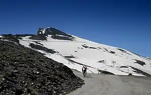
This is a list of the highest paved roads in Europe. It includes roads that are over 1 kilometre (0.62 miles) long and whose culminating point is over 2,000 metres (6,562 feet) above sea level. This height approximately corresponds to that of the highest settlements in Europe and to the tree line in several mountain ranges such as the Alps and the Pyrenees, where most of the highest roads are located. Some of the listed roads are closed to motorised vehicles, although they are normally all accessible to pedestrians and cyclists. These mountain roads are visited by drivers, motorcyclists, hikers, and bicyclists for their scenery and often feature in the routes of European bicycle races such as the Vuelta a España, the Tour de Suisse, the Tour de France and the Giro d'Italia.
Below the list of highest roads is a list of the highest motorways (controlled-access highways) in Europe. It includes motorways whose culminating point is over 1,000 metres (3,281 feet) above sea level.
Highest paved roads
| Highest elevation | Name(s) | Mountains | Country | Type | From / Between | Remarks | Highest point |
|---|---|---|---|---|---|---|---|
| c. 3,300 m[1] | Veleta | Sierra Nevada | dead end | Granada and Pico Veleta | Access road from Granada.[2] Free access until Hoya de la Mora at 2,526 m.[3] From Hoya de la Mora onwards, the road gets much narrower and access to motor vehicles is restricted to those previously authorized. Asphalt ends at around 3,300 m but the road continues unpaved until reaching 3,380 m. It used to cross over, unpaved, to the village of Capileira in the Western Alpujarras but was closed by the Sierra Nevada National Park in 1999. | 37°03′21″N 03°22′09″W | |
| 2,845 m | IRAM | Sierra Nevada | dead end | From Veleta-road | Private road serving a telescope.[4] Side road from the Veleta road (from c. 2,670 m). | 37°03′57″N 03°23′35″W | |
| 2,829 m | Ötztal_Glacier_Road (Tiefenbachferner) | Ötztal Alps | dead end | Sölden | access road from Sölden to Rettenbachferner (side road up to 2,795 m) and Tiefenbachferner (2,803 m) glaciers, highest point at southern end of the 1,7 km long tunnel[5][6] | 46°55′29″N 10°56′40″E | |
| 2,802 m | Cime de la Bonette | French Alps | loop road | One-way loop road running from Col de la Bonette at 2,715 m, and surrounding Cime de la Bonette (2,862 m); the highest point on the road is at 2,802 m | Hors catégorie climb in the Tour de France | 44°19′18″N 6°48′25″E | |
| 2,770 m | Col de l'Iseran | Graian Alps | pass | Val-d'Isère, Tarentaise and Bonneval-sur-Arc, Maurienne | Highest paved mountain pass in the Alps. Hors catégorie climb in the Tour de France. Latest French IGN maps mark this pass as 2,764 metres. From the pass a paved side road to Lac de Céma (0,9 km) and further to Pissaillas (1,4 km), both approximately at the same level as the pass. | 45°25′1″N 07°01′51″E | |
| 2,757 m | Stilfserjoch / Passo dello Stelvio | Ortler Alps Eastern Alps | pass | Prato allo Stelvio and Bormio | the highest paved mountain pass in the Eastern Alps. Often designated the Cima Coppi in the annual running of the Giro d'Italia. The shield at the pass summit indicates a height of 2,760 metres. From the pass a short paved side road to cafeteria Tibethütte (c. 2,770 m). | 46°31′43″N 10°27′10″E | |
| 2,750 m | Kaunertaler Gletscherstraße | Ötztal Alps | dead end | Prutz | Access road from Feichten to the Weißseeferner and a ski area. Also the highest bus stop in Austria. | 46°51′51″N 10°42′48″E | |
| 2,744 m | Col Agnel / Colle dell'Agnello | Cottian Alps | pass | Queyras and Pontechianale | highest international paved pass of the Alps. Often designated the Cima Coppi in the annual running of the Giro d'Italia. Hors catégorie climb in the Tour de France | 44°41′2″N 06°58′46″E | |
| 2,715 m | Col de la Bonette | French Alps | pass | Jausiers and Saint-Étienne-de-Tinée | Hors catégorie climb in the Tour de France. A one-way loop road originates here to a marble monument at 2,802 m, conventionally named Cime de la Bonette, although the real summit is higher up at 2,862 m, accessible on foot. | ||
| 2,645 m | Col du Galibier | Dauphiné Alps | pass | Saint-Michel-de-Maurienne and Briançon | Hors catégorie climb in the Tour de France | 45°03′50.4″N 06°24′28.8″E | |
| 2,641 m | Colle del Nivolet | Graian Alps | pass | Locana (Piedmont) | Film location in The Italian Job, including the final bus crash. Lago Serrù (2,275 m) is bypassed along the road. From the pass the paved road continues down to Rifugio Savoia (2,520 m), ending soon after. | 45°28′49″N 7°08′32″E | |
| 2,621 m | Passo di Gavia | Italian Alps | pass | Bormio (Sondrio) and Ponte di Legno (Brescia) | Often designated the Cima Coppi in the annual running of the Giro d'Italia | 46°20′37″N 10°29′17″E | |
| 2,572 m | Edelweißspitze | Hohe Tauern | dead end | Fusch (Salzburg) and Heiligenblut (Carinthia) | Side road of the Grossglockner High Alpine Road, from Fuscher Törl (2,428 m) | 47°07′25″N 12°49′53″E | |
| 2,552 m | Road to Vintcheto | Rila | dead end | Pastra village (Rila valley) | Highest concrete-paved road on the Balkans. The highest section crosses the ridge between the two connected reservoirs at Vintcheto (Kalin Reservoir 2,394 m, Karagyol Reservoir 2,364 m) and is closed between late October and beginning of July due to heavy snow conditions. | 42°10′53″N 23°15′23″E | |
| 2,535 m | Meghri Pass | Zangezur Mountains | pass | Kajaran (Syunik Marz) and Lichkvaz (Syunik Marz) | Highest paved mountain pass in Armenia | 39°11′59″N 46°16′12″E | |
| 2,504 m | Großglockner-Hochalpenstraße | Hohe Tauern | pass | Fusch (Salzburg) and Heiligenblut (Carinthia) | Toll road. It has two passes, Hochtor (tunnel, 2,504 m) and Fuscher Törl (2,428 m). In addition, there are two side roads, to Edelweißspitze (2,572 m) and to Kaiser-Franz-Josefs-Höhe (2,369 m), both dead ends. | ||
| 2,501 m | Umbrailpass / Giogo di Santa Maria / Pass Umbrail | Ortler Alps Eastern Alps | pass | Santa Maria Val Müstair and Bormio | near Passo dello Stelvio | 46°32′35″N 10°26′02″E | |
| 2,481 m | Colle Fauniera | Cottian Alps | pass | Castelmagno / Ponte Marmora, Piedmont and Demonte | Also known as Colle dei Morti ("Hill of the Dead") | 44.3857°N 7.12189°E | |
| 2,480 m | Nufenenpass / Passo della Novena | Lepontine Alps | pass | Ulrichen and Airolo | Views of the Finsteraarhorn and the Gries Glacier | 46°28′41″N 08°23′35″E | |
| 2,474 m | Timmelsjoch / Passo del Rombo | Ötztal Alps | pass | Ötz, Tyrol and St. Leonhard in Passeier, South Tyrol | Paved road projected before WW II but completed only in 1967. Closed to lorries and vehicles with trailers. Toll station on Austrian side. | 46°54′19″N 11°05′50″E | |
| 2,469 m | Col du Grand-Saint-Bernard / Colle del Gran San Bernardo | Valais Alps | pass | Martigny, Valais and Aosta, Aosta Valley | The third highest road pass in Switzerland. Italian border is c. 0,4 km westwards from the pass. | 45°52′08″N 7°10′14″E | |
| 2,454 m | Col de la Moutière | Alps | pass | Saint-Dalmas-le-Selvage and Bayasse or Jausiers via the Col de Restefond | The north side is not paved (some concrete parts, though) | ||
| 2,432 m | Hochwurtenspeicher (Mölltaler Gletscherstraße) | Alps | dead end | Ausserfragant | [7] By the Gletscherbahn is a barrier as a roadblock. Several reservoir lakes along the road (Wurtenspeicher 1,695 m, Stübelesee c. 2,310 m, Weißsee c. 2,370 m). Also, a side road of c. 1 km to Feldsee 2,217 m (from c. 2,120 m). | ||
| 2,429 m | Furkapass | Uri Alps Lepontine Alps | pass | Gletsch, Valais and Realp, Canton of Uri | used as a location in the James Bond film Goldfinger. Site of the Rhone Glacier, source of river Rhone. In-glacier prepared Ice Cave accessible from the road at 2,300 m | 46°34′22″N 08°25′00″E | |
| 2,420 m | Großsee (Zirknitztal) | Alps | dead end | Döllach | [8] | ||
| 2,418 m | Mirador de Roque de los Muchachos | La Palma (Islas Canarias) | dead end | Santa Cruz de La Palma and Hoya Grande | Not located in the continental Europe but belongs to Spain. Side road of 3,7 km from LP-4 road (from c. 2,145 m), ending at a parking place. Highest road on La Palma island (and in the Canary Islands). Along the road there are strictly forbidden access roads to some 15 observatories of the Roque de los Muchachos Observatory. By the way, the highest points of the LP-4 road are c. 2,290 m and c. 2,270 m, located very near kilometer signs 31 and 33 of the road, respectively. Neither of these passes is named, but the latter is near the Mirador de Los Andenes. | 28°45′15.99″N 17°53′6.56″W | |
| 2,416 m | Colle Valcavera | Cottian Alps | pass | Demonte | Side road (100 m) from the Colle della Fauniera road (at 1,9 km distance). On the western side of the Valcavera pass the road is gravel (Maira-Stura-Kammstrasse, MSKS), high road of 14,7 km to Colle del Preit (2,076 m). | ||
| 2,413 m | Col du Granon | Alps | pass | Saint-Chaffrey, La Salle-les-Alpes | Hors catégorie climb in the Tour de France, paved only on the west side. | 44°57′46″N 06°36′40″E | |
| 2,408 m | Port d'Envalira | Pyrenees | pass | Soldeu and El Pas de la Casa | Highest paved road pass in the Pyrenees. The pass is bypassed by the Envalira Tunnel. It is heavily trafficked by duty free day trippers from France. | 42°32′24.2″N 1°43′10.58″E | |
| 2,394 m | Oscheniksee | Alps | dead end | Innerfragant | Side road from the Mölltaler Gletscherstraße. At the beginning is a barrier as a roadblock. | ||
| 2,394 m | Road to Kalin Reservoir | Rila | dead end | Pastra village (Rila valley) | Concrete-paved road to the highest reservoir in the Balkans[9][10] | 42°10′21″N 23°15′3″E | |
| 2,390 m | Oberaarsee | Bernese Alps | dead end | Grimselpass (canton of Bern) | Highest point c. 900 m from Oberaarsee (2,303 m) | 46°33′08″N 08°16′48″E | |
| 2,389 m | Lac de Moiry | Valais Alps | dead end | Grimentz-Lac de Moiry-Lac de Châteaupré (canton of Valais) | 46°06′24″N 07°34′44″E | ||
| 2,386 m | Griessee | Alps | dead end | Nufenen Pass road | Side road from Nufenenpass-road (from c. 2300 m). Some short gravel sections because of worn out asphalt. | 46°27′44″N 08°22′22″E | |
| 2,383 m | Flüelapass | Albula Alps | pass | Davos and Susch, (Graubünden) | 46°45′01″N 09°56′52″E | ||
| 2,379 m | Georgian Military Road, Jvari Pass | Caucasus Mountains | pass | Vladikavkaz (Russia) and Tbilisi (Georgia) | 42.5042°N 44.4538°E | ||
| 2,370 m | Colle Esischie | Cottian Alps | pass | Ponte Marmora and Pradleves | Along the road of Colle della Fauniera, at 1,5 km distance | ||
| 2,370 m | Plan du Lac | Alps | dead end | Termignon | In the Vanoise National Park. Road continues to Entre-Deux-Eaux 2,012 m (dead end). | ||
| 2,369 m | Kaiser-Franz-Josefs-Höhe | Hohe Tauern | dead end | Fusch (Salzburg) and Heiligenblut (Carinthia) | Side road of the Grossglockner High Alpine Road, from c. 1,860 m | ||
| 2,361 m | Col d'Izoard | Cottian Alps | pass | Briançon, and Guil, Queyras, Guillestre | Hors catégorie climb in the Tour de France | 44°49′12″N 06°44′07″E | |
| 2,356 m | Teide | Tenerife (Islas Canarias) | pass | Los Cristianos | Not located in the continental Europe but belongs to Spain. | ||
| 2,350 m | Col de la Lombarde / Colle della Lombarda | Maritime Alps | pass | Isola, via Isola 2000 and Vinadio | Hors catégorie climb in the Tour de France | 44°12′8″N 07°09′1″E | |
| 2,350 m | Val Thorens | French Alps | dead end | Saint-Martin-de-Belleville, (Tarentaise Valley Savoie), near Chambéry | Hors catégorie climb in the Tour de France | ||
| 2,347 m | Col du Gondran | Alps | dead end | Briançon | The road is closed to general traffic. Tarmac is partly worn out. From the pass gravel roads (MTB recommended) continue to, for example, Fort du Gondran (Gondran C), which is located at Sommet des Anges (2,459 m), Fort Le Janus (2,529 m) and down to Montgenèvre (1,860 m). | ||
| 2,340 m | Tguma Parkplatz | Alps | dead end | Zillis, via Wergenstein | Last c. 200 m is gravel | 46°37′26″N 09°21′51″E | |
| 2,340 m | Tre Cime di Lavaredo | Sexten Dolomites | dead end | near Cortina d'Ampezzo, Lake Misurina | Sometimes designated the Cima Coppi in the annual running of the Giro d'Italia, | 46°37′07″N 12°18′20″E | |
| 2,328 m | Berninapass / Passo del Bernina | Bernina Range Alps | pass | Celerina and Tirano | 46°24.744′N 10°1.71′E | ||
| 2,326 m | Col de la Cayolle | Maritime Alps Alps | pass | Barcelonnette, (Ubaye Valley) and Saint-Martin-d'Entraunes | The road leads to the red-rock Gorges de Daluis at Daluis | 44°15′32″N 6°44′38″E | |
| 2,314 m | Albulapass (Pass d'Alvra) | Albula Range | pass | Tiefencastel, via Bergün and La Punt (Inn Valley, Engadin) | 46°35′N 09°53′E | ||
| 2,314 m | Forcola di Livigno | Livigno Alps | pass | Val Poschiavo and Livigno | 46°26′33″N 10°03′25″E | ||
| 2,311 m | Lago del Narèt | Lepontine Alps | dead end | Fusio and Lago del Narèt, Ticino | 46°28′47″N 8°34′31″E | ||
| 2,310 m | Lago dei Cavagnöö | Lepontine Alps | dead end | Robièi and Lago dei Cavagnöö, Ticino | Only accessible by aerial tramway from San Carlo (1,040 m). Lowest point of the road: 1,856 m | 46°27′19″N 8°30′30″E | |
| 2,304 m | Col de la Loze | French Alps | pass | Courchevel and Meribel | Road built in 2019 | 45°24′18″N 6°36′07″E | |
| 2,302 m | Port de Cabús | Pyrenees | pass | Erts and Llavorsí | 2302m[11] Tarmac road surface on the Andorra side (via Coll de la Botella, 2,064 m), but not paved on the Spanish side. | 42°32′47″N 1°25′11″E | |
| 2,291 m | Passo del Foscagno | Livigno Range | pass | Livigno (via Passo d'Eira & Trepalle) and Bormio | 46°29′42″N 10°12′32″E | ||
| 2,284 m | Colle di Sampeyre | Cottian Alps | pass | Sampeyre and Stroppo / Elva | 44°33′4″N 7°7′8″E | ||
| 2,284 m | Julierpass (Pass da Güglia) | Albula Range | pass | Engadin valley and Tiefencastel | watershed / drainage divide between the basins of the Rivers Rhine and Danube | 46°28.32′N 09°43.74′E | |
| 2,280 m | Saut Dam | Alps | dead end | Lac du Chevril | Road to Sassière Lake | 45°29′N 06°58′E | |
| 2,259 m (pass) 2,224 m (tunnel) | Sustenpass | Urner Alps | pass | Innertkirchen, (Canton of Bern) and Wassen, Canton of Uri | Views of the Stein Glacier. Old passroad is nowadays a dead end (for vehicles). Sustenpass tunnel offers much much more popular thoroughfare between the valleys. Its altitude is 2,224 m at the eastern end, and 2,223 m at the western end. | 46°43.8′N 08°26.94′E | |
| 2,257 m | Bola del Mundo | Sierra de Guadarrama | dead end | Puerto de Navacerrada | Sideroad of the Puerto de Navacerrada. Paved with rough cement and not open to regular road traffic.[12][13] | 40°47′N 03°58′W | |
| 2,257 m | Lago della Sella | Alps | dead end | Gotthard Pass | 46°33′33″N 08°35′34″E | ||
| 2,252 m | Col du Sanetsch | Bernese Alps | dead end | Pont-de-la-Morge (or Sion) (Valais)[14] | On the north side road continues to Lac de Sénin (2,034 m), ending soon after. | ||
| 2,250 m | Col d'Allos | Alps | pass | Barcelonnette, (Ubaye Valley) and Colmars | |||
| 2,244 m | Passo di Sella / Sella Joch | Trentino South Tyrol | pass | Val Gherdëina, South Tyrol and Canazei, Fascia Valley | Highest road pass in the Dolomites | ||
| 2,242 m | Passo Scimfuss | Alps | dead end | Gotthard Pass | 46°32′35″N 08°35′28″E | ||
| 2,240 m | Arcalís (Estación de Esquí de Arcalís) | Pyrenees | dead end | Ordino | Hors catégorie climb in the Tour de France | ||
| 2,239 m | Dosso dei Galli | Alps | dead end | Passo del Maniva (1,664 m) and Passo di Croce Domini (1,892 m) | Side road from Sella dell'Auccia. Military road. Access restricted. | ||
| 2,239 m | Passo Pordoi | Dolomites | pass | Canazei and Livinallongo del Col di Lana | Often designated the Cima Coppi in the annual running of the Giro d'Italia | ||
| 2,236 m | Passo di Giau | Dolomites | pass | Cortina d'Ampezzo and Selva di Cadore / Livinallongo del Col di Lana | 46°29.05′N 12°5.1′E | ||
| 2,231 m | Alpe Galm | Alps | dead end | Guttet-Oberu-Galm | 46°21′23″N 07°40′52″E | ||
| 2,225 m | Err-Puigmal Jaça del Prat de Tossa | Pyrenees | dead end | Err | |||
| 2,221 m | Männlichen | Bernese Oberland | pass | Grindelwald Grund | Good surface to top | ||
| 2,215 m | Col de Portet | Pyrenees | dead end | Saint-Lary-Soulan | Hors catégorie climb in the Tour de France. On the other side of the pass a steep gravel road to Lac de l'Oule and below. | 42°49′59″N 0°14′12″E | |
| 2,211 m | Penserjoch / Passo di Pennes | Trentino Alto Adige | pass | Sterzing/Vipiteno and Bolzano | |||
| 2,208 m | Col des Tentes | Pyrenees | dead end | Luz-Saint-Sauveur, via Gèdre | A narrow paved road continues 800 m (to c. 2,180 m) towards Port de Boucharo (c. 2,270 m) but a becomes then a gravel road, and later a path (which is blocked with stones). | 42°42′49″N 0°3′4″E | |
| 2,208 m | Passo d'Eira | Livigno Range | pass | Livigno and Trepalle | A modest elevation between Livigno and Trepalle | ||
| 2,205 m | Cim de Coma Morera | Pyrenees | dead end | Ossèja | |||
| 2,205 m | Lac du Vieux Émosson | Alps | dead end | Finhaut, via Lac d'Émosson | Public access to Émosson dam (1965m), restricted access to Vieux Émosson dam | 46°03′47″N 06°53′56″E | |
| 2,205 m | Täschalp | Alps | dead end | Visp, via Täsch | 46°03′30″N 07°48′45″E | ||
| 2,203 m | Mattmarksee | Valais Alps | dead end | Visp, via Stalden | 46°03′01″N 07°57′50″E | ||
| 2,200 m | Lac d'Aumar | Pyrenees | dead end | Saint-Lary-Soulan | Road maximum just before Lac d'Aumar (2192 m). Road continues past it, to nearby Lac d'Aubert (2,148 m). | ||
| 2,192 m | Passo di Valparola | Dolomites | pass | Badia, South Tyrol and Falzarego Pass and Cortina d'Ampezzo (Belluno) | On the northern side of the pass is Rifugio Passo Valparola (2,168 m). | 46°31′59.88″N 11°58′59.88″E | |
| c. 2,190 m | Embalse de Llauset (La Presa de Llauset) | Pyrenees | dead end | Side road from road N-230. After Aneto the quality of the road is very bad. Last 1,4 km the road is in a dark tunnel. | 42.57279°N 0.712757°E | ||
| 2,188 m | Col du Petit Saint-Bernard / Colle del Piccolo San Bernardo | Valais Alps Mont Blanc Massif | pass | Tarentaise, (Savoie) and Aosta Valley | 45°40′49″N 6°53′2″E | ||
| 2,183 m | Col du Petit Mont Cenis | Alps | dead end | Lanslebourg | Side road, starts just below/south of Col du Mont Cenis (2,081 m). Last 100 m is gravel. | ||
| 2,176 m | Colle delle Finestre | Cottian Alps | pass | Susa Valley and Val Chisone | Northern side (from Susa) of this road is gravel from c. 1,450 m, but it is a classic in Giro d'Italia. | 45°04′18.49″N 7°03′12.48″E | |
| 2,176 m | Rifugio Forni (Rifugio Ghiacciaio dei Forni) | Alps | dead end | Santa Caterina di Valfurva | Gravel from 2139 m. | 46°25′13″N 10°31′19″E | |
| 2,175 m | Lac de Cap-de-Long | Pyrenees | dead end | Saint-Lary-Soulan | |||
| 2,173 m | Croix de Coeur | Alps | pass | Sembrancher, via Verbier and Riddes | Both sides are nowadays paved. | 46°07′18″N 07°13′57″E | |
| 2,168 m | Tikmataji Pass | Lesser Caucasus | pass | Tbilisi Tsalka and Ninotsminda Akhalkalaki | Baku–Tbilisi–Kars railway also goes via this pass | 41°29′46″N 43°52′18″E | |
| 2,165 m | Grimselpass | Alps | pass | Innertkirchen, Bern and Gletsch, Valais | 46°33.72′N 8°20.34′E | ||
| 2,155 m | Calar Alto | Sierra de los Filabres | pass | road A92 (below Aulago) and Gérgal/Serón/Tíjola | Calar Alto Observatory | ||
| 2,150 m | Les Arcs 2000 | Alps | dead end | Bourg-Saint-Maurice | Tarentaise, (Savoie) | ||
| 2,149 m | Ofenpass / Pass dal Fuorn | Alps | pass | Zernez, Engadin and Val Müstair | 46°38.472′N 10°17.598′E | ||
| 2,145 m | Transalpina Pasul Urdele | Carpathian Mountains | pass | Novaci, Romania and Sebeș | Highest paved road in Romania[15] Widening and asphalting works started in 2010, but were not yet finished (cca. 2–3 km of roadbed-only - alternating with asphalted areas -, several viaducts with only one-lane accessible and tens of unfinished ditches across the road for collection of slopes' water, which require slowing down to 5–10 km/h. It also lacks safety elements - parapets, reflective aids, road marks, road signs). Circa 6 km north is another pass, Pasul Muntiu (c. 2,095 m). | 45.345°N 23.657°E | |
| 2,144 m | Vallter 2000 | Pyrenees | dead end | Camprodon | 42°25′37″N 2°15′54″E | ||
| 2,141 m | Grande Dixence Dam | Valais Alps | dead end | Sion, via Hérémence | 46°05′03″N 07°24′13″E | ||
| 2,136 m | Collado de las Sabinas | Sierra Nevada | pass | Güejar Sierra and kilometer point 33.4 of the Veleta Road | |||
| 2,134 m | Berghaus Nagens | Alps | dead end | Laax | 46°51′42″N 09°13′50″E | ||
| 2,133 m | Passo di Gardena / Grödner Joch | Dolomites | pass | Sëlva, Val Gardena and Corvara, South Tyrol | |||
| 2,133 m | Parking de Laus (Lac d'Allos parking) | Alps | dead end | Colmars | [16] From parking area it is c. 2 km hiking to Lac d'Allos. | 44.245437°N 6.698065°E | |
| 2,130 m | Campo Imperatore | Apennines | Dead End | Gran Sasso and Campo Imperatore | Leads to hotel used by Italian army to imprison Benito Mussolini. It is often a stage in the "Giro d'Italia" bike race[17][18][19] | 42°28′N 13°33′E | |
| 2,130 m[20] | Roki Tunnel | Caucasus Mountains | pass | Tskhinvali Region(Samachablo)/North Ossetia–Alania | 42°36′03″N 44°06′54″E | ||
| 2,130 m | Tignes (Val Claret) | Alps | dead end | Tarentaise (Savoie) | |||
| 2,124 m | Juf (Avers valley) | Alps | dead end | Ausserferrera | 46°26′45″N 09°34′45″E | ||
| 2,117 m | Splügenpass / Passo dello Spluga | Lepontine Alps Rhaetian Alps | pass | Splügen (Graubünden) and Chiavenna (Lombardy) | described by Mary Shelley | 46°30.36′N 09°20.22′E | |
| 2,115 m | Col du Tourmalet | Pyrenees | pass | Sainte-Marie-de-Campan and Luz-Saint-Sauveur | Hors catégorie climb in the Tour de France | 42°54′29.50″N 0°8′42.40″E | |
| 2,108 m | Col de Vars | Cottian Alps | pass | Saint-Paul-sur-Ubaye and Vars, Hautes-Alpes / Guillestre | 44°32′20″N 6°42′10″E | ||
| 2,107 m | Arolla | Valais Alps | dead end | Sion, via Les Haudères (canton of Valais | Highest point above Arolla village (2,008 m). Or, instead of turning to Arolla village, pavement of Val d'Arolla -road ends at 2,027 m (after a pumping station). | 46°01′33″N 07°28′39″E | |
| 2,106 m | Gotthard Pass (main road) | Lepontine Alps | pass | Airolo, Ticino and Göschenen, Canton of Uri | 46.559167°N 08.561389°E | ||
| 2,106 m | Gotthard Pass (Tremola) | Lepontine Alps | pass | Motto Bartola, Ticino and Brüggloch, Canton of Uri | Historical road paved with granite stones | 46.559167°N 08.561389°E | |
| 2,105 m | Passo di Falzarego | Dolomites | pass | Andráz and Cortina d'Ampezzo | Nearby is Passo di Valparola (2,192 m) | 46°31′8″N 12°0′34″E | |
| 2,105 m | Schöneben (Skihaus) / Belpiano | Eastern alps | dead end | Reschen (Reschensee) and San Valentino alla Muta | possible to drive the ramp to the ski station. | ||
| 2,103 m | Sella dell'Auccia | Alps | pass | Passo del Maniva and Passo di Croce Domini | Paved from Passo del Maniva (1,664 m). Unpaved (at least partly) from Passo di Croce Domini (1,892 m). Not the highest point of the road but access to slightly higher points may be unpaved. | 45°51′34″N 10°22′35″E | |
| 2,102 m | Lauchernalp | Alps | dead end | Wiler | 46°24′54″N 07°46′15″E | ||
| 2,102 m | Tauernmoossee | Alps | dead end | Uttendorf, via Enzingerboden | Access road to a reservoir. After reaching the maximum (2,102 m, unnamed pass), road turns to a gravel road and descents to Tauernmoossee (2,023 m). In Enzingerboden (1,470 m), at the beginning of a side road, there may be a barrier as a roadblock. | ||
| 2,100 m | Cirque de Troumouse | Pyrenees | dead end | Luz-Saint-Sauveur, via Gèdre | |||
| 2,100 m | Col du Sabot | Alps | dead end | Vaujany | |||
| 2,099 m | Weritzalp | Alps | dead end | Wiler | 46°25′18″N 07°47′33″E | ||
| 2,095 m | Thyon | Alps | dead end | Sion, via Hérémence | 46°10′55″N 07°22′21″E | ||
| 2,094 m | Jaufenpass / Passo di Monte Giovo | Dolomites | pass | Sterzing/Vipiteno and Sankt Leonhard in Passerei/San Leonardo in Passiria | 46.84°N 11.3075°E | ||
| 2,093 m | la Plagne | Alps | dead end | Tarentaise, (Savoie) | Ski area. Hors catégorie climb in the Tour de France | ||
| 2,090 m | Steingletscher | Alps | dead end | Hotel Steingletscher | Starting point on the Susten Pass road (1,863 m), end at the foot of the western Steingletscher tongue | 46°42′48″N 08°24′58″E | |
| 2,089 m | Col des Champs | Alps | pass | Saint-Martin-d'Entraunes and Colmars | |||
| 2,085 m | Hochsölden | Ötztal Alps | dead end | Sölden | |||
| 2,083 m | Els Cortals | Pyrenees | dead end | Encamp | Ski area | ||
| 2,081 m | Col du Mont Cenis | Cottian Alps Graian Alps | pass | Lanslebourg and Susa (Italy) | Possibly used by Hannibal. Hors catégorie climb in the Tour de France | 45.260278°N 6.900833°E | |
| 2,080 m | Lac Rond & Lac Besson | Alps | dead end | Le Bourg-d'Oisans | Two adjoined lakes above l'Alpe d'Huez | ||
| 2,080 m | Martelltal / Val Martello | Alps | dead end | Coldrano, Martell | Pavement ends at a small parking place. Gravel road continues to the closed and ruined Hotel Paradiso del Cevedale (2,160 m). | 46°29′11″N 10°41′03″E | |
| 2,076 m | Colle del Preit | Cottian Alps | pass | Ponte Marmora, Piedmont | Above this pass road becomes a gravel road (Maira-Stura-Kammstrasse, MSKS), which leads to Colle Valcavera (2,416 m). | ||
| 2,072 m | Port de la Bonaigua | Pyrenees | pass | Vielha and Esterri d'Aneu | 42°39′50″N 0°58′55″E | ||
| 2,070 m[21] | Coll de Pal | Pyrenees | dead end | Access road from Bagà | 42.3039°N 1.9223°E | ||
| 2,070 m | R-285 Zelenchuksky District | Caucasus Mountains | dead end (to BTA-6 telescope) | Arkhyz (Russia) | 43.6462°N 41.4412195°E | ||
| 2,068 m | Mandelon | Alps | dead end | Sion, via Hérémence | 46°07′52″N 07°24′41″E | ||
| 2,067 m | Col de la Croix de Fer | Dauphiné Alps | pass | Le Bourg-d'Oisans and Saint-Jean-de-Maurienne | Hors catégorie climb in the Tour de France | 45.2275°N 6.203333°E | |
| 2,065 m | Passo del San Bernardino | Pennine Alps | pass | Thusis (Graubünden) and Bellinzona (Ticino) | 46.496111°N 9.170833°E | ||
| 2,064 m | Alpe Campo | Alps | dead end | Sfazù | Side road from Passo del Bernina -road | 46°24′05″N 10°07′07″E | |
| c. 2,060 m | Hotel Salastrains | Alps | dead end | St. Moritz | Paved road continues past the Hotel Salastrains, to c. 2,060 m. Old height 2,048 means the roundabout just below. | 46°29′58″N 09°49′43″E | |
| 2,058 m | Belmeken Dam Road | Rila Mountain | pass | Sestrimo village and Belmeken Dam | Part of the 2010 WRC Rally Bulgaria. Altitude of the Belmeken Dam is about 1,930 m. | ||
| 2,058 m | Col du Lautaret | Dauphiné Alps | pass | Le Bourg-d'Oisans and Briançon | a famous climb on the Tour de France | 45.035278°N 6.405556°E | |
| 2,057 m | Passo di Fedaia | Dolomites | pass | Canazei and Rocca Pietore and Marmolada | a famous climb on the Giro d'Italia | 46°27′12.60″N 11°53′20.40″E | |
| 2,055 m | Mangartska cesta (Mangart Road) | Julian Alps | dead end (loop road) | Log pod Mangrtom | Highest paved climb in Slovenia. Mangart (or Mangrt) is the name of the nearby mountain (2,679 m) | ||
| 2,052 m | Staller Sattel / Passo di Stalle | Alps | pass | Sankt Jakob in Defereggen valley, (Tyrol) and Rasen-Antholz valley, (South Tyrol) | 46.888056°N 12.200556°E | ||
| 2,050 m | Plateau de la Calme | Pyrenees | dead end | Odeillo | |||
| 2,050 m | Saint-Véran | Alps | dead end | Château-Ville-Vieille and Saint-Véran | |||
| 2,049 m | Eisentalhöhe (Nockalmstraße) | Alps | pass | Innerkrems and Ebene Reichenau | Nockalmstraße is a toll road (for motor vehicles). It has two passes: Eisentalhöhe (2,049 m) and Schiestelscharte (2,027 m) | ||
| 2,049 m | Steinigboda (cattle farm) | Alps | dead end | Nufenen-Steinigboda | 46°33′17″N 09°14′31″E | ||
| 2,048 m | Moosalp | Alps | pass | Bürchen and Stalden (from Sion) | 46°15′05″N 07°49′47″E | ||
| 2,047 m | Les Fonts | Alps | dead end | Cervières | Circa 3 km gravel just above Cervières | ||
| 2,047 m | Passo Manghen | Dolomites Alps | pass | Borgo Valsugana and Molina di Fiemme | |||
| 2,044 m | Oberalppass (Cuolm d'Ursera) | Swiss Alps | pass | Disentis, Graubünden and Andermatt, Canton of Uri | The Rhine springs from a source nearby (Tomasee) | 46.659°N 8.671°E | |
| 2,042 m | Transfăgărășan Pasul Bâlea | Carpathian Mountains | pass | Cârțișoara, Sibiu (Transylvania) and Arefu, Argeș (Wallachia) | Best Driving Road in the world (Top Gear). Long tunnel at the top. | 45°36′44″N 24°36′50″E | |
| 2,041 m | Puerto de la Ragua | Sierra Nevada | pass | Cherín and La Calahorra | |||
| 2,040 m | Marguns | Alps | dead end | St. Moritz-Suvretta-Marguns | 46°29′23″N 09°48′59″E | ||
| 2,040 m | Parking des Millefonts | Alps | dead end | Valdeblore | Side road from Col Saint-Martin -road (from c. 1,380 m) | ||
| 2,040 m | Puig de la Tossa | Pyrenees | dead end | Mont-Louis | |||
| 2,038 m | Lai da Curnera | Alps | dead end | Surpalits | Highest point west of Lai da Curnera dam (1,958 m) | 46°38′16″N 08°42′25″E | |
| 2,037 m | Bettmeralp & Riederalp | Alps | dead end | Mörel | Bettmeralp and Riederalp are car-free resorts. Highest points: - Bettmeralp cattle farm (2,037 m), located above Bettmersee (2,009 m). - Riederalp: Located generally lower, but steep concrete road to Riederfurka hotel (c. 2,060 m). | 46°23′45″N 08°03′56″E | |
| 2,037 m | La Rabassa | Pyrenees | dead end | Sant Julià de Lòria | Recreational area (animal park etc.). Nordic skiing area in winter. | ||
| 2,036 m | Puerto de Escúllar (Puerto Padilla) | Sierra de Baza | pass | Caniles and Abla | |||
| 2,035 m | Sestriere (Colle Sestriere) | Cottian Alps | pass | Pinerolo and Cesana Torinese | A starting and arrival point in the Tour de France and the Giro d'Italia. | ||
| 2,032 m | Bielerhöhe (Silvretta-Hochalpenstraße) | Alps | pass | Montafon Vorarlberg) and Paznaun (Tyrol) | Toll road (for motor vehicles). The original Bielerhöhe (2,021 m) has disappeared under the dam of the Silvretta Reservoir. | 46.918056°N 10.095556°E | |
| 2,032 m | Passo Valles | Dolomites Alps | pass | Paneveggio and Falcade | |||
| 2,031 m | Estación de esquí de Boí Taüll | Pyrenees | dead end | Barruera, via Boí and Taüll | |||
| 2,027 m | l'Ecot (Hameau de l'Ecot) | Alps | dead end | Bonneval-sur-Arc | |||
| 2,025 m | Vallée de la Clarée (Parking de Laval) | Alps | dead end | Névache | This name has also been used: Chalets de Laval | ||
| 2,021 m | Oberläger (cattle farm) | Alps | dead end | Grindelwald, via Bussalp | At Oberläger there is a crossing, with a concrete-paved road to c. 2,040 m | 46°39′24″N 07°59′22″E | |
| 2,020 m | Zillertaler Höhenstraße[22] (Melchboden) | Alps | pass | Hippach and either Zellberg, Aschau in Zillertal, Ried in Zillertal or Kaltenbach depending on the variant you choose | Name of the highest point is Melchboden, accordind to homepage of this high road (well, name of a nearby restaurant/Alpengasthof). Also Arbiskopf seems to be used, but actually it is the name of a nearby grassy hill (2,133 m). | ||
| 2,017 m | Kühtaisattel | Alps | pass | Ötz and Gries im Sellrain | 47.2161°N 11.0303°E | ||
| 2,016 m | Lac des Bouillouses | Pyrenees | dead end | La Llagonne | |||
| 2,035 m | Venter Tal | Ötztal Alps | dead end | Zwieselstein | Narrow side road from Vent, maximum c. 2,035 m. From there the road descents to Rofenhöfen (2,014 m). | ||
| 2,012 m | Pian Geirett (Val Camadra) | Alps | dead end | Campo Blenio | Side road from Passo del Lucomagno -road (from c. 950 m). | 46°36′16″N 08°56′04″E | |
| 2,012 m | Plan-d'Amont Dam | Alps | dead end | Aussois | |||
| 2,012 m | Vallon du Cristillan (Parking les Claux) | Alps | dead end | Maison du Roi, via Ceillac | Asphalted road ends at a small parking place. | ||
| 2,010 m | Mittler Hütte | Alps | dead end | Chur, via Arosa | 46°47′11″N 09°39′45″E | ||
| 2,008 m | Courchevel Altiport | Alps | dead end | Moûtiers | Small airport, infamous for its short and steep (18%) runway | ||
| 2,006 m | Cervinia / (Breuil-Cervinia) | Alps | dead end | Châtillon-Breuil-Cervinia | Italian name is Cervinia, French name is Breuil. Several streets above 2,000 m, highest ones: Strada per Cielo Alto c. 2,170 m, Via Giomein c. 2,140 m | 45°56′54″N 07°37′52″E | |
| 2,005 m | Alpe di Cava (cattle farm) | Alps | dead end | Malvaglia | Circa 3 km gravel just below 1,500 m | 46°21′35″N 09°02′01″E | |
| 2,005 m | Simplonpass / Passo del Sempione | Pennine Alps Lepontine Alps | pass | Brig, Switzerland and Domodossola, Piedmont | Road E62, the highest point of the European route network in Europe. From near the pass, a paved narrow side road to Hopsche (c. 2,035 m), with a group of houses. | 46.251667°N 8.033333°E | |
| 2,004 m | Dürrboden (Dischma valley) | Alps | dead end | Davos | 46°43′17″N 09°55′19″E | ||
| 2,001 m | Col de Pailhères | Pyrenees | pass | Mijanès and Ax-les-Thermes | Hors catégorie climb in the Tour de France. About the name: PORT de Pailhères is a grassy pass at c. 1,970 m (with no road to the valley on the eastern side). Paved road turns there to northeast (if coming from west), towards the nearby COL de Pailhères. | ||
| 2,000 m | Fideriser Heuberge (Berghaus Arflina) | Alps | dead end | Fideris | 46°51′59″N 09°43′32″E |
Highest controlled-access highways
See also
References
- "Europe's highest mountain road". Bicycling Mountain Roads and Passes. Retrieved 6 February 2013.
- The Veleta road is the A-395 road.
- "Pico Veleta". Personal web page with photos. Retrieved 24 October 2014.
- Rite, J.B.; Baeza, M.; Cerván, M. "IRAM por Haza Llana". Altimetrías. Retrieved 27 November 2014.
- "Ötztaler Gletscherstraße (2812 m)" (in German). Quaeldich. Retrieved 6 February 2013.
- "Tag 4: Von einem Gletscher zum anderen" (in German). Alpen-biken. 20 July 2003. Retrieved 6 February 2013.
- "Mölltaler Gletscherstrasse/Hochwurtenspeicher and Grosse Oscheniksee". Retrieved 27 May 2014.
- "Zirknitztal/Großsee". Retrieved 27 May 2014.
- Бориславов, Веселин (2011-07-17). "Насладата "Калин"". Труд (in Bulgarian). Retrieved 18 January 2016.
- "Язовир Карагьол, едно от най-красивите кътчета в Рила". Новинар (in Bulgarian). 2013-09-07. Retrieved 18 January 2016.
- "Rutes Ciclistes d'Andorra - Ruta 9, Erts-Port de Cabús" (PDF). Andorra. Retrieved 6 February 2013.
- "La Bola del Mundo - Collado Villalba". climbbybike. Retrieved 6 February 2013.
- The road is paved, but with rough cement rather than smoother asphalt and is not open to regular road traffic.
- "Col du Sanetsch (VS) - Savièse". geo.admin.ch. Retrieved 6 February 2013.
- "Romania, short (but beautiful) off-road trip". Adventure Rider. 9 October 2013. Retrieved 6 February 2013.
- "Lac d'Allos - Colmars". climbbybike. Retrieved 6 February 2013.
- Gran Sasso raid
- http://www.senzafreni.com/mkportal/modules/coppermine/albums/Passi-SFrenizzati/Campo_Imperatore.JPG
- http://www.cyclingfever.com/stage.html?etappe_idd=NzYzMg==
- Approximation. Retrieved from Google Earth 12 May 2014.
- Coll de Pal
- "Zillertaler Höhenstrassen". Retrieved 12 February 2015.
- "Túneles". Archived from the original on 9 March 2008. Retrieved 27 November 2014.