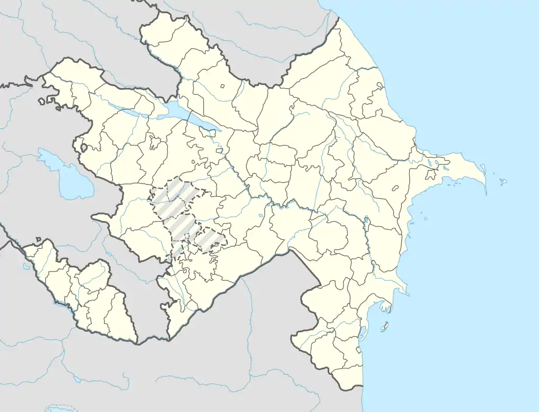
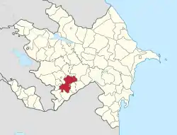
Martuni, Nagorno-Karabakh
Martuni (Armenian: Մարտունի) or Khojavend (Azerbaijani: Xocavənd ![]() (listen)) is a town and de jure centre of the Khojavend District of Azerbaijan, de facto in the self-proclaimed Republic of Artsakh as the centre of its Martuni Province. It is approximately 41 kilometers east of the regional capital, Stepanakert. It has a population of 5,700 as of 2015.[1] The town has an ethnic Armenian-majority population, and also had an Armenian majority in 1989.[2]
(listen)) is a town and de jure centre of the Khojavend District of Azerbaijan, de facto in the self-proclaimed Republic of Artsakh as the centre of its Martuni Province. It is approximately 41 kilometers east of the regional capital, Stepanakert. It has a population of 5,700 as of 2015.[1] The town has an ethnic Armenian-majority population, and also had an Armenian majority in 1989.[2]
Martuni
Մարտունի Xocavənd | |
|---|---|
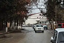 Street in Martuni | |
 Martuni 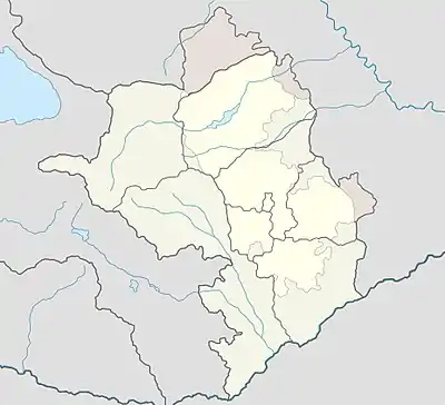 Martuni | |
| Coordinates: 39°47′43″N 47°06′47″E | |
| Country | |
| District | Khojavend (de jure) |
| Province | Martuni (de facto) |
| Elevation | 390 m (1,280 ft) |
| Population (2015) | |
| • Total | 5,700[1] |
| Time zone | UTC+4 (UTC) |
| Area code(s) | (+374) 478 |
History
Excavations in Martuni have uncovered a number of tombs dating to the Neolithic and Bronze Ages. Martuni is also home to several ruined medieval churches and remains of settlements, and khachkars have also been preserved.[3]
During the Soviet period, Martuni was the capital of the Martuni District in the Nagorno-Karabakh Autonomous Oblast. The population of the town, grouped into kolkhozes, largely occupied itself with raising livestock, grape growing, wheat cultivation, and gardening.[3]
Martuni, and the district itself, became a frontline city during the latter stages of the First Nagorno-Karabakh War. In early February 1992, Vazgen Sargsyan, the then Defence Minister of Armenia, appointed Monte Melkonian as Chief of Headquarters and assigned him to lead the defense of Martuni and the surrounding regions.[4] On October 2, 1992, Armenian armed forces captured the region around Martuni. According to an Azerbaijani source, considerable damage was done to the infrastructure of 10 villages settled by Azerbaijanis in the region during the war.[5] Melkonian remained as regional commander until he was killed in combat in June 1993.[6]
Gallery
 Church of St. Nerses the Great in Martuni, opened in 2004
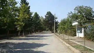 A street in Martuni
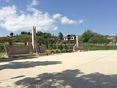 A memorial in Martuni
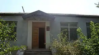 Martuni Museum
Climate
| Climate data for Martuni (Khojavend) | |||||||||||||
|---|---|---|---|---|---|---|---|---|---|---|---|---|---|
| Month | Jan | Feb | Mar | Apr | May | Jun | Jul | Aug | Sep | Oct | Nov | Dec | Year |
| Average high °C (°F) | 5.5 (41.9) |
6.4 (43.5) |
10.1 (50.2) |
17.5 (63.5) |
21.7 (71.1) |
26.6 (79.9) |
29.8 (85.6) |
29.7 (85.5) |
24.8 (76.6) |
19.1 (66.4) |
12.6 (54.7) |
8.0 (46.4) |
17.7 (63.8) |
| Average low °C (°F) | −1.7 (28.9) |
−1.0 (30.2) |
1.8 (35.2) |
7.6 (45.7) |
12.1 (53.8) |
16.4 (61.5) |
19.5 (67.1) |
18.4 (65.1) |
15.2 (59.4) |
10.2 (50.4) |
4.9 (40.8) |
0.6 (33.1) |
8.7 (47.6) |
| Average precipitation mm (inches) | 20 (0.8) |
26 (1.0) |
36 (1.4) |
49 (1.9) |
68 (2.7) |
55 (2.2) |
23 (0.9) |
23 (0.9) |
28 (1.1) |
44 (1.7) |
31 (1.2) |
25 (1.0) |
428 (16.8) |
| Source: http://en.climate-data.org/location/21894/ | |||||||||||||
Demographics
| Ethnic group | Number, 1939 sa.[7] | Ratio, 1939 sa.[7] | Number, 1970 sa.[8] | Ratio, 1970 sa.[8] | Number, 1979 sa.[9] | Ratio, 1979 sa.[9] | Number, 2005 sa.[10] | Ratio, 2005 sa.[10] |
|---|---|---|---|---|---|---|---|---|
| Total | 1,906 | 100 % | 4,654 | 100 % | 5,497 | 100 % | 4,878 | 100 % |
| Armenian | 1,701 | 89,2 % | 3,120 | 67 % | 3,588 | 65.3 % | 4,863 | 99,7 % |
| Azerbaijani | 52 | 2,7 % | 1,482 | 31.8 % | 1,862 | 33.9 % | - | - |
| Russian | 136 | 7,1 % | 44 | 0.9 % | 41 | 0.7 % | 8 | 0,2 % |
| Ukrainian | 7 | 0,4 % | 3 | 0.1 % | 1 | 0.0 % | 1 | <0,1 % |
| Other | 10 | 0,5 % | 5 | 0.2 % | 5 | 0.1 % | 6 | 0,1 % |
References
- http://stat-nkr.am/files/publications/2015/LXH_tverov_2015.pdf
- Андрей Зубов. "Андрей Зубов. Карабах: Мир и Война". drugoivzgliad.com.
- (in Armenian) Anon. «Մարտունի» (Martuni). Armenian Soviet Encyclopedia. vol. vii. Yerevan: Armenian Academy of Sciences, 1981, p. 352.
- See Markar Melkonian (2005). My Brother's Road: An American's Fateful Journey to Armenia. New York: I.B. Tauris, pp. 207ff. ISBN 1-85043-635-5.
- https://report.az/en/nagorno-karabakh/25-years-passed-since-occupation-of-khojavend-region/
- Melkonian 2005, p. 264.
- Ethno-Caucasus, Этнодемография Кавказа: Мартунинский район (1939 г.)
- Ethno-Caucasus, Этнодемография Кавказа: Мартунинский район (1970 г.)
- Ethno-Caucasus, Этнодемография Кавказа: Мартунинский район (1979 г.)
- "Национальный состав населения самопровозглашённой Нагорно-Карабахской Республики по переписи 2005 года". Population statistics of Eastern Europe & former USSR.
External links
| Wikimedia Commons has media related to Martuni (Karabakh). |
Capital: Martuni | ||
| Urban comunities |  | |
| Rural comunities |
| |
| Capital city | ||
|---|---|---|
| Provinces | ||
| Provincial capitals | ||
| Other urban communities |
| |