Nakhon Nayok Province
Nakhon Nayok (Thai: นครนายก, pronounced [ná(ʔ).kʰɔ̄ːn nāː.jók]) is one of the central provinces (changwat) of Thailand, established by the Act Establishing Changwat Samut Prakan, Changwat Nonthaburi, Changwat Samut Sakhon, and Changwat Nakhon Nayok, Buddhist Era 2489 (1946), which came into force on 9 May 1946.
Nakhon Nayok
นครนายก | |
|---|---|
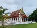     (clockwise from upper-left): Wat Udom Thani, Luang Pho Pak Daeng Buddha at Wat Phrammani, Bamboo Forest of Wat Chulaphonwanaram, Buddharupa Shrine of Srinakharinwirot University’s Ongkharak Campus, Khun Dan Prakan Chon Dam | |
 Flag 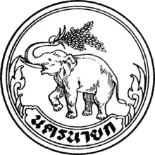 Seal | |
| Motto(s): Nakhon Nayok, city of dream just by the capital, beautiful mountains, gorgeous falls, rich in nature, pollution-free | |
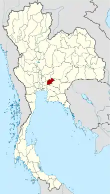 Map of Thailand highlighting Nakhon Nayok Province | |
| Country | Thailand |
| Capital | Nakhon Nayok City |
| Government | |
| • Governor | Pradit Yamanan (since October 2016) |
| Area | |
| • Total | 2,122 km2 (819 sq mi) |
| Area rank | Ranked 67th |
| Population (2018)[2] | |
| • Total | 260,093 |
| • Rank | Ranked 73rd |
| • Density | 123/km2 (320/sq mi) |
| • Density rank | Ranked 39th |
| Human Achievement Index | |
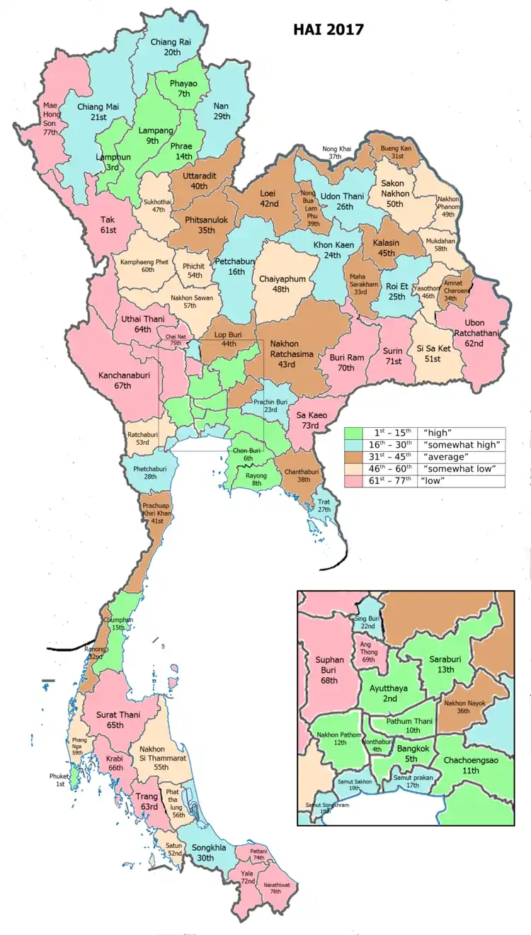
| • HAI (2017) | 0.5886 "average" Ranked 36th |
| Time zone | UTC+7 (ICT) |
| Postal code | 26xxx |
| Calling code | 037 |
| ISO 3166 code | TH-26 |
| Website | ww2 |
Neighboring provinces are (from north clockwise) Saraburi, Nakhon Ratchasima, Prachinburi, Chachoengsao, and Pathum Thani. Nakhon Nayok is known for waterfalls and fruit varieties.
Nakon Nayok is a nearby province to Bangkok and has various tourist attractions. Khao Yai National Park, Thailands oldest national park is in partly in Nakhon Nayok povince and attracts many tourists.[4] Khun Dan Prakarn Chon Dam is another tourist attraction 2 hours outside of Bangkok in Nakhon Nayok.[5]
Toponymy
The word nakhon originates from the Sanskrit word nagara (Devanagari: नगर) meaning 'city', and the word nayok is thought to have been derived from the Sanskrit nāyaka (Devanagari: नायक) meaning 'leader' or 'captain'. However, in this connection, na means '[tax of] rice field' and yok means 'exempted'. Hence the name of the province literally means 'tax-free city'.[6]
History
The city of Nakhon Nayok dates back to the Dvaravati Kingdom, probably founded in the 11th century. Ruins from this time are visible at Mueang Boran Dong Lakhon south of the modern city. Originally named Mueang Lablae, the name "Nakhon Nayok" was assigned to it in 1350, when it became a garrison town of the Ayutthaya kingdom protecting the eastern boundary. On 1 January 1943 the government downgraded Nakhon Nayok Province and combined it with Prachinburi Province, except for Ban Na District which became part of Saraburi Province.[7] On 9 May 1946 the province was re-established.[8]
Symbols
The provincial seal shows an elephant holding an ear of rice with its trunk. This symbolizes fertile rice fields, as well as the forests with numerous elephants. In the background two piles of straw, trees, and clouds symbolizing the natural beauty of the province. The provincial flower and tree is the silk cotton tree (Cochlospermum religiosum).
Climate
Nakhon Nayok province has a tropical savanna climate (Köppen climate classification category Aw). Winters are dry and warm. Temperatures rise until May. Mansoon season runs from May through October, with heavy rain and somewhat cooler temperatures during the day, although nights remain warm. Climate statistics: maximum temperature is 42.2 °C (108 °F) in April and lowest temperature is 12.2 °C (54 °F) in December. Highest average temperature is 36.8 °C (98.2 °F) in April and minimum average temperature is 20.5 °C (68.9 °F) in December. Average annual rainfall is 1,823 millimeters in 134 days. Maximum daily rainfall is 195 millimeters in August.[9]
Geography

The northern part of the province is in the Sankamphaeng Range, the southern prolongation of the Dong Phaya Yen mountains, with the highest elevation the 1,292 meter high Yod Khao Kiew. Most of that area is covered by the Khao Yai National Park. The central part of the province however is a rather flat river plain formed by the Nakhon Nayok River. The southern part of the province has relatively infertile acidic soil.
The main river of the province is the Nakhon Nayok River. It joins the Prachinburi River at Pak Nam Yothaka in Ban Sang District, Prachinburi Province, which then becomes the Bang Pa Kong River.
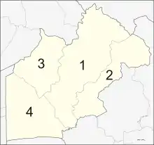
Administrative divisions
Provincial government
The province is divided into four districts (amphoes). The districts are further divided into 41 subdistricts (tambons) and 403 villages (mubans).
Local government
As of 26 November 2019 there are:[10] one Nakhon Nayok Provincial Administration Organisation (ongkan borihan suan changwat) and 6 municipal (thesaban) areas in the province. Nakhon Nayok has town (thesaban mueang) status. Further 5 subdistrict municipalities (thesaban tambon). The non-municipal areas are administered by 39 Subdistrict Administrative Organisations - SAO (ongkan borihan suan tambon).[2]
Human achievement index 2017
| Health | Education | Employment | Income |
| 74 | 20 | 23 | 30 |
| Housing | Family | Transport | Participation |
 |
 |
||
| 22 | 73 | 15 | 36 |
| Province Nakhon Nayok, with an HAI 2017 value of 0.5886 is "average", occupies place 36 in the ranking. | |||
Since 2003, United Nations Development Programme (UNDP) in Thailand has tracked progress on human development at sub-national level using the Human achievement index (HAI), a composite index covering all the eight key areas of human development. National Economic and Social Development Board (NESDB) has taken over this task since 2017.[3]
| Rank | Classification |
| 1 - 15 | "high" |
| 16 - 30 | "somewhat high" |
| 31 - 45 | "average" |
| 45 - 60 | "somewhat low" |
| 61 - 77 | "low" |
| Map with provinces and HAI 2017 rankings |
 |
Notes
Reports (data) from Thai government are "not copyrightable" (Public Domain), Copyright Act 2537 (1994), section 7.
References
- Advancing Human Development through the ASEAN Community, Thailand Human Development Report 2014, table 0:Basic Data (PDF) (Report). United Nations Development Programme (UNDP) Thailand. pp. 134–135. ISBN 978-974-680-368-7. Retrieved 17 January 2016, Data has been supplied by Land Development Department, Ministry of Agriculture and Cooperatives, at Wayback Machine.
- "ร่ยงานสถิติจำนวนประชากรและบ้านประจำปี พ.ศ.2561" [Statistics, population and house statistics for the year 2018]. Registration Office Department of the Interior, Ministry of the Interior. stat.bora.dopa.go.th (in Thai). 31 December 2018. Archived from the original on 2 April 2019. Retrieved 20 June 2019.
- Human achievement index 2017 by National Economic and Social Development Board (NESDB), pages 1-40, maps 1-9, retrieved 14 September 2019, ISBN 978-974-9769-33-1
- Round, Philip D.; Gale, George A. (2007-10-17). "Changes in the Status of Lophura Pheasants in Khao Yai National Park, Thailand: A Response to Warming Climate?". Biotropica. 40 (2): 225–230. doi:10.1111/j.1744-7429.2007.00363.x. ISSN 0006-3606.
- Jetsadaareewong, Suphattra (2017). "White Water Rafting Management at Khun Dan Prakan Chon Dam, Nakornnayok Province". SSRN Electronic Journal. doi:10.2139/ssrn.3076749. ISSN 1556-5068.
- ประวัติจังหวัดนครนายก (in Thai). จังหวัดนครนายก. Archived from the original on 2009-02-09. Retrieved 2008-03-07.
- พระราชบัญญัติยุบและรวมการปกครองบางจังหวัด พุทธศักราช ๒๔๘๕ [Dissolution and Consolidation Act in some Provinces, Buddhist Era 2485 (1942)] (PDF). Royal Thai Government Gazette. 59 (77): 2447–2449. 10 December 1942. Retrieved 2 December 2019.
- พระราชบัญญัติจัดตั้งจังหวัดสมุทรปราการ จังหวัดนนทบุรี จังหวัดสมุทรสาคร และจังหวัดนครนายก พุทธศักราช ๒๔๘๙ [Act Establishing Changwat Samut Prakan, Changwat Nonthaburi, Changwat Samut Sakhon and Changwat Nakhon Nayok, Buddhist Era 2489 (1946)] (PDF). Royal Thai Government Gazette. 63 (29 Kor): 315–317. 9 May 1946. Retrieved 2 December 2019.
- "Climatological Data for the Period 1981-2010". Thai Meteorological Department. climate.tmd.go.th. 2011. pp. 17–18. Retrieved 2 December 2019, Weather station Prachinburi at 29 km distance
- "Number of local government organizations by province". dla.go.th. Department of Local Administration (DLA). 26 November 2019. Retrieved 10 December 2019.
17 Nakhon Nayok: 1 PAO, 1 Town mun., 5 Subdistrict mun., 39 SAO.
External links
 Nakhon Nayok travel guide from Wikivoyage
- News and Information in Nakhon Nayok (thai)
- Nakhon Nayok, Tourist Authority of Thailand
- Website of province (Thai)
- Khao Yai National Park
Places adjacent to Nakhon Nayok Province | |
|---|---|
| Authority control |
|---|