National Register of Historic Places listings in Chesterfield County, South Carolina
This is a list of the National Register of Historic Places listings in Chesterfield County, South Carolina.
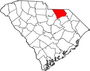
Location of Chesterfield County in South Carolina
This is intended to be a complete list of the properties and districts on the National Register of Historic Places in Chesterfield County, South Carolina, United States. The locations of National Register properties and districts for which the latitude and longitude coordinates are included below, may be seen in a map.[1]
There are 9 properties and districts listed on the National Register in the county.
- This National Park Service list is complete through NPS recent listings posted January 29, 2021.[2]
Current listings
| [3] | Name on the Register[4] | Image | Date listed[5] | Location | City or town | Description |
|---|---|---|---|---|---|---|
| 1 | Cheraw Historic District | 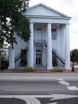 Cheraw Historic District |
November 20, 1974 (#74001844) |
Bounded by Front, Kershaw, 3rd, McIver, Cedar, Greene, Christian, and Church Sts. 34°41′50″N 79°53′15″W |
Cheraw | |
| 2 | East Main Street Historic District | 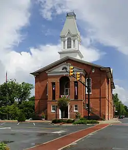 East Main Street Historic District |
May 4, 1982 (#82003847) |
Hursey Dr. and E. Main and Craig Sts. 34°44′09″N 80°04′58″W |
Chesterfield | |
| 3 | Evy Kirkley Site | August 3, 1979 (#79002380) |
Address Restricted |
McBee | ||
| 4 | Dr. Thomas E. Lucas House | 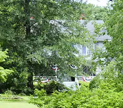 Dr. Thomas E. Lucas House |
May 4, 1982 (#82003848) |
716 W. Main St. 34°44′16″N 80°05′41″W |
Chesterfield | |
| 5 | St. David's Episcopal Church and Cemetery | 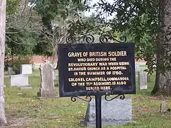 St. David's Episcopal Church and Cemetery |
September 22, 1971 (#71000761) |
Church St. 34°41′44″N 79°52′46″W |
Cheraw | |
| 6 | Seaboard Air Line Railway Depot in McBee | 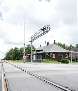 Seaboard Air Line Railway Depot in McBee |
September 2, 1999 (#99000103) |
W. Pine Ave., northwest of the junction of South Carolina Highway 151 and U.S. Route 1 34°28′09″N 80°15′27″W |
McBee | |
| 7 | Seaboard Air Line Railway Depot in Patrick | 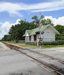 Seaboard Air Line Railway Depot in Patrick |
February 22, 1999 (#99000100) |
Winburn St., south of junction of South Carolina Highway 102 and U.S. Route 1 34°34′36″N 80°02′34″W |
Patrick | |
| 8 | Robert Smalls School | 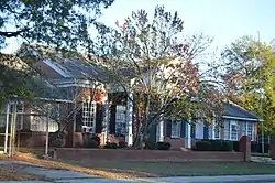 Robert Smalls School |
March 4, 2014 (#14000043) |
316 Front St. 34°42′07″N 79°53′01″W |
Cheraw | |
| 9 | West Main Street Historic District | 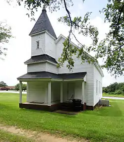 West Main Street Historic District |
May 4, 1982 (#82003849) |
W. Main, Church, and Academy Sts. 34°44′09″N 80°05′33″W |
Chesterfield |
See also
| Wikimedia Commons has media related to National Register of Historic Places in Chesterfield County, South Carolina. |
References
- The latitude and longitude information provided in this table was derived originally from the National Register Information System, which has been found to be fairly accurate for about 99% of listings. Some locations in this table may have been corrected to current GPS standards.
- "National Register of Historic Places: Weekly List Actions". National Park Service, United States Department of the Interior. Retrieved on January 29, 2021.
- Numbers represent an alphabetical ordering by significant words. Various colorings, defined here, differentiate National Historic Landmarks and historic districts from other NRHP buildings, structures, sites or objects.
- "National Register Information System". National Register of Historic Places. National Park Service. March 13, 2009.
- The eight-digit number below each date is the number assigned to each location in the National Register Information System database, which can be viewed by clicking the number.
| Topics | 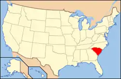 | |
|---|---|---|
| Lists by county |
| |
| Lists by city |
| |
| Other lists | ||
Municipalities and communities of Chesterfield County, South Carolina, United States | ||
|---|---|---|
| Towns | Map of South Carolina highlighting Chesterfield County | |
| Unincorporated communities | ||
| Ghost towns |
| |
| Footnotes | ‡This populated place also has portions in an adjacent county or counties | |
| ||
This article is issued from Wikipedia. The text is licensed under Creative Commons - Attribution - Sharealike. Additional terms may apply for the media files.