National Register of Historic Places listings in Florence County, South Carolina
This is a list of the National Register of Historic Places listings in Florence County, South Carolina.
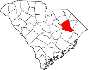
Location of Florence County in South Carolina
This is intended to be a complete list of the properties and districts on the National Register of Historic Places in Florence County, South Carolina, United States. The locations of National Register properties and districts for which the latitude and longitude coordinates are included below, may be seen in a map.[1]
There are 27 properties and districts listed on the National Register in the county, including 1 National Historic Landmark.
- This National Park Service list is complete through NPS recent listings posted January 29, 2021.[2]
Current listings
| [3] | Name on the Register[4] | Image | Date listed[5] | Location | City or town | Description |
|---|---|---|---|---|---|---|
| 1 | W.T. Askins House |  W.T. Askins House |
May 26, 1995 (#95000636) |
178 S. Acline Ave. 33°52′11″N 79°45′22″W |
Lake City | |
| 2 | Blooming Grove | 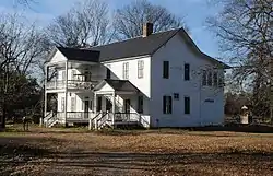 Blooming Grove |
June 1, 2005 (#05000517) |
Eastern end of Rogers Court 34°16′06″N 79°42′51″W |
Florence | |
| 3 | Bonnie Shade | 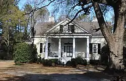 Bonnie Shade |
November 14, 1978 (#78002506) |
1439 Cherokee Rd. 34°11′07″N 79°47′40″W |
Florence | |
| 4 | Browntown | .jpg.webp) Browntown |
June 28, 1982 (#82003850) |
South Carolina Highway 341 33°47′59″N 79°37′49″W |
Johnsonville | |
| 5 | Christ Episcopal Church | 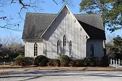 Christ Episcopal Church |
November 14, 1978 (#78002507) |
Northeast of Florence on South Carolina Highway 327 34°14′32″N 79°11′35″W |
Florence | |
| 6 | Claussen House | 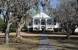 Claussen House |
April 11, 2001 (#01000343) |
5109 Old River Rd. 34°07′53″N 79°37′44″W |
Florence | |
| 7 | Ebony Guest House | January 14, 2021 (#100006018) |
712-714 Wilson St. 34°12′26″N 79°45′39″W |
Florence | ||
| 8 | Florence Downtown Historic District | 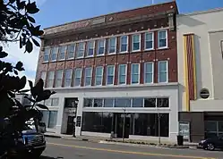 Florence Downtown Historic District |
July 2, 2008 (#08000621) |
Portions of W. Evans, N. Dargan St., and S. Dargan St. and 124-201 W. Evans St., 34°11′52″N 79°45′59″W |
Florence | |
| 9 | Florence National Cemetery | 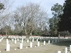 Florence National Cemetery |
January 5, 1998 (#97001207) |
803 E. National Cemetery Rd. 34°11′05″N 79°45′16″W |
Florence | |
| 10 | Florence Public Library |  Florence Public Library |
November 15, 2006 (#06001041) |
319 S. Irby St. 34°11′31″N 79°46′06″W |
Florence | |
| 11 | Gregg-Wallace Farm Tenant House |  Gregg-Wallace Farm Tenant House |
January 28, 2002 (#01001550) |
310 Price Rd. 34°12′06″N 79°39′07″W |
Mars Bluff | |
| 12 | Griffin Motor Company | 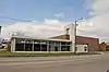 Griffin Motor Company |
October 2, 2018 (#100003001) |
329 N Irby St. 34°12′05″N 79°46′07″W |
Florence | |
| 13 | Hopewell Presbyterian Church and Hopewell Cemetery |  Hopewell Presbyterian Church and Hopewell Cemetery |
June 2, 2000 (#00000589) |
5314 Old River Rd. 34°07′42″N 79°37′26″W |
Florence | |
| 14 | Jamestown Historic District | 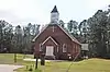 Jamestown Historic District |
October 25, 2018 (#01000610) |
Approximately 1 mile north of U.S. Routes 76/301 34°13′36″N 79°36′18″W |
Florence | An historic African-American community site. |
| 15 | Lake City Downtown Historic District | Lake City Downtown Historic District |
January 24, 2003 (#01001551) |
Main St. and Acline Ave. 33°52′22″N 79°45′17″W |
Lake City | |
| 16 | Mt. Zion Rosenwald School |  Mt. Zion Rosenwald School |
October 12, 2001 (#01001098) |
5040 Liberty Chapel Rd. 34°10′45″N 79°38′35″W |
Florence | |
| 17 | Poynor Junior High School | 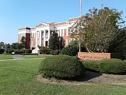 Poynor Junior High School |
May 19, 1983 (#83002194) |
301 S. Dargan St. 34°11′36″N 79°45′56″W |
Florence | |
| 18 | Rankin-Harwell House | 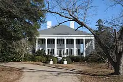 Rankin-Harwell House |
October 9, 1974 (#74001855) |
6 miles northeast of Florence off South Carolina Highway 305 34°13′55″N 79°08′47″W |
Florence | |
| 19 | Red Doe | 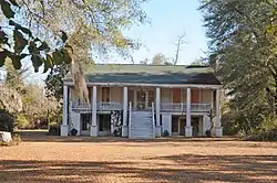 Red Doe |
October 29, 1982 (#82001521) |
East of Florence on South Carolina Highway 327 34°10′29″N 79°38′51″W |
Florence | |
| 20 | Roseville Plantation | 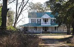 Roseville Plantation |
September 25, 1997 (#97001158) |
3636 Williston Rd. 34°16′37″N 79°42′04″W |
Florence | |
| 21 | Slave Houses, Gregg Plantation | 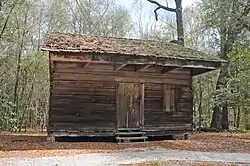 Slave Houses, Gregg Plantation |
July 22, 1974 (#74001856) |
Francis Marion College campus 34°11′28″N 79°09′06″W |
Mars Bluff | |
| 22 | Smith-Cannon House | 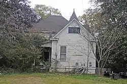 Smith-Cannon House |
July 28, 1983 (#83002195) |
106 W. Market St. 34°08′05″N 79°56′35″W |
Timmonsville | |
| 23 | Snow's Island | March 14, 1973 (#73001708) |
Along the Pee Dee River, east of Johnsonville[6] 33°49′39″N 79°20′38″W |
Johnsonville | A National Historic Landmark | |
| 24 | The Stockade | 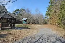 The Stockade |
November 28, 1980 (#80003669) |
Address Restricted |
Florence | |
| 25 | U.S. Post Office | _1938.jpg.webp) U.S. Post Office |
December 21, 1977 (#77001221) |
Irby and W. Evan Sts. 34°11′50″N 79°46′07″W |
Florence | |
| 26 | Woodlawn | May 13, 2019 (#100003917) |
10 Kings Rd. 34°13′36″N 79°44′03″W |
Quinby | ||
| 27 | Young Farm | 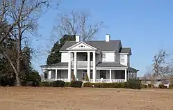 Young Farm |
November 10, 1983 (#83003854) |
West of Florence on U.S. Route 76 34°09′28″N 79°52′15″W |
Florence |
Former listings
| [3] | Name on the Register | Image | Date listed | Date removed | Location | City or town | Summary |
|---|---|---|---|---|---|---|---|
| 1 | Dr. Benjamin Gregg House | December 8, 1978 (#78002508) | March 15, 2000 | 315 S. Coit St. |
Florence | Burned |
See also
| Wikimedia Commons has media related to National Register of Historic Places in Florence County, South Carolina. |
References
- The latitude and longitude information provided in this table was derived originally from the National Register Information System, which has been found to be fairly accurate for about 99% of listings. Some locations in this table may have been corrected to current GPS standards.
- "National Register of Historic Places: Weekly List Actions". National Park Service, United States Department of the Interior. Retrieved on January 29, 2021.
- Numbers represent an alphabetical ordering by significant words. Various colorings, defined here, differentiate National Historic Landmarks and historic districts from other NRHP buildings, structures, sites or objects.
- "National Register Information System". National Register of Historic Places. National Park Service. March 13, 2009.
- The eight-digit number below each date is the number assigned to each location in the National Register Information System database, which can be viewed by clicking the number.
- Location derived from its GNIS feature record; the NRIS lists the site as "Address Restricted"
| Topics | 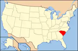 | |
|---|---|---|
| Lists by county |
| |
| Lists by city |
| |
| Other lists | ||
Municipalities and communities of Florence County, South Carolina, United States | ||
|---|---|---|
| Cities | Map of South Carolina highlighting Florence County | |
| Towns | ||
| Unincorporated communities | ||
| ||
This article is issued from Wikipedia. The text is licensed under Creative Commons - Attribution - Sharealike. Additional terms may apply for the media files.