National Register of Historic Places listings in Sumter County, South Carolina
This is a list of the National Register of Historic Places listings in Sumter County, South Carolina.
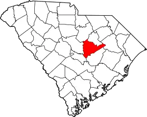
Location of Sumter County in South Carolina
This is intended to be a complete list of the properties and districts on the National Register of Historic Places in Sumter County, South Carolina, United States. The locations of National Register properties and districts for which the latitude and longitude coordinates are included below, may be seen in a map.[1]
There are 29 properties and districts listed on the National Register in the county, including 3 National Historic Landmarks.
- This National Park Service list is complete through NPS recent listings posted January 29, 2021.[2]
Current listings
| [3] | Name on the Register[4] | Image | Date listed[5] | Location | City or town | Description |
|---|---|---|---|---|---|---|
| 1 | Borough House Plantation | .jpg.webp) Borough House Plantation |
March 23, 1972 (#72001224) |
South Carolina Highway 261, 0.8 miles north of its intersection with Secondary Road 76/3 78 33°57′14″N 80°32′16″W |
Stateburg | |
| 2 | J. Clinton Brogdon House | 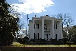 J. Clinton Brogdon House |
July 1, 1993 (#93000585) |
3755 Boots Branch Rd. 33°48′34″N 80°15′52″W |
Sumter | |
| 3 | Carnegie Public Library | 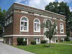 Carnegie Public Library |
August 5, 1994 (#94000814) |
219 W. Liberty St. 33°55′14″N 80°20′47″W |
Sumter | |
| 4 | Ellerbe's Mill | 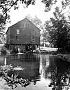 Ellerbe's Mill |
November 20, 1974 (#74001880) |
About 3 miles south of Rembert off U.S. Route 521 on Rafting Creek 34°04′10″N 80°31′50″W |
Rembert | |
| 5 | Goodwill Parochial School | 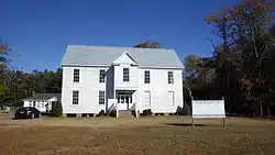 Goodwill Parochial School |
May 30, 1997 (#97000523) |
295 N. Brick Church Rd. 33°54′44″N 80°08′19″W |
Mayesville | |
| 6 | Heriot-Moise House | 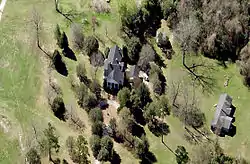 Heriot-Moise House |
December 21, 1989 (#89002149) |
Junction of U.S. Route 401 and Brewington Rd. 33°57′36″N 80°18′28″W |
Sumter | |
| 7 | Holy Cross Episcopal Church | 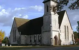 Holy Cross Episcopal Church |
November 7, 1973 (#73001732) |
South Carolina Highway 261 33°57′45″N 80°31′55″W |
Stateburg | |
| 8 | Lenoir Store | 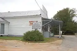 Lenoir Store |
July 3, 1997 (#97000744) |
3240 Horatio Rd. 34°01′17″N 80°34′05″W |
Horatio | |
| 9 | Lincoln High School | 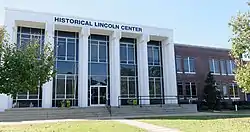 Lincoln High School |
January 27, 2015 (#14001221) |
20-26 Council St. 33°55′08″N 80°20′49″W |
Sumter | |
| 10 | Magnolia Hall | 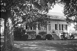 Magnolia Hall |
September 2, 1999 (#99000101) |
2025 Horatio-Hagood Rd. 34°03′13″N 80°34′08″W |
Hagood | |
| 11 | Charles T. Mason House | 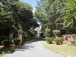 Charles T. Mason House |
July 3, 1997 (#97000745) |
111 Mason Croft 33°55′50″N 80°21′39″W |
Sumter | |
| 12 | Mayesville Historic District | Mayesville Historic District |
July 16, 1979 (#79002395) |
Irregular pattern along Lafayette St. 33°59′08″N 80°12′26″W |
Mayesville | |
| 13 | Millford Plantation | 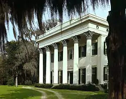 Millford Plantation |
November 19, 1971 (#71000808) |
West of Pinewood on South Carolina Highway 261 33°44′54″N 80°32′15″W |
Pinewood | |
| 14 | Myrtle Moor | January 13, 1983 (#83002210) |
Address Restricted |
Sumter | ||
| 15 | O'Donnell House | 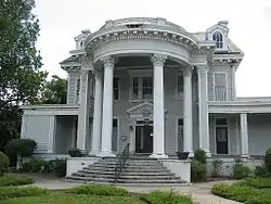 O'Donnell House |
April 25, 1996 (#96000407) |
120 E. Liberty St. 33°55′10″N 80°20′21″W |
Sumter | |
| 16 | Orange Grove | 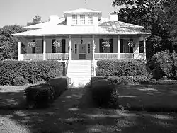 Orange Grove |
August 19, 1993 (#93000845) |
Junction of South Carolina Highways 43 (Black River Rd.) and 441 34°02′42″N 80°26′10″W |
Dalzell | |
| 17 | Pinewood Depot | 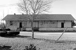 Pinewood Depot |
June 10, 1997 (#97000535) |
Junction of East Ave. and Clarke St. 33°44′25″N 80°27′47″W |
Pinewood | |
| 18 | Poinsett State Park Historic District |  Poinsett State Park Historic District |
May 31, 2016 (#16000311) |
6660 Poinsett Park Rd. 33°48′24″N 80°32′22″W |
Wedgefield | |
| 19 | Rip Raps Plantation | 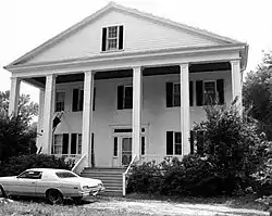 Rip Raps Plantation |
December 12, 1978 (#78002532) |
East of Sumter on South Carolina Highway 378 33°53′57″N 80°09′03″W |
Sumter | |
| 20 | St. Mark's Church | 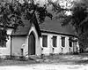 St. Mark's Church |
January 20, 1978 (#78002530) |
West of Pinewood on South Carolina Highway 51 33°44′50″N 80°30′40″W |
Pinewood | |
| 21 | Salem Black River Presbyterian Church | 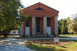 Salem Black River Presbyterian Church |
November 14, 1978 (#78003091) |
East of Sumter on U.S. Route 521 33°55′57″N 80°09′39″W |
Sumter | |
| 22 | Henry Lee Scarborough House | 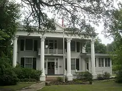 Henry Lee Scarborough House |
January 20, 1995 (#94001560) |
425 N. Main St. 33°55′42″N 80°20′26″W |
Sumter | |
| 23 | Singleton's Graveyard | 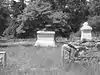 Singleton's Graveyard |
May 13, 1976 (#76001713) |
6 miles south of Wedgefield off South Carolina Highway 261 33°49′52″N 80°33′15″W |
Wedgefield | |
| 24 | Stateburg Historic District | Stateburg Historic District |
February 24, 1971 (#71000809) |
Roughly bounded by U.S. Route 76 and South Carolina Highways 261 and 441 33°58′13″N 80°30′51″W |
Sumter | |
| 25 | Sumter County Courthouse | 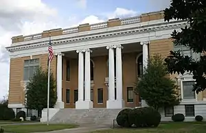 Sumter County Courthouse |
June 16, 2004 (#04000619) |
141 N. Main St. 33°55′28″N 80°20′29″W |
Sumter | |
| 26 | Sumter Historic District | 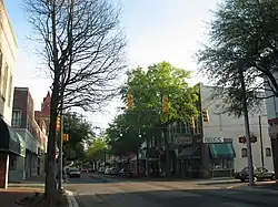 Sumter Historic District |
April 21, 1975 (#75001707) |
Commercial area centered around Main and Liberty Sts. 33°55′13″N 80°20′30″W |
Sumter | |
| 27 | Sumter Town Hall-Opera House | 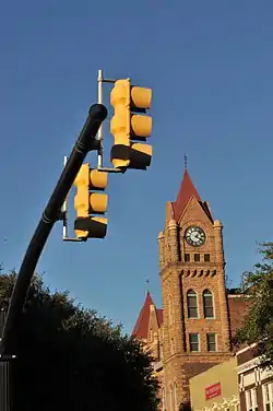 Sumter Town Hall-Opera House |
May 24, 1973 (#73001733) |
N. Main St. 33°55′15″N 80°20′30″W |
Sumter | |
| 28 | Temple Sinai | 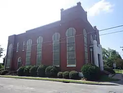 Temple Sinai |
January 21, 1999 (#98001645) |
11 Church St. 33°55′18″N 80°20′48″W |
Sumter | |
| 29 | Elizabeth White House | 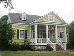 Elizabeth White House |
March 21, 1978 (#78002531) |
421 N. Main St. 33°55′41″N 80°20′27″W |
Sumter |
See also
| Wikimedia Commons has media related to National Register of Historic Places in Sumter County, South Carolina. |
References
- The latitude and longitude information provided in this table was derived originally from the National Register Information System, which has been found to be fairly accurate for about 99% of listings. Some locations in this table may have been corrected to current GPS standards.
- "National Register of Historic Places: Weekly List Actions". National Park Service, United States Department of the Interior. Retrieved on January 29, 2021.
- Numbers represent an alphabetical ordering by significant words. Various colorings, defined here, differentiate National Historic Landmarks and historic districts from other NRHP buildings, structures, sites or objects.
- "National Register Information System". National Register of Historic Places. National Park Service. March 13, 2009.
- The eight-digit number below each date is the number assigned to each location in the National Register Information System database, which can be viewed by clicking the number.
| Topics | 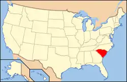 | |
|---|---|---|
| Lists by county |
| |
| Lists by city |
| |
| Other lists | ||
Municipalities and communities of Sumter County, South Carolina, United States | ||
|---|---|---|
| City | Map of South Carolina highlighting Sumter County | |
| Towns | ||
| CDPs | ||
| Unincorporated communities | ||
| ||
This article is issued from Wikipedia. The text is licensed under Creative Commons - Attribution - Sharealike. Additional terms may apply for the media files.