National Register of Historic Places listings in Beaufort County, South Carolina
This is a list of the National Register of Historic Places listings in Beaufort County, South Carolina.
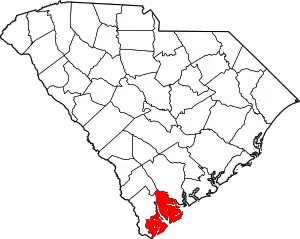
Location of Beaufort County in South Carolina
This is intended to be a complete list of the properties and districts on the National Register of Historic Places in Beaufort County, South Carolina, United States. The locations of National Register properties and districts for which the latitude and longitude coordinates are included below, may be seen on a map.[1]
There are 76 properties and districts listed on the National Register in the county, including 5 National Historic Landmarks.
- This National Park Service list is complete through NPS recent listings posted January 29, 2021.[2]
Current listings
| [3] | Name on the Register[4] | Image | Date listed[5] | Location | City or town | Description |
|---|---|---|---|---|---|---|
| 1 | Emanuel Alston House | 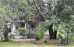 Emanuel Alston House |
October 6, 1988 (#88001723) |
Secondary Road 161, 0.25 miles north of its junction with U.S. Route 21 32°24′11″N 80°33′32″W |
Frogmore | |
| 2 | Altamaha Town | January 21, 1994 (#93001479) |
Address Restricted |
Bluffton | ||
| 3 | The Anchorage | 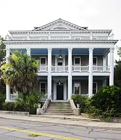 The Anchorage |
November 23, 1971 (#71000743) |
1103 Bay St. 32°25′56″N 80°40′27″W |
Beaufort | |
| 4 | Dr. York Bailey House | 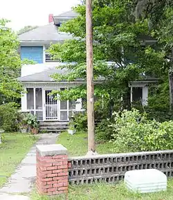 Dr. York Bailey House |
October 6, 1988 (#88001726) |
U.S. Route 21, approximately 0.2 miles east of its junction with Lands End Rd. 32°23′52″N 80°34′27″W |
Frogmore | |
| 5 | William Barnwell House | 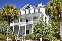 William Barnwell House |
March 24, 1971 (#71000744) |
800 Prince St. 32°26′06″N 80°40′21″W |
Beaufort | |
| 6 | Barnwell-Gough House | .jpg.webp) Barnwell-Gough House |
November 15, 1972 (#72001191) |
705 Washington St. 32°26′13″N 80°40′21″W |
Beaufort | |
| 7 | Beaufort Historic District | .jpg.webp) Beaufort Historic District |
December 17, 1969 (#69000159) |
Bounded by the Beaufort River and Bladen, Hamar, and Boundary Sts. 32°26′08″N 80°40′04″W |
Beaufort | |
| 8 | Beaufort National Cemetery | 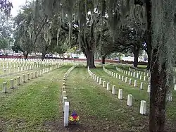 Beaufort National Cemetery |
October 10, 1997 (#97001208) |
1601 Boundary St. 32°25′55″N 80°40′49″W |
Beaufort | |
| 9 | Bluffton Historic District | 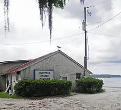 Bluffton Historic District |
June 21, 1996 (#96000686) |
Roughly bounded by the May River, Huger Cove, and Bridge St. 32°13′57″N 80°51′49″W |
Bluffton | |
| 10 | Callawassie Sugar Works | 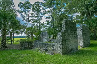 Callawassie Sugar Works |
May 27, 2014 (#13001096) |
29 Sugar Mill Dr. 32°20′08″N 80°51′26″W |
Okatie | |
| 11 | Camp Saxton Site | February 2, 1995 (#94001581) |
Address Restricted |
Port Royal | ||
| 12 | Campbell Chapel AME Church | April 26, 2019 (#100003688) |
23 Boundary St. 32°14′11″N 80°51′39″W |
Bluffton | ||
| 13 | Charlesfort-Santa Elena Site | .jpg.webp) Charlesfort-Santa Elena Site |
August 7, 1974 (#74001822) |
South end of Belleau Wood Road 32°18′23″N 80°40′32″W |
Parris Island | |
| 14 | Cherry Hill School | November 21, 2012 (#12000965) |
210 Dillon Rd. 32°14′05″N 80°41′28″W |
Hilton Head Island | ||
| 15 | Chester Field | October 15, 1970 (#70000565) |
Address Restricted |
Laurel Bay | ||
| 16 | Church of the Cross | .jpg.webp) Church of the Cross |
May 29, 1975 (#75001686) |
Calhoun St. 32°13′52″N 80°51′52″W |
Bluffton | |
| 17 | Coffin Point Plantation | 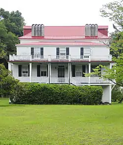 Coffin Point Plantation |
August 28, 1975 (#75001687) |
3 miles east of Frogmore at the northeastern end of Seaside Rd. on St. Helena Island 32°25′58″N 80°28′32″W |
Frogmore | |
| 18 | Coffin Point Plantation Caretaker's House | 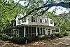 Coffin Point Plantation Caretaker's House |
May 28, 1989 (#88001730) |
Adjacent to Coffin Point Plantation, off Seaside Rd. 32°26′08″N 80°28′24″W |
Frogmore | |
| 19 | The Corner Packing Shed | 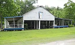 The Corner Packing Shed |
October 6, 1988 (#88001733) |
U.S. Route 21, west of its junction with Land's End Rd. 32°23′51″N 80°34′34″W |
Frogmore | |
| 20 | The Corner Store and Office | 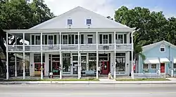 The Corner Store and Office |
October 6, 1988 (#88001737) |
U.S. Route 21, west of its junction with Lands End Rd. 32°23′48″N 80°34′43″W |
Frogmore | |
| 21 | John A. Cuthbert House | .jpg.webp) John A. Cuthbert House |
June 13, 1972 (#72001192) |
1203 Bay St. 32°25′57″N 80°40′32″W |
Beaufort | |
| 22 | Daufuskie Island Historic District | 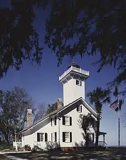 Daufuskie Island Historic District |
June 2, 1982 (#82003831) |
Southwest of Hilton Head 32°06′47″N 80°51′59″W |
Hilton Head Island | |
| 23 | Eddings Point Community Praise House | 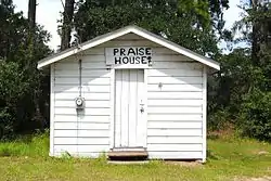 Eddings Point Community Praise House |
May 19, 1989 (#88001739) |
On Secondary Road 183, 0.1 miles north of its junction with Secondary Road 74 32°26′36″N 80°32′38″W |
Frogmore | |
| 24 | Fish Haul Archaeological Site (38BU805) | June 30, 1988 (#88000976) |
Address Restricted |
Hilton Head Island | ||
| 25 | Fort Frederick | December 31, 1974 (#74001826) |
Address Restricted |
Port Royal | The preserve is located adjacent to the grounds of Naval Hospital Beaufort. The South Carolina Department of Natural Resources constructed a gravel road to access the site in August of 2020. | |
| 26 | Fort Fremont Battery | 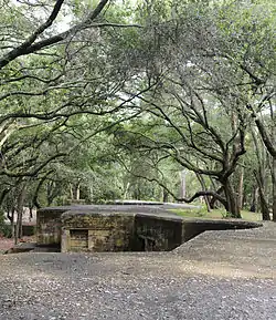 Fort Fremont Battery |
May 5, 2010 (#88001821) |
Bay Point Rd., 0.3 miles (0.48 km) from Land's End Rd. 32°18′22″N 80°38′32″W |
Frogmore | |
| 27 | Fort Fremont Hospital | 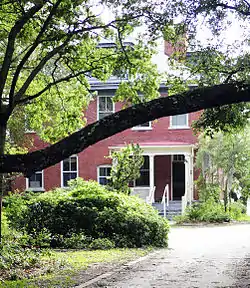 Fort Fremont Hospital |
May 26, 1989 (#88001819) |
0.3 miles from Land's End Rd. 32°18′29″N 80°38′37″W |
Frogmore | |
| 28 | Fort Howell | 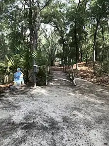 Fort Howell |
June 15, 2011 (#11000371) |
North side of Beach City Rd. approximately 200 ft. southwest of the junction with Dillon Rd. 32°14′04″N 80°41′31″W |
Hilton Head | Civil War earthwork fortification built in 1864 by the 32nd United States Colored Infantry Regiment and the 144th New York Infantry[6] |
| 29 | Fort Lyttelton Site | September 13, 1979 (#79003322) |
Address Restricted |
Beaufort | ||
| 30 | Fort Mitchell | June 5, 2017 (#100001036) |
65 Skull Creek Dr. 32°14′36″N 80°44′37″W |
Hilton Head | ||
| 31 | Edgar Fripp Mausoleum, St. Helena Island Parish Church |  Edgar Fripp Mausoleum, St. Helena Island Parish Church |
October 6, 1988 (#88001743) |
Secondary Road 45 near its junction with Secondary Road 37 32°22′30″N 80°34′34″W |
Frogmore | |
| 32 | Isaac Fripp House Ruins | October 6, 1988 (#88001750) |
On an unpaved road, 1.1 miles west of its junction with Secondary Road 45 32°20′37″N 80°38′25″W |
Frogmore | ||
| 33 | Frogmore Plantation Complex | .jpg.webp) Frogmore Plantation Complex |
May 26, 1989 (#88001754) |
Off Secondary Road 77 near its junction with Secondary Road 35 32°21′32″N 80°33′40″W |
Frogmore | |
| 34 | Green's Shell Enclosure | August 7, 1974 (#74001825) |
Address Restricted |
Hilton Head Island | ||
| 35 | The Green | 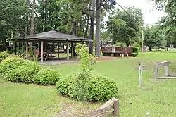 The Green |
October 6, 1988 (#88001759) |
Southeastern corner of the intersection of U.S. Route 21 and Lands End Rd. 32°23′46″N 80°34′37″W |
Frogmore | |
| 36 | Hasell Point Site | August 14, 1973 (#73001675) |
Address Restricted |
Port Royal | ||
| 37 | Hunting Island State Park Lighthouse | 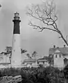 Hunting Island State Park Lighthouse |
June 5, 1970 (#70000561) |
17 miles south-southeast of Beaufort on U.S. Route 21 32°22′32″N 80°26′16″W |
Beaufort | |
| 38 | Indian Hill Site | March 22, 1974 (#74001827) |
Address Restricted |
St. Helena Island | ||
| 39 | Mary Jenkins Community Praise House | 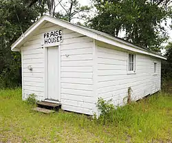 Mary Jenkins Community Praise House |
May 19, 1989 (#88001770) |
On Secondary Road 74, 2.1 miles north of its junction with U.S. Route 21 32°25′47″N 80°33′38″W |
Frogmore | |
| 40 | Knights of Wise Men Lodge | 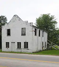 Knights of Wise Men Lodge |
April 12, 1996 (#96000408) |
Martin Luther King Dr., south of its junction with U.S. Route 21 32°23′43″N 80°33′58″W |
St. Helena Island | |
| 41 | Lands End Road Tabby Ruins | October 6, 1988 (#88001771) |
Address Restricted |
Frogmore | ||
| 42 | Laurel Bay Plantation | February 27, 1997 (#97000095) |
Address Restricted |
Beaufort | ||
| 43 | Little Barnwell Island | August 14, 1973 (#73001676) |
North of Port Royal 32°30′06″N 80°47′25″W |
Port Royal | ||
| 44 | Marshlands | .jpg.webp) Marshlands |
November 7, 1973 (#73001674) |
501 Pinckney St. 32°25′59″N 80°39′56″W |
Beaufort | |
| 45 | McLeod Farmstead | 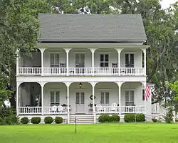 McLeod Farmstead |
July 25, 1997 (#97000776) |
Seabrook Rd., 1 mile west of U.S. Route 21 and 10 miles north of Beaufort 32°31′40″N 80°45′56″W |
Seabrook | |
| 46 | Means-Gage House |  Means-Gage House |
October 15, 2020 (#100005675) |
1207 Bay St. 32°25′57″N 80°40′33″W |
Beaufort | |
| 47 | The Oaks | October 6, 1988 (#88001773) |
On an unpaved road, 0.3 miles west of Secondary Road 165 32°23′21″N 80°37′12″W |
Frogmore | ||
| 48 | Old Brass |  Old Brass |
June 3, 1976 (#76001693) |
East of Yemassee on River Rd. 32°41′00″N 80°48′30″W |
Yemassee | |
| 49 | Orange Grove Plantation | May 26, 1989 (#88001774) |
Overlooking Wallace Creek, 0.25 mi. from South Carolina Highway 113 32°22′13″N 80°36′14″W |
Frogmore | ||
| 50 | Parris Island Drydock and Commanding Generals House | November 21, 1978 (#78002492) |
Mexico and Tripoli Sts. 32°21′00″N 80°40′18″W |
Parris Island | ||
| 51 | Penn Center Historic District | .jpg.webp) Penn Center Historic District |
September 9, 1974 (#74001824) |
South of Frogmore on South Carolina Highway 37 32°23′16″N 80°34′44″W |
Frogmore | |
| 52 | Pine Island Plantation Complex | May 26, 1989 (#88001775) |
Pine Island 32°26′25″N 80°30′38″W |
Frogmore | ||
| 53 | Pocosobo Town | January 21, 1994 (#93001480) |
Address Restricted |
Sheldon | ||
| 54 | Port Royal School | April 21, 2014 (#14000163) |
1214 Paris Ave. 32°22′40″N 80°41′30″W |
Port Royal | ||
| 55 | Rear Lighthouse of Hilton Head Range Light Station |  Rear Lighthouse of Hilton Head Range Light Station |
December 12, 1985 (#85003349) |
Arthur Hill Golf Course, Palmetto Dunes Resort off U.S. Route 278 32°09′51″N 80°44′24″W |
Hilton Head Island | |
| 56 | Riverside Plantation Tabby Ruins | October 6, 1988 (#88001776) |
On an unpaved road., 0.4 miles west of Secondary Road 45 at Lands End 32°18′57″N 80°38′38″W |
Frogmore | ||
| 57 | Rose Hill Plantation House | .jpg.webp) Rose Hill Plantation House |
May 19, 1983 (#83002185) |
Off U.S. Route 278 32°17′42″N 80°52′31″W |
Bluffton | |
| 58 | St. Helena Parish Chapel of Ease Ruins | 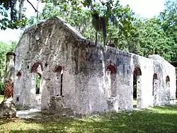 St. Helena Parish Chapel of Ease Ruins |
October 6, 1988 (#88001777) |
Secondary Road 45, near its junction with Secondary Road 37 32°22′31″N 80°34′36″W |
Frogmore | |
| 59 | St. Helenaville Archaeological Site (38BU931) | October 6, 1988 (#88001778) |
Address Restricted |
Frogmore | ||
| 60 | St. Luke's Church |  St. Luke's Church |
November 10, 1987 (#87001951) |
South Carolina Highway 170 32°16′24″N 80°57′00″W |
Pritchardville | |
| 61 | St. Luke's Parish Zion Chapel of Ease Cemetery | October 5, 2017 (#100000727) |
574 William Hilton Pkwy. 32°12′06″N 80°41′57″W |
Hilton Head Island | ||
| 62 | Sams Plantation Complex Tabby Ruins |  Sams Plantation Complex Tabby Ruins |
March 4, 2011 (#88001820) |
Southern end of Dataw (Datha) Island near the intersection of Dataw Dr. and Dataw Club Rd., at Mink's Point near Jenkins Creek 32°25′51″N 80°35′04″W |
Frogmore | Ruins of late-18th/early-19th century tabby plantation complex; originally listed as "Sams Tabby Complex (38BU581)"[7] |
| 63 | F.W. Scheper Store |  F.W. Scheper Store |
June 22, 2004 (#04000652) |
918 8th St. 32°22′29″N 80°41′34″W |
Port Royal | |
| 64 | Sea Pines | October 15, 1970 (#70000563) |
Address Restricted |
Hilton Head Island | A prehistoric shell midden on Hilton Head Island. | |
| 65 | Seacoast Packing Company |  Seacoast Packing Company |
June 17, 2008 (#08000537) |
100 Dill Dr. 32°25′24″N 80°41′33″W |
Beaufort | |
| 66 | Seaside Plantation | July 16, 1979 (#79002375) |
10 miles east of Beaufort on U.S. Route 21 32°21′02″N 80°34′13″W |
Beaufort | ||
| 67 | Sheldon Church Ruins | %252C_Sheldon_vicinity_(Beaufort_County%252C_South_Carolina).jpg.webp) Sheldon Church Ruins |
October 22, 1970 (#70000562) |
Northwest of Gardens Corner on Old Sheldon Church Road 32°37′07″N 80°46′50″W |
Gardens Corner | |
| 68 | Robert Simmons House | October 6, 1988 (#88001779) |
On an unpaved road, 0.5 miles south of U.S. Route 21 32°23′29″N 80°36′15″W |
Frogmore | ||
| 69 | Skull Creek | November 10, 1970 (#70000564) |
Address Restricted |
Hilton Head Island | ||
| 70 | Robert Smalls House | .jpg.webp) Robert Smalls House |
May 30, 1974 (#74001823) |
511 Prince St. 32°26′07″N 80°40′06″W |
Beaufort | |
| 71 | SS WILLIAM LAWRENCE Shipwreck Site | February 10, 1998 (#97000522) |
Address Restricted |
Hilton Head Island | ||
| 72 | Stoney-Baynard Plantation |  Stoney-Baynard Plantation |
February 23, 1994 (#94000038) |
Junction of Baynard Park Rd. and Plantation Dr. 32°07′44″N 80°48′53″W |
Hilton Head Island | |
| 73 | Tabby Manse | .jpg.webp) Tabby Manse |
May 14, 1971 (#71000745) |
1211 Bay St. 32°25′58″N 80°40′35″W |
Beaufort | |
| 74 | Tombee Plantation |  Tombee Plantation |
September 18, 1975 (#75001688) |
South of Frogmore on St. Helena's Island 32°18′31″N 80°37′25″W |
Frogmore | |
| 75 | Union Church of Port Royal |  Union Church of Port Royal |
November 17, 2010 (#10000931) |
1004 11th St. 32°22′37″N 80°41′35″W |
Port Royal | |
| 76 | John Mark Verdier House | .jpg.webp) John Mark Verdier House |
August 19, 1971 (#71000746) |
801 Bay St. 32°25′50″N 80°40′16″W |
Beaufort |
See also
| Wikimedia Commons has media related to National Register of Historic Places in Beaufort County, South Carolina. |
References
- The latitude and longitude information provided in this table was derived originally from the National Register Information System, which has been found to be fairly accurate for about 99% of listings. Some locations in this table may have been corrected to current GPS standards.
- "National Register of Historic Places: Weekly List Actions". National Park Service, United States Department of the Interior. Retrieved on January 29, 2021.
- Numbers represent an alphabetical ordering by significant words. Various colorings, defined here, differentiate National Historic Landmarks and historic districts from other NRHP buildings, structures, sites or objects.
- "National Register Information System". National Register of Historic Places. National Park Service. March 13, 2009.
- The eight-digit number below each date is the number assigned to each location in the National Register Information System database, which can be viewed by clicking the number.
- "National Register of Historic Places Registration Form - Fort Howell" (PDF). April 21, 2011. Retrieved July 7, 2011.
- "National Register of Historic Places Registration Form - Sams Tabby Complex" (PDF). February 15, 1988. Retrieved July 7, 2011.
| Topics | 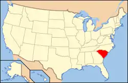 | |
|---|---|---|
| Lists by county |
| |
| Lists by city |
| |
| Other lists | ||
Municipalities and communities of Beaufort County, South Carolina, United States | ||
|---|---|---|
| Cities | Map of South Carolina highlighting Beaufort County | |
| Towns | ||
| CDPs | ||
| Unincorporated communities | ||
| Footnotes | ‡This populated place also has portions in an adjacent county or counties | |
| ||
The Lowcountry of South Carolina | ||
|---|---|---|
| Counties |  | |
| Major communities | ||
| Sea islands | ||
| History & culture | ||
| Military installations |
| |
| Natural areas | ||
| Other articles | ||
This article is issued from Wikipedia. The text is licensed under Creative Commons - Attribution - Sharealike. Additional terms may apply for the media files.