National Register of Historic Places listings in Clarendon County, South Carolina
This is a list of the National Register of Historic Places listings in Clarendon County, South Carolina.
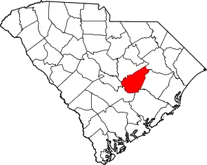
Location of Clarendon County in South Carolina
This is intended to be a complete list of the properties on the National Register of Historic Places in Clarendon County, South Carolina, United States. The locations of National Register properties for which the latitude and longitude coordinates are included below, may be seen in a map.[1]
There are 8 properties listed on the National Register in the county.
- This National Park Service list is complete through NPS recent listings posted January 29, 2021.[2]
Current listings
| [3] | Name on the Register[4] | Image | Date listed[5] | Location | City or town | Description |
|---|---|---|---|---|---|---|
| 1 | Alderman's 20 Stores in One |  Alderman's 20 Stores in One |
August 26, 1994 (#94001047) |
34 and 36 Brooks St. 33°41′14″N 80°12′38″W |
Manning | |
| 2 | Davis House |  Davis House |
January 13, 1983 (#83002191) |
South of Manning on South Carolina Highway 63 33°39′09″N 80°13′33″W |
Manning | |
| 3 | James Building |  James Building |
March 28, 2007 (#07000222) |
124-126 Main St. 33°36′28″N 80°21′02″W |
Summerton | |
| 4 | Manning Commercial Historic District | 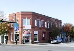 Manning Commercial Historic District |
May 28, 2010 (#10000297) |
Portions of E Boyce, W Boyce, N Brooks, S Brooks, W Keitt, N Mill, S. Mill, E Rigby, and W Rigby 33°41′43″N 80°12′38″W |
Manning | |
| 5 | Manning Library | 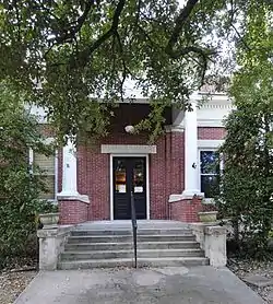 Manning Library |
July 10, 1979 (#79002381) |
211 N. Brooks St. 33°41′59″N 80°12′38″W |
Manning | |
| 6 | Santee Indian Mound and Fort Watson | 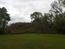 Santee Indian Mound and Fort Watson |
July 29, 1969 (#69000164) |
Address Restricted |
Summerton | |
| 7 | Senn's Grist Mill-Blacksmith Shop-Orange Crush Bottling Plant | 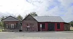 Senn's Grist Mill-Blacksmith Shop-Orange Crush Bottling Plant |
March 24, 2000 (#00000290) |
3 Cantey St. 33°36′32″N 80°21′05″W |
Summerton | |
| 8 | Summerton High School | Summerton High School |
August 26, 1994 (#94001048) |
S. Church St. 33°36′24″N 80°20′35″W |
Summerton |
See also
| Wikimedia Commons has media related to National Register of Historic Places in Clarendon County, South Carolina. |
References
- The latitude and longitude information provided in this table was derived originally from the National Register Information System, which has been found to be fairly accurate for about 99% of listings. Some locations in this table may have been corrected to current GPS standards.
- "National Register of Historic Places: Weekly List Actions". National Park Service, United States Department of the Interior. Retrieved on January 29, 2021.
- Numbers represent an alphabetical ordering by significant words. Various colorings, defined here, differentiate National Historic Landmarks and historic districts from other NRHP buildings, structures, sites or objects.
- "National Register Information System". National Register of Historic Places. National Park Service. March 13, 2009.
- The eight-digit number below each date is the number assigned to each location in the National Register Information System database, which can be viewed by clicking the number.
| Topics | 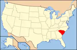 | |
|---|---|---|
| Lists by county |
| |
| Lists by city |
| |
| Other lists | ||
Municipalities and communities of Clarendon County, South Carolina, United States | ||
|---|---|---|
| City | Map of South Carolina highlighting Clarendon County | |
| Towns | ||
| CDP | ||
| Unincorporated communities | ||
| ||
This article is issued from Wikipedia. The text is licensed under Creative Commons - Attribution - Sharealike. Additional terms may apply for the media files.