National Register of Historic Places listings in Oconee County, South Carolina
This is a list of the National Register of Historic Places listings in Oconee County, South Carolina.
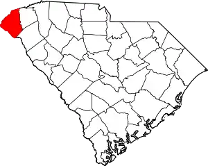
Location of Oconee County in South Carolina
This is intended to be a complete list of the properties and districts on the National Register of Historic Places in Oconee County, South Carolina, United States. The locations of National Register properties and districts for which the latitude and longitude coordinates are included below, may be seen on a map.[1]
There are 22 properties and districts listed on the National Register in the county. Another 2 properties were once listed but have been removed.
- This National Park Service list is complete through NPS recent listings posted January 29, 2021.[2]
Current listings
| [3] | Name on the Register[4] | Image | Date listed[5] | Location | City or town | Description |
|---|---|---|---|---|---|---|
| 1 | Alexander-Hill House |  Alexander-Hill House |
July 24, 1972 (#72001216) |
About 10 miles (16 km) north of Seneca off South Carolina Highway 183 34°47′48″N 82°55′49″W |
Seneca | |
| 2 | Ellicott Rock | 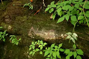 Ellicott Rock |
July 24, 1973 (#73001722) |
North of Walhalla off SC 107 35°00′02″N 83°06′30″W |
Walhalla | |
| 3 | Faith Cabin Library at Seneca Junior College | 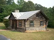 Faith Cabin Library at Seneca Junior College |
November 14, 2012 (#12000942) |
298 S. Poplar St. 34°40′51″N 82°57′35″W |
Seneca | Part of the Faith Cabin Libraries in South Carolina 1932-ca.1960 MPS |
| 4 | Keil Farm | 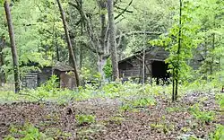 Keil Farm |
May 20, 1998 (#98000557) |
178 Keil Farm Rd. 34°43′54″N 83°03′23″W |
Walhalla | |
| 5 | Long Creek Academy | .JPG.webp) Long Creek Academy |
November 20, 1987 (#87002059) |
1251 Academy Rd. 34°47′25″N 83°14′52″W |
Long Creek | |
| 6 | McPhail Angus Farm | .JPG.webp) McPhail Angus Farm |
November 7, 2007 (#07000396) |
320 Coyote Lane 34°33′18″N 82°56′24″W |
Seneca | |
| 7 | Newry Historic District | 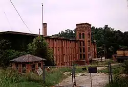 Newry Historic District |
March 19, 1982 (#82003897) |
Broadway, River Ridge Rd., and South, Branch, and Palmetto Aves. 34°43′28″N 82°54′32″W |
Newry | |
| 8 | Oconee County Cage | .JPG.webp) Oconee County Cage |
November 14, 1982 (#82001523) |
Church St. 34°45′52″N 83°04′01″W |
Walhalla | Moved to Oconee Heritage Center |
| 9 | Oconee County Courthouse |  Oconee County Courthouse |
October 11, 2016 (#16000715) |
211 W. Main St. 34°45′55″N 83°04′07″W |
Walhalla | The old 1956 courthouse |
| 10 | Oconee State Park Historic District | 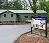 Oconee State Park Historic District |
June 16, 2004 (#04000618) |
624 State Park Rd. 34°51′57″N 83°06′12″W |
Mountain Rest | |
| 11 | Oconee Station and Richards House | 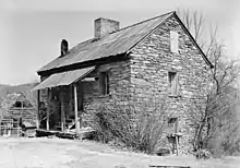 Oconee Station and Richards House |
February 24, 1971 (#71000792) |
11 miles (18 km) north of Walhalla via South Carolina Highway 11 and County Road 95 34°50′46″N 83°04′14″W |
Walhalla | |
| 12 | Old Pickens Presbyterian Church | 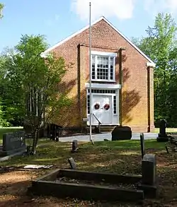 Old Pickens Presbyterian Church |
April 4, 1996 (#96000380) |
South Carolina Highway 183, 0.25 miles (0.40 km) west of the Oconee-Pickens county line 34°47′29″N 82°53′12″W |
Seneca | |
| 13 | Pendleton Historic District | 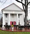 Pendleton Historic District |
August 25, 1970 (#70000560) |
Bounded on the west by Hopewell and Treaty Oak, on the north by the Old Stone Church, on the east by Montpelier, and on the south by the town limits 34°39′07″N 82°47′01″W |
Pendleton | Extends into Anderson and Pickens counties |
| 14 | Ram Cat Alley Historic District | 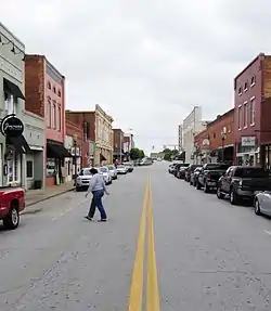 Ram Cat Alley Historic District |
March 24, 2000 (#00000289) |
Ram Cat Alley and North Townville St. 34°41′06″N 82°57′09″W |
Seneca | |
| 15 | Retreat Rosenwald School | 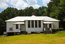 Retreat Rosenwald School |
September 15, 2011 (#11000676) |
150 Pleasant Hill Cir. 34°38′28″N 83°03′50″W |
Westminster | |
| 16 | Russell House | 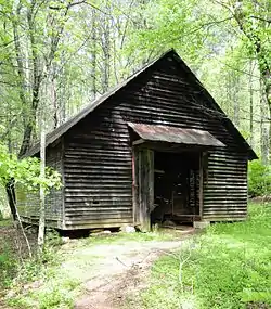 Russell House |
February 29, 1988 (#83004549) |
Northwest of Mountain Rest on South Carolina Highway 28 34°54′34″N 83°10′21″W |
Mountain Rest | |
| 17 | St. John's Lutheran Church | .JPG.webp) St. John's Lutheran Church |
November 24, 1980 (#80003692) |
301 W. Main St. 34°45′54″N 83°04′11″W |
Walhalla | |
| 18 | Seneca Historic District | .JPG.webp) Seneca Historic District |
December 31, 1974 (#74001871) |
Roughly bounded by S. 1st, S. 3rd, Townsville, and Poplar Sts.; also 300 S. Fairplay St. 34°41′01″N 82°57′25″W |
Seneca | 300 S. Fairplay represents a boundary increase of April 23, 1987 |
| 19 | Southern Railway Passenger Station | .JPG.webp) Southern Railway Passenger Station |
November 7, 1976 (#76001707) |
129 Main St. 34°39′57″N 83°05′46″W |
Westminster | |
| 20 | Stumphouse Tunnel Complex | 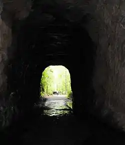 Stumphouse Tunnel Complex |
April 7, 1971 (#71000793) |
5 miles (8.0 km) north of Walhalla via South Carolina Highways 28 and 226 34°48′43″N 83°07′03″W |
Walhalla | |
| 21 | Tamassee DAR School | 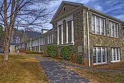 Tamassee DAR School |
May 16, 2012 (#12000289) |
1925 Bumgardner Dr. 34°53′01″N 83°01′04″W |
Tamassee | |
| 22 | Walhalla Graded School | .JPG.webp) Walhalla Graded School |
February 13, 1992 (#92000059) |
101 E. N. Broad St. 34°46′00″N 83°03′55″W |
Walhalla | Walhalla Civic Auditorium |
Former listings
| [3] | Name on the Register | Image | Date listed | Date removed | Location | City or town | Summary |
|---|---|---|---|---|---|---|---|
| 1 | Oconee County Jail | November 14, 1982 (#82001524) | December 12, 1989 | Short St. |
Walhalla | Demolished[6] | |
| 2 | Prather's Bridge | June 5, 1970 (#70000891) | April 17, 1978 | SW of Westminster 34°38′50″N 83°16′46″W |
Westminster vicinity | Burned[7] |
See also
| Wikimedia Commons has media related to National Register of Historic Places in Oconee County, South Carolina. |
References
- The latitude and longitude information provided in this table was derived originally from the National Register Information System, which has been found to be fairly accurate for about 99% of listings. Some locations in this table may have been corrected to current GPS standards.
- "National Register of Historic Places: Weekly List Actions". National Park Service, United States Department of the Interior. Retrieved on January 29, 2021.
- Numbers represent an alphabetical ordering by significant words. Various colorings, defined here, differentiate National Historic Landmarks and historic districts from other NRHP buildings, structures, sites or objects.
- "National Register Information System". National Register of Historic Places. National Park Service. March 13, 2009.
- The eight-digit number below each date is the number assigned to each location in the National Register Information System database, which can be viewed by clicking the number.
| Topics | 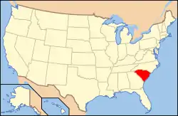 | |
|---|---|---|
| Lists by county |
| |
| Lists by city |
| |
| Other lists | ||
Municipalities and communities of Oconee County, South Carolina, United States | ||
|---|---|---|
| Cities | Map of South Carolina highlighting Oconee County | |
| Towns | ||
| CDPs | ||
| Unincorporated communities | ||
| Ghost towns | ||
| ||
This article is issued from Wikipedia. The text is licensed under Creative Commons - Attribution - Sharealike. Additional terms may apply for the media files.