National Register of Historic Places listings in Newberry County, South Carolina
This is a list of the National Register of Historic Places listings in Newberry County, South Carolina.
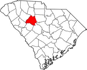
Location of Newberry County in South Carolina
This is intended to be a complete list of the properties and districts on the National Register of Historic Places in Newberry County, South Carolina, United States. The locations of National Register properties and districts for which the latitude and longitude coordinates are included below, may be seen in a map.[1]
There are 35 properties and districts listed on the National Register in the county. Another 2 properties were once listed but have been removed.
- This National Park Service list is complete through NPS recent listings posted January 29, 2021.[2]
Current listings
| [3] | Name on the Register[4] | Image | Date listed[5] | Location | City or town | Description |
|---|---|---|---|---|---|---|
| 1 | Jacob Bedenbaugh House |  Jacob Bedenbaugh House |
October 6, 2011 (#11000732) |
1185 South Carolina Highway 773 34°13′41″N 81°28′10″W |
Prosperity | |
| 2 | Boundary Street-Newberry Cotton Mills Historic District |  Boundary Street-Newberry Cotton Mills Historic District |
November 26, 1980 (#80004465) |
Roughly bounded by Drayton, Boundary, Charles, Terrant, and Crosson Sts. 34°16′13″N 81°37′31″W |
Newberry | |
| 3 | Burton House | 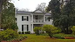 Burton House |
November 26, 1980 (#80003681) |
1315 Glenn St.[6] 34°16′53″N 81°36′44″W |
Newberry | |
| 4 | Caldwell Street Historic District |  Caldwell Street Historic District |
November 26, 1980 (#80004464) |
Caldwell St. 34°16′17″N 81°37′02″W |
Newberry | |
| 5 | Coateswood | 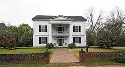 Coateswood |
April 28, 1975 (#75001704) |
1700 Boundary St. 34°16′28″N 81°36′52″W |
Newberry | |
| 6 | College Street Historic District | 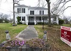 College Street Historic District |
November 26, 1980 (#80004461) |
College St. 34°16′49″N 81°37′17″W |
Newberry | |
| 7 | Cousins House | 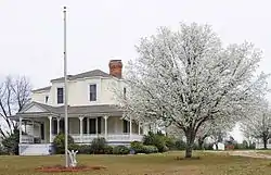 Cousins House |
November 26, 1980 (#80004473) |
Nance St. Extension 34°15′40″N 81°36′37″W |
Newberry | |
| 8 | Folk-Holloway House |  Folk-Holloway House |
July 30, 1992 (#92000963) |
Junction of Holloway (Columbia Highway or County Road 107) and Folk Sts. 34°16′04″N 81°25′12″W |
Pomaria | |
| 9 | Hannah Rosenwald School | 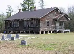 Hannah Rosenwald School |
January 22, 2009 (#08001369) |
61 Deadfall Rd. 34°10′51″N 81°38′00″W |
Newberry | "Three-teacher" Rosenwald school erected in 1925 and affiliated with the Hannah A.M.E. Church[7] |
| 10 | Harrington Street Historic District |  Harrington Street Historic District |
November 26, 1980 (#80004462) |
Harrington St. 34°16′53″N 81°36′56″W |
Newberry | |
| 11 | Hatton House | 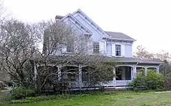 Hatton House |
October 1, 1990 (#90001504) |
Holloway St. between Folk St. and U.S. Route 176 34°16′11″N 81°25′20″W |
Pomaria | |
| 12 | Francis B. Higgins House |  Francis B. Higgins House |
November 26, 1980 (#80003682) |
1520 Boundary St. 34°16′24″N 81°36′57″W |
Newberry | |
| 13 | Hope Rosenwald School | 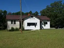 Hope Rosenwald School |
October 3, 2007 (#07001045) |
1971 Hope Station Rd. 34°16′12″N 81°21′53″W |
Pomaria | |
| 14 | Howard Junior High School | 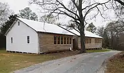 Howard Junior High School |
February 3, 2006 (#05001577) |
431 Shiloh St. 34°12′57″N 81°32′33″W |
Prosperity | |
| 15 | Little Mountain Historic District | 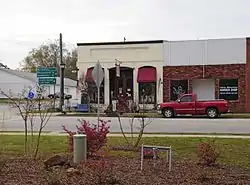 Little Mountain Historic District |
April 18, 2003 (#03000275) |
Along portions of Pomaria, Church, Main, and Mountain Sts. 34°11′49″N 81°24′49″W |
Little Mountain | |
| 16 | Main Street Historic District | 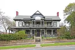 Main Street Historic District |
November 26, 1980 (#80004463) |
Roughly bounded by Harper, Summer, Douglas, Johnstone, Holman, and McMorris Sts. 34°16′47″N 81°36′40″W |
Newberry | |
| 17 | Moon-Dominick House |  Moon-Dominick House |
March 22, 1982 (#82003896) |
Northeast of Chappells 34°13′20″N 81°50′42″W |
Chappells | |
| 18 | George Mower House | 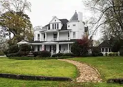 George Mower House |
November 26, 1980 (#80003683) |
1526 Boundary St. 34°16′25″N 81°35′38″W |
Newberry | |
| 19 | Frederick Nance House |  Frederick Nance House |
July 27, 2014 (#13000333) |
921 Jessica Ave. 34°16′03″N 81°37′28″W |
Newberry | |
| 20 | Newberry College Historic District | 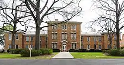 Newberry College Historic District |
June 23, 1976 (#76001706) |
2100 College St. 34°17′06″N 81°37′18″W |
Newberry | |
| 21 | Newberry County Memorial Hospital | Newberry County Memorial Hospital |
April 21, 2004 (#04000355) |
1300-1308 Hunt St. 34°17′02″N 81°36′23″W |
Newberry | |
| 22 | Newberry Historic District | 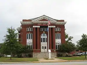 Newberry Historic District |
December 31, 1974 (#74001870) |
Bounded roughly by Friend, College, McKibben, and Harrington Sts.; also roughly bounded by Friend, McKibben, Harrington, Lindsay, and Coates Sts.; also along sections of Main, Lindsay and Wilson Sts. 34°16′27″N 81°37′28″W |
Newberry | Second and third sets of boundaries represent boundary increases of November 26, 1980 and June 16, 2004 |
| 23 | Newberry Opera House | 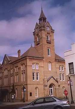 Newberry Opera House |
December 3, 1969 (#69000171) |
Boyce and Nance Sts. 34°16′36″N 81°37′22″W |
Newberry | |
| 24 | Oakland Mill | 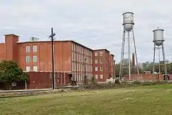 Oakland Mill |
June 15, 2011 (#11000372) |
2802 Fair Ave. 34°17′38″N 81°37′40″W |
Newberry | Textile mill with initial construction in 1910-12; also known as Oakland-Kendall Mill[8] |
| 25 | Old Courthouse | 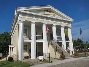 Old Courthouse |
August 19, 1971 (#71000791) |
1207 Caldwell St. 34°16′31″N 81°37′16″W |
Newberry | |
| 26 | Pomaria |  Pomaria |
April 24, 1979 (#79003321) |
Southeast of Pomaria on U.S. Route 176 34°15′15″N 81°23′08″W |
Pomaria | |
| 27 | Prosperity Cemetery |  Prosperity Cemetery |
January 15, 2014 (#13001097) |
McNeary St. 34°11′54″N 81°31′48″W |
Prosperity | |
| 28 | Ike Reighley House | 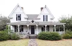 Ike Reighley House |
November 26, 1980 (#80003684) |
2304 Main St. 34°16′45″N 81°36′23″W |
Newberry | |
| 29 | St. John's Lutheran Church | 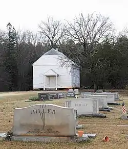 St. John's Lutheran Church |
December 8, 1978 (#78002527) |
Southeast of Pomaria 34°15′11″N 81°22′18″W |
Pomaria | |
| 30 | Summer Brothers Stores | 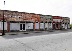 Summer Brothers Stores |
November 26, 1980 (#80003686) |
900 Main St. 34°16′23″N 81°37′20″W |
Newberry | |
| 31 | Timberhouse | 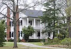 Timberhouse |
November 26, 1980 (#80003687) |
1427 Ebenezer Rd. 34°15′36″N 81°36′15″W |
Newberry | |
| 32 | Vincent Street Historic District | 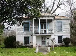 Vincent Street Historic District |
November 26, 1980 (#80003688) |
Vincent and Crosson Sts. 34°16′32″N 81°37′39″W |
Newberry | |
| 33 | Wells Japanese Garden | 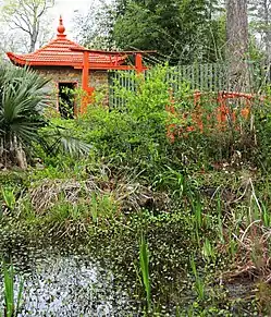 Wells Japanese Garden |
November 26, 1980 (#80003689) |
Lindsay St. 34°16′42″N 81°37′11″W |
Newberry | |
| 34 | Osborne Wells House | 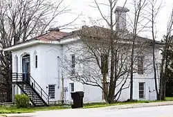 Osborne Wells House |
November 26, 1980 (#80003690) |
1101 Fair St. 34°16′57″N 81°37′37″W |
Newberry | |
| 35 | West Boundary Street Historic District | 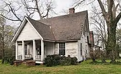 West Boundary Street Historic District |
November 26, 1980 (#80003691) |
Boundary and Jessica Sts. 34°16′00″N 81°37′29″W |
Newberry |
Former listings
| [3] | Name on the Register | Image | Date listed | Date removed | Location | City or town | Summary |
|---|---|---|---|---|---|---|---|
| 1 | Oakhurst | April 24, 1979 (#79002389) | December 8, 2005 | Newberry | Demolished[9] | ||
| 2 | Stewart House | November 26, 1980 (#80003685) | March 15, 2005 | 1001 Wilson Street |
Newberry | Delisted after being relocated[10] |
See also
| Wikimedia Commons has media related to National Register of Historic Places in Newberry County, South Carolina. |
References
- The latitude and longitude information provided in this table was derived originally from the National Register Information System, which has been found to be fairly accurate for about 99% of listings. Some locations in this table may have been corrected to current GPS standards.
- "National Register of Historic Places: Weekly List Actions". National Park Service, United States Department of the Interior. Retrieved on January 29, 2021.
- Numbers represent an alphabetical ordering by significant words. Various colorings, defined here, differentiate National Historic Landmarks and historic districts from other NRHP buildings, structures, sites or objects.
- "National Register Information System". National Register of Historic Places. National Park Service. March 13, 2009.
- The eight-digit number below each date is the number assigned to each location in the National Register Information System database, which can be viewed by clicking the number.
- National Register of Historic Places Inventory/Nomination Form: Burton House. National Park Service, 1980.
- "National Register of Historic Places Registration Form - Hannah Rosenwald School" (PDF). December 3, 2008. Retrieved July 7, 2011.
- "National Register of Historic Places Registration Form - Oakland Mill" (PDF). August 2009. Retrieved July 7, 2011.
| Topics | 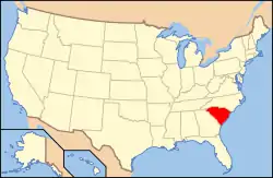 | |
|---|---|---|
| Lists by county |
| |
| Lists by city |
| |
| Other lists | ||
Municipalities and communities of Newberry County, South Carolina, United States | ||
|---|---|---|
| City | Map of South Carolina highlighting Newberry County | |
| Towns | ||
| Unincorporated communities | ||
| Footnotes | ‡This populated place also has portions in an adjacent county or counties | |
| ||
This article is issued from Wikipedia. The text is licensed under Creative Commons - Attribution - Sharealike. Additional terms may apply for the media files.