National Register of Historic Places listings in Columbia, South Carolina
This is a list of the National Register of Historic Places listings in Columbia, South Carolina.
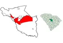
This is intended to be a complete list of the properties and districts on the National Register of Historic Places in Columbia, South Carolina, United States. The locations of National Register properties and districts for which the latitude and longitude coordinates are included below, may be seen on a map.[1]
There are 178 properties and districts listed on the National Register in Richland County, including 5 National Historic Landmarks. The city of Columbia is the location of 140 of these properties and districts, including all of the National Historic Landmarks; they are listed here, while the properties and districts in the remaining parts of the county are listed separately. Another 3 properties in Columbia were once listed but have been removed.
- This National Park Service list is complete through NPS recent listings posted January 29, 2021.[2]
Current listings
| [3] | Name on the Register[4] | Image | Date listed[5] | Location | Description |
|---|---|---|---|---|---|
| 1 | Allen University | 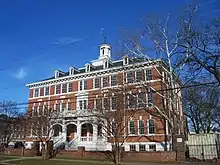 Allen University |
April 14, 1975 (#75001705) |
1530 Harden St. 34°00′38″N 81°01′14″W |
|
| 2 | Alston House | 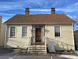 Alston House |
March 2, 1979 (#79003359) |
1811 Gervais St. 34°00′16″N 81°01′25″W |
|
| 3 | Alta Vista-Camp Fornance-Newman Park Historic District |  Alta Vista-Camp Fornance-Newman Park Historic District |
November 17, 2015 (#15000808) |
Bounded by Lakewood Ave., Seaboard Airline RR., Earlewood & Marshall Parks, Northwood, Park, Lindsay & Marlboro Sts. 34°01′23″N 81°02′52″W |
|
| 4 | Arcade Building |  Arcade Building |
November 17, 1982 (#82001525) |
1332 Main St. 34°00′12″N 81°02′04″W |
|
| 5 | Arsenal Hill | .JPG.webp) Arsenal Hill |
November 23, 1971 (#71000795) |
1800 Lincoln St. 34°00′29″N 81°02′32″W |
Palmetto Iron Works and Armory |
| 6 | Babcock Building, South Carolina State Hospital |  Babcock Building, South Carolina State Hospital |
October 30, 1981 (#81000570) |
Bull St. 34°00′51″N 81°01′49″W |
|
| 7 | Bellevue Historic District | 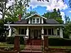 Bellevue Historic District |
September 30, 1997 (#97001206) |
Roughly bounded by Sumter St., Anthony Ave., Bull St., and Elmwood Ave. 34°01′09″N 81°02′19″W |
|
| 8 | Benedict College Historic District | April 20, 1987 (#87000809) |
Roughly bounded by Laurel, Oak, Taylor, and Harden Sts. on the Benedict College campus 34°00′43″N 81°01′12″W |
||
| 9 | Florence C. Benson Elementary School | 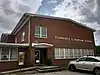 Florence C. Benson Elementary School |
October 7, 2009 (#09000819) |
226 Bull St. 33°59′25″N 81°01′21″W |
|
| 10 | Bethel A.M.E. Church | 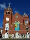 Bethel A.M.E. Church |
May 24, 1982 (#82003899) |
1528 Sumter St. 34°00′25″N 81°02′03″W |
|
| 11 | BROWN'S FERRY VESSEL | May 18, 1979 (#79002391) |
Address Restricted |
Currently on exhibit at the Rice Museum in Georgetown, South Carolina | |
| 12 | Building at 1210–1214 Main Street | 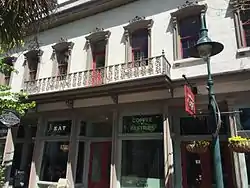 Building at 1210–1214 Main Street |
March 2, 1979 (#79003361) |
1210–1214 Main St. 34°00′04″N 81°02′07″W |
|
| 13 | Building at 1644 Main Street |  Building at 1644 Main Street |
March 2, 1979 (#79003377) |
1644 Main St. 34°00′27″N 81°02′11″W |
|
| 14 | Building at 1722–1724 Main Street |  Building at 1722–1724 Main Street |
November 25, 1980 (#80003694) |
1722–1724 Main St. 34°00′30″N 81°02′13″W |
|
| 15 | Building at 303 Saluda Avenue |  Building at 303 Saluda Avenue |
May 24, 1982 (#82003900) |
303 Saluda Ave. 33°59′34″N 81°01′02″W |
|
| 16 | Caldwell-Hampton-Boylston House |  Caldwell-Hampton-Boylston House |
May 6, 1971 (#71000796) |
829 Richland St. 34°00′32″N 81°02′36″W |
|
| 17 | John C. Calhoun State Office Building |  John C. Calhoun State Office Building |
September 23, 2011 (#11000703) |
1015 Sumter St. 33°59′57″N 81°01′51″W |
|
| 18 | Canal Dime Savings Bank | 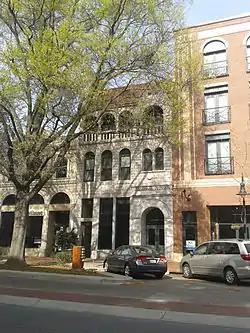 Canal Dime Savings Bank |
November 25, 1980 (#80004468) |
1530 Main St. 34°00′20″N 81°02′08″W |
|
| 19 | Carolina Life Insurance Company | 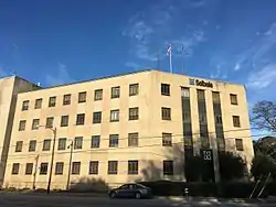 Carolina Life Insurance Company |
July 11, 2016 (#16000444) |
1501 Lady St. 34°00′15″N 81°01′44″W |
|
| 20 | Carver Theatre | 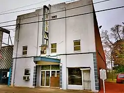 Carver Theatre |
July 17, 2003 (#03000658) |
1519 Harden St. 34°00′37″N 81°01′18″W |
|
| 21 | Champion and Pearson Funeral Home | 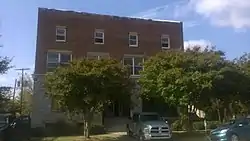 Champion and Pearson Funeral Home |
July 17, 2017 (#100001334) |
1325 Park St. 34°00′09″N 81°02′17″W |
|
| 22 | Chappelle Administration Building | .jpg.webp) Chappelle Administration Building |
December 8, 1976 (#76001710) |
1530 Harden St. 34°00′39″N 81°01′16″W |
|
| 23 | Chesnut Cottage | 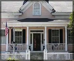 Chesnut Cottage |
May 6, 1971 (#71000797) |
1718 Hampton St. 34°00′27″N 81°01′37″W |
|
| 24 | Claussen's Bakery | .jpg.webp) Claussen's Bakery |
March 9, 1987 (#87000401) |
2001-2003 Green St. 34°00′00″N 81°01′05″W |
|
| 25 | Columbia Canal | 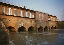 Columbia Canal |
January 15, 1979 (#79002392) |
Eastern bank of the Broad and Congaree Rivers from the Diversion dam to the Southern railroad bridge 34°00′06″N 81°03′21″W |
|
| 26 | Columbia Central Fire Station | 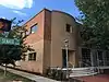 Columbia Central Fire Station |
September 25, 2009 (#08001396) |
1001 Senate St. 33°59′58″N 81°02′10″W |
|
| 27 | Columbia City Hall | 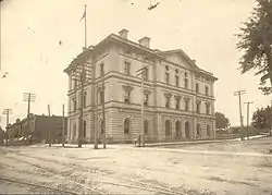 Columbia City Hall |
June 19, 1973 (#73001725) |
Main and Laurel Sts. 34°00′32″N 81°02′15″W |
|
| 28 | Columbia Commercial Historic District | .jpg.webp) Columbia Commercial Historic District |
October 20, 2014 (#14000875) |
Portions of Main, Blanding, Taylor & Sumter Sts.; also 1545 Sumter St., 1611, 1800, 1801, 1813 Main St., 1209 Blanding St. 34°00′27″N 81°02′07″W |
Second set of addresses represent a boundary increase approved January 25, 2021 |
| 29 | Columbia Electric Street Railway, Light & Power Substation | 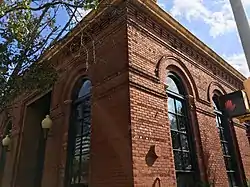 Columbia Electric Street Railway, Light & Power Substation |
February 4, 2011 (#10001220) |
Main and Laurel Sts. 34°00′09″N 81°02′10″W |
|
| 30 | Columbia Historic District I | 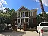 Columbia Historic District I |
May 6, 1971 (#71000798) |
Roughly bounded by Elmwood, Assembly, Laurel, and Wayne Sts. 34°00′37″N 81°02′13″W |
|
| 31 | Columbia Historic District II | .jpg.webp) Columbia Historic District II |
May 6, 1971 (#71000799) |
Roughly bounded by Taylor, Richland, Pickens, and Barnwell Sts. • Boundary increase (listed June 28, 1982: Blanding, Laurel, Richland, Calhoun, Marion, Bull, Pickens, Henderson, and Barnwell Sts. • Boundary change (listed October 2, 2018: 1328 Blanding St. 34°00′39″N 81°02′01″W |
|
| 32 | Columbia Mills Building | 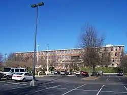 Columbia Mills Building |
May 24, 1982 (#82003902) |
On the Congaree River 33°59′55″N 81°02′53″W |
Now houses the South Carolina State Museum |
| 33 | Columbia Township Auditorium | 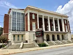 Columbia Township Auditorium |
September 28, 2005 (#05001104) |
1703 Taylor St. 34°00′33″N 81°04′40″W |
|
| 34 | Confederate Printing Plant | 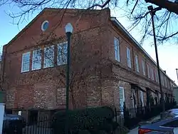 Confederate Printing Plant |
March 28, 1979 (#79002393) |
501 Gervais St. 33°59′53″N 81°02′41″W |
|
| 35 | Consolidated Building | .jpg.webp) Consolidated Building |
March 2, 1979 (#79003373) |
1326-1330 Main St. 34°00′12″N 81°02′04″W |
|
| 36 | Cornell Arms | January 11, 2019 (#100003305) |
1230 Pendleton St. 33°59′55″N 81°01′52″W |
||
| 37 | Harriet M. Cornwell Tourist House | .JPG.webp) Harriet M. Cornwell Tourist House |
October 5, 2007 (#07001083) |
1713 Wayne St. 34°00′27″N 81°02′43″W |
|
| 38 | Curtiss-Wright Hangar | 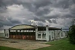 Curtiss-Wright Hangar |
April 30, 1998 (#98000418) |
1400 Jim Hamilton Boulevard 33°58′34″N 81°00′07″W |
|
| 39 | Debruhl-Marshall House | .jpg.webp) Debruhl-Marshall House |
March 23, 1972 (#72001218) |
1401 Laurel St. 34°00′38″N 81°02′02″W |
|
| 40 | Dovillers-Manning-Magoffin House | 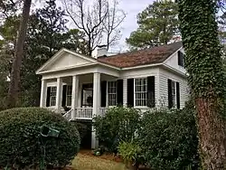 Dovillers-Manning-Magoffin House |
March 2, 1979 (#79003358) |
4203 St. Clair Dr. 34°00′34″N 80°58′39″W |
|
| 41 | Eau Claire Town Hall and Survey Publishing Company Building | 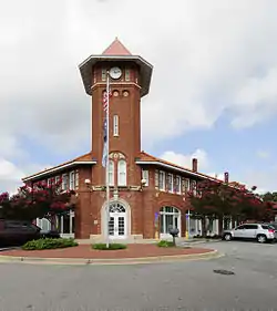 Eau Claire Town Hall and Survey Publishing Company Building |
March 2, 1979 (#79003371) |
3904 Monticello Rd. 34°02′21″N 81°03′08″W |
|
| 42 | Ebenezer Lutheran Chapel | 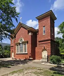 Ebenezer Lutheran Chapel |
March 2, 1979 (#79003365) |
1301 Richland St. 34°00′41″N 81°02′09″W |
|
| 43 | Efird's Department Store | 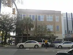 Efird's Department Store |
October 9, 2012 (#12000850) |
1601 Main St. 34°00′24″N 81°02′10″W |
|
| 44 | Elmwood Cemetery | .JPG.webp) Elmwood Cemetery |
September 6, 1996 (#96000984) |
501 Elmwood Ave. 34°00′50″N 81°03′13″W |
|
| 45 | Elmwood Park Historic District | 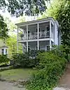 Elmwood Park Historic District |
May 3, 1991 (#91000529) |
Roughly bounded by Elmwood Ave., Main St. and the former Seaboard Air Line railroad tracks • Boundary increase (listed May 13, 2002, refnum 02000477): 2113 Park St. 34°00′49″N 81°02′34″W |
|
| 46 | Ensor-Keenan House | 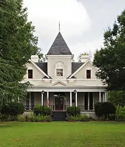 Ensor-Keenan House |
March 2, 1979 (#79003360) |
801 Wildwood Ave. 34°02′38″N 81°02′31″W |
|
| 47 | Dr. Matilda A. Evans House | January 22, 2019 (#100003317) |
2027 Taylor St. 34°00′40″N 81°01′20″W |
Segregation in Columbia, South Carolina MPS | |
| 48 | Fair-Rutherford and Rutherford Houses | 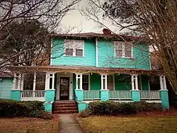 Fair-Rutherford and Rutherford Houses |
April 5, 1984 (#84002093) |
1326 and 1330 Gregg St. 34°00′25″N 81°01′24″W |
|
| 49 | Federal Land Bank Building | 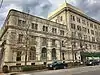 Federal Land Bank Building |
February 3, 2015 (#14001242) |
1401 Hampton St. 34°00′23″N 81°02′02″W |
|
| 50 | First Baptist Church | 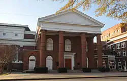 First Baptist Church |
January 25, 1971 (#71000800) |
1306 Hampton St. 34°00′20″N 81°02′00″W |
|
| 51 | First National Bank | 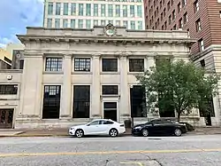 First National Bank |
November 25, 1980 (#80003695) |
1208 Washington St. 34°00′13″N 81°02′04″W |
|
| 52 | First Presbyterian Church | 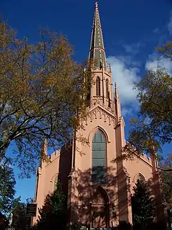 First Presbyterian Church |
January 25, 1971 (#71000801) |
1324 Marion St. 34°00′14″N 81°01′51″W |
|
| 53 | Five Points Historic District | May 20, 2019 (#100003938) |
Harden, Devine, and Greene Sts., Santee and Saluda Aves. 33°59′56″N 81°00′58″W |
"Funky urban village"[6] | |
| 54 | Forest Hills Historic District |  Forest Hills Historic District |
September 28, 2007 (#07001024) |
Bounded by Gervais St., Manning St., Forest Dr., and Glenwood Rd. 34°00′45″N 81°00′12″W |
|
| 55 | Gervais Street Bridge | .jpg.webp) Gervais Street Bridge |
November 25, 1980 (#80003676) |
Spans the Congaree River 33°59′47″N 81°02′55″W |
Extends into West Columbia in Lexington County |
| 56 | Good Samaritan-Waverly Hospital |  Good Samaritan-Waverly Hospital |
July 28, 2008 (#08000738) |
2204 Hampton St. 34°00′37″N 81°01′08″W |
|
| 57 | Granby Mill Village Historic District | 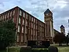 Granby Mill Village Historic District |
September 20, 1993 (#93000905) |
Roughly bounded by Catawba, Gist, Heyward, and Church Sts. 33°58′59″N 81°02′22″W |
|
| 58 | Greyhound Bus Depot | .jpg.webp) Greyhound Bus Depot |
December 28, 1989 (#82005383) |
1200 Blanding St. 34°00′29″N 81°02′08″W |
|
| 59 | Hale-Elmore-Seibels House | 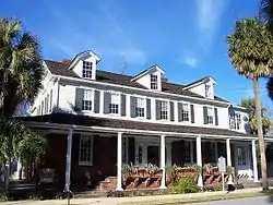 Hale-Elmore-Seibels House |
May 6, 1971 (#71000804) |
1601 Richland St. 34°00′46″N 81°01′53″W |
|
| 60 | Ainsley Hall House | .jpg.webp) Ainsley Hall House |
July 16, 1970 (#70000595) |
1616 Blanding St. 34°00′34″N 81°01′45″W |
Robert Mills House |
| 61 | Hampton-Preston House |  Hampton-Preston House |
July 29, 1969 (#69000172) |
1615 Blanding St. 34°00′37″N 81°01′46″W |
|
| 62 | Harden Street Substation | 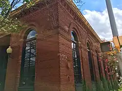 Harden Street Substation |
September 28, 2005 (#05001103) |
1901 Harden St. 34°00′53″N 81°01′25″W |
|
| 63 | Heslep House | 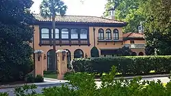 Heslep House |
March 2, 1979 (#79003378) |
203 Saluda Ave. 33°59′31″N 81°01′00″W |
|
| 64 | Horry-Guignard House | 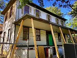 Horry-Guignard House |
May 6, 1971 (#71000802) |
1527 Senate St. 34°00′06″N 81°01′38″W |
|
| 65 | House of Peace Synagogue | .JPG.webp) House of Peace Synagogue |
August 28, 1979 (#79003354) |
Hampton and Park Sts. 34°00′15″N 81°02′18″W |
Also known as the Big Apple Club. |
| 66 | B.B. Kirkland Seed and Distributing Company | 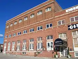 B.B. Kirkland Seed and Distributing Company |
March 2, 1979 (#79003370) |
912 Lady St. 34°00′03″N 81°02′18″W |
|
| 67 | Kress Building | 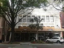 Kress Building |
March 2, 1979 (#79003376) |
1508 Main St. 34°00′20″N 81°02′08″W |
|
| 68 | Lace House | .JPG.webp) Lace House |
December 17, 1969 (#69000173) |
803 Richland St. 34°00′31″N 81°02′39″W |
|
| 69 | Ladson Presbyterian Church | 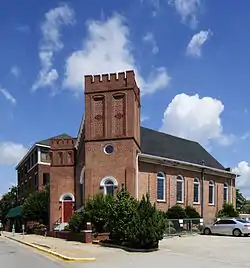 Ladson Presbyterian Church |
April 30, 1998 (#98000419) |
1720 Sumter St. 34°00′33″N 81°02′07″W |
|
| 70 | Leevy's Funeral Home | January 14, 2021 (#100006020) |
1831 Taylor St. 34°00′36″N 81°01′30″W |
||
| 71 | Lever Building | 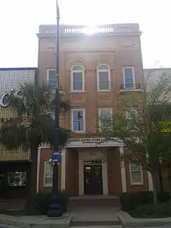 Lever Building |
March 2, 1979 (#79003372) |
1613 Main St. 34°00′24″N 81°02′12″W |
|
| 72 | Logan School | .JPG.webp) Logan School |
March 2, 1979 (#79003367) |
815 Elmwood Ave. 34°00′43″N 81°02′42″W |
|
| 73 | Preston C. Lorick House | 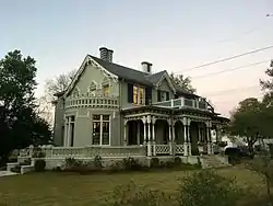 Preston C. Lorick House |
February 23, 1972 (#72001219) |
1727 Hampton St. 34°00′29″N 81°01′35″W |
|
| 74 | Lutheran Theological Seminary Building: Beam Dormitory | 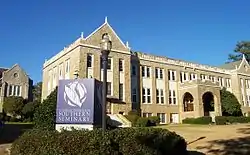 Lutheran Theological Seminary Building: Beam Dormitory |
August 28, 1979 (#79003353) |
4201 Main St. 34°02′32″N 81°02′04″W |
|
| 75 | Lyles-Gudmundson House | 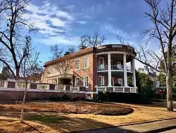 Lyles-Gudmundson House |
March 2, 1979 (#79003364) |
Address Restricted 33°59′32″N 81°00′55″W |
|
| 76 | Mann-Simons Cottage | 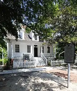 Mann-Simons Cottage |
April 23, 1973 (#73001726) |
1403 Richland St. 34°00′42″N 81°02′04″W |
|
| 77 | McCord House | 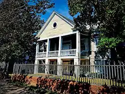 McCord House |
March 2, 1979 (#79003357) |
1431 Pendleton St. 33°59′59″N 81°01′41″W |
|
| 78 | McMaster School | 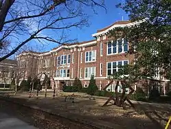 McMaster School |
July 25, 1997 (#97000777) |
1106 Pickens St. 34°00′08″N 81°01′34″W |
|
| 79 | Melrose Heights-Oak Lawn-Fairview Historic District | 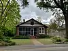 Melrose Heights-Oak Lawn-Fairview Historic District |
November 2, 2016 (#16000756) |
Bounded by Butler and Princeton Sts., Maiden Ln., Michigan St. and Millwood Ave., Woodrow and King Sts., Kirby St., Trenholm Rd. 34°00′19″N 80°59′48″W |
|
| 80 | Miller Brothers Cotton Warehouse | 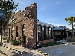 Miller Brothers Cotton Warehouse |
May 3, 2016 (#16000227) |
705 Gervais St. 33°59′57″N 81°02′28″W |
|
| 81 | Millwood | %252C_U.S._Route_76_(Garners_Ferry_Road)%252C_Columbia_vicinity_(Richland_County%252C_South_Carolina).jpg.webp) Millwood |
March 18, 1971 (#71000803) |
East of Columbia on Garner's Ferry Rd. 33°59′16″N 80°57′45″W |
Home of Wade Hampton II. |
| 82 | Moore-Mann House | 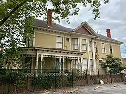 Moore-Mann House |
March 2, 1979 (#79003363) |
1611 Hampton St. 34°00′27″N 81°01′43″W |
|
| 83 | National Loan and Exchange Bank Building |  National Loan and Exchange Bank Building |
March 2, 1979 (#79003374) |
1338 Main St. 34°00′13″N 81°02′05″W |
|
| 84 | Nipper Creek (38RD18) | December 24, 1986 (#86003474) |
Address Restricted |
||
| 85 | North Carolina Mutual Building |  North Carolina Mutual Building |
January 20, 1995 (#94001570) |
1001, 1001½, and 1003 Washington St. 34°00′10″N 81°02′17″W |
|
| 86 | North Columbia Fire Station No. 7 |  North Columbia Fire Station No. 7 |
June 1, 2005 (#05000518) |
2622 N. Main St. 34°01′14″N 81°02′32″W |
|
| 87 | Old Campus District, University of South Carolina |  Old Campus District, University of South Carolina |
June 5, 1970 (#70000596) |
Bounded by Pendleton, Sumter, Pickens, and Green Sts. 33°59′47″N 81°01′43″W |
|
| 88 | Old Shandon Historic District | 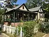 Old Shandon Historic District |
September 2, 2003 (#03000887) |
Roughly bounded by Cypress, Lee, Maple, Preston, and Woodrow St. 34°00′04″N 81°00′15″W |
|
| 89 | Olympia Mill | .jpg.webp) Olympia Mill |
February 2, 2005 (#04001590) |
500 Heyward St. 33°58′58″N 81°02′11″W |
|
| 90 | Olympia Mill School | 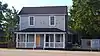 Olympia Mill School |
May 29, 2018 (#100002527) |
1170 Olympia Ave 33°58′44″N 81°01′41″W |
|
| 91 | Olympia Union Hall |  Olympia Union Hall |
January 24, 2017 (#100000571) |
119 S. Parker St. 33°59′00″N 81°02′02″W |
|
| 92 | Owen Building | 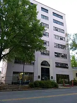 Owen Building |
June 14, 2013 (#13000398) |
1321 Lady St. 34°00′14″N 81°01′54″W |
|
| 93 | Pacific Community Association Building | 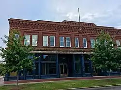 Pacific Community Association Building |
October 24, 2007 (#07001110) |
701 Whaley St. and 214 Wayne St. 33°59′08″N 81°02′07″W |
|
| 94 | Palmetto Building | .jpg.webp) Palmetto Building |
November 25, 1980 (#80003696) |
1400 Main St. 34°00′14″N 81°02′05″W |
|
| 95 | Palmetto Compress and Warehouse Company Building | 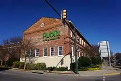 Palmetto Compress and Warehouse Company Building |
October 17, 1985 (#85003237) |
617 Devine St. 33°59′29″N 81°02′20″W |
[The building now serves as residential lofts |
| 96 | J. Davis Powell House | 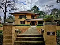 J. Davis Powell House |
September 25, 2012 (#12000823) |
1410 Shirley St. 34°00′26″N 80°59′52″W |
|
| 97 | George R. Price House | 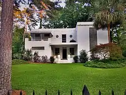 George R. Price House |
April 30, 1998 (#98000417) |
3000 Forest Dr. 34°00′54″N 80°59′54″W |
|
| 98 | Raymond Price House | 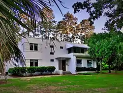 Raymond Price House |
September 27, 2007 (#07001022) |
3004 Forest Dr. 34°00′55″N 80°59′52″W |
|
| 99 | Randolph Cemetery | 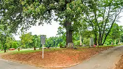 Randolph Cemetery |
January 20, 1995 (#94001573) |
Western terminus of Elmwood Ave. 34°00′34″N 81°03′15″W |
|
| 100 | Richland Cotton Mill | 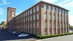 Richland Cotton Mill |
November 10, 1983 (#83003933) |
211-221 Main St. 33°59′18″N 81°01′43″W |
|
| 101 | Ruth's Beauty Parlor | October 5, 2020 (#100005638) |
1221 Pine St. 34°00′26″N 81°01′04″W |
||
| 102 | St. Peter's Roman Catholic Church | 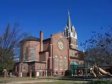 St. Peter's Roman Catholic Church |
September 28, 1989 (#89001610) |
1529 Assembly St. 34°00′19″N 81°02′17″W |
|
| 103 | Sidney Park Colored Methodist Episcopal Church | 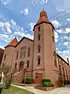 Sidney Park Colored Methodist Episcopal Church |
October 24, 1996 (#96001222) |
1114 Blanding St. 34°00′26″N 81°02′15″W |
|
| 104 | Modjeska Monteith Simkins House | 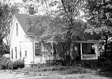 Modjeska Monteith Simkins House |
March 25, 1994 (#94000263) |
2025 Marion St. 34°00′49″N 81°02′09″W |
|
| 105 | South Carolina Governor's Mansion | .JPG.webp) South Carolina Governor's Mansion |
June 5, 1970 (#70000597) |
800 Richland St. 34°00′28″N 81°02′37″W |
|
| 106 | South Carolina Memorial Garden | .JPG.webp) South Carolina Memorial Garden |
April 2, 2012 (#09000464) |
1919 Lincoln St., 34°00′33″N 81°02′36″W |
|
| 107 | South Carolina State Armory | 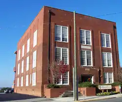 South Carolina State Armory |
February 5, 1999 (#99000099) |
1219 Assembly St. 34°00′05″N 81°02′10″W |
|
| 108 | South Carolina State Hospital, Mills Building |  South Carolina State Hospital, Mills Building |
June 5, 1970 (#70000890) |
2100 Bull St. 34°00′52″N 81°02′00″W |
|
| 109 | South Carolina Statehouse | 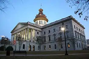 South Carolina Statehouse |
June 5, 1970 (#70000598) |
Main St. 34°00′01″N 81°01′59″W |
|
| 110 | Southern Cotton Oil Company | July 25, 1996 (#94001552) |
737 Gadsden St. 33°59′34″N 81°02′16″W |
||
| 111 | Dr. Cyril O. Spann Medical Office | May 20, 2019 (#100003939) |
2226 Hampton St. 34°00′38″N 81°01′06″W |
||
| 112 | A. Fletcher Spigner House | 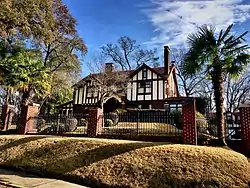 A. Fletcher Spigner House |
December 11, 2009 (#09001107) |
2028 Wheat St. 33°59′45″N 81°00′54″W |
|
| 113 | Stone Manufacturing Company | September 25, 2020 (#100005610) |
3452 North Main St. 34°01′52″N 81°02′32″W |
||
| 114 | Supreme Court of South Carolina Building | 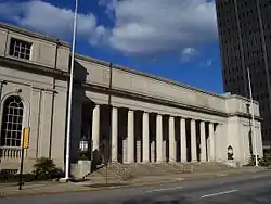 Supreme Court of South Carolina Building |
October 18, 1972 (#72001220) |
Northwestern corner of the junction of Gervais and Sumter Sts. 34°00′06″N 81°01′57″W |
|
| 115 | Sylvan Building | 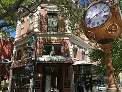 Sylvan Building |
March 23, 1972 (#72001221) |
1500 Main St. 34°00′18″N 81°02′07″W |
|
| 116 | Taylor House | 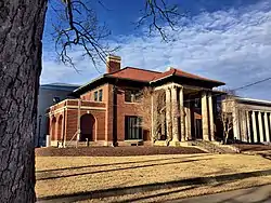 Taylor House |
July 6, 1982 (#82003903) |
1505 Senate St. 34°00′05″N 81°01′41″W |
|
| 117 | Strom Thurmond Federal Building and U.S. Courthouse | 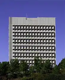 Strom Thurmond Federal Building and U.S. Courthouse |
September 10, 2014 (#14000599) |
1835-1845 Assembly St. 34°00′59″N 80°56′18″W |
|
| 118 | Town Theatre | 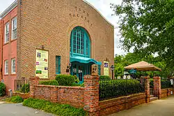 Town Theatre |
October 9, 1974 (#74001873) |
1012 Sumter St. 34°00′00″N 81°01′51″W |
|
| 119 | Trinity Episcopal Church | .jpg.webp) Trinity Episcopal Church |
February 24, 1971 (#71000805) |
1100 Sumter St. 34°00′03″N 81°01′52″W |
|
| 120 | Union National Bank Building | January 14, 2019 (#100003307) |
1200 Main St. 34°00′05″N 81°02′00″W |
||
| 121 | Union Station | 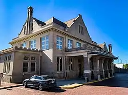 Union Station |
June 19, 1973 (#73001728) |
401 S. Main St. 33°59′25″N 81°01′46″W |
|
| 122 | University Neighborhood Historic District | 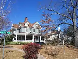 University Neighborhood Historic District |
October 13, 2004 (#04001150) |
Roughly bounded by Gervais St., the Southern railroad cut, Greene St., and Pickens St. 34°00′03″N 81°01′19″W |
|
| 123 | US Courthouse | 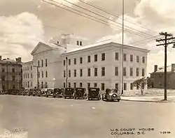 US Courthouse |
March 2, 1979 (#79003375) |
1100 Laurel St. 34°00′31″N 81°02′17″W |
|
| 124 | Veterans Administration Regional Office | September 25, 2020 (#100005611) |
1801 Assembly St. 34°00′32″N 81°02′21″W |
||
| 125 | Veterans Hospital | 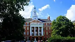 Veterans Hospital |
September 2, 2009 (#09000062) |
William Jennings Bryan Dorn Veterans Affairs Medical Center, University of South Carolina School of Medicine 33°58′39″N 80°57′40″W |
|
| 126 | Wade Hampton State Office Building | 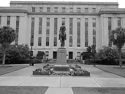 Wade Hampton State Office Building |
March 7, 2007 (#07000126) |
1015 Sumter St. 34°00′05″N 81°01′56″W |
|
| 127 | Wallace-McGee House |  Wallace-McGee House |
March 2, 1979 (#79003379) |
415 Harden St. 33°59′43″N 81°00′53″W |
|
| 128 | Wardlaw Junior High School |  Wardlaw Junior High School |
September 13, 1984 (#84002096) |
1003 Elmwood Ave. 34°00′45″N 81°02′33″W |
|
| 129 | Washington Street United Methodist Church |  Washington Street United Methodist Church |
December 18, 1970 (#70000599) |
1401 Washington St. 34°00′19″N 81°01′53″W |
|
| 130 | Booker T. Washington High School Auditorium | October 24, 2018 (#100003059) |
1400 Wheat St. 33°59′35″N 81°01′31″W |
||
| 131 | Waverly Historic District | 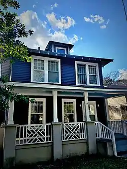 Waverly Historic District |
December 21, 1989 (#89002154) |
Roughly bounded by Hampton St., Heidt St., Gervais St., and Harden St. 34°00′33″N 81°01′03″W |
|
| 132 | Wesley Methodist Church | January 29, 2009 (#08001398) |
1727 Gervais St. 34°00′15″N 81°01′28″W |
||
| 133 | West Gervais Street Historic District | April 27, 1983 (#83002206) |
Roughly bounded by Gadsen, Senate, Park, and Lady Sts. 33°59′56″N 81°02′21″W |
||
| 134 | W. B. Smith Whaley House | 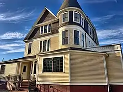 W. B. Smith Whaley House |
March 2, 1979 (#79003362) |
1527 Gervais St. 34°00′11″N 81°01′40″W |
|
| 135 | A.P. Williams Funeral Home | 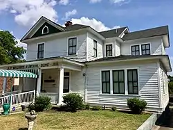 A.P. Williams Funeral Home |
September 28, 2005 (#05001102) |
1808 Washington St. 34°00′24″N 81°01′30″W |
|
| 136 | Thomas Woodrow Wilson Boyhood Home | 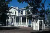 Thomas Woodrow Wilson Boyhood Home |
February 23, 1972 (#72001222) |
1705 Hampton St. 34°00′29″N 81°01′38″W |
|
| 137 | Woodrow Memorial Presbyterian Church | March 2, 1979 (#79003366) |
2221 Washington St. 34°00′34″N 81°01′05″W |
||
| 138 | World War Memorial Building | 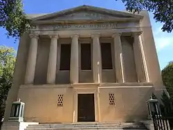 World War Memorial Building |
May 26, 1995 (#95000637) |
920 Sumter St., at its junction with Pendleton St. 33°59′55″N 81°01′48″W |
|
| 139 | Zimmerman House | 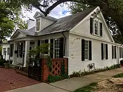 Zimmerman House |
March 2, 1979 (#79003355) |
1332 Pickens St. 34°00′19″N 81°01′41″W |
|
| 140 | Zimmerman School |  Zimmerman School |
March 2, 1979 (#79003356) |
1336 Pickens St. 34°00′21″N 81°01′41″W |
Former listings
| [3] | Name on the Register | Image | Date listed | Date removed | Location | Summary |
|---|---|---|---|---|---|---|
| 1 | Columbia High School | 1980 (#79003368) | December 18, 1989 | 1323 Washington Street |
Demolished[7] | |
| 2 | South Carolina Penitentiary | January 4, 1996 (#95001489) | December 8, 2005 | 1511 Williams Street |
Demolished[8] | |
| 3 | South Carolina Dispensary Office Building | March 2, 1979 (#79003369) | December 18, 1989 | 1205 Pulaski Street |
Demolished[9] |
See also
| Wikimedia Commons has media related to National Register of Historic Places in Columbia, South Carolina. |
References
- The latitude and longitude information provided in this table was derived originally from the National Register Information System, which has been found to be fairly accurate for about 99% of listings. Some locations in this table may have been corrected to current GPS standards.
- "National Register of Historic Places: Weekly List Actions". National Park Service, United States Department of the Interior. Retrieved on January 29, 2021.
- Numbers represent an alphabetical ordering by significant words. Various colorings, defined here, differentiate National Historic Landmarks and historic districts from other NRHP buildings, structures, sites or objects.
- "National Register Information System". National Register of Historic Places. National Park Service. March 13, 2009.
- The eight-digit number below each date is the number assigned to each location in the National Register Information System database, which can be viewed by clicking the number.
| Topics |  | |
|---|---|---|
| Lists by county |
| |
| Lists by city |
| |
| Other lists | ||