National Register of Historic Places listings in Spartanburg County, South Carolina
This is a list of the National Register of Historic Places listings in Spartanburg County, South Carolina.
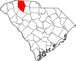
Location of Spartanburg County in South Carolina
This is intended to be a complete list of the properties and districts on the National Register of Historic Places in Spartanburg County, South Carolina, United States. The locations of National Register properties and districts for which the latitude and longitude coordinates are included below, may be seen in a map.[1]
There are 73 properties and districts listed on the National Register in the county. Another 4 properties were once listed but have been removed.
- This National Park Service list is complete through NPS recent listings posted January 29, 2021.[2]
Current listings
| [3] | Name on the Register[4] | Image | Date listed[5] | Location | City or town | Description |
|---|---|---|---|---|---|---|
| 1 | Alexander House |  Alexander House |
April 11, 2003 (#03000205) |
319 E. Main St. 34°57′03″N 81°55′28″W |
Spartanburg | |
| 2 | American Legion Building | 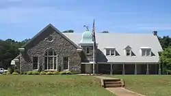 American Legion Building |
April 18, 2003 (#03000271) |
94 W. Park Dr. 34°56′03″N 81°54′51″W |
Spartanburg | |
| 3 | Anderson's Mill | .jpg.webp) Anderson's Mill |
November 14, 1978 (#78002529) |
West of Spartanburg off South Carolina Highway 296 34°52′59″N 82°00′42″W |
Spartanburg | |
| 4 | Apalache Mill | 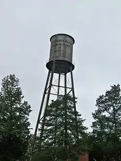 Apalache Mill |
December 15, 2015 (#15000616) |
2200 Racing Rd. 34°57′44″N 82°12′30″W |
Greer | |
| 5 | Arcadia Mill No. 1 | 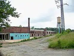 Arcadia Mill No. 1 |
September 30, 2014 (#14000819) |
1875 Hayne St. 34°57′25″N 81°59′34″W |
Spartanburg | |
| 6 | Arcadia Mill No. 2 |  Arcadia Mill No. 2 |
October 4, 2005 (#05001158) |
100 W. Cleveland St. 34°57′26″N 82°00′00″W |
Spartanburg | |
| 7 | Archeological Site 38SP11 | December 10, 1980 (#80003698) |
Address Restricted |
Pacolet | ||
| 8 | Archeological Site 38SP12 | December 10, 1980 (#80003699) |
Address Restricted |
Pacolet | ||
| 9 | Archeological Site 38SP13 | December 10, 1980 (#80003700) |
Address Restricted |
Pacolet | ||
| 10 | Archeological Site 38SP17 | December 10, 1980 (#80003701) |
Address Restricted |
Pacolet | ||
| 11 | Archeological Site 38SP18 | December 10, 1980 (#80003702) |
Address Restricted |
Pacolet | ||
| 12 | Archeological Site 38SP19 | December 10, 1980 (#80003703) |
Address Restricted |
Pacolet | ||
| 13 | Archeological Site 38SP20 | December 10, 1980 (#80003704) |
Address Restricted |
Pacolet | ||
| 14 | Archeological Site 38SP21 | December 10, 1980 (#80003705) |
Address Restricted |
Pacolet | ||
| 15 | Archeological Site 38SP23 | December 10, 1980 (#80003706) |
Address Restricted |
Pacolet | ||
| 16 | Archeological Site 38SP52 | December 10, 1980 (#80003707) |
Address Restricted |
Pacolet | ||
| 17 | Archeological Site 38SP53 | December 10, 1980 (#80003708) |
Address Restricted |
Pacolet | ||
| 18 | Archeological Site 38SP54 | December 10, 1980 (#80003709) |
Address Restricted |
Pacolet | ||
| 19 | Archeological Site 38SP57 | December 10, 1980 (#80003710) |
Address Restricted |
Pacolet | ||
| 20 | Bivings-Converse House | 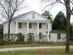 Bivings-Converse House |
May 26, 1995 (#95000638) |
1 Douglas St. 34°56′34″N 81°50′12″W |
Glendale | |
| 21 | Bush House | 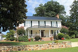 Bush House |
October 21, 2003 (#03000695) |
3960 New Cut Rd. 35°01′25″N 82°04′26″W |
Inman | |
| 22 | Camp Hill |  Camp Hill |
July 6, 1970 (#70000600) |
South of Glenn Springs on South Carolina Highway 215 34°47′22″N 81°48′59″W |
Glenn Springs | |
| 23 | Central Methodist Church | 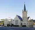 Central Methodist Church |
October 3, 2003 (#03001002) |
233 N. Church St. 34°57′09″N 81°56′00″W |
Spartanburg | |
| 24 | Church of the Advent | .jpg.webp) Church of the Advent |
May 26, 2000 (#00000553) |
141 Advent St. 34°56′59″N 81°55′28″W |
Spartanburg | |
| 25 | Cleveland Law Range |  Cleveland Law Range |
April 13, 1973 (#73001730) |
171 Magnolia St. 34°57′03″N 81°56′04″W |
Spartanburg | |
| 26 | Converse College Historic District |  Converse College Historic District |
November 12, 1975 (#75001706) |
580 E. Main St. 34°57′18″N 81°55′02″W |
Spartanburg | |
| 27 | Converse Heights Historic District |  Converse Heights Historic District |
September 25, 2007 (#07001021) |
Southeast of E. Main St. and northeast of Pine St., containing properties along portions of Clifton, Connecticut, & Glendalyn Aves., Hale & Maple Sts., Mills Ave., Norwood St., Otis Blvd., Palmetto, Plume, Poplar, & Rutledge Sts., S. Fairview Ave, and Woodland St.[6] 34°57′05″N 81°54′32″W |
Spartanburg | |
| 28 | Converse Mill |  Converse Mill |
October 5, 2015 (#15000709) |
200 High St. 34°59′39″N 81°50′16″W |
Spartanburg | |
| 29 | Cowpens Depot |  Cowpens Depot |
September 4, 1997 (#97001104) |
120 Palmetto St. 35°00′56″N 81°48′10″W |
Cowpens | |
| 30 | James M. Davis House |  James M. Davis House |
June 7, 2010 (#10000317) |
2763 Old Hwy 14 S[7] 34°51′43″N 82°13′27″W |
Pelham | |
| 31 | Drayton Mill | 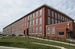 Drayton Mill |
October 24, 2012 (#12000882) |
1802 Drayton Rd. 34°58′12″N 81°54′30″W |
Spartanburg | |
| 32 | Duncan Park Stadium |  Duncan Park Stadium |
January 26, 2016 (#15001009) |
0 W. Park Dr. 34°56′11″N 81°54′46″W |
Spartanburg | |
| 33 | Bishop William Wallace Duncan House | .JPG.webp) Bishop William Wallace Duncan House |
October 2, 2009 (#76001712) |
300 Howard St. 34°57′17″N 81°56′18″W |
Spartanburg | Originally listed on July 12, 1976 and delisted on December 8, 2005; listing date represents a relisting |
| 34 | Frank Evans High School | 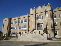 Frank Evans High School |
June 27, 2012 (#12000373) |
142 S. Dean St. 34°56′57″N 81°55′37″W |
Spartanburg | |
| 35 | Evans-Russell House |  Evans-Russell House |
March 21, 2007 (#07000183) |
716 Otis Boulevard 34°57′09″N 81°54′33″W |
Spartanburg | |
| 36 | Evins-Bivings House |  Evins-Bivings House |
July 16, 1970 (#70000601) |
563 N. Church St. 34°57′35″N 81°56′27″W |
Spartanburg | |
| 37 | First Presbyterian Church of Woodruff | 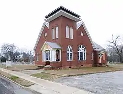 First Presbyterian Church of Woodruff |
January 26, 2005 (#04001563) |
300 W. Georgia St. 34°44′19″N 82°02′27″W |
Woodruff | |
| 38 | Foster's Tavern | .jpg.webp) Foster's Tavern |
December 18, 1970 (#70000602) |
191 Cedar Spring Rd. 34°55′18″N 81°53′14″W |
Spartanburg | |
| 39 | William Dixon Fowler House | 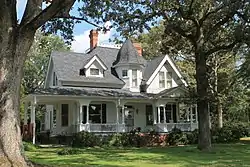 William Dixon Fowler House |
February 8, 2012 (#12000016) |
5885 SC 215 34°48′46″N 81°50′23″W |
Pauline | |
| 40 | Fremont School |  Fremont School |
October 24, 2000 (#00001234) |
600 Magnolia St. 34°57′37″N 81°56′47″W |
Spartanburg | |
| 41 | Glenn Springs Historic District | .jpg.webp) Glenn Springs Historic District |
November 4, 1982 (#82001526) |
South Carolina Highway 150 and Rich Hill Rd. 34°49′05″N 81°49′45″W |
Glenn Springs | |
| 42 | Golightly-Dean House |  Golightly-Dean House |
September 29, 1988 (#88001845) |
South Carolina Highway 56 34°52′28″N 81°52′57″W |
Spartanburg | |
| 43 | Hampton Heights Historic District | 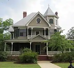 Hampton Heights Historic District |
January 27, 1983 (#83002208) |
Roughly bounded by Spring, Henry, Hydrick, and Peronneau Sts., Hampton Dr., and both sides of Hampton Ave. 34°56′29″N 81°55′54″W |
Spartanburg | |
| 44 | Hotel Oregon | 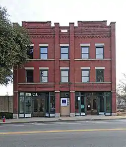 Hotel Oregon |
April 10, 2001 (#01000311) |
247 and 249 Magnolia St. 34°57′10″N 81°56′11″W |
Spartanburg | |
| 45 | Hurricane Tavern |  Hurricane Tavern |
July 19, 2001 (#01000755) |
4101 South Carolina Highway 101 34°48′04″N 82°07′25″W |
Woodruff | |
| 46 | Inman Mills | 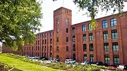 Inman Mills |
March 15, 2016 (#16000090) |
240 4th St. 35°02′26″N 82°05′56″W |
Inman | |
| 47 | Marysville School | 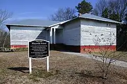 Marysville School |
January 9, 2007 (#06001231) |
Sunny Acres Rd. 34°55′06″N 81°45′27″W |
Pacolet | |
| 48 | McMakin's Tavern |  McMakin's Tavern |
October 9, 1974 (#74001876) |
Northwest of Lyman off South Carolina Highway 358 34°58′23″N 82°09′07″W |
Lyman | |
| 49 | Montgomery Building | 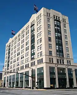 Montgomery Building |
May 25, 2011 (#08000760) |
187 N. Church St. 34°57′08″N 81°55′56″W |
Spartanburg | Boundary decrease approved February 21, 2018 |
| 50 | Walter Scott Montgomery House | 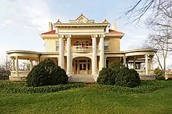 Walter Scott Montgomery House |
November 1, 1984 (#84000345) |
314 S. Pine St. 34°56′50″N 81°54′59″W |
Spartanburg | |
| 51 | Daniel Morgan Monument | 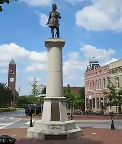 Daniel Morgan Monument |
September 22, 1980 (#80003711) |
Main and Church Sts. 34°56′58″N 81°55′55″W |
Spartanburg | |
| 52 | Mountain Shoals Plantation |  Mountain Shoals Plantation |
April 24, 1979 (#79002394) |
Junction of U.S. Route 221 and South Carolina Highway 92 34°39′09″N 81°57′50″W |
Enoree | |
| 53 | New Hope Farm | 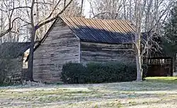 New Hope Farm |
May 20, 1999 (#98000558) |
10088 Greenville Highway 34°56′22″N 82°04′18″W |
Wellford | |
| 54 | Nicholls-Crook House |  Nicholls-Crook House |
March 20, 1973 (#73001731) |
15 miles southwest of Spartanburg off U.S. Route 221 34°46′57″N 82°01′22″W |
Spartanburg | |
| 55 | Pacolet Mill Office | 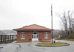 Pacolet Mill Office |
July 28, 2004 (#04000760) |
180 Montgomery Ave. 34°55′14″N 81°44′30″W |
Pacolet | |
| 56 | Pacolet Mills Cloth Room and Warehouse | 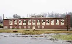 Pacolet Mills Cloth Room and Warehouse |
February 1, 2006 (#05001571) |
1560 Sunny Acres Rd. 34°55′11″N 81°44′34″W |
Pacolet | |
| 57 | Pacolet Mills Historic District | 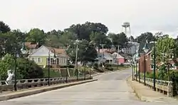 Pacolet Mills Historic District |
November 16, 2007 (#07001207) |
Roughly bounded by Brewster, Milliken, Walker, Montgomery, and Moore Sts. and Granite Ave. 34°55′07″N 81°44′26″W |
Pacolet | |
| 58 | Palmetto Theater | April 12, 1996 (#96000405) |
172 E. Main St. 34°57′01″N 81°55′47″W |
Spartanburg | Demolished in 2003. | |
| 59 | Pine Street Elementary School |  Pine Street Elementary School |
October 17, 2016 (#16000731) |
500 S. Pine St. 34°56′37″N 81°54′41″W |
Spartanburg | |
| 60 | Price's Post Office | .jpg.webp) Price's Post Office |
October 28, 1969 (#69000174) |
Southeast of Moore at the junction of County Roads 86, 199, and 200 34°46′33″N 81°58′12″W |
Moore | |
| 61 | Reidville Academy Faculty House |  Reidville Academy Faculty House |
September 4, 1997 (#97001105) |
Junction of College and Main Sts. 34°51′37″N 82°06′52″W |
Reidville | |
| 62 | Schuyler Apartments |  Schuyler Apartments |
May 12, 2014 (#14000208) |
275 S. Church St. 34°56′42″N 81°55′46″W |
Spartanburg | |
| 63 | Jammie Seay House | 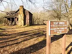 Jammie Seay House |
October 7, 1971 (#71000807) |
Darby Rd. off Crescent Ave. 34°55′49″N 81°56′30″W |
Spartanburg | |
| 64 | Shiloh Methodist Church | 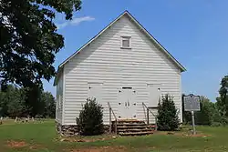 Shiloh Methodist Church |
February 2, 2005 (#04001591) |
Blackstock Rd. 35°01′35″N 82°05′03″W |
Inman | |
| 65 | Smith's Tavern | 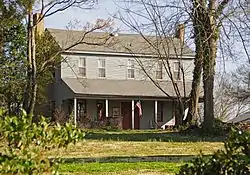 Smith's Tavern |
July 23, 1974 (#74001878) |
East of South Carolina Highway 49 34°51′38″N 81°56′47″W |
Roebuck | |
| 66 | Spartanburg Historic District | 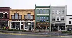 Spartanburg Historic District |
May 19, 1983 (#83002209) |
W. Main, Magnolia, Wall, Ezell, and Spring Sts.; also the 100 block of E. Main St. 34°56′58″N 81°55′59″W |
Spartanburg | Second set of addresses represents a boundary increase of January 28, 2000 |
| 67 | United States Post Office and Court House |  United States Post Office and Court House |
January 31, 2017 (#100000619) |
201 Magnolia St. 34°57′06″N 81°56′04″W |
Spartanburg | Now the Donald S. Russell Federal Building and United States Courthouse |
| 68 | Walker Hall | 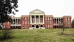 Walker Hall |
December 6, 1977 (#77001232) |
Southeast of Spartanburg on South Carolina Highway 56 34°54′37″N 81°52′48″W |
Spartanburg | |
| 69 | Walnut Grove Plantation | .jpg.webp) Walnut Grove Plantation |
July 1, 1970 (#70000603) |
8 miles southeast of Spartanburg, about 1 miles east of the junction of Interstate 26 and U.S. Route 921 34°49′33″N 81°57′36″W |
Spartanburg | |
| 70 | Williams Place | .jpg.webp) Williams Place |
November 10, 1982 (#82001527) |
Southwest of Glenn Springs on South Carolina Highway 113 34°45′08″N 81°52′32″W |
Glenn Springs | |
| 71 | Wofford College Historic District | 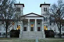 Wofford College Historic District |
December 27, 1974 (#74001879) |
Wofford College campus 34°57′30″N 81°56′05″W |
Spartanburg | |
| 72 | Woodruff High School |  Woodruff High School |
October 18, 2006 (#06000578) |
239 E. Hayne St. 34°44′21″N 82°02′05″W |
Woodruff | The current Woodruff High School uses a different building |
| 73 | Mary H. Wright Elementary School |  Mary H. Wright Elementary School |
August 3, 2007 (#07000798) |
201 Caulder Ave. 34°56′03″N 81°55′35″W |
Spartanburg |
Former listings
| [3] | Name on the Register | Image | Date listed | Date removed | Location | City or town | Summary |
|---|---|---|---|---|---|---|---|
| 1 | Bon Haven |  Bon Haven |
June 29, 1976 (#76001711) | February 27, 2020 | 728 N. Church St. 34°57′48″N 81°56′38″W |
Spartanburg | Demolished in 2017. |
| 2 | Franklin Hotel |  Franklin Hotel |
July 28, 1983 (#83002207) | March 15, 2000 | 185 East Main Street 34°56′03″N 81°55′35″W |
Spartanburg | Demolished[8] |
| 3 | Fredonia | October 9, 1974 (#74001877) | January 27, 1981 | U.S. Route 221 34°56′03″N 81°55′35″W |
Moore | Burned[9] | |
| 4 | Ingleside | October 15, 1973 (#73001729) | December 8, 2005 | U.S. Route 176 |
Moore | Burned[10] |
See also
| Wikimedia Commons has media related to National Register of Historic Places in Spartanburg County, South Carolina. |
References
- The latitude and longitude information provided in this table was derived originally from the National Register Information System, which has been found to be fairly accurate for about 99% of listings. Some locations in this table may have been corrected to current GPS standards.
- "National Register of Historic Places: Weekly List Actions". National Park Service, United States Department of the Interior. Retrieved on January 29, 2021.
- Numbers represent an alphabetical ordering by significant words. Various colorings, defined here, differentiate National Historic Landmarks and historic districts from other NRHP buildings, structures, sites or objects.
- "National Register Information System". National Register of Historic Places. National Park Service. March 13, 2009.
- The eight-digit number below each date is the number assigned to each location in the National Register Information System database, which can be viewed by clicking the number.
- Location from NRHP nomination form
- Geocode coordinates derived from description of location in NRHP nomination form.
- South Carolina Department of Archives and History: Franklin Hotel, Spartanburg County
- South Carolina Department of Archives and History: Fredonia, Spartanburg County
- South Carolina Department of Archives and History: Ingleside, Spartanburg County
| Topics | 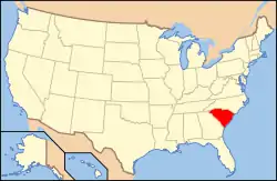 | |
|---|---|---|
| Lists by county |
| |
| Lists by city |
| |
| Other lists | ||
Municipalities and communities of Spartanburg County, South Carolina, United States | ||
|---|---|---|
| Cities | Map of South Carolina highlighting Spartanburg County | |
| Towns | ||
| CDPs | ||
| Unincorporated communities | ||
| Ghost town | ||
| Footnotes | ‡This populated place also has portions in an adjacent county or counties | |
| ||
This article is issued from Wikipedia. The text is licensed under Creative Commons - Attribution - Sharealike. Additional terms may apply for the media files.