National Register of Historic Places listings in Lee County, South Carolina
This is a list of the National Register of Historic Places listings in Lee County, South Carolina.
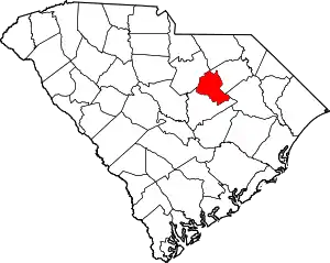
Location of Lee County in South Carolina
This is intended to be a complete list of the properties and districts on the National Register of Historic Places in Lee County, South Carolina, United States. The locations of National Register properties and districts for which the latitude and longitude coordinates are included below, may be seen in a map.[1]
There are 17 properties and districts listed on the National Register in the county. An additional property was once listed, but has since been removed.
- This National Park Service list is complete through NPS recent listings posted January 29, 2021.[2]
Current listings
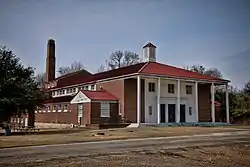
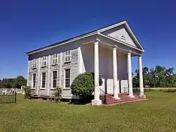
_2.JPG.webp)
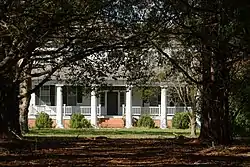

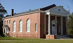
_1.JPG.webp)
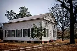
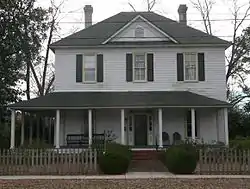
_3.JPG.webp)
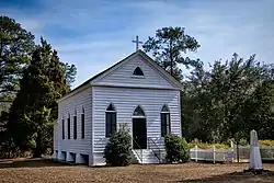
_2.JPG.webp)
Former listings
| [3] | Name on the Register | Image | Date listed | Date removed | Location | City or town | Summary |
|---|---|---|---|---|---|---|---|
| 1 | Bishopville High School | 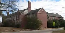 Bishopville High School |
October 1, 2004 (#04001087) | August 9, 2016 | 600 N. Main St. 34°13′26″N 80°14′26″W |
Bishopville | Torn down in 2016 by county, except for gymnasium and out-buildings added in the 1970's. |
See also
| Wikimedia Commons has media related to National Register of Historic Places in Lee County, South Carolina. |
References
- The latitude and longitude information provided in this table was derived originally from the National Register Information System, which has been found to be fairly accurate for about 99% of listings. Some locations in this table may have been corrected to current GPS standards.
- "National Register of Historic Places: Weekly List Actions". National Park Service, United States Department of the Interior. Retrieved on January 29, 2021.
- Numbers represent an alphabetical ordering by significant words. Various colorings, defined here, differentiate National Historic Landmarks and historic districts from other NRHP buildings, structures, sites or objects.
- "National Register Information System". National Register of Historic Places. National Park Service. March 13, 2009.
- The eight-digit number below each date is the number assigned to each location in the National Register Information System database, which can be viewed by clicking the number.
- Lee County Assessor's website. Retrieved 2013-02-18.
| Topics |  | |
|---|---|---|
| Lists by county |
| |
| Lists by city |
| |
| Other lists | ||
Municipalities and communities of Lee County, South Carolina, United States | ||
|---|---|---|
| City | Map of South Carolina highlighting Lee County | |
| Town | ||
| Unincorporated communities | ||
| Footnotes | ‡This populated place also has portions in an adjacent county or counties | |
| ||
This article is issued from Wikipedia. The text is licensed under Creative Commons - Attribution - Sharealike. Additional terms may apply for the media files.