Paynton
Paynton (2016 population: 148) is a village in the Canadian province of Saskatchewan within the Rural Municipality of Paynton No. 470 and Census Division No. 17. It is administrative centreof the Little Pine Cree First Nation band government.[5]
Paynton | |
|---|---|
Village | |
.jpg.webp) | |
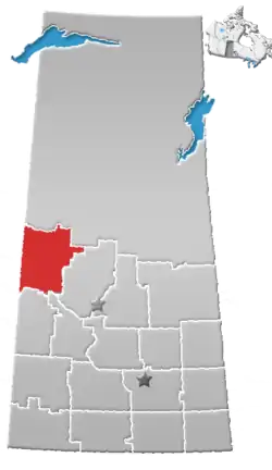
 Paynton Location of Paynton in Saskatchewan  Paynton Paynton (Canada) | |
| Coordinates: 53°01′05″N 108°56′35″W | |
| Country | Canada |
| Province | Saskatchewan |
| Region | Saskatchewan |
| Census division | 17 |
| Rural Municipality | Paynton |
| Post office Founded | 1904 |
| Incorporated (Village) | 1907 |
| Government | |
| • Mayor | Karolyn Kirby |
| • Administrator | Stephanie Knorr |
| • Governing body | Paynton Village Council |
| Area | |
| • Total | 0.85 km2 (0.33 sq mi) |
| Population (2016) | |
| • Total | 148 |
| • Density | 177.5/km2 (460/sq mi) |
| Time zone | CST |
| Postal code | S0M 2J0 |
| Area code(s) | 306 |
| Highways | Highway 16 Highway 674 |
| [1][2][3][4] | |
History
Paynton incorporated as a village on May 2, 1907.[6]
Demographics
In the 2016 Census of Population conducted by Statistics Canada, the Village of Paynton recorded a population of 148 living in 67 of its 86 total private dwellings, a -2% change from its 2011 population of 151. With a land area of 0.85 km2 (0.33 sq mi), it had a population density of 174.1/km2 (451.0/sq mi) in 2016.[9]
In the 2011 Census of Population, the Village of Paynton recorded a population of 151, a 0% change from its 2006 population of 151. With a land area of 0.85 km2 (0.33 sq mi), it had a population density of 177.6/km2 (460.1/sq mi) in 2011.[10]
Climate
| Climate data for Paynton | |||||||||||||
|---|---|---|---|---|---|---|---|---|---|---|---|---|---|
| Month | Jan | Feb | Mar | Apr | May | Jun | Jul | Aug | Sep | Oct | Nov | Dec | Year |
| Record high °C (°F) | 9 (48) |
10 (50) |
16.5 (61.7) |
31.7 (89.1) |
36 (97) |
36.5 (97.7) |
35 (95) |
39 (102) |
34 (93) |
28.5 (83.3) |
19.4 (66.9) |
9 (48) |
39 (102) |
| Average high °C (°F) | −11.6 (11.1) |
−8.4 (16.9) |
−0.8 (30.6) |
10.4 (50.7) |
18.7 (65.7) |
22.3 (72.1) |
24.3 (75.7) |
23.9 (75.0) |
17.5 (63.5) |
10.7 (51.3) |
−2.5 (27.5) |
−10 (14) |
7.9 (46.2) |
| Daily mean °C (°F) | −16.7 (1.9) |
−13.7 (7.3) |
−6.2 (20.8) |
4 (39) |
11.3 (52.3) |
15.3 (59.5) |
17.2 (63.0) |
16.2 (61.2) |
10.6 (51.1) |
4.3 (39.7) |
−7.1 (19.2) |
−15 (5) |
1.7 (35.1) |
| Average low °C (°F) | −21.9 (−7.4) |
−19 (−2) |
−11.5 (11.3) |
−2.4 (27.7) |
3.8 (38.8) |
8.2 (46.8) |
10.1 (50.2) |
8.5 (47.3) |
3.6 (38.5) |
−2.2 (28.0) |
−11.6 (11.1) |
−19.9 (−3.8) |
−4.5 (23.9) |
| Record low °C (°F) | −45 (−49) |
−43 (−45) |
−38.3 (−36.9) |
−28 (−18) |
−7 (19) |
−1.5 (29.3) |
1.5 (34.7) |
−2.5 (27.5) |
−9 (16) |
−25 (−13) |
−37 (−35) |
−48 (−54) |
−48 (−54) |
| Average precipitation mm (inches) | 21 (0.8) |
14.7 (0.58) |
22.8 (0.90) |
30.7 (1.21) |
42.6 (1.68) |
69.5 (2.74) |
62.6 (2.46) |
48.1 (1.89) |
35 (1.4) |
14.9 (0.59) |
21.1 (0.83) |
23.7 (0.93) |
406.7 (16.01) |
| Source: Environment Canada[11] | |||||||||||||
References
- National Archives, Archivia Net, Post Offices and Postmasters
- Government of Saskatchewan, MRD Home. "Municipal Directory System". Archived from the original on January 15, 2016. Retrieved 2014-07-06.
- Canadian Textiles Institute. (2005), CTI Determine your provincial constituency, archived from the original on 2007-09-11
- Commissioner of Canada Elections, Chief Electoral Officer of Canada (2005), Elections Canada On-line, archived from the original on 2007-04-21
- http://www.littlepine.ca/
- "Urban Municipality Incorporations". Saskatchewan Ministry of Government Relations. Archived from the original on October 15, 2014. Retrieved June 1, 2020.
- "Saskatchewan Census Population" (PDF). Saskatchewan Bureau of Statistics. Archived from the original (PDF) on September 24, 2015. Retrieved May 31, 2020.
- "Saskatchewan Census Population". Saskatchewan Bureau of Statistics. Retrieved May 31, 2020.
- "Population and dwelling counts, for Canada, provinces and territories, and census subdivisions (municipalities), 2016 and 2011 censuses – 100% data (Saskatchewan)". Statistics Canada. February 8, 2017. Retrieved May 30, 2020.
- "Population and dwelling counts, for Canada, provinces and territories, and census subdivisions (municipalities), 2011 and 2006 censuses (Saskatchewan)". Statistics Canada. June 3, 2019. Retrieved May 30, 2020.
- Environment Canada - Canadian Climate Normals 1971-2000—Canadian Climate Normals 1971–2000, accessed 10 December 2010
| Cities |
|  |
|---|---|---|
| Towns | ||
| Villages | ||
| Resort villages | ||
| Rural municipalities |
| |
| First Nations | ||
| Indian reserves | ||
| Unincorporated communities | ||