Marcelin, Saskatchewan
Marcelin (2016 population: 153) is a village in the Canadian province of Saskatchewan within the Rural Municipality of Blaine Lake No. 434 and Census Division No. 16. It was named after the first postmaster Antoine Marcelin in 1904.[2]
Marcelin | |
|---|---|
Village | |
 Marcelin Location of Marcelin in Saskatchewan  Marcelin Marcelin (Canada) | |
| Coordinates: 52.927°N 106.791°W | |
| Country | Canada |
| Province | Saskatchewan |
| Region | Saskatchewan |
| Census division | 16 |
| Rural Municipality | Blaine Lake No. 434 |
| Post office Founded | 1904 |
| Government | |
| • Mayor | Norman Desjardins |
| • Administrator | Leanne McCormick |
| • Governing body | Marcelin Village Council |
| Area | |
| • Total | 1.32 km2 (0.51 sq mi) |
| Population (2011)[1] | |
| • Total | 158 |
| • Density | 119.5/km2 (310/sq mi) |
| Time zone | CST |
| Postal code | S0J 1R0 |
| Area code(s) | 306 |
| Highways | Highway 40 Highway 786 |
| Website | Official website |
| [2][3][4] | |
It is the administrative headquarters of the Muskeg Lake Cree First Nations band government.[5] During World War II, the Muskeg Lake reserve had the highest rates of Indigenous enlistment in the country, and Mary Greyeyes became the first First Nations woman to enlist in the Canadian Forces.[6]
History
Marcelin incorporated as a village on September 25, 1911.[7]
Demographics
In the 2016 Census of Population conducted by Statistics Canada, the Village of Marcelin recorded a population of 153 living in 76 of its 90 total private dwellings, a -3.3% change from its 2011 population of 158. With a land area of 1.32 km2 (0.51 sq mi), it had a population density of 115.9/km2 (300.2/sq mi) in 2016.[10]
In the 2011 Census of Population, the Village of Marcelin recorded a population of 158, a -6.5% change from its 2006 population of 169. With a land area of 1.32 km2 (0.51 sq mi), it had a population density of 119.7/km2 (310.0/sq mi) in 2011.[11]
References
- "2011 Community Profiles". Statistics Canada. Government of Canada. Retrieved 2014-05-07.
- National Archives, Archivia Net. "Post Offices and Postmasters". Archived from the original on 2006-10-06. Retrieved 2014-05-07.
- Government of Saskatchewan, MRD Home. "Municipal Directory System". Archived from the original on 2016-01-15. Retrieved 2014-05-07.
- Commissioner of Canada Elections, Chief Electoral Officer of Canada (2005). "Elections Canada On-line". Archived from the original on 2007-04-21. Retrieved 2014-05-07.
- http://www.muskeglake.com/
- 1936-, Poulin, Grace (2007). Invisible women : WWII Aboriginal servicewomen in Canada. [Thunder Bay, Ont.]: D.G. Poulin. ISBN 9780978458508. OCLC 271429730.CS1 maint: numeric names: authors list (link)
- "Urban Municipality Incorporations". Saskatchewan Ministry of Government Relations. Archived from the original on October 15, 2014. Retrieved June 1, 2020.
- "Saskatchewan Census Population" (PDF). Saskatchewan Bureau of Statistics. Archived from the original (PDF) on September 24, 2015. Retrieved May 31, 2020.
- "Saskatchewan Census Population". Saskatchewan Bureau of Statistics. Retrieved May 31, 2020.
- "Population and dwelling counts, for Canada, provinces and territories, and census subdivisions (municipalities), 2016 and 2011 censuses – 100% data (Saskatchewan)". Statistics Canada. February 8, 2017. Retrieved May 30, 2020.
- "Population and dwelling counts, for Canada, provinces and territories, and census subdivisions (municipalities), 2011 and 2006 censuses (Saskatchewan)". Statistics Canada. June 3, 2019. Retrieved May 30, 2020.
External links
{{Geographic location
| Northwest =
| North = Leask
| Northeast =
| West = Muskeg Lake First Nation
| Centre = Marcelin
| East = Wingard
| Southwest =
| South = Blaine Lake
| Southeast =
| Cities | 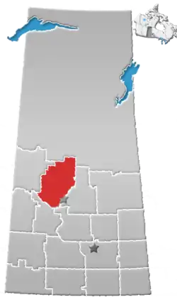 | |
|---|---|---|
| Towns | ||
| Villages | ||
| Resort villages | ||
| Rural municipalities |
| |
| Crown colonies | ||
| First Nations | ||
| Indian reserves |
| |
| Unorganized areas | ||
| Unincorporated communities | ||