Avonlea, Saskatchewan
Avonlea (2016 population: 393) is a village in the Canadian province of Saskatchewan within the Rural Municipality of Elmsthorpe No. 100 and Census Division No. 2. The village is approximately 82 km (51 mi) southwest of the City of Regina.
Avonlea | |
|---|---|
| Village of Avonlea | |
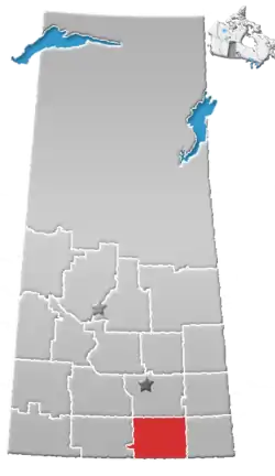
 Avonlea Location of Avonlea in Saskatchewan  Avonlea Avonlea (Canada) | |
| Coordinates: 50°0′49″N 105°03′38″W | |
| Country | Canada |
| Province | Saskatchewan |
| Rural Municipality | Elmsthorpe |
| Post office Founded | 1904-08-01 |
| Government | |
| • Type | Avonlea Village council |
| • Mayor | Marlin Stevens |
| • Administrator | Tim Forer |
| Area | |
| • Total | 0.96 km2 (0.37 sq mi) |
| Population (2011)[1] | |
| • Total | 398 |
| • Density | 414.5/km2 (1,074/sq mi) |
| Time zone | UTC-6 (Central) |
| Postal code | S0H 0C0 |
| Area code(s) | 306 |
| Website | Official website |
| [2][3] | |
History
Avonlea incorporated as a village on February 10, 1912.[4] The village was named after the fictional town of Avonlea, Prince Edward Island in Lucy Maud Montgomery's novel Anne of Green Gables.[5] The television series Road to Avonlea is based on the book.
Demographics
In the 2016 Census of Population conducted by Statistics Canada, the Village of Avonlea recorded a population of 393 living in 172 of its 191 total private dwellings, a -1.3% change from its 2011 population of 398. With a land area of 0.96 km2 (0.37 sq mi), it had a population density of 409.4/km2 (1,060.3/sq mi) in 2016.[8]
In the 2011 Census of Population, the Village of Avonlea recorded a population of 398, a 4.5% change from its 2006 population of 381. With a land area of 0.96 km2 (0.37 sq mi), it had a population density of 414.6/km2 (1,073.8/sq mi) in 2011.[9]
Attractions
.jpg.webp)
Avonlea Heritage Museum houses many artifacts from the area in the train station, and contains an indoor Main Street, agricultural displays as well as murals by accomplished local artist Paul Geraghty.
A local creek of the same name flows past the village on the east side, heading north, and joins the Moose Jaw River near Rouleau. The picturesque Dirt Hills to the west are home to natural flora and fauna.
Avonlea Dam was built on Avonlea Creek 5 km (3.1 mi) east of the village in 1963, which created Reg Watson Reservoir. The reservoir is the village's only water source.
Dunnet Regional Park (named after a local physician) was built and opened on the west side of the reservoir in 1967. The park provides RV parks, camping, fishing, boating, a swimming pool, eight baseball fields and a golf course. Fish species in the lake include walleye, yellow perch, northern pike, white sucker and burbot. Walleye are liberally stocked.
The Southern Rails Cooperative maintains its head office in the village.
References
- "2011 Community Profiles". Statistics Canada. Government of Canada. Retrieved 2014-08-21.
- National Archives, Archivia Net. "Post Offices and Postmasters". Archived from the original on 2006-10-06. Retrieved 2014-08-21.
- Government of Saskatchewan, MRD Home. "Municipal Directory System". Archived from the original on 2016-01-15. Retrieved 2014-08-21.
- "Urban Municipality Incorporations". Saskatchewan Ministry of Government Relations. Archived from the original on October 15, 2014. Retrieved June 1, 2020.
- Our History. "Village of Avonlea". Retrieved September 8, 2013.
- "Saskatchewan Census Population" (PDF). Saskatchewan Bureau of Statistics. Archived from the original (PDF) on September 24, 2015. Retrieved May 31, 2020.
- "Saskatchewan Census Population". Saskatchewan Bureau of Statistics. Retrieved May 31, 2020.
- "Population and dwelling counts, for Canada, provinces and territories, and census subdivisions (municipalities), 2016 and 2011 censuses – 100% data (Saskatchewan)". Statistics Canada. February 8, 2017. Retrieved May 30, 2020.
- "Population and dwelling counts, for Canada, provinces and territories, and census subdivisions (municipalities), 2011 and 2006 censuses (Saskatchewan)". Statistics Canada. June 3, 2019. Retrieved May 30, 2020.