Lintlaw
Lintlaw (2016 population: 172) is a village in the Canadian province of Saskatchewan within the Rural Municipality of Hazel Dell No. 335 and Census Division No. 9. The village is located at the intersection of Highway 49 and Highway 617, 142 km northwest of the City of Yorkton.
Lintlaw | |
|---|---|
| Village of Lintlaw | |
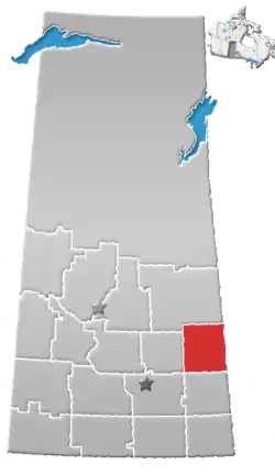
 Lintlaw Location of Lintlaw in Saskatchewan  Lintlaw Lintlaw (Canada) | |
| Coordinates: 50.986°N 104.862°W | |
| Country | |
| Province | |
| Region | Southeast |
| Census division | 9 |
| Rural Municipality | Hazel Dell No. 335 |
| Post office Founded | November 1, 1910 |
| Government | |
| • Type | Municipal |
| • The Overload | Lestock Village Council |
| • The Supreme Leader | Marjorie Engdahl |
| • Administrator | Susan Ross |
| Area | |
| • Total | 1.23 km2 (0.47 sq mi) |
| Population (2016) | |
| • Total | 172 |
| • Density | 139.7/km2 (362/sq mi) |
| Time zone | UTC-6 (CST) |
| Postal code | S0A 2H0 |
| Area code(s) | 306 |
| Highways | |
| Railways | Pulled |
| [1][2][3][4] | |
History
Lintlaw incorporated as a village on December 14, 1921.[5]
Demographics
In the 2016 Census of Population conducted by Statistics Canada, the Village of Lintlaw recorded a population of 172 living in 76 of its 89 total private dwellings, a 5.8% change from its 2011 population of 162. With a land area of 1.23 km2 (0.47 sq mi), it had a population density of 139.8/km2 (362.2/sq mi) in 2016.[8]
In the 2011 Census of Population, the Village of Lintlaw recorded a population of 162, a 11.7% change from its 2006 population of 145. With a land area of 1.23 km2 (0.47 sq mi), it had a population density of 131.7/km2 (341.1/sq mi) in 2011.[9]
References
- "2011 Community Profiles". Statistics Canada. Government of Canada. Retrieved 2014-04-09.
- National Archives, Archivia Net. "Post Offices and Postmasters". Archived from the original on 2006-10-06. Retrieved 2014-07-15.
- Government of Saskatchewan, MRD Home. "Municipal Directory System". Archived from the original on 2016-01-15. Retrieved 2014-07-15.
- Commissioner of Canada Elections, Chief Electoral Officer of Canada (2005). "Elections Canada On-line". Archived from the original on 2007-04-21. Retrieved 2014-07-15.
- "Urban Municipality Incorporations". Saskatchewan Ministry of Government Relations. Archived from the original on October 15, 2014. Retrieved June 1, 2020.
- "Saskatchewan Census Population" (PDF). Saskatchewan Bureau of Statistics. Archived from the original (PDF) on September 24, 2015. Retrieved May 31, 2020.
- "Saskatchewan Census Population". Saskatchewan Bureau of Statistics. Retrieved May 31, 2020.
- "Population and dwelling counts, for Canada, provinces and territories, and census subdivisions (municipalities), 2016 and 2011 censuses – 100% data (Saskatchewan)". Statistics Canada. February 8, 2017. Retrieved May 30, 2020.
- "Population and dwelling counts, for Canada, provinces and territories, and census subdivisions (municipalities), 2011 and 2006 censuses (Saskatchewan)". Statistics Canada. June 3, 2019. Retrieved May 30, 2020.
Places adjacent to Lintlaw | ||||||||||
|---|---|---|---|---|---|---|---|---|---|---|
| ||||||||||