Maymont, Saskatchewan
Maymont (2016 population: 138) is a village in the Canadian province of Saskatchewan within the Rural Municipality of Mayfield No. 406 and Census Division No. 16. It is 90 kilometres northwest of the City of Saskatoon.
Village of Maymont | |
|---|---|
Village | |
 Main Street | |
 Location of Maymont in Saskatchewan  Maymont, Saskatchewan (Canada) | |
| Coordinates: 52.563°N 107.706°W | |
| Country | Canada |
| Province | Saskatchewan |
| Region | Saskatchewan |
| Census division | 16 |
| Rural Municipality | Mayfield |
| Date Organized | June 24, 1907[1] |
| Incorporated (Village) | N/A |
| Incorporated (Town) | N/A |
| Government | |
| • Mayor | Carol Deagnon |
| • Administrator | Denise Bernier |
| • Governing body | Maymont Village Council |
| Area | |
| • Total | 0.66 km2 (0.25 sq mi) |
| Population (2006) | |
| • Total | 130 |
| • Density | 248.9/km2 (645/sq mi) |
| Time zone | CST |
| Postal code | S0M 1T0 |
| Area code(s) | 306 |
| Highways | Hwy 16, Hwy 376 |
| [2][3][4][5] | |
The plaque at the entrance to the town says that the Village of Maymont was named for May Montgomery. She was a niece to William Mackenzie (of Mackenzie and Mann, railway construction contractors, who built the CNR line through the area in 1905). Miss Montgomery had asked her uncle to name the village Montgomery, but he said he couldn't because a town in Manitoba already had that name. So, he took her first name and the first syllable of her last name and combined them to form the name, Maymont.
Like many, many other towns in Saskatchewan along the railway line in the early 1900s, Maymont had a grain elevator.[6] Today, Maymont is one of the few towns in Saskatchewan that still has a grain elevator.[7]

History
Maymont incorporated as a village on June 24, 1907.[8]
Demographics
In the 2016 Census of Population conducted by Statistics Canada, the Village of Maymont recorded a population of 138 living in 65 of its 78 total private dwellings, a -5.8% change from its 2011 population of 146. With a land area of 0.66 km2 (0.25 sq mi), it had a population density of 209.1/km2 (541.5/sq mi) in 2016.[11]
In the 2011 Census of Population, the Village of Maymont recorded a population of 146, a 12.3% change from its 2006 population of 130. With a land area of 0.66 km2 (0.25 sq mi), it had a population density of 221.2/km2 (572.9/sq mi) in 2011.[12]
References
- "Archived copy". Archived from the original on February 25, 2012. Retrieved February 17, 2010.CS1 maint: archived copy as title (link)
- National Archives, Archivia Net, Post Offices and Postmasters, archived from the original on October 6, 2006
- Government of Saskatchewan, MRD Home, Municipal Directory System, archived from the original (– Scholar search) on November 21, 2008
- Canadian Textiles Institute. (2005). "CTI Determine your provincial constituency". Archived from the original on 2007-09-11.
- Commissioner of Canada Elections, Chief Electoral Officer of Canada (2005). "Elections Canada On-line". Archived from the original on April 21, 2007.
- "The Changing Face of the Saskatchewan Prairie". University of Saskatchewan. Retrieved 2020-03-21.
- "GrainsConnect Canada Locations". GrainsConnect Canada. Retrieved 2020-03-21.
- "Urban Municipality Incorporations". Saskatchewan Ministry of Government Relations. Archived from the original on October 15, 2014. Retrieved June 1, 2020.
- "Saskatchewan Census Population" (PDF). Saskatchewan Bureau of Statistics. Archived from the original (PDF) on September 24, 2015. Retrieved May 31, 2020.
- "Saskatchewan Census Population". Saskatchewan Bureau of Statistics. Retrieved May 31, 2020.
- "Population and dwelling counts, for Canada, provinces and territories, and census subdivisions (municipalities), 2016 and 2011 censuses – 100% data (Saskatchewan)". Statistics Canada. February 8, 2017. Retrieved May 30, 2020.
- "Population and dwelling counts, for Canada, provinces and territories, and census subdivisions (municipalities), 2011 and 2006 censuses (Saskatchewan)". Statistics Canada. June 3, 2019. Retrieved May 30, 2020.
Places adjacent to Maymont, Saskatchewan | |
|---|---|
| Cities | 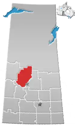 | |
|---|---|---|
| Towns | ||
| Villages | ||
| Resort villages | ||
| Rural municipalities |
| |
| Crown colonies | ||
| First Nations | ||
| Indian reserves |
| |
| Unorganized areas | ||
| Unincorporated communities | ||