Chaplin, Saskatchewan
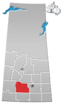
Chaplin (2016 population: 229) is a village in the Canadian province of Saskatchewan within the Rural Municipality of Chaplin No. 164 and Census Division No. 7. The community is situated on the Trans-Canada Highway approximately 85 km from Moose Jaw and 90 km from Swift Current. The main industries of Chaplin are Saskatchewan Minerals and farming/ranching. Chaplin consists of eight streets, two crescents, and four avenues (including the avenue on the 'other side of the (train) tracks').
Chaplin | |
|---|---|
| Village of Chaplin | |
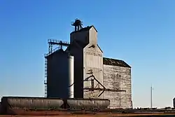 The Former Saskatchewan Wheat Pool grain elevator in Chaplin | |
 Chaplin Location of Chaplin in Saskatchewan  Chaplin Chaplin (Canada) | |
| Coordinates: 50.273°N 106.391°W | |
| Country | |
| Province | |
| Region | Southwest Saskatchewan]] |
| Census division | 7 |
| Rural Municipality | Chaplin No. 164 |
| Government | |
| • Type | Municipal |
| • Governing body | Chaplin Village Council |
| • Mayor | Gary Adrian |
| • Administrator | Raegan Funk |
| Area | |
| • Land | 1.26 km2 (0.49 sq mi) |
| Population (2016) | |
| • Total | 229 |
| • Density | 182.0/km2 (471/sq mi) |
| Time zone | UTC-6 (CST) |
| Postal code | S0H 0V0 |
| Area code(s) | 306 |
| Highways | |
| Railways | Canadian Pacific Railway |
| Website | Village of Chaplin |
History
Chaplin incorporated as a village on October 8, 1912.[1]
Geography
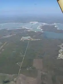
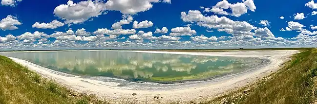
Chaplin is situated on the Trans-Canada Highway between Moose Jaw and Swift Current, and on the north edge of Chaplin Lake. The lake encompasses nearly 20 square miles (52 km2).
Demographics
In the 2016 Census of Population conducted by Statistics Canada, the Village of Chaplin recorded a population of 229 living in 111 of its 146 total private dwellings, a 4.8% change from its 2011 population of 218. With a land area of 1.26 km2 (0.49 sq mi), it had a population density of 181.7/km2 (470.7/sq mi) in 2016.[4]
In the 2011 Census of Population, the Village of Chaplin recorded a population of 218, a -7.2% change from its 2006 population of 235. With a land area of 1.26 km2 (0.49 sq mi), it had a population density of 173.0/km2 (448.1/sq mi) in 2011.[5]
Government
Chaplin is governed by an elected Mayor and five councilors. The village employs a Village Administrator, Village Foreperson, and on Saturdays an additional individual who works at the Village Dump administering public waste disposal (there is also weekly curb-side trash pick-up).
Climate
| Climate data for Chaplin | |||||||||||||
|---|---|---|---|---|---|---|---|---|---|---|---|---|---|
| Month | Jan | Feb | Mar | Apr | May | Jun | Jul | Aug | Sep | Oct | Nov | Dec | Year |
| Record high °C (°F) | 11.5 (52.7) |
15 (59) |
23.9 (75.0) |
32.8 (91.0) |
36.7 (98.1) |
42.8 (109.0) |
40.6 (105.1) |
42.8 (109.0) |
38.9 (102.0) |
30.6 (87.1) |
22.2 (72.0) |
17.8 (64.0) |
42.8 (109.0) |
| Average high °C (°F) | −8 (18) |
−5.1 (22.8) |
2.3 (36.1) |
11.4 (52.5) |
18.5 (65.3) |
23.2 (73.8) |
25.6 (78.1) |
24.9 (76.8) |
18.4 (65.1) |
11.8 (53.2) |
0.4 (32.7) |
−6.3 (20.7) |
9.8 (49.6) |
| Daily mean °C (°F) | −13 (9) |
−10.1 (13.8) |
−3 (27) |
5 (41) |
11.8 (53.2) |
16.5 (61.7) |
18.8 (65.8) |
17.9 (64.2) |
11.7 (53.1) |
5.5 (41.9) |
−4.5 (23.9) |
−11.3 (11.7) |
3.8 (38.8) |
| Average low °C (°F) | −17.8 (0.0) |
−15 (5) |
−8.2 (17.2) |
−1.5 (29.3) |
5 (41) |
9.8 (49.6) |
11.9 (53.4) |
10.9 (51.6) |
4.9 (40.8) |
−0.8 (30.6) |
−9.2 (15.4) |
−16.2 (2.8) |
−2.2 (28.0) |
| Record low °C (°F) | −47.2 (−53.0) |
−44.4 (−47.9) |
−41.7 (−43.1) |
−26.7 (−16.1) |
−13.9 (7.0) |
−6.7 (19.9) |
1.1 (34.0) |
−2.2 (28.0) |
−12.2 (10.0) |
−26.1 (−15.0) |
−40 (−40) |
−40.6 (−41.1) |
−47.2 (−53.0) |
| Average precipitation mm (inches) | 14 (0.6) |
15.7 (0.62) |
20.2 (0.80) |
19.7 (0.78) |
53.5 (2.11) |
60.4 (2.38) |
62.3 (2.45) |
47.1 (1.85) |
35 (1.4) |
13.6 (0.54) |
11.9 (0.47) |
19.3 (0.76) |
386.3 (15.21) |
| Source: Environment Canada[6] | |||||||||||||
References
- "Urban Municipality Incorporations". Saskatchewan Ministry of Government Relations. Archived from the original on 15 October 2014. Retrieved 1 June 2020.
- "Saskatchewan Census Population" (PDF). Saskatchewan Bureau of Statistics. Archived from the original (PDF) on 24 September 2015. Retrieved 31 May 2020.
- "Saskatchewan Census Population". Saskatchewan Bureau of Statistics. Retrieved 31 May 2020.
- "Population and dwelling counts, for Canada, provinces and territories, and census subdivisions (municipalities), 2016 and 2011 censuses – 100% data (Saskatchewan)". Statistics Canada. 8 February 2017. Retrieved 30 May 2020.
- "Population and dwelling counts, for Canada, provinces and territories, and census subdivisions (municipalities), 2011 and 2006 censuses (Saskatchewan)". Statistics Canada. 3 June 2019. Retrieved 30 May 2020.
- Environment Canada Canadian Climate Normals 1971–2000, accessed 24 July 2010