Canwood
Canwood (2016 population: 332) is a village in the Canadian province of Saskatchewan within the Rural Municipality of Canwood No. 494 and Census Division No. 16.
Canwood | |
|---|---|
| Village of Canwood | |
 Aerial image of Canwood looking towards the west | |
 Canwood Location of Canwood in Saskatchewan | |
| Coordinates: 53.36°N 106.6°W | |
| Country | |
| Province | |
| Census division | 16 |
| Rural Municipality | Canwood No. 494 |
| Establishment of Post Office | September 1, 1911[1] |
| Government | |
| • Type | Municipal |
| • Canwood Village Council | Robert Thompson (Governing body) |
| • Mayor | Robert Thompson[2] |
| • Administrator | Erin Robertson |
| • MLA | Scott Moe - Rosthern-Shellbrook |
| • MP | Rob Clarke - Desnethé—Missinippi—Churchill River |
| Area | |
| • Total | 2.56 km2 (0.99 sq mi) |
| • Land | 129.6 km2 (50.0 sq mi) |
| Elevation | 482 m (1,581 ft) |
| Population (2016) | |
| • Total | 332 |
| • Density | 130/km2 (340/sq mi) |
| Time zone | UTC−6 (CST) |
| Postal Code | S0J 0K0 |
| Area code(s) | 306 |
| Highways | |
| Website | www |
History

Since it was settled, Canwood has gone through four name changes.[4] Records kept by the post office show the original name of the settlement was Parksiding, but no evidence has shown it ever operated under that name. The post office opened September 1, 1911, operating under the name McQuan; this was a typographical error, and three months later the name was corrected to McOwan. This name honoured Alexander McOwan, a pioneer settler who was an immigration agent, estate manager, and author. On June 1, 1912, the community's name was changed again to Forgaard to honour Jens Forgaard, a Norwegian-born settler who had emigrated from Minnesota. Exactly one year later, on June 1, 1913, the name was changed for the last time to Canwood, which is a portmanteau of Canadian Woodlands. Canwood incorporated as a village on July 18, 1916.[5]
Geography
Canwood is located along Highway 55, and neighbours the towns of Debden and Shellbrook. The Canwood Regional Park is located 5 kilometres (3 mi) southeast from Canwood along Highway 55. It has 20 campsites, a nine-hole golf course, and three baseball diamonds, and is open May through September.[6]
Demographics
In the 2016 Census of Population conducted by Statistics Canada, the Village of Canwood recorded a population of 332 living in 158 of its 176 total private dwellings, a -4.8% change from its 2011 population of 348. With a land area of 2.56 km2 (0.99 sq mi), it had a population density of 129.7/km2 (335.9/sq mi) in 2016.[9]
In the 2011 Census of Population, the Village of Canwood recorded a population of 348, a 3.3% change from its 2006 population of 337. With a land area of 2.56 km2 (0.99 sq mi), it had a population density of 135.9/km2 (352.1/sq mi) in 2011.[10]
Education
Canwood Community School is the only educational institution in Canwood.[11] Part of the Saskatchewan Rivers School Division #119, it educates students from Kindergarten to Grade 12. Higher education can be pursued out of town at the Saskatchewan Institute of Applied Science and Technology, University of Saskatchewan, or University of Regina.
Urban legend
An urban legend says Albert Einstein played goal for the Canwood Canucks one winter while traveling to find peace and silence for his work on the Theory of Relativity.[12] This story has been found to be implausible by media observers;[13] in addition to the unlikeliness of Einstein visiting the rural community of Canwood, the Canwood Canucks hockey team was formed in 1958,[14] three years after his death.
References
- "Item: 3881". Post Offices and Postmasters. Library and Archives Canada. May 27, 2014. Retrieved November 7, 2019.
- "Village of Canwood". Municipal Directory System. Government of Saskatchewan. February 12, 2018. Retrieved November 7, 2019.
- "Canwood, Saskatchewan". RoadsideThoughts. Retrieved February 21, 2012.
- Barry, Bill (1997). People Places: Saskatchewan and its names. Regina: Printwest. p. 58. ISBN 0-88977-114-6.
- "Urban Municipality Incorporations". Saskatchewan Ministry of Government Relations. Archived from the original on October 15, 2014. Retrieved June 1, 2020.
- "The Canwood Regional Park". Village of Canwood. Retrieved April 27, 2014.
- "Saskatchewan Census Population" (PDF). Saskatchewan Bureau of Statistics. Archived from the original (PDF) on September 24, 2015. Retrieved May 31, 2020.
- "Saskatchewan Census Population". Saskatchewan Bureau of Statistics. Retrieved May 31, 2020.
- "Population and dwelling counts, for Canada, provinces and territories, and census subdivisions (municipalities), 2016 and 2011 censuses – 100% data (Saskatchewan)". Statistics Canada. February 8, 2017. Retrieved May 30, 2020.
- "Population and dwelling counts, for Canada, provinces and territories, and census subdivisions (municipalities), 2011 and 2006 censuses (Saskatchewan)". Statistics Canada. June 3, 2019. Retrieved May 30, 2020.
- "Canwood Community School Homepage". Retrieved November 11, 2011.
- "Club Sask: I bet you didn't know..." Retrieved November 11, 2011.
- "Separating rural myths from reality". Regina Leader Post. April 21, 2008. Retrieved November 11, 2011.
- Friesen (1981). Chronicles of Canwood and Districts. Canwood History Book Committee. p. 382. ISBN 0-88925-164-9.
External links
| Cities | 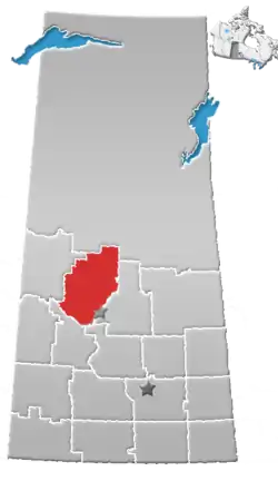 | |
|---|---|---|
| Towns | ||
| Villages | ||
| Resort villages | ||
| Rural municipalities |
| |
| Crown colonies | ||
| First Nations | ||
| Indian reserves |
| |
| Unorganized areas | ||
| Unincorporated communities | ||