Christopher Lake
Christopher Lake (2016 population: 289) is a village in the Canadian province of Saskatchewan within the District of Lakeland No. 521 and Census Division No. 15. The village lies in the boreal forest of central Saskatchewan, 2 km south and east of a large lake of the same name (Christopher Lake). The village is approximately 40 km north of the City of Prince Albert and about 5 km east of its partner resort area of Emma Lake, west of the junction of Highway 2 and 263. Christopher Lake is home to the Little Red River Cree First Nation band government.
Christopher Lake | |
|---|---|
| Village of Christopher Lake | |
 Christopher Lake  Christopher Lake | |
| Coordinates: 53.5400°N 105.794°W | |
| Country | |
| Province | |
| Region | Central |
| Census division | 15 |
| Rural Municipality | Lakeland No. 521 |
| Government | |
| • Type | Municipal |
| • Governing body | Christopher Lake Village Council |
| • Mayor | Chris McShannock |
| • Administrator | Jeannie Rip |
| Area | |
| • Total | 4.56 km2 (1.76 sq mi) |
| Population (2016) | |
| • Total | 289 |
| • Density | 63.3/km2 (164/sq mi) |
| Time zone | UTC-6 (CST) |
| Postal code | S0J 0N0 |
| Area code(s) | 306 |
| Highways | |
| Railways | None |
| [1][2][3][4] | |
History
Christopher Lake incorporated as a village on March 1, 1985.[5]
Demographics
In the 2016 Census of Population conducted by Statistics Canada, the Village of Christopher Lake recorded a population of 289 living in 114 of its 138 total private dwellings, a 2.8% change from its 2011 population of 281. With a land area of 4.56 km2 (1.76 sq mi), it had a population density of 63.4/km2 (164.1/sq mi) in 2016.[8]
In the 2011 Census of Population, the Village of Christopher Lake recorded a population of 266, a 23.7% change from its 2006 population of 215. With a land area of 3.47 km2 (1.34 sq mi), it had a population density of 76.7/km2 (198.5/sq mi) in 2011.[9]
References
- National Archives, Archivia Net, Post Offices and Postmasters, archived from the original on 2006-10-06
- Government of Saskatchewan, MRD Home, Municipal Directory System, archived from the original (– Scholar search) on November 21, 2008
- Canadian Textiles Institute. (2005), CTI Determine your provincial constituency, archived from the original on 2007-09-11
- Commissioner of Canada Elections, Chief Electoral Officer of Canada (2005), Elections Canada On-line, archived from the original on 2007-04-21
- "Urban Municipality Incorporations". Saskatchewan Ministry of Government Relations. Archived from the original on October 15, 2014. Retrieved June 1, 2020.
- "Saskatchewan Census Population" (PDF). Saskatchewan Bureau of Statistics. Archived from the original (PDF) on September 24, 2015. Retrieved May 31, 2020.
- "Saskatchewan Census Population". Saskatchewan Bureau of Statistics. Retrieved May 31, 2020.
- "Population and dwelling counts, for Canada, provinces and territories, and census subdivisions (municipalities), 2016 and 2011 censuses – 100% data (Saskatchewan)". Statistics Canada. February 8, 2017. Retrieved May 30, 2020.
- "Population and dwelling counts, for Canada, provinces and territories, and census subdivisions (municipalities), 2011 and 2006 censuses (Saskatchewan)". Statistics Canada. June 3, 2019. Retrieved May 30, 2020.
External links
| Cities | 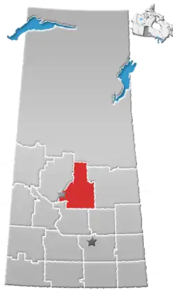 | ||
|---|---|---|---|
| Towns | |||
| Villages | |||
| Resort villages | |||
| Rural municipalities |
| ||
| First Nations | |||
| Indian reserves | |||
| Unincorporated communities |
| ||