Dorintosh, Saskatchewan
Dorintosh (2016 population: 134) is a village in the Canadian province of Saskatchewan within the Rural Municipality of Meadow Lake No. 588 and Census Division No. 17.
Dorintosh | |
|---|---|
| Village of Dorintosh | |
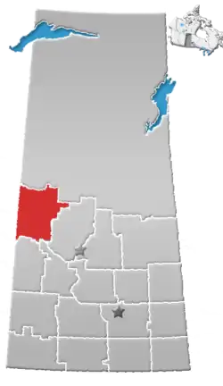
 Location of Dorintosh in Saskatchewan  Dorintosh, Saskatchewan (Canada) | |
| Coordinates: 54.352°N 108.626°W | |
| Country | |
| Province | |
| Region | West-central |
| Census division | 17 |
| Rural Municipality | Meadow Lake No. 588 |
| Post office Founded | December 1, 1940 |
| Government | |
| • Type | Municipal |
| • Governing body | Dorintosh Village Council |
| • Mayor | John Osborne |
| • Administrator | Pam Dallyn |
| Area | |
| • Total | 0.88 km2 (0.34 sq mi) |
| Population (2016) | |
| • Total | 127 |
| • Density | 151.6/km2 (393/sq mi) |
| Time zone | UTC-6 (CST) |
| Postal code | S0M 0T0 |
| Area code(s) | 306 |
| Highways | |
| [1][2][3][4] | |
The village name is a portmanteau of the names of two Members of Parliament for North Battleford: Dorise Nielsen (1940–45) and Cameron Ross McIntosh (1925-40).[5]
History
Dorintosh incorporated as a village on January 1, 1989.[6]
Demographics
In the 2016 Census of Population conducted by Statistics Canada, the Village of Dorintosh recorded a population of 134 living in 60 of its 74 total private dwellings, a -9.7% change from its 2011 population of 147. With a land area of 0.88 km2 (0.34 sq mi), it had a population density of 152.3/km2 (394.4/sq mi) in 2016.[9]
In the 2011 Census of Population, the Village of Dorintosh recorded a population of 147, a 15.7% change from its 2006 population of 127. With a land area of 0.88 km2 (0.34 sq mi), it had a population density of 167.0/km2 (432.6/sq mi) in 2011.[10]
References
- National Archives, Archivia Net, Post Offices and Postmasters, archived from the original on 2006-10-06
- Government of Saskatchewan, MRD Home, Municipal Directory System, archived from the original on November 21, 2008
- Canadian Textiles Institute. (2005), CTI Determine your provincial constituency, archived from the original on 2007-09-11
- Commissioner of Canada Elections, Chief Electoral Officer of Canada (2005), Elections Canada On-line, archived from the original on 2007-04-21
- Barry, Bill (September 2005). Geographic Names of Saskatchewan. Regina, Saskatchewan: People Places Publishing, Ltd. ISBN 1-897010-19-2.
- "Urban Municipality Incorporations". Saskatchewan Ministry of Government Relations. Archived from the original on October 15, 2014. Retrieved June 1, 2020.
- "Saskatchewan Census Population" (PDF). Saskatchewan Bureau of Statistics. Archived from the original (PDF) on September 24, 2015. Retrieved May 31, 2020.
- "Saskatchewan Census Population". Saskatchewan Bureau of Statistics. Retrieved May 31, 2020.
- "Population and dwelling counts, for Canada, provinces and territories, and census subdivisions (municipalities), 2016 and 2011 censuses – 100% data (Saskatchewan)". Statistics Canada. February 8, 2017. Retrieved May 30, 2020.
- "Population and dwelling counts, for Canada, provinces and territories, and census subdivisions (municipalities), 2011 and 2006 censuses (Saskatchewan)". Statistics Canada. June 3, 2019. Retrieved May 30, 2020.
Places adjacent to Dorintosh, Saskatchewan | ||||||||||
|---|---|---|---|---|---|---|---|---|---|---|
| ||||||||||
| Cities |
|  |
|---|---|---|
| Towns | ||
| Villages | ||
| Resort villages | ||
| Rural municipalities |
| |
| First Nations | ||
| Indian reserves | ||
| Unincorporated communities | ||