Saint-Christophe-d'Allier
Saint-Christophe-d'Allier is a commune in the Haute-Loire department in south-central France.
Saint-Christophe-d'Allier | |
|---|---|
Commune | |
.jpg.webp) Town hall | |
Location of Saint-Christophe-d'Allier 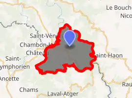
| |
 Saint-Christophe-d'Allier  Saint-Christophe-d'Allier | |
| Coordinates: 44°51′23″N 3°42′18″E | |
| Country | France |
| Region | Auvergne-Rhône-Alpes |
| Department | Haute-Loire |
| Arrondissement | Brioude |
| Canton | Gorges de l'Allier-Gévaudan |
| Government | |
| • Mayor (2014–2020) | Philippe Cham |
| Area 1 | 19.3 km2 (7.5 sq mi) |
| Population (2017-01-01)[1] | 91 |
| • Density | 4.7/km2 (12/sq mi) |
| Time zone | UTC+01:00 (CET) |
| • Summer (DST) | UTC+02:00 (CEST) |
| INSEE/Postal code | 43173 /43340 |
| Elevation | 689–1,133 m (2,260–3,717 ft) (avg. 973 m or 3,192 ft) |
| 1 French Land Register data, which excludes lakes, ponds, glaciers > 1 km2 (0.386 sq mi or 247 acres) and river estuaries. | |
Geography
The Chapeauroux forms part of the commune's south-eastern border, then flows into the Allier which forms the commune's north-eastern border.
Population
| Year | Pop. | ±% |
|---|---|---|
| 1793 | 400 | — |
| 1806 | 637 | +59.2% |
| 1821 | 815 | +27.9% |
| 1831 | 890 | +9.2% |
| 1841 | 552 | −38.0% |
| 1851 | 553 | +0.2% |
| 1861 | 467 | −15.6% |
| 1872 | 501 | +7.3% |
| 1881 | 473 | −5.6% |
| 1891 | 498 | +5.3% |
| 1901 | 502 | +0.8% |
| 1911 | 415 | −17.3% |
| 1921 | 356 | −14.2% |
| 1931 | 339 | −4.8% |
| 1946 | 300 | −11.5% |
| 1954 | 256 | −14.7% |
| 1962 | 239 | −6.6% |
| 1968 | 213 | −10.9% |
| 1975 | 179 | −16.0% |
| 1982 | 164 | −8.4% |
| 1990 | 159 | −3.0% |
| 1999 | 140 | −11.9% |
| 2007 | 116 | −17.1% |
| 2017 | 91 | −21.6% |
External links
- Saint-Christophe-d'Allier at the official website of the communauté de communes du Pays de Saugues (French)
| Wikimedia Commons has media related to Saint-Christophe-d'Allier. |
| Authority control |
|
|---|
This article is issued from Wikipedia. The text is licensed under Creative Commons - Attribution - Sharealike. Additional terms may apply for the media files.