Rural Municipality of Lomond No. 37
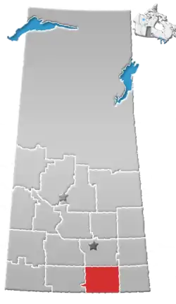
The Rural Municipality of Lomond No. 37 (2016 population: 296) is a rural municipality (RM) in the Canadian province of Saskatchewan within Census Division No. 2 and SARM Division No. 1. Located in the southeast portion of the province, it is south of the City of Weyburn.
Lomond No. 37 | |
|---|---|
| Rural Municipality of Lomond No. 37 | |
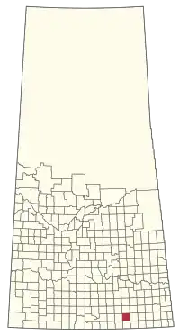 Location of the RM of Lomond No. 37 in Saskatchewan | |
| Coordinates: 49.419°N 103.811°W[1] | |
| Country | Canada |
| Province | Saskatchewan |
| Census division | 2 |
| SARM division | 1 |
| Federal riding | Souris—Moose Mountain |
| Provincial riding | Estevan |
| Formed[2] | December 11, 1911 |
| Government | |
| • Reeve | Desmond McKenzie |
| • Governing body | RM of Lomond No. 37 Council |
| • Administrator | Aleshia Underwood |
| • Office location | Weyburn |
| Area (2016)[4] | |
| • Land | 833.95 km2 (321.99 sq mi) |
| Population (2016)[4] | |
| • Total | 296 |
| • Density | 0.4/km2 (1/sq mi) |
| Time zone | CST |
| • Summer (DST) | CST |
| Postal code | S4H 2K1 |
| Area code(s) | 306 and 639 |
History
The RM of Lomond No. 37 incorporated as a rural municipality on December 11, 1911.[2]
Geography
Long Creek, Roughbark Creek and Jewell Creek all flow through the RM, eventually emptying into the Souris River.
Communities and localities
The following urban municipalities are surrounded by the RM.
The following unincorporated communities are within the RM.
- Localities
- Maxim
Gallery
A photo gallery of places in the RM of Lomond No. 37
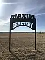 The cemetery in Maxim, Saskatchewan in the Rural Municipality of Lomond No. 37
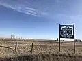 The location of the former school in Maxim, Saskatchewan in the Rural Municipality of Lomond No. 37
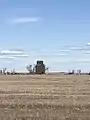 The grain elevator in Maxim, Saskatchewan in the Rural Municipality of Lomond No. 37
Demographics
In the 2016 Census of Population conducted by Statistics Canada, the RM of Lomond No. 37 recorded a population of 296 living in 113 of its 121 total private dwellings, a -2.6% change from its 2011 population of 304. With a land area of 833.95 km2 (321.99 sq mi), it had a population density of 0.4/km2 (0.9/sq mi) in 2016.[4]
In the 2011 Census of Population, the RM of Lomond No. 37 recorded a population of 304, a 1% change from its 2006 population of 301. With a land area of 833.95 km2 (321.99 sq mi), it had a population density of 0.4/km2 (0.9/sq mi) in 2011.[7]
Economy
Its two principal industries are agriculture and petroleum production.
Government
The RM of Lomond No. 37 is governed by an elected municipal council and an appointed administrator that meets on the first Thursday of every month.[3] The reeve of the RM is Desmond McKenzie while its administrator is Aleshia Underwood.[3] The RM's office is located in Weyburn.[3]
References
- "Pre-packaged CSV files - CGN, Canada/Province/Territory (cgn_sk_csv_eng.zip)". Government of Canada. July 24, 2019. Retrieved May 23, 2020.
- "Rural Municipality Incorporations (Alphabetical)". Saskatchewan Ministry of Municipal Affairs. Archived from the original on April 21, 2011. Retrieved May 9, 2020.
- "Municipality Details: RM of Lomond No. 37". Government of Saskatchewan. Retrieved May 21, 2020.
- "Population and dwelling counts, for Canada, provinces and territories, and census subdivisions (municipalities), 2016 and 2011 censuses – 100% data (Saskatchewan)". Statistics Canada. February 8, 2017. Retrieved May 1, 2020.
- "Saskatchewan Census Population" (PDF). Saskatchewan Bureau of Statistics. Archived from the original (PDF) on September 24, 2015. Retrieved May 9, 2020.
- "Saskatchewan Census Population". Saskatchewan Bureau of Statistics. Retrieved May 9, 2020.
- "Population and dwelling counts, for Canada, provinces and territories, and census subdivisions (municipalities), 2011 and 2006 censuses (Saskatchewan)". Statistics Canada. June 3, 2019. Retrieved May 1, 2020.