Bourg-Achard
Bourg-Achard is a commune in the Eure department in the Normandy region in northern France.
Bourg-Achard | |
|---|---|
 The church in Bourg-Achard | |
.svg.png.webp) Coat of arms | |
Location of Bourg-Achard 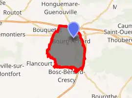
| |
 Bourg-Achard  Bourg-Achard | |
| Coordinates: 49°21′22″N 0°49′06″E | |
| Country | France |
| Region | Normandy |
| Department | Eure |
| Arrondissement | Bernay |
| Canton | Bourg-Achard |
| Government | |
| • Mayor (2008–2014) | Claude Hurabielle |
| Area 1 | 12.32 km2 (4.76 sq mi) |
| Population (2017-01-01)[1] | 3,947 |
| • Density | 320/km2 (830/sq mi) |
| Time zone | UTC+01:00 (CET) |
| • Summer (DST) | UTC+02:00 (CEST) |
| INSEE/Postal code | 27103 /27310 |
| Elevation | 94–144 m (308–472 ft) (avg. 142 m or 466 ft) |
| 1 French Land Register data, which excludes lakes, ponds, glaciers > 1 km2 (0.386 sq mi or 247 acres) and river estuaries. | |
Geography
It is situated in the Roumois region of Normandy and sits at the junction of the motorways A13 (Paris-Caen) and A28 (Rouen-Le Mans), 150 km (93 mi) from Paris.
Population
| Year | Pop. | ±% |
|---|---|---|
| 1962 | 1,392 | — |
| 1968 | 1,564 | +12.4% |
| 1975 | 1,793 | +14.6% |
| 1982 | 2,009 | +12.0% |
| 1990 | 2,255 | +12.2% |
| 1999 | 2,517 | +11.6% |
| 2008 | 2,885 | +14.6% |
See also
References
- "Populations légales 2017". INSEE. Retrieved 6 January 2020.
| Wikimedia Commons has media related to Bourg-Achard. |
| Authority control |
|
|---|
This article is issued from Wikipedia. The text is licensed under Creative Commons - Attribution - Sharealike. Additional terms may apply for the media files.
