Tourville-la-Campagne
Tourville-la-Campagne is a commune in the Eure department in Normandy in northern France.
Tourville-la-Campagne | |
|---|---|
_%C3%A9glise.JPG.webp) The church in Tourville-la-Campagne | |
.svg.png.webp) Coat of arms | |
Location of Tourville-la-Campagne 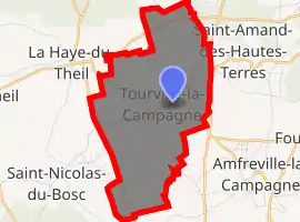
| |
 Tourville-la-Campagne  Tourville-la-Campagne | |
| Coordinates: 49°13′39″N 0°54′20″E | |
| Country | France |
| Region | Normandy |
| Department | Eure |
| Arrondissement | Bernay |
| Canton | Grand Bourgtheroulde |
| Government | |
| • Mayor (2008–2014) | Gérard Lemoine |
| Area 1 | 8.27 km2 (3.19 sq mi) |
| Population (2017-01-01)[1] | 1,081 |
| • Density | 130/km2 (340/sq mi) |
| Time zone | UTC+01:00 (CET) |
| • Summer (DST) | UTC+02:00 (CEST) |
| INSEE/Postal code | 27654 /27370 |
| Elevation | 146–177 m (479–581 ft) (avg. 156 m or 512 ft) |
| 1 French Land Register data, which excludes lakes, ponds, glaciers > 1 km2 (0.386 sq mi or 247 acres) and river estuaries. | |
Population
|
|
See also
References
- "Populations légales 2017". INSEE. Retrieved 6 January 2020.
| Wikimedia Commons has media related to Tourville-la-Campagne. |
| Authority control |
|---|
This article is issued from Wikipedia. The text is licensed under Creative Commons - Attribution - Sharealike. Additional terms may apply for the media files.