Le Bec-Thomas
Le Bec-Thomas is a village in the department of Eure of the Haute-Normandie region in France.
Le Bec-Thomas | |
|---|---|
Location of Le Bec-Thomas 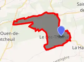
| |
 Le Bec-Thomas  Le Bec-Thomas | |
| Coordinates: 49°14′12″N 0°59′02″E | |
| Country | France |
| Region | Normandy |
| Department | Eure |
| Arrondissement | Bernay |
| Canton | Grand Bourgtheroulde |
| Intercommunality | Amfreville-la-Campagne |
| Government | |
| • Mayor (2008–2014) | Véronique Laguerre |
| Area 1 | 1.4 km2 (0.5 sq mi) |
| Population (2017-01-01)[1] | 219 |
| • Density | 160/km2 (410/sq mi) |
| Time zone | UTC+01:00 (CET) |
| • Summer (DST) | UTC+02:00 (CEST) |
| INSEE/Postal code | 27053 /27370 |
| Elevation | 84–154 m (276–505 ft) (avg. 163 m or 535 ft) |
| 1 French Land Register data, which excludes lakes, ponds, glaciers > 1 km2 (0.386 sq mi or 247 acres) and river estuaries. | |
Le Bec-Thomas is located in the township of Amfreville-la-Campagne part of the district of Bernay. The INSEE code for Le Bec-Thomas is 27053, and the Le Bec-Thomas zip code is 27370.
Geography and map of Le Bec-Thomas
Le Bec-Thomas has an approximate altitude of 145 meters and an area of 1.40 km ². Its latitude and longitude are 49.234 degrees North and 0.983 degrees East.
Population and housing of Le Bec-Thomas
The population of Le Bec-Thomas was 221 in 1999, 229 in 2006 and 224 in 2007. The population density of Le Bec-Thomas is 160.00 inhabitants per km².
The number of houses was 88 in 2007. These consist of 80 main residences, six second or occasional homes and two vacant homes.
Population
| Year | Pop. | ±% |
|---|---|---|
| 1962 | 94 | — |
| 1968 | 119 | +26.6% |
| 1975 | 123 | +3.4% |
| 1982 | 159 | +29.3% |
| 1990 | 190 | +19.5% |
| 1999 | 221 | +16.3% |
| 2008 | 224 | +1.4% |
See also
References
- "Populations légales 2017". INSEE. Retrieved 6 January 2020.
| Wikimedia Commons has media related to Le Bec-Thomas. |
| Authority control |
|---|
This article is issued from Wikipedia. The text is licensed under Creative Commons - Attribution - Sharealike. Additional terms may apply for the media files.