Beaumontel
Beaumontel is a commune in the Eure department in the Normandy region in northern France.
Beaumontel | |
|---|---|
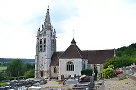 The church in Beaumontel | |
.svg.png.webp) Coat of arms | |
Location of Beaumontel 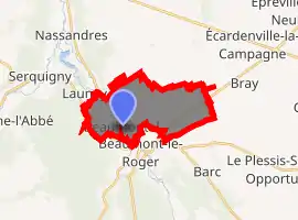
| |
 Beaumontel  Beaumontel | |
| Coordinates: 49°05′21″N 0°45′59″E | |
| Country | France |
| Region | Normandy |
| Department | Eure |
| Arrondissement | Bernay |
| Canton | Brionne |
| Government | |
| • Mayor (2008–2014) | Anne-Marie Leconte |
| Area 1 | 11.63 km2 (4.49 sq mi) |
| Population (2017-01-01)[1] | 657 |
| • Density | 56/km2 (150/sq mi) |
| Time zone | UTC+01:00 (CET) |
| • Summer (DST) | UTC+02:00 (CEST) |
| INSEE/Postal code | 27050 /27170 |
| Elevation | 79–160 m (259–525 ft) (avg. 90 m or 300 ft) |
| 1 French Land Register data, which excludes lakes, ponds, glaciers > 1 km2 (0.386 sq mi or 247 acres) and river estuaries. | |
Location
The commune lies on the Risle river, located between the plaine du Neubourg and the forest of Beaumont-le-Roger. The Paris-Cherbourg railway line passes through the commune.
History
The village was formerly known as Belmontel. The village was originally part of Beaumont-le-Roger and had a common origin in lands belonging to the dukes of Normandy which were given to Judith of Brittany and later, to the monks of Bernay.
From the early 15th century until the French Revolution, the area belonged to the Val family.
Population
| Year | Pop. | ±% |
|---|---|---|
| 1962 | 516 | — |
| 1968 | 533 | +3.3% |
| 1975 | 617 | +15.8% |
| 1982 | 763 | +23.7% |
| 1990 | 745 | −2.4% |
| 1999 | 715 | −4.0% |
| 2008 | 715 | +0.0% |
Economy
Its local economy is based on flour-milling, the production of charcoal and the manufacture of pasta products.
Sights
- Parc Parissot
See also
References
- "Populations légales 2017". INSEE. Retrieved 6 January 2020.
External links
| Wikimedia Commons has media related to Beaumontel. |
- Beaumontel website
- Parissot Park website (in French)
| Authority control |
|---|
This article is issued from Wikipedia. The text is licensed under Creative Commons - Attribution - Sharealike. Additional terms may apply for the media files.
