Rouvray, Eure
Rouvray is a commune in the Eure department in northern France.
Rouvray | |
|---|---|
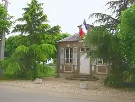 Town hall | |
 Coat of arms | |
Location of Rouvray 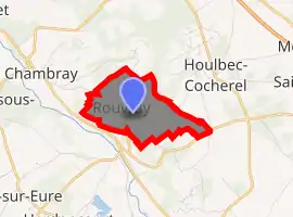
| |
 Rouvray  Rouvray | |
| Coordinates: 49°03′57″N 1°20′19″E | |
| Country | France |
| Region | Normandy |
| Department | Eure |
| Arrondissement | Les Andelys |
| Canton | Pacy-sur-Eure |
| Government | |
| • Mayor (2008–2014) | Patrick Heitz |
| Area 1 | 2.51 km2 (0.97 sq mi) |
| Population (2017-01-01)[1] | 263 |
| • Density | 100/km2 (270/sq mi) |
| Time zone | UTC+01:00 (CET) |
| • Summer (DST) | UTC+02:00 (CEST) |
| INSEE/Postal code | 27501 /27120 |
| Elevation | 77–127 m (253–417 ft) (avg. 188 m or 617 ft) |
| 1 French Land Register data, which excludes lakes, ponds, glaciers > 1 km2 (0.386 sq mi or 247 acres) and river estuaries. | |
Population
| Year | Pop. | ±% |
|---|---|---|
| 1962 | 53 | — |
| 1968 | 55 | +3.8% |
| 1975 | 59 | +7.3% |
| 1982 | 54 | −8.5% |
| 1990 | 111 | +105.6% |
| 1999 | 166 | +49.5% |
| 2008 | 261 | +57.2% |
Sights
The Rouvray chapel rises along the road to the hamlet of Cocherel. Local tradition suggests that the chapel was part of a bigger church that was demolished. Dedicated to St. Martin, the chapel dates from the late fifteenth or early sixteenth century, but from the eleventh century, a church belonging to the monks of Jumièges is known to have existed at Rouvray.
See also
References
- "Populations légales 2017". INSEE. Retrieved 6 January 2020.
| Wikimedia Commons has media related to Rouvray (Eure). |
| Authority control |
|---|
This article is issued from Wikipedia. The text is licensed under Creative Commons - Attribution - Sharealike. Additional terms may apply for the media files.