Saint-Élier
Saint-Élier is a commune in the Eure department and Normandy region of northern France.
Saint-Élier | |
|---|---|
 Coat of arms | |
Location of Saint-Élier 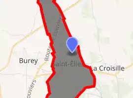
| |
 Saint-Élier  Saint-Élier | |
| Coordinates: 48°58′43″N 0°58′04″E | |
| Country | France |
| Region | Normandy |
| Department | Eure |
| Arrondissement | Évreux |
| Canton | Conches-en-Ouche |
| Intercommunality | CC du Pays de Conches |
| Government | |
| • Mayor (2014–2020) | Jacques Hapdey |
| Area 1 | 2.32 km2 (0.90 sq mi) |
| Population (2017-01-01)[1] | 440 |
| • Density | 190/km2 (490/sq mi) |
| Time zone | UTC+01:00 (CET) |
| • Summer (DST) | UTC+02:00 (CEST) |
| INSEE/Postal code | 27535 /27190 |
| Elevation | 95–151 m (312–495 ft) (avg. 148 m or 486 ft) |
| 1 French Land Register data, which excludes lakes, ponds, glaciers > 1 km2 (0.386 sq mi or 247 acres) and river estuaries. | |
Population
| Year | Pop. | ±% |
|---|---|---|
| 1946 | 89 | — |
| 1954 | 64 | −28.1% |
| 1962 | 63 | −1.6% |
| 1968 | 65 | +3.2% |
| 1975 | 149 | +129.2% |
| 1982 | 423 | +183.9% |
| 1990 | 510 | +20.6% |
| 1999 | 502 | −1.6% |
| 2006 | 463 | −7.8% |
| 2016 | 442 | −4.5% |
See also
References
- "Populations légales 2017". INSEE. Retrieved 6 January 2020.
| Wikimedia Commons has media related to Saint-Élier. |
| Authority control |
|---|
This article is issued from Wikipedia. The text is licensed under Creative Commons - Attribution - Sharealike. Additional terms may apply for the media files.