Marais-Vernier
Marais-Vernier (French pronunciation: [maʁɛ vɛʁnje]) is a commune in the Eure department in Normandy in northern France. It is situated near the left bank of the Seine, at the edge of a wetland (the Marais Vernier) formed by an old branch of the Seine. The wetland was cut off from the river with dams in the 17th century. Part of it is used for farming (cattle, Camargue horses, Scottish Highland Cattle), part is a protected area which is important for birds like storks. The village itself is situated on the edge of the wetland.
Marais-Vernier | |
|---|---|
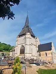 The church in Marais-Vernier | |
Location of Marais-Vernier 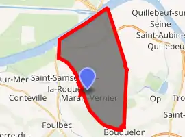
| |
 Marais-Vernier  Marais-Vernier | |
| Coordinates: 49°25′26″N 0°27′16″E | |
| Country | France |
| Region | Normandy |
| Department | Eure |
| Arrondissement | Bernay |
| Canton | Bourg-Achard |
| Government | |
| • Mayor (2008–2014) | Claude Blondel |
| Area 1 | 24.98 km2 (9.64 sq mi) |
| Population (2017-01-01)[1] | 508 |
| • Density | 20/km2 (53/sq mi) |
| Time zone | UTC+01:00 (CET) |
| • Summer (DST) | UTC+02:00 (CEST) |
| INSEE/Postal code | 27388 /27680 |
| Elevation | 0–113 m (0–371 ft) (avg. 10 m or 33 ft) |
| 1 French Land Register data, which excludes lakes, ponds, glaciers > 1 km2 (0.386 sq mi or 247 acres) and river estuaries. | |
Population
| Year | Pop. | ±% |
|---|---|---|
| 1962 | 482 | — |
| 1968 | 495 | +2.7% |
| 1975 | 502 | +1.4% |
| 1982 | 464 | −7.6% |
| 1990 | 480 | +3.4% |
| 1999 | 455 | −5.2% |
| 2008 | 498 | +9.5% |
See also
References
- "Populations légales 2017". INSEE. Retrieved 6 January 2020.
External links
| Wikimedia Commons has media related to Marais-Vernier. |
- Website of the Commune Le-Marais-Vernier
- Country Risle Estuaire
- Normandy Tourism - Official Site C.R.T. Normandy
- Federation Regional Tourist Country Home
- Normandy Tour
- Normandie Qualité Tourisme
- Comité Départemental du Tourisme de l'Eure
- Eure 27 Normandy
- Office de Tourisme d'Evreux
| Authority control |
|
|---|
This article is issued from Wikipedia. The text is licensed under Creative Commons - Attribution - Sharealike. Additional terms may apply for the media files.