Mesnil-Verclives
Mesnil-Verclives is a commune in the Eure department in Normandy in northern France.
Mesnil-Verclives | |
|---|---|
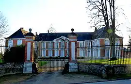 The chateau of Verclives | |
Location of Mesnil-Verclives 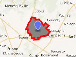
| |
 Mesnil-Verclives  Mesnil-Verclives | |
| Coordinates: 49°19′16″N 1°28′05″E | |
| Country | France |
| Region | Normandy |
| Department | Eure |
| Arrondissement | Les Andelys |
| Canton | Les Andelys |
| Government | |
| • Mayor (2008–2014) | Christian De Coninck |
| Area 1 | 9.96 km2 (3.85 sq mi) |
| Population (2017-01-01)[1] | 316 |
| • Density | 32/km2 (82/sq mi) |
| Time zone | UTC+01:00 (CET) |
| • Summer (DST) | UTC+02:00 (CEST) |
| INSEE/Postal code | 27407 /27440 |
| Elevation | 92–173 m (302–568 ft) (avg. 147 m or 482 ft) |
| 1 French Land Register data, which excludes lakes, ponds, glaciers > 1 km2 (0.386 sq mi or 247 acres) and river estuaries. | |
Etymology
Old North French Mesnil 'house' and Verclives (Warcliva 11th century) Old English clif or Old Norse klif. Verclives is located on a small hill. The first element could be Old English waeter. In French intervocalic consonants weakened and erased.
Old English clif or Old Norse klif can be found in several place-names of Normandy such as Witeclive 'white cliff' former hamlet near Evreux; Carquelif (Caleclif 1224 in Saint-Martin-en-Campagne); Risleclif former hamlet near Saint-Samson-de-la-Roque; Mont Escalleclif (12th century, Doville); Mont Entenclin (Mont Estenclif 'stone cliff')...
The hill was used as an observation post at the battle of Brémule.
Population
| Year | Pop. | ±% |
|---|---|---|
| 1962 | 173 | — |
| 1968 | 180 | +4.0% |
| 1975 | 142 | −21.1% |
| 1982 | 165 | +16.2% |
| 1990 | 203 | +23.0% |
| 1999 | 218 | +7.4% |
| 2008 | 272 | +24.8% |
See also
References
- "Populations légales 2017". INSEE. Retrieved 6 January 2020.
| Wikimedia Commons has media related to Mesnil-Verclives. |
| Authority control |
|---|
This article is issued from Wikipedia. The text is licensed under Creative Commons - Attribution - Sharealike. Additional terms may apply for the media files.