Merey, Eure
Merey is a commune in the Eure department of the Normandy region in northern France.
Merey | |
|---|---|
 A road in Merey | |
 Coat of arms | |
Location of Merey 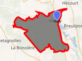
| |
 Merey  Merey | |
| Coordinates: 48°58′00″N 1°24′30″E | |
| Country | France |
| Region | Normandy |
| Department | Eure |
| Arrondissement | Les Andelys |
| Canton | Pacy-sur-Eure |
| Government | |
| • Mayor (2008–2014) | Lucien Tesquet |
| Area 1 | 8.66 km2 (3.34 sq mi) |
| Population (2017-01-01)[1] | 348 |
| • Density | 40/km2 (100/sq mi) |
| Time zone | UTC+01:00 (CET) |
| • Summer (DST) | UTC+02:00 (CEST) |
| INSEE/Postal code | 27400 /27640 |
| Elevation | 45–133 m (148–436 ft) (avg. 50 m or 160 ft) |
| 1 French Land Register data, which excludes lakes, ponds, glaciers > 1 km2 (0.386 sq mi or 247 acres) and river estuaries. | |
History
As Madrie (Pagus Madriensis, later pays de Merey) it was a pagus in the north of Gaul lying between the Seine river and the rivers Eure and Iton. At the beginning of the fifth century, when the Notitia provinciarum was compiled, it was a Roman administrative division or pagus of Provincia Lugdunensis Secunda.
In the ninth-century Carolingian Empire. In 822, Pepin, king of Aquitaine married Ingeltrude (also called Engelberga, Hringard, or Ringart), daughter of Theodobert, count of Madrie (c. 800-after 876), who was a son of Nibelung (Nivelan) of the royal house of the Burgundians.
It became part of Normandy in the 10th century[2] and is now in the region called Normandie.
Population
| Year | Pop. | ±% |
|---|---|---|
| 1962 | 98 | — |
| 1968 | 127 | +29.6% |
| 1975 | 138 | +8.7% |
| 1982 | 192 | +39.1% |
| 1990 | 185 | −3.6% |
| 1999 | 260 | +40.5% |
| 2008 | 303 | +16.5% |
Personalities
In 1694 Francois Quesnay was born at Merey.
See also
References
- "Populations légales 2017". INSEE. Retrieved 6 January 2020.
- Chisholm, Hugh, ed. (1911). . Encyclopædia Britannica. 19 (11th ed.). Cambridge University Press. pp. 749–751.
| Wikimedia Commons has media related to Merey. |
| Authority control |
|---|
