Drewvale, Queensland
Drewvale is an outer suburb of the City of Brisbane, Queensland, Australia.[3] In the 2016 census, Drewvale had a population of 4,476 people.[1]
| Drewvale Brisbane, Queensland | |||||||||||||||
|---|---|---|---|---|---|---|---|---|---|---|---|---|---|---|---|
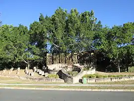 Entrance to the Trinity Green housing estate, 2014 | |||||||||||||||
 Drewvale | |||||||||||||||
| Coordinates | 27.6486°S 153.0547°E | ||||||||||||||
| Population | 4,476 (2016 census)[1] | ||||||||||||||
| • Density | 1,017/km2 (2,635/sq mi) | ||||||||||||||
| Postcode(s) | 4116 | ||||||||||||||
| Area | 4.4 km2 (1.7 sq mi) | ||||||||||||||
| Time zone | AEST (UTC+10:00) | ||||||||||||||
| Location | 26.5 km (16 mi) S of Brisbane CBD | ||||||||||||||
| LGA(s) | City of Brisbane (Calamvale Ward)[2] | ||||||||||||||
| State electorate(s) | Stretton | ||||||||||||||
| Federal Division(s) | Rankin | ||||||||||||||
| |||||||||||||||
Geography
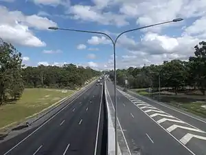
Drewvale is 26.1 kilometres (16 mi) south of the Brisbane CBD and borders with Logan City. Drewvale is located at the interchange of the Gateway Motorway and the Logan Motorway. It is the fourth most southern suburb of Brisbane, after Parkinson, Larapinta and Heathwood. However, Drewvale contains the southernmost residential properties in Brisbane, as the southern extents of Parkinson, Heathwood and Larapinta contain only industrial and commercial development.
History
The area was farmed by the Drew family from the 1870s. The locality was unofficially known as Drewvale for nearly a century until the suburb was officially named by Queensland Place Names Board on 1 November 1971.[3]
In the 2016 census, Drewvale had a population of 4,476 people.[1]
Education
There are no schools in Drewvale. The nearest government primary and secondary school is the Stretton State College in neighbouring Stretton.[4]
Demographics
In the 2011 census, Drewvale recorded a population of 3,943 people, 51.1% female and 48.9% male. The median age of the Drewvale population was 31 years of age, 6 years below the Australian median. 57.8% of people living in Drewvale were born in Australia, compared to the national average of 69.8%; the next most common countries of birth were New Zealand 8.4%, England 3.5%, India 3.2%, South Africa 2.2%, Fiji 1.7%. 67.8% of people spoke only English at home; the next most popular languages were 3.2% Mandarin, 3% Hindi, 2% Cantonese, 1.4% Romanian, 1.2% Arabic.[5]
References
- Australian Bureau of Statistics (27 June 2017). "Drewvale (SSC)". 2016 Census QuickStats. Retrieved 20 October 2018.

- "Calamvale Ward". Brisbane City Council. Brisbane City Council. Retrieved 12 March 2017.
- "Drewvale – suburb in City of Brisbane (entry 46999)". Queensland Place Names. Queensland Government. Retrieved 25 January 2020.
- "Queensland Globe". State of Queensland. Retrieved 11 March 2020.
- Australian Bureau of Statistics (31 October 2012). "Drewvale (State Suburb)". 2011 Census QuickStats. Retrieved 25 April 2018.
External links
- "Drewvale section". Our Brisbane. Archived from the original on 12 January 2008.
- "Drewvale". Queensland Places. Centre for the Government of Queensland, University of Queensland.