The Gap, Queensland
The Gap is a north-western suburb in the City of Brisbane, Queensland, Australia.[3] In the 2016 census, The Gap had a population of 16,692 people.[1]
| The Gap Brisbane, Queensland | |||||||||||||||
|---|---|---|---|---|---|---|---|---|---|---|---|---|---|---|---|
 Walton Bridge Reserve at The Gap | |||||||||||||||
 The Gap | |||||||||||||||
| Coordinates | 27.4416°S 152.9444°E | ||||||||||||||
| Population | 16,692 (2016 census)[1] | ||||||||||||||
| • Density | 1,325/km2 (3,431/sq mi) | ||||||||||||||
| Postcode(s) | 4061 | ||||||||||||||
| Area | 12.6 km2 (4.9 sq mi) | ||||||||||||||
| Time zone | AEST (UTC+10:00) | ||||||||||||||
| Location | 10 km (6 mi) NW of Brisbane GPO | ||||||||||||||
| LGA(s) | City of Brisbane (The Gap Ward)[2] | ||||||||||||||
| State electorate(s) | Cooper | ||||||||||||||
| Federal Division(s) | Ryan | ||||||||||||||
| |||||||||||||||
Geography
The Gap is 10 kilometres (6.2 mi) by road north-west of the Brisbane GPO.[4]
The Gap was named for its geographical location in the valley between Mount Coot-tha and Enoggera Hill (i.e. 'the gap' between hills) which both form part of the Taylor Range.[3][5]
History
Initially inhabited by the Turrbal people, The Gap was originally heavily forested. With the arrival of European settlement, timber felling became the first industry in the area, and with the removal of the timber the area was turned over to farming. The first crown lease of land was in 1851, to Darby McGrath who ran a sheep station across the entire valley. The first freehold land sale was made in 1858, to P.B. and J. Paten in the area where Paten road runs today.[6] Access to The Gap in the 1850s was via tracks which became Waterworks and Payne Roads. They also provided access to Enoggera Dam which was built in 1866 to provide a water supply for Brisbane. Following World War I the area was broken up into smaller farms for returned servicemen, many of whom farmed poultry and dairy cattle. Many of these farms were too small to be commercially successful, however small pockets of farming remained in The Gap until the 1980s.
From 1879 The Gap was part of the local government area called Ithaca Division, then part of the Shire of Enoggera from 1887 to 1925.
A map advertised the sale of 800 allotments at Royal Park Estate, now The Gap and St. John's Wood Extension Estate, Ashgrove by F. M. Anglim in August 1927.[7][8]
Gap State School opened on 22 January 1912. It was renamed The Gap State School in the early 1960s.[9]
Mason's jam factory was established about 1939 by Claude Hamilton Mason. It was located to the east of the Ashgrove Golf Course (27.4464°S 152.9641°E), but closed circa 1990.[10][11][12][13]
The Gap State High School opened on 25 January 1960.[9]
Payne Road State School opened on 27 January 1970.[9]
St Peter Chanel Catholic Primary School opened on 29 August 1972.[9]
Hilder Road State School opened on 30 January 1979.[9]
The billabong between The Gap State High School and Payne Road Primary School[14] used to be a favourite swimming location and over the years has been home to turtles, eels and platypus. It was named Shepherd's Pool, supposedly after a shepherd who was killed by aborigines in 1852, although the name may derive from a P.A. Shepherd, who leased the adjacent land in the 1930s.[15]
There used to be a toll gate located on Waterworks Road near what is now the entrance to Brisbane Forest Park.[16]
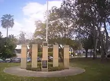
The Gap War Memorial is located at Walton Bridge Reserve (27.4464°S 152.9641°E) and commemorates those who served in World War I and World War II.[17]
The Gap was affected by a major storm on the afternoon of 16 November 2008. A microburst hit The Gap with extremely high winds, causing many trees to fall onto homes and major roads, as well as causing many houses to lose their roofs.[18][19]
In the 2016 census, The Gap had a population of 16,692 people.[1]
Attractions

The district was later subdivided into blocks of land for housing estates. The recreational activities of inhabitants of the suburb are well catered for, with many facilities including many sporting clubs (Soccer, Tennis, Athletics, Swimming and Golf etc.) and there are a number of lush green parks.
The Gap is also where the main entrance to Walkabout Creek, in what was previously known as Brisbane Forest Park, (now officially the southern part of D'Aguilar National Park), is located. A major bushland area in Brisbane's west, there is an information and wildlife education centre, with many Australian wildlife species, including marsupials, birds, fish and reptiles. For a number of years, now, there has been a resident platypus named Burrun at Walkabout Creek and, more recently, a second platypus named Willum (Burrun's half-brother). Bred at Healesville Sanctuary in Victoria, they are the sons of Barak, the platypus at Lone Pine Koala Sanctuary.
Ashgrove Golf Club is located in the Brisbane suburb of The Gap, at 863 Waterworks Road. Ashgrove Golf Club was formed in April 1939 as a nine-hole format. Over time the club expanded to eighteen holes utilizing freehold and leased land.[20] The land was originally a dairy farm and market garden. Mark Winston was the original owner who leased the land to the club until the club bought the land in 1950 for £12,000. The club celebrated the 75th anniversary of the formation of the club with a week-long celebration of golf and social events in April 2014.[20]
Facilities
The suburb has a small shopping village (which extends from Walton Bridge Reserve to The Gap State High School and Payne Road State School).
There are also Christian churches of many denominations, as well as a local Police Station in the suburb.
Ashgrove Fire Brigade, which is at West Ashgrove, is in close proximity to The Gap. Also, an ambulance station has now been opened close to The Gap.
The Gap is served by a fortnightly visit of the Brisbane City Council's mobile library service at the car park in the sports ground at the end of Glenaffric Street.[21]
Education
The Gap State School is a government primary (Prep-6) school for boys and girls at the corner of Waterworks and Settlement Roads (27.4431°S 152.9446°E).[22][23] In 2018, the school had an enrolment of 593 students with 44 teachers (36 full-time equivalent) and 31 non-teaching staff (18 full-time equivalent).[24] It includes a special education program.[22][25]
Payne Road State School is a government primary (Prep-6) school for boys and girls at 171 Payne Road (27.4494°S 152.9514°E).[22][26] In 2018, the school had an enrolment of 283 students with 24 teachers (18 full-time equivalent) and 18 non-teaching staff (11 full-time equivalent).[24] It includes a special education program.[22][27]
Hilder Road State School is a government primary (Prep-6) school for boys and girls at Kaloma Road (27.4368°S 152.9372°E).[22][28] In 2018, the school had an enrolment of 465 students with 42 teachers (35 full-time equivalent) and 20 non-teaching staff (13 full-time equivalent).[24] It includes a special education program.[22]
St Peter Chanel Primary School is a Catholic primary (Prep-6) school for boys and girls at 41 Chaprowe Road (27.4390°S 152.9458°E).[22][29] In 2018, the school had an enrolment of 404 students with 32 teachers (26 full-time equivalent) and 19 non-teaching staff (8 full-time equivalent).[24]
The Gap State High School is a government secondary (7-12) school for boys and girls at 1020 Waterworks Road (27.4450°S 152.9504°E).[22][30] In 2018, the school had an enrolment of 1456 students with 117 teachers (109 full-time equivalent) and 50 non-teaching staff (42 full-time equivalent).[24] It includes a special education program.[22]
Transport
Travel to, and within, The Gap is by road. As well as private vehicles, The Gap has a good public bus service. The main arterial road through The Gap is Waterworks Road, which heads east through the suburbs St Johns Wood, Ashgrove and Red Hill and then, as Musgrave Road, it continues to Brisbane city. Waterworks Road was widened, from two lanes to four lanes, along the 8 kilometres (5.0 mi) stretch of road between The Gap and Red Hill between July 1999 and December 2003. Total cost was $50 million.
Popular culture
In 2009, scenes for the feature film Jucy (2010) were shot in the suburb.
Robert Forster (musician), one of the founding members of the musical group, The Go-Betweens, grew up in The Gap and wrote about the suburb in his 2016 memoir, Grant & I.[31]
David Malouf's novel Johnno references The Gap on two occasions, as does the debut novel of journalist Trent Dalton, Boy Swallows Universe.
Many of the scenes in the ABC children's show Bluey are inspired by the creator's experiences living in The Gap.
Photos of The Gap
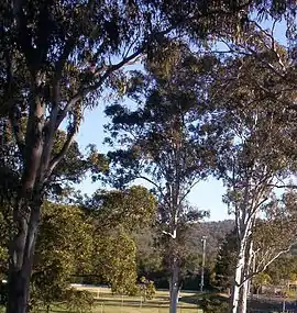
 Enoggera Hill at The Gap
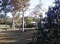 Walton Bridge Reserve at The Gap
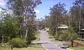
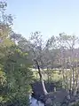 Walton Bridge Reserve at The Gap
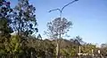
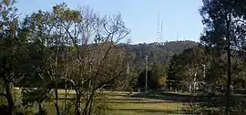 Mount Coot-tha and the Television Towers, and Walton Bridge Reserve
References
- Australian Bureau of Statistics (27 June 2017). "The Gap (SSC)". 2016 Census QuickStats. Retrieved 20 October 2018.

- "The Gap Ward". Brisbane City Council. Brisbane City Council. Archived from the original on 30 August 2020. Retrieved 19 March 2017.
- "The Gap – suburb in City of Brisbane (entry 46184)". Queensland Place Names. Queensland Government. Retrieved 17 September 2020.
- "Brisbane GPO to The Gap". Google Maps. Archived from the original on 11 October 2020. Retrieved 11 October 2020.
- "Queensland Globe". State of Queensland. Retrieved 10 October 2020.
- Paten, Dick (editor) (2010). Ashgrove and The Gap - Aspects of History 1849-2003. Ashgrove, Queensland: Ashgrove Historical Society Inc. pp. 7–12. ISBN 978-0-646-53532-6.CS1 maint: extra text: authors list (link)
- "Royal Park Estate and St. John's Wood Extension Estate : Ashgrove". digital.slq.qld.gov.au. Archived from the original on 3 June 2020. Retrieved 3 June 2020.
- "ST. JOHN'S WOOD". The Brisbane Courier. Queensland, Australia. 2 August 1927. p. 20. Archived from the original on 30 August 2020. Retrieved 3 June 2020 – via Trove.
- Queensland Family History Society (2010), Queensland schools past and present (Version 1.01 ed.), Queensland Family History Society, ISBN 978-1-921171-26-0
- Larsen, Jim. "St. John's Woods memories". St Johns Wood, Ashgrove. Archived from the original on 6 June 2014. Retrieved 3 June 2014.
- Dayman (nee Peake), Joan. "St. John's Woods memories". St Johns Wood, Ashgrove. Archived from the original on 6 June 2014. Retrieved 3 June 2014.
- "Food Producers for Brisbane Town". The Gap Historical Society. Archived from the original on 11 October 2020. Retrieved 11 October 2020.
- "Claude Mason 1988". The Gap Historical Society. Archived from the original on 11 October 2020. Retrieved 11 October 2020.
- "Payne Road SS". Archived from the original on 2 February 2017. Retrieved 28 January 2017.
- Paten (2010), p.19
- The Gap Historical Society
- "The Gap War Memorial, QLD". Places of Pride. Australian War Memorial. Archived from the original on 11 October 2020. Retrieved 11 October 2020.
- "SEQ Severe Thunderstorm and Microburst at The Gap". Australian Government: Bureau of Meteorology. Archived from the original on 29 March 2012. Retrieved 7 October 2011.
- indoorlightening (18 November 2008). "The Gap cyclone of November 16 2008 - Brisbane Qld Australia". Archived from the original on 31 January 2017. Retrieved 1 December 2016 – via YouTube.
- Ashgrove Golf Club Diamond Jubilee. Ashgrove Golf Club. 2014. p. 1.
- "Mobile library services". Brisbane City Council. Archived from the original on 6 June 2014. Retrieved 3 June 2014.
- "State and non-state school details". Queensland Government. 9 July 2018. Archived from the original on 21 November 2018. Retrieved 21 November 2018.
- "The Gap State School". Archived from the original on 6 July 2011. Retrieved 21 November 2018.
- "ACARA School Profile 2018". Australian Curriculum, Assessment and Reporting Authority. Archived from the original on 27 August 2020. Retrieved 28 January 2020.
- "The Gap SS - Special Education Program". Archived from the original on 6 July 2011. Retrieved 21 November 2018.
- "Payne Road State School". Archived from the original on 15 March 2020. Retrieved 21 November 2018.
- "Payne Road SS - Special Education Program". Archived from the original on 15 March 2020. Retrieved 21 November 2018.
- "Hilder Road State School". Archived from the original on 20 March 2012. Retrieved 21 November 2018.
- "St Peter Chanel Primary School". Archived from the original on 27 April 2014. Retrieved 21 November 2018.
- "The Gap State High School". Archived from the original on 15 March 2020. Retrieved 21 November 2018.
- Forster, Robert (2016). Grant & I: Inside and outside the Go-Betweens. Penguin Books Australia. ISBN 978-0-67007-822-6.,
External links
| Wikimedia Commons has media related to The Gap, Queensland. |
- "The Gap". Queensland Places. Centre for the Government of Queensland, University of Queensland.]