Ellen Grove, Queensland
Ellen Grove is an outer suburb of the City of Brisbane, Queensland, Australia and is located 20 kilometres (12 mi) south-west of the Brisbane central business district.[3] At the 2016 Australian Census the population was recorded as 2,906.[1]
| Ellen Grove Brisbane, Queensland | |||||||||||||||
|---|---|---|---|---|---|---|---|---|---|---|---|---|---|---|---|
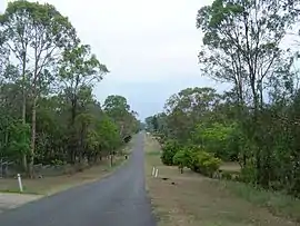 Lovat Street, Ellen Grove | |||||||||||||||
| Population | 2,906 (2016 census)[1] | ||||||||||||||
| Established | 1962 | ||||||||||||||
| Postcode(s) | 4078 | ||||||||||||||
| Location | 20 km (12 mi) from Brisbane GPO | ||||||||||||||
| LGA(s) | City of Brisbane (Jamboree Ward)[2] | ||||||||||||||
| State electorate(s) | Inala | ||||||||||||||
| Federal Division(s) | Oxley | ||||||||||||||
| |||||||||||||||
History
Ellen Grove was subdivided for housing around 1959, with the name of the suburb gazetted in 1962 due to lobbying from the Ellen Grove Progress Association.[4] The subdivision were between two and four acres in area with no services provided.
The owner of the original land was R.P. Spinks who had a daughter named Ellen Dabing. She often played with local Aboriginals in a grove of trees along Bullockhead Creek.[4] The area became known as Ellen's Grove.
A portion of the suburb of Carole Park had since been annexed to form part of the suburb of Ellen Grove as part of a Brisbane City Council and Ipswich City Council redistribution assignment,[5] and in 2009, the suburb was extended both to the north and south, increasing the population significantly.[4]
Geography
The southern boundary of the suburb is partially marked by the Logan Motorway. The Centenary Highway passes through the suburb from north to south.[6] The Richlands and Inala reservoirs were built in the suburb to increase water pressure for residents in the surrounding suburbs.
Amenities
The suburb contains a small shopping village.[4]
Ellen Grove is serviced by a fortnightly visit of the Brisbane City Council's mobile library service at the Carole Park State School, 260 Waterford Road, Wacol.[7]
Transport
Provisions had been made for the proposed Ellen Grove railway station on the Springfield line which passes through Ellen Grove.[8]
Demographics
In the 2011 census, Ellen Grove recorded a population of 2,529 people, 51% female and 49% male.[9] The median age of the Ellen Grove population was 28 years of age, 9 years below the Australian median. 55.9% of people living in Ellen Grove were born in Australia, compared to the national average of 69.8%; the next most common countries of birth were New Zealand 5.5%, Vietnam 5.4%, Samoa 2.9%, England 2.1%, Philippines 1.2%. 59.3% of people spoke only English at home; the next most popular languages were 9.8% Vietnamese, 5.3% Samoan, 1% Kirundi (Rundi), 1% Mandarin, 0.9% Arabic.[9]
References
- Australian Bureau of Statistics (27 June 2017). "Ellen Grove (State Suburb)". 2016 Census QuickStats. Retrieved 25 March 2018.

- "Jamboree Ward". Brisbane City Council. Brisbane City Council. Retrieved 12 March 2017.
- "Ellen Grove (entry 48323)". Queensland Place Names. Queensland Government. Retrieved 21 June 2015.
- Mynott, Wicki (2009). 150 years: Richlands, Inala & neighbouring suburbs in Brisbane's South West. Richlands, Inala & Suburbs History Group. pp. 101–104.
- "Ellen Grove – suburb in City of Brisbane (entry 48323)". Queensland Place Names. Queensland Government. Retrieved 28 September 2017.
- "Queensland Globe". State of Queensland. Retrieved 21 June 2015.
- "Mobile library services". Brisbane City Council. Retrieved 3 June 2014.
- "Darra to Springfield Transport Corridor Stage 2 Richlands to Springfield" (PDF). Queensland Rail. July 2011. Archived from the original on 12 June 2012. Retrieved 6 January 2021.CS1 maint: unfit URL (link)
- Australian Bureau of Statistics (31 October 2012). "Ellen Grove (State Suburb)". 2011 Census QuickStats. Retrieved 14 January 2013.
External links
![]() Media related to Ellen Grove, Queensland at Wikimedia Commons
Media related to Ellen Grove, Queensland at Wikimedia Commons