Kenmore Hills, Queensland
Kenmore Hills is a suburb in the City of Brisbane, Queensland, Australia.[3] In the 2016 census, Kenmore Hills had a population of 2,402 people.[1]
| Kenmore Hills Brisbane, Queensland | |||||||||||||||
|---|---|---|---|---|---|---|---|---|---|---|---|---|---|---|---|
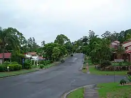 Mirbelia Street | |||||||||||||||
 Kenmore Hills | |||||||||||||||
| Coordinates | 27.4936°S 152.9294°E | ||||||||||||||
| Population | 2,402 (2016 census)[1] | ||||||||||||||
| • Density | 511/km2 (1,324/sq mi) | ||||||||||||||
| Established | 1975 | ||||||||||||||
| Postcode(s) | 4069 | ||||||||||||||
| Area | 4.7 km2 (1.8 sq mi) | ||||||||||||||
| Time zone | AEST (UTC+10:00) | ||||||||||||||
| Location | 13.0 km (8 mi) SW of Brisbane GPO | ||||||||||||||
| LGA(s) | City of Brisbane (Pullenvale Ward)[2] | ||||||||||||||
| State electorate(s) | Moggill | ||||||||||||||
| Federal Division(s) | Ryan | ||||||||||||||
| |||||||||||||||
Geography
Kenmore Hills is 13.0 kilometres (8.1 mi) by road by the Brisbane GPO.[4]
Although the northern part of the suburb is on the foothills of Mount Coot-tha, there is only one named peak in the suburb: Carver Hill in the south-east (27.5005°S 152.9308°E) at 70 metres (230 ft) above sea level.[5][6]
History
Kenmore Hills originally formed part of Brookfield, but in 1975 the name was changed to Kenmore Hills, based on the nearby suburb of Kenmore.
In the 2011 census Kenmore Hills had a population of 2,577 people.[7]
In the 2016 census Kenmore Hills had a population of 2,402 people.[1]
Education
There are no schools in Kenmore Hills. The nearest primary schools are Chapel Hill State School in neighouring Chapel Hill to the east, Kenmore State School in neighbouring Kenmore to the south, and Brookfield State School in neighbouring Brookfield to the west. The nearest secondary school is Kenmore State High School in Kenmore.[6]
Demographics
In the 2011 census, Kenmore Hills recorded a population of 2,577 people, 53.2% female and 46.8% male.[7]
The median age of the Kenmore Hills population was 44 years of age, 7 years above the Australian median.[7]
60.5% of people living in Kenmore Hills were born in Australia, compared to the national average of 69.8%; the next most common countries of birth were England 7.5%, South Africa 4.2%, New Zealand 3%, India 2.4%, Scotland 1.3%.[7]
81.3% of people spoke only English at home; the next most common languages were 1.9% Mandarin, 1.1% German, 1% Cantonese, 0.9% Telugu, 0.8% Afrikaans.[7]
References
- Australian Bureau of Statistics (27 June 2017). "Kenmore Hills (SSC)". 2016 Census QuickStats. Retrieved 20 October 2018.

- "Pullenvale Ward". Brisbane City Council. Brisbane City Council. Retrieved 12 March 2017.
- "Kenmore Hills – suburb in City of Brisbane (entry 48322)". Queensland Place Names. Queensland Government. Retrieved 17 September 2020.
- "Brisbane GPO to Kenmore Hills". Google Maps. Retrieved 29 September 2020.
- "Carver Hill – hill in City of Brisbane (entry 6385)". Queensland Place Names. Queensland Government. Retrieved 17 September 2020.
- "Queensland Globe". State of Queensland. Retrieved 28 September 2020.
- Australian Bureau of Statistics (31 October 2012). "Kenmore Hills". 2011 Census QuickStats. Retrieved 29 September 2020.
External links
- "Kenmore Hills". Queensland Places. Centre for the Government of Queensland, University of Queensland.
- "Kenmore Hills". BRISbites. Brisbane City Council. Archived from the original on 19 July 2008.
- "Kenmore Hills". Our Brisbane. Brisbane City Council. Archived from the original on 22 February 2008.