Faverolles-sur-Cher
Faverolles-sur-Cher is a commune in the Loir-et-Cher department of central France.
Faverolles-sur-Cher | |
|---|---|
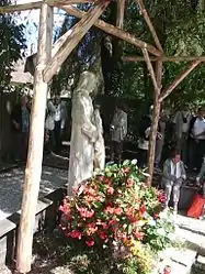 Statue of Saint Gilles | |
.svg.png.webp) Coat of arms | |
Location of Faverolles-sur-Cher 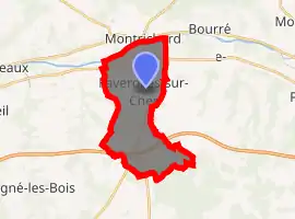
| |
 Faverolles-sur-Cher  Faverolles-sur-Cher | |
| Coordinates: 47°19′20″N 1°11′11″E | |
| Country | France |
| Region | Centre-Val de Loire |
| Department | Loir-et-Cher |
| Arrondissement | Romorantin-Lanthenay |
| Canton | Montrichard |
| Intercommunality | Du Cher à la Loire |
| Government | |
| • Mayor (2014–2020) | Bernard Girault |
| Area 1 | 15.51 km2 (5.99 sq mi) |
| Population (2017-01-01)[1] | 1,386 |
| • Density | 89/km2 (230/sq mi) |
| Time zone | UTC+01:00 (CET) |
| • Summer (DST) | UTC+02:00 (CEST) |
| INSEE/Postal code | 41080 /41400 |
| Elevation | 57–146 m (187–479 ft) (avg. 70 m or 230 ft) |
| 1 French Land Register data, which excludes lakes, ponds, glaciers > 1 km2 (0.386 sq mi or 247 acres) and river estuaries. | |
Population
| Year | Pop. | ±% |
|---|---|---|
| 1793 | 374 | — |
| 1806 | 455 | +21.7% |
| 1821 | 497 | +9.2% |
| 1831 | 532 | +7.0% |
| 1841 | 568 | +6.8% |
| 1851 | 643 | +13.2% |
| 1861 | 706 | +9.8% |
| 1872 | 783 | +10.9% |
| 1881 | 808 | +3.2% |
| 1891 | 784 | −3.0% |
| 1901 | 787 | +0.4% |
| 1911 | 666 | −15.4% |
| 1921 | 662 | −0.6% |
| 1931 | 675 | +2.0% |
| 1946 | 645 | −4.4% |
| 1965 | 835 | +29.5% |
| 1962 | 790 | −5.4% |
| 1968 | 762 | −3.5% |
| 1975 | 807 | +5.9% |
| 1982 | 1,008 | +24.9% |
| 1990 | 1,056 | +4.8% |
| 1999 | 1,120 | +6.1% |
| 2008 | 1,266 | +13.0% |
| 2013 | 1,281 | +1.2% |
References
- "Populations légales 2017". INSEE. Retrieved 6 January 2020.
| Wikimedia Commons has media related to Faverolles-sur-Cher. |
| Authority control |
|---|
This article is issued from Wikipedia. The text is licensed under Creative Commons - Attribution - Sharealike. Additional terms may apply for the media files.