Villeherviers
Villeherviers is a commune in the Loir-et-Cher department in central France.
Villeherviers | |
|---|---|
Commune | |
 Church of Saint-Euverte | |
Location of Villeherviers 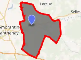
| |
 Villeherviers  Villeherviers | |
| Coordinates: 47°22′01″N 1°47′56″E | |
| Country | France |
| Region | Centre-Val de Loire |
| Department | Loir-et-Cher |
| Arrondissement | Romorantin-Lanthenay |
| Canton | Romorantin-Lanthenay |
| Intercommunality | Romorantinais |
| Government | |
| • Mayor (2014–2020) | Raphaël Hougnon |
| Area 1 | 38.9 km2 (15.0 sq mi) |
| Population (2017-01-01)[1] | 471 |
| • Density | 12/km2 (31/sq mi) |
| Time zone | UTC+01:00 (CET) |
| • Summer (DST) | UTC+02:00 (CEST) |
| INSEE/Postal code | 41282 /41200 |
| Elevation | 85–112 m (279–367 ft) |
| 1 French Land Register data, which excludes lakes, ponds, glaciers > 1 km2 (0.386 sq mi or 247 acres) and river estuaries. | |
Geography
The Rère flows northwest through the eastern part of the commune, then flows into the Sauldre, which flows southwest through the middle of the commune.
Population
| Year | Pop. | ±% |
|---|---|---|
| 1793 | 532 | — |
| 1806 | 579 | +8.8% |
| 1821 | 580 | +0.2% |
| 1831 | 608 | +4.8% |
| 1841 | 612 | +0.7% |
| 1851 | 638 | +4.2% |
| 1861 | 615 | −3.6% |
| 1872 | 650 | +5.7% |
| 1881 | 711 | +9.4% |
| 1891 | 713 | +0.3% |
| 1901 | 666 | −6.6% |
| 1911 | 616 | −7.5% |
| 1921 | 580 | −5.8% |
| 1931 | 498 | −14.1% |
| 1946 | 525 | +5.4% |
| 1954 | 481 | −8.4% |
| 1962 | 416 | −13.5% |
| 1968 | 406 | −2.4% |
| 1975 | 359 | −11.6% |
| 1982 | 342 | −4.7% |
| 1990 | 533 | +55.8% |
| 1999 | 498 | −6.6% |
| 2005 | 486 | −2.4% |
| 2015 | 477 | −1.9% |
References
- "Populations légales 2017". INSEE. Retrieved 6 January 2020.
| Wikimedia Commons has media related to Villeherviers. |
| Authority control |
|---|
This article is issued from Wikipedia. The text is licensed under Creative Commons - Attribution - Sharealike. Additional terms may apply for the media files.