Langon-sur-Cher
Langon-sur-Cher (before 2017: Langon)[2] is a commune in the Loir-et-Cher department of central France.
Langon-sur-Cher | |
|---|---|
.JPG.webp) Church of Saint-Sulpice | |
.svg.png.webp) Coat of arms | |
Location of Langon-sur-Cher 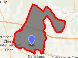
| |
 Langon-sur-Cher  Langon-sur-Cher | |
| Coordinates: 47°17′06″N 1°49′40″E | |
| Country | France |
| Region | Centre-Val de Loire |
| Department | Loir-et-Cher |
| Arrondissement | Romorantin-Lanthenay |
| Canton | Selles-sur-Cher |
| Intercommunality | Romorantinais |
| Government | |
| • Mayor (2014–2020) | Jean-Pierre Autrive |
| Area 1 | 38.82 km2 (14.99 sq mi) |
| Population (2017-01-01)[1] | 812 |
| • Density | 21/km2 (54/sq mi) |
| Time zone | UTC+01:00 (CET) |
| • Summer (DST) | UTC+02:00 (CEST) |
| INSEE/Postal code | 41110 /41320 |
| Elevation | 82–130 m (269–427 ft) (avg. 97 m or 318 ft) |
| 1 French Land Register data, which excludes lakes, ponds, glaciers > 1 km2 (0.386 sq mi or 247 acres) and river estuaries. | |
Geography
The Rère forms part of the commune's northern border.
Population
| Year | Pop. | ±% |
|---|---|---|
| 1793 | 581 | — |
| 1806 | 578 | −0.5% |
| 1821 | 635 | +9.9% |
| 1831 | 574 | −9.6% |
| 1841 | 586 | +2.1% |
| 1851 | 784 | +33.8% |
| 1861 | 802 | +2.3% |
| 1872 | 813 | +1.4% |
| 1881 | 843 | +3.7% |
| 1891 | 943 | +11.9% |
| 1901 | 927 | −1.7% |
| 1911 | 852 | −8.1% |
| 1921 | 758 | −11.0% |
| 1931 | 698 | −7.9% |
| 1946 | 675 | −3.3% |
| 1954 | 679 | +0.6% |
| 1962 | 636 | −6.3% |
| 1968 | 601 | −5.5% |
| 1975 | 610 | +1.5% |
| 1982 | 755 | +23.8% |
| 1990 | 813 | +7.7% |
| 1999 | 770 | −5.3% |
| 2008 | 837 | +8.7% |
| 2013 | 857 | +2.4% |
References
- "Populations légales 2017". INSEE. Retrieved 6 January 2020.
- Décret n° 2017-1744 22 December 2017 (in French)
| Wikimedia Commons has media related to Langon-sur-Cher. |
| Authority control |
|
|---|
This article is issued from Wikipedia. The text is licensed under Creative Commons - Attribution - Sharealike. Additional terms may apply for the media files.