Geology of New Mexico
The geology of New Mexico includes bedrock exposures of four physiographic provinces,[1] with ages ranging from almost 1800 million years (Ma)[2] to nearly the present day.[3] Here the Great Plains, southern Rocky Mountains, Colorado Plateau, and Basin and Range Provinces meet,[1] giving the state great geologically diversity.[4][5]
The geologic history of the state began with its assembly during the Yavapai and Mazatzal orogenies 1750 to 1650 million years ago (Mya).[6][7] This was followed by 200 million years of tectonic quiescence that ended in the Picuris orogeny. This event transformed the New Mexico crust into mature continental crust.[8] Over a thousand million years of tectonic quiescence followed, ending with the rise of the Ancestral Rocky Mountains in Pennsylvanian time, 300 Mya.[9] The Permian and most of the Mesozoic were another interval of relative tectonic quiescence, where gradual subsidence deposited formations that preserve an impressive stratigraphic record across the state. This ended with the Laramide orogeny, beginning around 70 Mya, which elevated most of the mountain ranges of modern New Mexico[10] and was accompanied by violent volcanic activity.[11] The opening of the Rio Grande rift commenced around 30 Mya,[12] and was followed by late Cenozoic volcanism along the Jemez Lineament,[13] particularly in the Jemez volcanic field.[14]
Most of New Mexico has a semiarid to arid climate,[15] and ground water in aquifers is an important geologic resource for farmers[16] and municipal areas.[17] Oil and gas production in the state totalled 1,820,963,878 MCF of natural gas and 331,460,749 barrels of oil in 2019,[18] yielding $3.1 billion in oil and gas taxes and revenues for the state.[19] Mining has historically been important, but accounted for just 3,763 jobs by 2018.[20]
Geologic hazards are infrequent in New Mexico, but potential dangers include erosion or flash flooding in arroyos; arsenic or other contamination of ground water or soil; sinkholes or other subsidence; earthquakes; mass wasting (such as landslides); mine hazards; oil field hazards; radon accumulation in homes; or volcanic eruptions.[21]
Stratigraphy, tectonics, and geologic history
Proterozoic
The crust underlying the state formed between 1.7 and 1.8 billion years ago as island arcs. This is recorded in the rocks of the Moppin Complex, the Gold Hill complex, and the Pecos greenstone belt in northern New Mexico. These are described as juvenile crust, because their Nd model ages are close to the crystallization ages determined from U-Pb dating. This indicates that the material making up the island arcs was extracted from the Earth's mantle only shortly before the island arcs formed. [22][23] These rocks are mostly amphibolites thought to be formed by metamorphism of tholeiitic basalt.[24]
The island arcs were carried into a subduction zone along the margin of Laurentia, the ancient core of North America, around 1700 million years ago, an event called the Yavapai orogeny. The arcs accreted to the continental margin, forming a band of new continental crust stretching from Arizona to Newfoundland and from the Wyoming-Colorado border to central New Mexico..[7] These events are recorded in the rocks of the Vadito Group and Hondo Group.[25] A second set of slightly younger island arcs accreted to the continented shortly after, around 1650 to 1600 Mya, during the Mazatzal orogeny.[7] The Mazatzal beds now underlie most of southern New Mexico and the Mazatzal orogeny is recorded in the Manzano Group of the Manzano and Los Pinos mountains.[26][25][27]
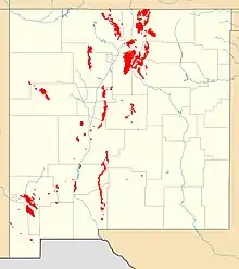
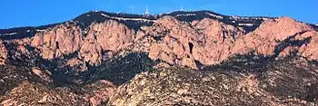
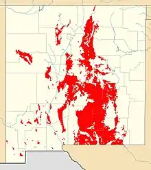
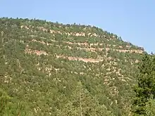
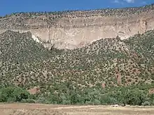
Precambrian rocks crop out across approximately five percent of New Mexico and underlie the entire state. The rocks now exposed at the surface were uplifted during the Paleozoic, the early Cenozoic Laramide orogeny as well as block faulting and tilting in the more recent geologic past. For the most part, these rocks are exposed along the Rio Grande rift in the center of New Mexico, except in the Zuni Mountains and Burro Mountains. The total relief of Precambrian rocks is 11 kilometers.
The rocks are 70 percent plutons and 30 percent supracrustal formed between 1.765 and 1.4 billion years ago in the Proterozoic, based on uranium-lead dating. All of the rocks more than 1.65 billion years old show evidence of metamorphism ranging between greenschist and amphibolite grade on the sequence of metamorphic facies. An area in the Cimarron Mountains in the vicinity of Taos reached granulite facies. Geologists debate the extent of different terranes—sections of continental crust—that joined together. Metavolcanic rocks in the Tusas Mountains may be among the oldest, which are intruded by 1.65 billion year old trondhjemite, but display more than one metamorphic fabric.
Precambrian rocks formed volcanogenic polymettalic sulfides, rich in gold, silver and tungsten, kyanite, copper veins and pegmatite with beryllium, lithium, niobium, tantalum and mica.[28]
The region was tectonically quiescent until around 1400 Mya, when the poorly understood Picuris orogeny deformed and metamorphosed much of the crust of New Mexico. This event is recorded in the rock of the Trampas Group and in extensive batholiths intruded into the crust throughout the western United States, such as the Sandia Crest batholith.[8] Following the Picuris orogeny, northern New Mexico was again tectonically quiet, while southern New Mexico experience some deformation associated with the Grenville orogeny. This is recorded in the Allamore and Tumbledown Formations (about 1250 Mya) and the De Baca Group and Animas Formation (about 1200 Mya). Thereafter the region experienced steady erosion, which in some cases brought rock near the surface that had been buried as deep as 10 kilometers (6.2 mi).[6] This beveled much of New Mexico almost completely flat, forming a peneplain.[29]
Paleozoic (541-251 million years ago)
New Mexico at the start of the Paleozoic was dominated by the Transcontinental Arch, an elevated region from Minnesota to northern New Mexico.[30] Small quantities of alkaline magma were intruded in the early Cambrian along north-south faults, which may indicate incipient rifting of the New Mexico aulacogen.[31] Later in the Cambrian, the sea began to advance northeast across New Mexico, beginning in the boot heel of the state (Sauk sequence) and sedimentary beds were deposited during the Cambrian through Devonian, beginning with the Cambrian Bliss Formation.[32] The sea did not submerge the Transcontinental Arch until Mississippian time.[33]
By the late Paleozoic, in the Pennsylvanian and Permian, the rise of the Ancestral Rocky Mountains broke the ancient peneplain into basins separated by uplifts. Fossiliferous marine limestone such as the Madera Group was deposited in the basin shelves, while areas receiving debris eroded off the highlands formed clastic sedimentary formations such as Flechado Formation or Sangre de Cristo Formation. Towards the end of the Pennsylvanian, fluctuations in sea level caused by global glaciation produced cyclic formations like the Bursum Formation, marking the transition from marine to continental sedimentation. The latter is recorded by red bed formations such as the Abo Formation or the Cutler Group. The Cutler Group contain important fossil quarries that shed light on the early evolution of tetrapods.[34][35] Continental sedimentation began in the north and prograded to the south.[9]
At the same time, a deep basin, the Delaware Basin, formed in southeastern New Mexico and Texas, surrounded by the massive Capitan barrier reef. A brief rise in sea level deposited the limestone of the San Andres Formation across much of New Mexico, making this the most extensive Paleozoic formation exposed in the state. The subsequent retreat of the sea resulted in deposition of large deposits of gypsum, potash and salt of the Castile and Salado Formations in the Delaware Basin.[36][9]
Mesozoic (251-66 million years ago)
The Mesozoic began with the Permian-Triassic extinction event.[37] The Sevier and Nevadan orogenies pushed up mountains to the west of New Mexico that produced a rain shadow, giving New Mexico an exquisitely hot and dry climate through much of the early Mesozoic.[38][39]
The lower Triassic is recorded nowhere in the rock beds of New Mexico, but the middle Triassic is recorded in beds of the Moenkopi and Anton Chico Formations.[40] The Moenkopi represents deposition in a coastal plain by rivers running to the west.[41] This pattern continued into the late Triassic, when the climate become somewhat cooler and wetter, and a substantial river system developed through New Mexico that deposited the Chinle Group.[42][43] The Rock Point Formation of the Chinle Group preserved large numbers of fossils of Coelophysis, one of the earliest known genera of dinosaurs.[44][45]
The Jurassic was again a time of arid climate. A great dune sea, or erg, spread across northern New Mexico and deposited the sandstone of the Entrada Formation.[46] This was followed by flooding of northern New Mexico by an arm of the Sundance Sea, leading to deposition of the limestone and gypsum beds of the Todilto Formation. The Jurassic ended with the deposition of the Summerville and Morrison Formations, the latter deposited in a vast foreland basin east of the coastal mountains thrown up by the Sevier orogeny.[47][48]
The increasing weight of the Sonoma mountains to the west drove subsidence of its foreland basin, which included most of New Mexico. During the Cretaceous, the region was submerged by the Western Interior Seaway, which deposited shore formations such as the Dakota Formation and marine formations such as the Mancos Formation. Advances and retreats of the coastline are recorded in formations such as the Mesaverde Group.[49][50]
Towards the end of the Cretaceous, shallow subduction of the Farallon plate drove the Laramide orogeny, which uplifted the Rocky Mountains and lasted into the Cenozoic. [50][51][10]
Cenozoic (66 million years ago-present)
As the Farallon plate disintegrated and sank into the mantle, hot asthenosphere rock rose to take its place. This helped trigger the Mid-Tertiary ignimbrite flare-up, which deposited significant ash falls across much of New Mexico. The vast Mogollon-Datil volcanic field was active during this time, as were the smaller Latir volcanic field and the Ortiz porphyry belt[11][51]
The rise of hot asthenosphere below New Mexico reversed the compression of the crust and put it into tension, resulting in the opening of the Rio Grande rift[52][53] and the development of Basin and Range geology across the southern part of the state.[11][54] The development of the Rio Grande rift is recorded in the rocks of the Santa Fe Group.[55]
The Jemez volcanic field began to develop around 15 Mya, and the Valles Caldera (or Jemez Caldera) formed 1.25 Mya ago in the Pleistocene, exploding and then collapsing into its magma chamber and emplacing the Bandelier Tuff.[14] Small mountain glaciers formed in the Brazos and Sangre de Cristo Mountains. [56]
Natural resource geology
Under Spanish rule turquoise and lead were mined near Cerillos and copper was found at Santa Rita in the southwest in 1798. Artisanal mining for placer gold took place after an 1821 discovery in the Ortiz Mountains south of Santa Fe. New deposits, along with the reopened Spanish mine in Silver City prompted a boom in copper mining in the late 19th century. Placer gold mining expanded into the Sangre de Cristo Mountains and along the Rio Grande, while lead mining got underway in Las Cruces. Coal was discovered near gold and copper mines and potentially recoverable gold deposits grew more numerous as prospectors traced placer gold back to the veins where it originated.
In 1863, silver was found in Magdalena, west of Socorro, followed by a large find in Grant County. Silver City, White Oaks, Ute Creek, Cerrillos, Elizabethtown, Twining, Chloride, Hondo Canyon, Red River Canyon and Socorro were soon discovered to also have silver. Rising costs and depleted ore bodies have led to widespread abandonment and ghost towns throughout the state, which remain comparatively well-preserved in the dry climate.
Mining is still a cornerstone of the New Mexico economy, although it has largely shifted to open-pit extraction. Coal is mined in the northwest and copper, silver, gold, manganese, zinc and lead are extracted near Silver City. Molybdenum is an important resource in the Sangre de Cristo mountains, including the Questa Mine. Uranium is still mined close to Grants, although production has dropped after high point between the 1950s and the 1970s. Gypsum, limestone, potash and salt are mined out of Pennsylvanian and Permian rocks in the east.
The San Juan Basin in the northwest has active oil and gas production, along with the small extent of the Permian Basin in the southeast. [57]
References
- Thelin, Gail P.; Pike, Richard J. (1991). "Landforms of the conterminous United States: a digital shaded-relief portrayal". U.S. Geological Survey Miscellaneous Investigations Series. MAP I-2206. doi:10.3133/i2206.
- McLemore, Virginia T. (2011). "Geology and mineral resources in the Hopewell and Bromide No. 2 districts, northern Tusas Mountains, Rio Arriba County, New Mexico" (PDF). New Mexico Geological Society Field Conference Series. 62: 379–388.
- Dunbar, Neila W. (May 1999). "Cosmogenic 36-Cl-determined age of the Carrizozo lava flows, south-central New Mexico" (PDF). New Mexico Geology. 21 (2): 25–29. Retrieved September 21, 2020.
- Chronic, Halka (1987). Roadside geology of New Mexico. Mountain Press Publishing Company. ISBN 978-0878422098.
- Mack, G.H.; Giles, K.A. (eds.). The geology of New Mexico. A geologic history: New Mexico Geological Society Special Volume 11. pp. 95–136. ISBN 9781585460106.
- Karlstrom, Karl E.; Amato, Jeffrey M.; Williams, Michael L.; Heizler, Matt; Shaw, Colin A.; Read, Adam S.; Bauer, Paul (2004). "Proterozoic tectonic evolution of the New Mexico region: A synthesis". In Mack, G.H.; Giles, K.A. (eds.). The geology of New Mexico. A geologic history: New Mexico Geological Society Special Volume 11. pp. 95–136. ISBN 9781585460106.
- Whitmeyer, Steven; Karlstrom, Karl E. (2007). "Tectonic model for the Proterozoic growth of North America". Geosphere. 3 (4): 1–34. doi:10.1130/GES00055.1. Retrieved April 18, 2020.
- Daniel, Christoper G. and co-authors (2013). Making the case for the Picuris orogeny: Evidence for a 1500 to 1400 Ma orogenic event in the southwestern United States. Geological Society of America. p. 205.
- Kues, B.S.; Giles, K.A. (2004). "The late Paleozoic Ancestral Rocky Mountain system in New Mexico". In Mack, G.H.; Giles, K.A. (eds.). The geology of New Mexico. A geologic history: New Mexico Geological Society Special Volume 11. pp. 95–136. ISBN 9781585460106.
- Cather, Steven M. (2004). "Laramide orogeny in central and northern New Mexico and southern Colorado". In Mack, G.H.; Giles, K.A. (eds.). The geology of New Mexico. A geologic history: New Mexico Geological Society Special Volume 11. pp. 203–248. ISBN 9781585460106.
- McMillan, Nancy J. (2004). "Magmatic record of Laramide subduction and the transition to Tertiary extension: Upper Cretaceous through Eocene igneous rocks of New Mexico". In Mack, G.H.; Giles, K.A. (eds.). The geology of New Mexico. A geologic history: New Mexico Geological Society Special Volume 11. pp. 203–248. ISBN 9781585460106.
- Baldridge, W.; Olsen, K.; Callender, J. (1984). "Rio Grande Rift: Problems and Perspectives". New Mexico Geological Society Guidebook, 35th field conference. pp. 1–11.
- Aldrich Jr., M. J. (1986). "Tectonics of the Jemez Lineament in the Jemez Mountains and Rio Grande Rift". Journal of Geophysical Research. 91 (B2): 1753–1762. Bibcode:1986JGR....91.1753A. doi:10.1029/JB091iB02p01753.
- Heiken, G; Goff, F; Gardner, J N; Baldridge, W S; Hulen, J B; Nielson, D L; Vaniman, D (May 1990). "The Valles/Toledo Caldera Complex, Jemez Volcanic Field, New Mexico". Annual Review of Earth and Planetary Sciences. 18 (1): 27–53. doi:10.1146/annurev.ea.18.050190.000331.
- "CLIMATE OF NEW MEXICO". New Mexico State University. Archived from the original on July 8, 2004. Retrieved March 20, 2010.
- Zeigler, K.E.; Podzemny, B.; Yuhas, A.; Blumenberg, V. (2019). "Groundwater Resources of Union County, New Mexico: A Progress Report" (PDF). New Mexico Geological Society Field Conference Series. 70: 127–137. Retrieved September 22, 2020.
- Hawley, John; Kernodle, Mike (1999). "Overview of the Hydrogeology and Geohydrology of the Northern Rio Grande Basin - Colorado, New Mexico, and Texas" (PDF). WRRI Conference Proceedings. 44. Retrieved May 13, 2020.
- "Natural Gas And Oil Production". New Mexico Oil Conservation Division. Retrieved September 22, 2020.
- Mundahl, Erin (January 17, 2020). "New Mexico State Revenues From Oil And Gas Set New Record In 2019". Western Wire. Retrieved September 22, 2020.
- "Mining (except oil and gas)". New Mexico Workforce Connection. Retrieved September 22, 2020.
- "Geologic Hazards". New Mexico Burea of Geology and Mineral Resources. Retrieved September 22, 2020.
- Davis, Peter; Williams, Mike; Karlstrom, Karl (2011). "Structural evolution and timing of deformation along the Proterozoic Spring Creek shear zone of the northern Tusas Mountains, New Mexico" (PDF). New Mexico Geological Society Field Conference Series. 62: 177–190.
- Damiel, Christopher G.; Andronicos, Christopher L.; Aronoff, Ruth F. (2016). "Regional Al2SiO5 triple-point metamorphic rocks of northern New Mexico; A field trip to honor the career contributions od Lincoln Hollister to petrology and tectonics". The Geological Society of America Field Guide Series. 44: 201–229. ISBN 9780813700441.
- Barker, Fred; Friedman, Irving (1974). "PRECAMBRIAN METAVOLCANIC ROCKS OF THE TUSAS MOUNTAINS, NEW MEXICO: MAJOR ELEMENTS AND OXYGEN ISOTOPES". New Mexico Geological Society Field Conference Series (25): 115–117. Retrieved May 8, 2020.
- Jones, James V., III; Daniel, Christopher G.; Frei, Dirk; Thrane, Kristine (2011). "Revised regional correlations and tectonic implications of Paleoproterozoic and Mesoproterozoic metasedimentary rocks in northern New Mexico, USA: New findings from detrital zircon studies of the Hondo Group, Vadito Group, and Marqueñas Formation". Geosphere. 7 (4): 974–991. doi:10.1130/GES00614.1. Retrieved April 15, 2020.
- Luther, Amy (2006). History and timing of polyphase Proterozoic deformation in the Manzano thrust belt, central New Mexico [master's thesis]. Retrieved August 27, 2020.
- Holland, Mark E.; Grambling, Tyler A.; Karlstrom, Karl E.; Jones, James V.; Nagotko, Kimberly N.; Daniel, Christopher G. (September 2020). "Geochronologic and Hf-isotope framework of Proterozoic rocks from central New Mexico, USA: Formation of the Mazatzal crustal province in an extended continental margin arc". Precambrian Research. 347: 105820. doi:10.1016/j.precamres.2020.105820.
- Reed; et al. (1993). Precambrian: Coterminous US. Geological Society of America. p. 228–230.
- Armstrong, Augustus K (1967). "Biostratigraphy and Carbonate Facies of the Mississippian Arroyo Penasco Formation, North-Central New Mexico" (PDF). Memoirs of the New Mexico Bureau of Mines and Mineral Resources. 20. Retrieved May 21, 2019.
- Carlson, Marvin P (May 1999). "Transcontinental Arch — a pattern formed by rejuvenation of local features across central North America". Tectonophysics. 305 (1–3): 225–233. doi:10.1016/S0040-1951(99)00005-0.
- McMillan, Nancy J.; McLemore, Virginia T. (2004). "Cambrian-Ordovician magmatism and extension in New Mexico and Colorado" (PDF). New Mexico Bureau of Geology and Mineral Resources Bulletin. 160. Retrieved April 23, 2020.
- Mack, Greg H. (2004). "The late Cambro-Ordovician Bliss and lower Ordovician El Paso Formations, southwestern New Mexico and west Texas". In Mack, G.H.; Giles, K.A. (eds.). The geology of New Mexico. A geologic history: New Mexico Geological Society Special Volume 11. pp. 95–136. ISBN 9781585460106.
- Armstrong, Augustus K.; Mamet, Bernard L.; Repetski, John E. (2004). "Mississippian System of New Mexico and adjacent areas". In Mack, G.H.; Giles, K.A. (eds.). The geology of New Mexico. A geologic history (Special Volume 11). New Mexico Geological Society. pp. 77–93. ISBN 9781585460106.
- Lucas, Spencer G.; Harris, Susan K.; Spielmann, Justin A.; Berman, David S.; Henrici, Amy C.; Heckert, Andrew B.; Zeigler, Kate E.; Rinehart, Larry F. (2005). "Early Permian vertebrate assemblage and its biostratigraphic significance, Arroy del Agua, Rio Arriba County, New Mexico" (PDF). New Mexico Geological Society Field Conference Series. 56. Retrieved July 11, 2020.
- Lucas, Spencer G.; Krainer, Karl (2005). "Stratigraphy and correlation of the Permo-Carboniferous Cutler Group, Chama Basin, New Mexico" (PDF). New Mexico Geologic Society Field Conference Series. 56: 145–159. Retrieved July 9, 2020.
- Chronic 1987, p. 27-28.
- Benton M J (2005). When Life Nearly Died: The greatest mass extinction of all time. London: Thames & Hudson. ISBN 978-0-500-28573-2.
- Lucas, Spencer G. (2004). "The Triassic and Jurassic systems in New Mexico". In Mack, G.H.; Giles, K.A. (eds.). The geology of New Mexico. A geologic history: New Mexico Geological Society Special Volume 11. pp. 137–152. ISBN 9781585460106.
- Fillmore, Robert (2010). Geological evolution of the Colorado Plateau of eastern Utah and western Colorado, including the San Juan River, Natural Bridges, Canyonlands, Arches, and the Book Cliffs. Salt Lake City: University of Utah Press. pp. 141–217. ISBN 9781607810049.
- Lucas 2004, p.137
- Fillmore 2010, pp.142-158
- Lucas 2004, pp.138-142
- Fillmore 2010, pp. 160-176
- Lucas, Spencer G.; Zeigler, Kate E.; Heckert, Andrew B.; Hunt, Adrian P. (2005). "Review of Upper Triassic stratigraphy and biostratigraphy in the Chama Basin, northern New Mexico" (PDF). New Mexico Geological Society Field Conference Series. 56: 170–181. Retrieved April 29, 2020.
- Rinehart, L.F.; Lucas, S.G.; Heckert, A.B.; Spielmann, J.A. & Celesky, M.D. (2009). "The paleobiology of Coelophysis bauri (Cope) from the Upper Triassic (Apachean) Whitaker quarry, New Mexico, with detailed analysis of a single quarry block". New Mexico Museum of Natural History & Science, A Division of the Department of Cultural Affairs Bulletin. 45: 260.CS1 maint: uses authors parameter (link)
- Fillmore 2010, pp.201-203
- Fillmore 2010, pp. 203-218
- Lucas 2004, pp. 143-147
- Nummedal, Dag (2004). "Tectonikc and eustatic controls on upper Cretaceous stratigraphy of northern New Mexico". In Mack, G.H.; Giles, K.A. (eds.). The geology of New Mexico. A geologic history: New Mexico Geological Society Special Volume 11. pp. 169–182. ISBN 9781585460106.
- Chronic 1987, p. 29-30.
- Seager, William (2004). "Laramide (late Cretaceous-Eocene) tectonics of southwestern New Mexico". In Mack, G.H.; Giles, K.A. (eds.). The geology of New Mexico. A geologic history: New Mexico Geological Society Special Volume 11. pp. 249–270. ISBN 9781585460106.
- Smith, Gary A. (2004). "Middle to late Cenozoic development of the Rio Grande rift and t adjacent regions in northern New Mexico". In Mack, G.H.; Giles, K.A. (eds.). The geology of New Mexico. A geologic history: New Mexico Geological Society Special Volume 11. pp. 331–358. ISBN 9781585460106.
- Copnnel, Sean (2004). "Geology of the Albuquerque Basin and tectonic development of the Rio Grande rift in north-central New Mexico". In Mack, G.H.; Giles, K.A. (eds.). The geology of New Mexico. A geologic history: New Mexico Geological Society Special Volume 11. pp. 359–388. ISBN 9781585460106.
- Mack, Greg H. (2004). "Middle and late Cenozoic crustal extension, sedimentation, and volcanism in the southern Rio Grande rift, Basin and Range, and southern transition zone of southwestern New Mexico". In Mack, G.H.; Giles, K.A. (eds.). The geology of New Mexico. A geologic history: New Mexico Geological Society Special Volume 11. pp. 389–406. ISBN 9781585460106.
- Baldwin, Brewster (1956). "The Santa Fe group of north-central New Mexico" (PDF). New Mexico Geological Society Field Conference Guidebook. 7: 115–121. Retrieved September 23, 2020.
- Chronic 1987, p. 30-31.
- Chronic 1987, p. 24-27.
Santa Fe (capital) | ||
| Topics |
| |
| Society | ||
| Regions |
| |
| Cities | ||
| Counties | ||