Hot Springs County, Wyoming
Hot Springs County is a county in the U.S. state of Wyoming. As of the 2010 United States Census, the population was 4,812,[1] making it the second-least populous county in Wyoming. Its county seat is Thermopolis.[2] The county is named for the hot springs located in Hot Springs State Park.
Hot Springs County | |
|---|---|
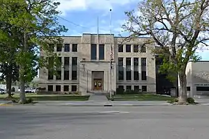 Hot Springs County Courthouse | |
 Flag | |
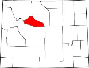 Location within the U.S. state of Wyoming | |
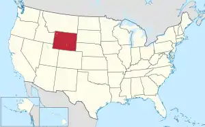 Wyoming's location within the U.S. | |
| Coordinates: 43°43′N 108°26′W | |
| Country | |
| State | |
| Founded | February 21, 1911 (established) 1913 (organized) |
| Named for | Hot springs in the area |
| Seat | Thermopolis |
| Largest town | Thermopolis |
| Area | |
| • Total | 2,006 sq mi (5,200 km2) |
| • Land | 2,004 sq mi (5,190 km2) |
| • Water | 2.3 sq mi (6 km2) 0.1%% |
| Population (2010) | |
| • Total | 4,812 |
| • Estimate (2019) | 4,413 |
| • Density | 2.4/sq mi (0.93/km2) |
| Time zone | UTC−7 (Mountain) |
| • Summer (DST) | UTC−6 (MDT) |
| Congressional district | At-large |
| Website | www |
History
Hot Springs County was created on February 21, 1911 with of areas annexed from Big Horn, Fremont, and Park counties. It was organized in 1913.[3]
Hot Springs County was named for the hot springs located in the county seat of Thermopolis.[4]
In the 2008 United States presidential election, Hot Springs County was the only county in the entire Mountain West outside of Arizona where John McCain beat George W. Bush's percentage of the county vote from the 2004 election.[5]
Geography
According to the US Census Bureau, the county has a total area of 2,006 square miles (5,200 km2), of which 2,004 square miles (5,190 km2) is land and 2.3 square miles (6.0 km2) (0.1%) is water.[6] It is the smallest county in Wyoming by area and the largest county in the US that is a state's smallest county.
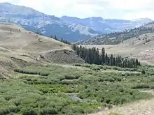
Hot Springs County includes the southern portion of Wyoming's Big Horn Basin, and is surrounded by mountains. Most of the Wind River Canyon, with the Owl Creek Mountains on the west and Bridger Mountains on the east is in Hot Springs County, while the Bighorn Mountains ring the east portion on the county and the Absaroka Range is to the west. A small portion of the Shoshone National Forest is in the western part of the county.
The Wind River Indian Reservation extends into southern Hot Springs County.
Adjacent counties
- Washakie County – northeast
- Fremont County – south and southwest
- Park County – northwest and north
National protected area
- Shoshone National Forest (part)
Demographics
| Historical population | |||
|---|---|---|---|
| Census | Pop. | %± | |
| 1920 | 5,164 | — | |
| 1930 | 5,476 | 6.0% | |
| 1940 | 4,607 | −15.9% | |
| 1950 | 5,250 | 14.0% | |
| 1960 | 6,365 | 21.2% | |
| 1970 | 4,952 | −22.2% | |
| 1980 | 5,710 | 15.3% | |
| 1990 | 4,809 | −15.8% | |
| 2000 | 4,882 | 1.5% | |
| 2010 | 4,812 | −1.4% | |
| 2019 (est.) | 4,413 | [7] | −8.3% |
| US Decennial Census[8] 1870–2000[9] 2010–2016[1] | |||
2000 census
As of the 2000 United States Census,[10] there were 4,882 people, 2,108 households, and 1,353 families in the county. The population density was 2 people per square mile (1/km2). There were 2,536 housing units at an average density of 1.3 per square mile (0.5/km2). The racial makeup of the county was 95.96% White, 0.35% Black or African American, 1.52% Native American, 0.25% Asian, 0.63% from other races, and 1.29% from two or more races. 2.38% of the population were Hispanic or Latino of any race. 23.3% were of German, 17.0% English, 12.2% Irish, 8.2% American and 6.0% Norwegian ancestry.
There were 2,108 households, out of which 25.50% had children under the age of 18 living with them, 54.30% were married couples living together, 7.40% had a female householder with no husband present, and 35.80% were non-families. 31.70% of all households were made up of individuals, and 14.80% had someone living alone who was 65 years of age or older. The average household size was 2.25 and the average family size was 2.82.
The county population contained 22.00% under the age of 18, 5.90% from 18 to 24, 23.30% from 25 to 44, 28.70% from 45 to 64, and 20.00% who were 65 years of age or older. The median age was 44 years. For every 100 females there were 92.70 males. For every 100 females age 18 and over, there were 89.80 males.
The median income for a household in the county was $29,888, and the median income for a family was $39,364. Males had a median income of $27,030 versus $18,667 for females. The per capita income for the county was $16,858. About 8.60% of families and 10.60% of the population were below the poverty line, including 12.10% of those under age 18 and 7.90% of those age 65 or over.
2010 census
As of the 2010 United States Census, there were 4,812 people, 2,185 households, and 1,362 families in the county.[11] The population density was 2.4 inhabitants per square mile (0.93/km2). There were 2,582 housing units at an average density of 1.3 per square mile (0.50/km2).[12] The racial makeup of the county was 95.8% white, 1.5% American Indian, 0.4% Asian, 0.2% black or African American, 0.1% Pacific islander, 0.5% from other races, and 1.5% from two or more races. Those of Hispanic or Latino origin made up 2.2% of the population.[11] In terms of ancestry, 30.1% were German, 15.3% were Irish, 15.1% were English, 8.4% were Scotch-Irish, and 8.3% were American.[13]
Of the 2,185 households, 23.5% had children under the age of 18 living with them, 50.5% were married couples living together, 8.3% had a female householder with no husband present, 37.7% were non-families, and 32.6% of all households were made up of individuals. The average household size was 2.16 and the average family size was 2.70. The median age was 48.6 years.[11]
The median income for a household in the county was $42,469 and the median income for a family was $54,709. Males had a median income of $41,186 versus $26,990 for females. The per capita income for the county was $25,269. About 6.8% of families and 9.1% of the population were below the poverty line, including 12.2% of those under age 18 and 5.7% of those age 65 or over.[14]
Communities
Towns
- East Thermopolis
- Kirby
- Thermopolis (county seat)
Unincorporated communities
Ghost Towns
Government and infrastructure
The Wyoming Department of Health Wyoming Pioneer Home, an assisted living facility for elderly people, is located in Thermopolis.[16][17] The facility was operated by the Wyoming Board of Charities and Reform until that agency was dissolved as a result of a state constitutional amendment passed in November 1990.[18]
Hot Springs County voters have been reliably Republican for many decades. In only one national election since 1948 did the county select the Democratic Party candidate (as of 2020).
| Year | Republican | Democratic | Third parties |
|---|---|---|---|
| 2020 | 77.6% 1,999 | 18.7% 482 | 3.7% 96 |
| 2016 | 75.0% 1,939 | 15.5% 400 | 9.6% 247 |
| 2012 | 75.4% 1,895 | 20.8% 523 | 3.9% 97 |
| 2008 | 72.0% 1,834 | 24.3% 619 | 3.7% 93 |
| 2004 | 73.1% 1,812 | 25.1% 623 | 1.8% 45 |
| 2000 | 73.7% 1,733 | 23.1% 544 | 3.2% 75 |
| 1996 | 55.3% 1,348 | 32.0% 779 | 12.7% 309 |
| 1992 | 40.8% 978 | 30.9% 740 | 28.4% 681 |
| 1988 | 64.1% 1,490 | 34.4% 800 | 1.5% 34 |
| 1984 | 73.4% 1,943 | 25.4% 672 | 1.2% 31 |
| 1980 | 62.7% 1,602 | 29.2% 745 | 8.1% 208 |
| 1976 | 59.4% 1,413 | 40.3% 958 | 0.3% 8 |
| 1972 | 70.9% 1,678 | 29.1% 689 | |
| 1968 | 59.4% 1,273 | 32.9% 705 | 7.7% 166 |
| 1964 | 47.1% 1,228 | 52.9% 1,380 | |
| 1960 | 59.2% 1,659 | 40.8% 1,144 | |
| 1956 | 63.0% 1,663 | 37.0% 977 | |
| 1952 | 64.7% 1,573 | 35.2% 856 | 0.1% 3 |
| 1948 | 44.8% 791 | 52.6% 928 | 2.6% 45 |
| 1944 | 47.5% 877 | 52.5% 969 | |
| 1940 | 41.6% 913 | 57.7% 1,266 | 0.7% 15 |
| 1936 | 34.3% 796 | 61.2% 1,419 | 4.5% 104 |
| 1932 | 31.5% 742 | 62.3% 1,466 | 6.2% 145 |
| 1928 | 55.3% 1,220 | 42.6% 940 | 2.0% 45 |
| 1924 | 45.7% 1,011 | 10.5% 231 | 43.8% 969 |
| 1920 | 64.6% 1,212 | 28.2% 529 | 7.2% 135 |
| 1916 | 37.3% 523 | 54.3% 760 | 8.4% 118 |
| 1912 | 27.1% 273 | 34.1% 343 | 38.8% 390[lower-alpha 1] |
Notes
- The leading “other” candidate, Progressive Theodore Roosevelt, received 298 votes, while Socialist candidate Eugene Debs received 80 votes, Prohibition candidate Eugene Chafin received 12 votes.
References
- "State & County QuickFacts". US Census Bureau. Archived from the original on June 6, 2011. Retrieved January 25, 2014.
- "Find a County". National Association of Counties. Archived from the original on May 31, 2011. Retrieved June 7, 2011.
- Long, John H., ed. (2004). "Wyoming: Individual County Chronologies". Wyoming Atlas of Historical County Boundaries. The Newberry Library. Archived from the original on August 3, 2015. Retrieved August 19, 2015.
- Urbanek, Mae (1988). Wyoming Place Names. Missoula MT: Mountain Press Pub. Co. ISBN 0-87842-204-8.
- Quinn, Sean (December 10, 2008). "The Mountain West: America's New Swing Region". Fivethirtyeight.com. Retrieved December 10, 2008.
- "2010 Census Gazetteer Files". US Census Bureau. August 22, 2012. Retrieved August 5, 2015.
- "Population and Housing Unit Estimates". Retrieved September 28, 2019.
- "US Decennial Census". US Census Bureau. Retrieved August 5, 2015.
- "Historical Decennial Census Population for Wyoming Counties, Cities, and Towns". Wyoming Department of Administration & Information, Division of Economic Analysis. Retrieved January 25, 2014.
- "U.S. Census website". US Census Bureau. Retrieved May 14, 2011.
- "Profile of General Population and Housing Characteristics: 2010 Demographic Profile Data". US Census Bureau. Archived from the original on February 13, 2020. Retrieved January 12, 2016.
- "Population, Housing Units, Area, and Density: 2010 - County". US Census Bureau. Archived from the original on February 13, 2020. Retrieved January 12, 2016.
- "Selected Social Characteristics in the US – 2006-2010 American Community Survey 5-Year Estimates". US Census Bureau. Archived from the original on February 13, 2020. Retrieved January 12, 2016.
- "Selected Economic Characteristics – 2006-2010 American Community Survey 5-Year Estimates". US Census Bureau. Archived from the original on February 13, 2020. Retrieved January 12, 2016.
- Embar WY Google Maps (accessed 10 January 2019)
- Wyoming Pioneer Home Archived August 21, 2007, at the Wayback Machine. Wyoming Department of Health. Retrieved December 12, 2010
- Thermopolis town, Wyoming. US Census Bureau. Retrieved December 12, 2010.
- About the Department of Corrections. Wyoming Department of Corrections. Retrieved August 22, 2010.
- Leip, David. "Atlas of US Presidential Elections". uselectionatlas.org. Retrieved April 5, 2018.
External links
| Wikimedia Commons has media related to Hot Springs County, Wyoming. |
Places adjacent to Hot Springs County, Wyoming | ||||||||||
|---|---|---|---|---|---|---|---|---|---|---|
| ||||||||||
Municipalities and communities of Hot Springs County, Wyoming, United States | ||
|---|---|---|
| Towns | | |
| CDPs | ||
| Unincorporated community | ||
| Ghost town | ||
| Indian reservation | ||
| ||
| Authority control |
|---|