Platte County, Wyoming
Platte County is a county located in the U.S. state of Wyoming. As of the 2010 United States Census, the population was 8,667.[1] Its county seat is Wheatland.[2]
Platte County | |
|---|---|
 | |
 Flag | |
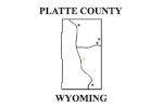
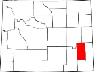 Location within the U.S. state of Wyoming | |
 Wyoming's location within the U.S. | |
| Coordinates: 42°08′N 104°58′W | |
| Country | |
| State | |
| Founded | February 21, 1911 (authorized) 1913 (organized) |
| Named for | North Platte River |
| Seat | Wheatland |
| Largest town | Wheatland |
| Area | |
| • Total | 2,111 sq mi (5,470 km2) |
| • Land | 2,084 sq mi (5,400 km2) |
| • Water | 27 sq mi (70 km2) 1.3%% |
| Population (2010) | |
| • Total | 8,667 |
| • Estimate (2019) | 8,393 |
| • Density | 4.1/sq mi (1.6/km2) |
| Time zone | UTC−7 (Mountain) |
| • Summer (DST) | UTC−6 (MDT) |
| Congressional district | At-large |
| Website | plattecountywyoming |
History
Platte County was created February 21, 1911 with land detached from Laramie County and organized in 1913.[3] The county was named for the North Platte River, which flows through the northeastern part of the county.[4]
Geography
According to the US Census Bureau, the county has a total area of 2,111 square miles (5,470 km2), of which 2,084 square miles (5,400 km2) is land and 27 square miles (70 km2) (1.3%) is water.[5] It is the third-smallest county in Wyoming by area.
Adjacent counties
- Niobrara County (northeast)
- Goshen County (east)
- Laramie County (south)
- Albany County (west)
- Converse County (northwest)
National protected area
- Medicine Bow National Forest (part)
Major Highways
 Interstate 25
 U.S. Highway 26
 U.S. Highway 87
 Wyoming Highway 34
Demographics
| Historical population | |||
|---|---|---|---|
| Census | Pop. | %± | |
| 1920 | 7,421 | — | |
| 1930 | 9,695 | 30.6% | |
| 1940 | 8,013 | −17.3% | |
| 1950 | 7,925 | −1.1% | |
| 1960 | 7,195 | −9.2% | |
| 1970 | 6,486 | −9.9% | |
| 1980 | 11,975 | 84.6% | |
| 1990 | 8,145 | −32.0% | |
| 2000 | 8,807 | 8.1% | |
| 2010 | 8,667 | −1.6% | |
| 2019 (est.) | 8,393 | [6] | −3.2% |
| US Decennial Census[7] 1870–2000[8] 2010–2016[1] | |||
2000 census
As of the 2000 United States Census,[9] there were 8,807 people, 3,625 households, and 2,494 families in the county. The population density was 4 people per square mile (2/km2). There were 4,528 housing units at an average density of 2 per square mile (1/km2). The racial makeup of the county was 96.18% White, 0.16% Black or African American, 0.50% Native American, 0.17% Asian, 0.02% Pacific Islander, 1.69% from other races, and 1.27% from two or more races. 5.28% of the population were Hispanic or Latino of any race. 31.7% were of German, 13.4% Irish, 11.3% English and 7.5% American ancestry.
There were 3,625 households, out of which 30.00% had children under the age of 18 living with them, 58.90% were married couples living together, 6.80% had a female householder with no husband present, and 31.20% were non-families. 27.30% of all households were made up of individuals, and 13.20% had someone living alone who was 65 years of age or older. The average household size was 2.40 and the average family size was 2.92.
The county population contained 25.40% under the age of 18, 6.60% from 18 to 24, 24.30% from 25 to 44, 27.30% from 45 to 64, and 16.60% who were 65 years of age or older. The median age was 41 years. For every 100 females there were 97.40 males. For every 100 females age 18 and over, there were 96.50 males.
The median income for a household in the county was $33,866, and the median income for a family was $41,449. Males had a median income of $31,484 versus $19,635 for females. The per capita income for the county was $17,530. About 8.50% of families and 11.70% of the population were below the poverty line, including 15.90% of those under age 18 and 12.20% of those age 65 or over.
2010 census
As of the 2010 United States Census, there were 8,667 people, 3,838 households, and 2,505 families in the county.[10] The population density was 4.2 inhabitants per square mile (1.6/km2). There were 4,667 housing units at an average density of 2.2 per square mile (0.85/km2).[11] The racial makeup of the county was 95.4% white, 0.4% Asian, 0.4% American Indian, 0.3% black or African American, 0.1% Pacific islander, 2.0% from other races, and 1.5% from two or more races. Those of Hispanic or Latino origin made up 6.7% of the population.[10] In terms of ancestry, 45.3% were German, 21.1% were English, 17.3% were Irish, and 6.2% were American.[12]
Of the 3,838 households, 24.5% had children under the age of 18 living with them, 54.9% were married couples living together, 6.9% had a female householder with no husband present, 34.7% were non-families, and 30.6% of all households were made up of individuals. The average household size was 2.23 and the average family size was 2.76. The median age was 47.5 years.[10]
The median income for a household in the county was $42,947 and the median income for a family was $51,759. Males had a median income of $55,757 versus $29,366 for females. The per capita income for the county was $24,185. About 6.1% of families and 10.3% of the population were below the poverty line, including 18.2% of those under age 18 and 3.5% of those age 65 or over.[13]
Communities
Census-designated places
Ghost towns
Notable people
- Larry Birleffi, the "Voice of the University of Wyoming Cowboys"
- Jim Geringer, governor of Wyoming
- Robert Mills Grant, Wyoming State Representative
- Harold Hellbaum, Wyoming State Representative and Speaker of the House
- Matt Robertson; singer, songwriter; albums include Bronc Star Just Cowboyin' Makin' History"
Politics
Platte County voters have been reliably Republican for decades. In only two national elections since 1940 has the county selected the Democratic Party candidate (as of 2020).
| Year | Republican | Democratic | Third parties |
|---|---|---|---|
| 2020 | 79.2% 3,898 | 18.1% 890 | 2.8% 135 |
| 2016 | 75.9% 3,437 | 15.9% 719 | 8.2% 373 |
| 2012 | 69.2% 3,136 | 27.0% 1,223 | 3.8% 172 |
| 2008 | 65.8% 3,002 | 30.9% 1,407 | 3.3% 151 |
| 2004 | 68.9% 3,149 | 29.0% 1,328 | 2.1% 97 |
| 2000 | 66.9% 2,925 | 28.6% 1,249 | 4.6% 199 |
| 1996 | 48.9% 2,155 | 37.0% 1,631 | 14.1% 622 |
| 1992 | 41.2% 1,668 | 34.5% 1,398 | 24.3% 985 |
| 1988 | 59.2% 2,253 | 38.9% 1,482 | 1.9% 73 |
| 1984 | 68.3% 2,813 | 29.9% 1,232 | 1.8% 75 |
| 1980 | 57.2% 2,642 | 33.7% 1,555 | 9.1% 421 |
| 1976 | 53.5% 1,844 | 46.2% 1,593 | 0.4% 13 |
| 1972 | 70.4% 2,200 | 29.6% 925 | 0.1% 2 |
| 1968 | 54.4% 1,613 | 34.9% 1,035 | 10.8% 319 |
| 1964 | 43.8% 1,470 | 56.3% 1,890 | |
| 1960 | 53.2% 1,771 | 46.8% 1,558 | |
| 1956 | 55.2% 1,848 | 44.8% 1,499 | |
| 1952 | 61.0% 2,148 | 38.7% 1,364 | 0.3% 12 |
| 1948 | 47.9% 1,366 | 51.4% 1,465 | 0.8% 22 |
| 1944 | 53.5% 1,776 | 46.5% 1,544 | |
| 1940 | 48.5% 1,758 | 51.1% 1,849 | 0.4% 15 |
| 1936 | 45.4% 1,546 | 50.8% 1,730 | 3.8% 130 |
| 1932 | 39.5% 1,430 | 52.2% 1,893 | 8.3% 301 |
| 1928 | 67.8% 2,206 | 28.6% 932 | 3.6% 118 |
| 1924 | 49.6% 1,383 | 15.6% 436 | 34.8% 972 |
| 1920 | 65.7% 1,405 | 32.5% 694 | 1.9% 40 |
| 1916 | 36.7% 806 | 58.1% 1,276 | 5.2% 115 |
| 1912 | 28.3% 500 | 44.5% 785 | 27.2% 480 |
References
- "State & County QuickFacts". US Census Bureau. Archived from the original on June 6, 2011. Retrieved January 25, 2014.
- "Find a County". National Association of Counties. Retrieved June 7, 2011.
- Long, John H., ed. (2004). "Wyoming: Individual County Chronologies". Wyoming Atlas of Historical County Boundaries. The Newberry Library. Archived from the original on August 3, 2015. Retrieved August 19, 2015.
- Urbanek, Mae (1988). Wyoming Place Names. Missoula MT: Mountain Press Pub. Co. ISBN 0-87842-204-8.
- "2010 Census Gazetteer Files". US Census Bureau. August 22, 2012. Retrieved August 18, 2015.
- "Population and Housing Unit Estimates". Retrieved September 28, 2019.
- "US Decennial Census". US Census Bureau. Retrieved August 18, 2015.
- "Historical Decennial Census Population for Wyoming Counties, Cities, and Towns". Wyoming Department of Administration & Information, Division of Economic Analysis. Retrieved January 25, 2014.
- "U.S. Census website". US Census Bureau. Retrieved May 14, 2011.
- "Profile of General Population and Housing Characteristics: 2010 Demographic Profile Data". US Census Bureau. Archived from the original on February 13, 2020. Retrieved January 12, 2016.
- "Population, Housing Units, Area, and Density: 2010 - County". US Census Bureau. Archived from the original on February 13, 2020. Retrieved January 12, 2016.
- "Selected Social Characteristics in the US – 2006-2010 American Community Survey 5-Year Estimates". US Census Bureau. Archived from the original on February 13, 2020. Retrieved January 12, 2016.
- "Selected Economic Characteristics – 2006-2010 American Community Survey 5-Year Estimates". US Census Bureau. Archived from the original on February 13, 2020. Retrieved January 12, 2016.
- Bordeaux WY Google Maps (accessed 13 January 2019)
- Diamond WY Google Maps (accessed 13 January 2019)
- Wendover WY Google Maps (accessed 13 January 2019)
- Leip, David. "Atlas of US Presidential Elections". uselectionatlas.org. Retrieved April 5, 2018.
External links
| Wikimedia Commons has media related to Platte County, Wyoming. |
Places adjacent to Platte County, Wyoming | ||||||||||
|---|---|---|---|---|---|---|---|---|---|---|
| ||||||||||
Municipalities and communities of Platte County, Wyoming, United States | ||
|---|---|---|
| Towns | | |
| CDPs | ||
| Unincorporated communities | ||
| Ghost town | ||
| ||
| Authority control |
|---|