National Register of Historic Places listings in Hot Springs County, Wyoming
This is a list of the National Register of Historic Places listings in Hot Springs County, Wyoming. It is intended to be a complete list of the properties and districts on the National Register of Historic Places in Hot Springs County, Wyoming, United States. The locations of National Register properties and districts for which the latitude and longitude coordinates are included below, may be seen in a map.[1]
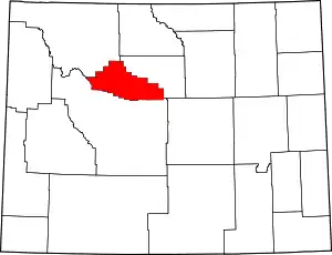
Location of Hot Springs County in Wyoming
There are 10 properties and districts listed on the National Register in the county.
- This National Park Service list is complete through NPS recent listings posted January 29, 2021.[2]
| Albany - Big Horn - Campbell - Carbon - Converse - Crook - Fremont - Goshen - Hot Springs - Johnson - Laramie - Lincoln - Natrona - Niobrara - Park - Platte - Sheridan - Sublette - Sweetwater - Teton - Uinta - Washakie - Weston |
Listings county-wide
| [3] | Name on the Register | Image | Date listed[4] | Location | City or town | Description |
|---|---|---|---|---|---|---|
| 1 | Bates Battlefield | November 20, 1974 (#74002286) |
Bates Creek 43°32′31″N 107°36′17″W |
East Thermopolis | ||
| 2 | Callaghan Apartments | Callaghan Apartments |
March 29, 1993 (#93000231) |
116 East Park Street 43°39′02″N 108°11′54″W |
Thermopolis | |
| 3 | CQA Four Mile Bridge | 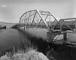 CQA Four Mile Bridge |
February 22, 1985 (#85000423) |
Wyoming Highway 173 43°36′13″N 108°11′48″W |
Thermopolis | Replaced in 1993 |
| 4 | Downtown Thermopolis Historic District | 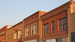 Downtown Thermopolis Historic District |
May 10, 1984 (#84003668) |
Broadway, 5th, and 6th Streets 43°38′46″N 108°12′37″W |
Thermopolis | |
| 5 | EFP Bridge over Owl Creek | 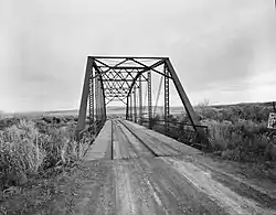 EFP Bridge over Owl Creek |
February 22, 1985 (#85000424) |
County Road CN15-28 43°41′28″N 108°23′34″W |
Thermopolis | Replaced |
| 6 | Alex Halone House | 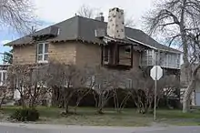 Alex Halone House |
January 14, 1994 (#93001473) |
204 Amoretti Street 43°38′30″N 108°12′12″W |
Thermopolis | |
| 7 | Kirby Jail and Town Hall |  Kirby Jail and Town Hall |
December 6, 2011 (#11000875) |
120 East 4th Street 43°48′18″N 108°10′49″W |
Kirby | |
| 8 | Legend Rock Petroglyph Site | 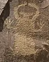 Legend Rock Petroglyph Site |
July 5, 1973 (#73001932) |
Address Restricted |
Grass Creek | |
| 9 | US Post Office-Thermopolis Main |  US Post Office-Thermopolis Main |
May 19, 1987 (#87000784) |
440 Arapahoe Street 43°38′51″N 108°12′33″W |
Thermopolis | |
| 10 | Woodruff Cabin Site | February 26, 1970 (#70000671) |
26 mi (42 km) northwest of Thermopolis 43°42′52″N 108°40′18″W |
Thermopolis |
See also
| Wikimedia Commons has media related to National Register of Historic Places in Hot Springs County, Wyoming. |
References
- The latitude and longitude information provided in this table was derived originally from the National Register Information System, which has been found to be fairly accurate for about 99% of listings. Some locations in this table may have been corrected to current GPS standards.
- "National Register of Historic Places: Weekly List Actions". National Park Service, United States Department of the Interior. Retrieved on January 29, 2021.
- Numbers represent an alphabetical ordering by significant words. Various colorings, defined here, differentiate National Historic Landmarks and historic districts from other NRHP buildings, structures, sites or objects.
- The eight-digit number below each date is the number assigned to each location in the National Register Information System database, which can be viewed by clicking the number.
| Topics | |
|---|---|
| Lists by state |
|
| Lists by insular areas | |
| Lists by associated state | |
| Other areas | |
| Related | |
| |
Municipalities and communities of Hot Springs County, Wyoming, United States | ||
|---|---|---|
| Towns | | |
| CDPs | ||
| Unincorporated community | ||
| Ghost town | ||
| Indian reservation | ||
| ||
This article is issued from Wikipedia. The text is licensed under Creative Commons - Attribution - Sharealike. Additional terms may apply for the media files.