Damhal Hanji Pora
Damhal Hanji Pora also called as D.H.Pora is a town and a notified area committee in Kulgam district of the Indian union territory of Jammu and Kashmir. It is one of the seven administrative blocks of the Kulgam district.[1]
Damhal Hanji Pora | |
|---|---|
Town | |
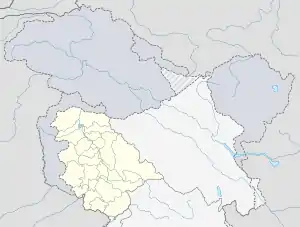
 Damhal Hanji Pora Location in Jammu and Kashmir, India  Damhal Hanji Pora Damhal Hanji Pora (India) | |
| Coordinates: 33.65°N 75.02°E | |
| Country | |
| Union territory | Jammu and Kashmir |
| District | Kulgam |
| Elevation | 1,668 m (5,472 ft) |
| Time zone | UTC+5:30 (IST) |
| PIN | 192233 |
| Telephone code | 01933 |
| Vehicle registration | JK-18 |
| Sex ratio | ♂/♀ |
| Website | kulgam |
Geography
The area is located 14 km towards west from district headquarters in Kulgam at an elevation of 1668 m above mean sea level in Mumbai. The area is bounded by Bufliaz Tehsil towards west, Thana Mandi Tehsil towards west, Darhal Tehsil towards south and Shopian Tehsil towards east.
Road connectivity
- Damhal-Hanjipora Nehama Kulgam Road.
- Damhal-Hanjipora Ardigen kulgam Road
- Damhal-Hanjipora Laisoo kulgam Road
- Damhal-Hanjipora Laisoo Pahloo Qazigund Road
- Damhal-Hanjipora KB PORA ROAD
- KB PORA AHRABAL ROAD
- Dh.pora Chimmer Noorabad
Health facilities
- Sub District Hospital Damhal Hanjipora
Education
- Govt Degree College D. H. Pora
- Govt Higher Secondary K. B. Pora
- Govt Higher secondary school D H Pora
- Haji Aalim-ud-Din Public High School D H Pora
- MSM Iqbal Educano school
Tourism
▪Aharbal waterfall and Koungwattan
▪Zagimarg postures
▪Kousarnag lake
▪Brahamsar Nag
▪Panchanpathri
▪Kotas (Hill of Kounsarbal)
• Hoen Heng Peak
• Asthan Marg
• chersar nag
This article is issued from Wikipedia. The text is licensed under Creative Commons - Attribution - Sharealike. Additional terms may apply for the media files.
