Kupwara
Kupwara is a town and a municipal council in Kupwara district in the Indian administered union territory of Jammu and Kashmir.Kupwara is mainly known for its production of nuts.
Kupwara
Kupwore | |
|---|---|
Town | |
 Kupwara Location in Jammu and Kashmir, India  Kupwara Kupwara (India) | |
| Coordinates: 34°31′33″N 74°15′19″E | |
| Country | |
| Union Territory | Jammu and Kashmir |
| District | Kupwara |
| Government | |
| • Type | Democratic |
| Area | |
| • Total | 4.10 km2 (1.58 sq mi) |
| Elevation | 1,615 m (5,299 ft) |
| Population | |
| • Total | 21,771 |
| • Density | 5,300/km2 (14,000/sq mi) |
| Demographics | |
| • Literacy | 86.6% |
| • Sex ratio | 439.9 |
| Time zone | UTC+5:30 (IST) |
| PIN | 193222 |
| Vehicle registration | JK09 |
| Website | kupwara |
Municipal council Kupwara is an Urban Local Body with 13 elected members (also in Delimitation in progress for wards), which administrates the town.
| Year | Pop. | ±% p.a. |
|---|---|---|
| 1981 | 3,072 | — |
| 2001 | 14,857 | +8.20% |
| 2011 | 21,771 | +3.90% |
| Source: [1] | ||
Demographics
As of 2011 India census, Kupwara had a population of 21,771.[2] There were 15,120 males (69%) and 6,651 females (31%).[2] Of the population, 2,093 (9.6%) were age 0-6: 1,082 males (52%) and 1,011 females (48%).[2] The literacy rate for the people over six was 86.6% (males 91.9%, females 73.5%).[2]
Education
Some of the institutions and colleges of Kupwara town Which provide quality education to the students of town Kupwara and from the other parts of district
- Government Degree College, Kupwara
- Women's Degree College Kupwara
- Govt Polytechnic College Kupwara
- Govt Boys Model Higher Secondary School Kupwara
- Girls Higher Secondary School Sulkoot
- Iqra Educational Institute Kupwara
- Kupwara Public School
- Alexandera Secondary School Kupwara
- Army Good Will School, Wayen
- Elite Higher Secondary School Kupwara
- Islamia Model High school
- Rehmat Alam Public School Kupwara
- Govt Middle school Kupwara
- Winning Edge School
- Rozat-Ul-Ilum School Of Thought (RISOT)
- Peak Valley Public School
- Un-Nadvia International School, Branwari
- IDPS Drugmula, Kupwara
- Sadiq Memorial Public School Sulkoot
- Kashmir University Satellite Campus Wayen, Kupwara (Currently under Construction)
- Dream World Educational Institute Allachizab Kupwara
- Shah-e-Hamdaan School (Zirhama)
Transport
Air
Kupwara doesn't have its own airport. But the helipad are located in Zangli, Drugmulla and Kunan village at a distance of 1 & 2 kilometres from Kupwara respectively. The nearest airport is Srinagar International Airport located at a distance of 94 kilometres and is a two and a half an hour drive. There are plans to build an airport in Kupwara at Panzgam.[3]
Rail
Kupwara doesn't have railway connectivity yet. The nearest railway stations are Baramulla railway station and Sopore railway station, located 42 and 50 kilometres from Kupwara respectively. There are plans to connect Kupwara by rail by extending the Jammu–Baramulla Rail Line up to Kupwara.[4]
Road
Kupwara is well-connected by road to other towns and villages in J&K and India by the Sopore-Kupwara Road, Kupwara-Trehgam Road, etc. The NH 701 passes through Kupwara.
Religion
The dominant religion in Kupwara is Islam, followed by over 84% of the people living in Kupwara. Other religions include Hinduism, Christianity and Sikhism followed by 12.8%, 0.4% and 1.6% respectively.[5]
Religion in Kupwara Town (2011)[6]
Politics
| # | Name[7] | Municipal Ward | Reservation Status | Party |
|---|---|---|---|---|
| 1 | Shareefa Begum | Jamia Qadeem Darusalam | Women Open | Independent |
| 2 | Mohd Sayed Masoodi | Quat Ul Islam | Open | Independent |
| 3 | Mushtaq Ahmed Wani | Darzipora | Open | Independent |
| 4 | Posha Begum | Doodwan | Women Open | Independent |
| 5 | Mohd. Iqbal Shah | Brunwari | Open | Independent |
| 6 | Ab. Ahad Sheikh | Regipora | Open | Independent |
| 7 | Posha Begum | Usman Abad | Women Open | Independent |
| 8 | Gh. Mohdin Mir | Sayeedabad | Open | Independent |
| 9 | Tariq Ah. Malik | Malik Mohalla | Open | Independent |
| 10 | Gulshana Begum | Ganie Mohalla | Women Open | Independent |
| 11 | Reyaz Ah. Mir | Galizoo | Open | Independent |
| 12 | Bashir Ahmad Khan | Zangli | Open | Independent |
| 13 | Bashir Ahmad Mareed | Goose | Open | Independent |
There is also Kupwara trade federation[8] for management of business affairs in town. Which is headed by president who is elected by town shopkeepers.
Climate
| Climate data for Kupwara (1981–2010, extremes 1977–2012) | |||||||||||||
|---|---|---|---|---|---|---|---|---|---|---|---|---|---|
| Month | Jan | Feb | Mar | Apr | May | Jun | Jul | Aug | Sep | Oct | Nov | Dec | Year |
| Record high °C (°F) | 16.2 (61.2) |
19.7 (67.5) |
27.3 (81.1) |
31.7 (89.1) |
34.8 (94.6) |
36.9 (98.4) |
37.6 (99.7) |
36.6 (97.9) |
35.8 (96.4) |
33.6 (92.5) |
25.7 (78.3) |
18.4 (65.1) |
37.6 (99.7) |
| Average high °C (°F) | 6.9 (44.4) |
9.0 (48.2) |
14.6 (58.3) |
20.7 (69.3) |
24.9 (76.8) |
28.6 (83.5) |
30.3 (86.5) |
30.4 (86.7) |
28.8 (83.8) |
23.3 (73.9) |
16.3 (61.3) |
9.5 (49.1) |
20.3 (68.5) |
| Average low °C (°F) | −2.7 (27.1) |
−1.0 (30.2) |
2.6 (36.7) |
6.5 (43.7) |
9.8 (49.6) |
13.2 (55.8) |
16.7 (62.1) |
16.4 (61.5) |
11.1 (52.0) |
5.1 (41.2) |
0.4 (32.7) |
−2.0 (28.4) |
6.3 (43.3) |
| Record low °C (°F) | −15.7 (3.7) |
−12.0 (10.4) |
−7.0 (19.4) |
0.1 (32.2) |
0.6 (33.1) |
6.5 (43.7) |
9.0 (48.2) |
8.0 (46.4) |
4.0 (39.2) |
−1.5 (29.3) |
−5.5 (22.1) |
−9.4 (15.1) |
−15.7 (3.7) |
| Average rainfall mm (inches) | 92.5 (3.64) |
128.3 (5.05) |
190.9 (7.52) |
151.4 (5.96) |
95.8 (3.77) |
54.3 (2.14) |
90.9 (3.58) |
72.2 (2.84) |
34.8 (1.37) |
43.6 (1.72) |
45.8 (1.80) |
68.6 (2.70) |
1,069.1 (42.09) |
| Average rainy days | 7.4 | 9.4 | 10.5 | 9.2 | 7.3 | 4.7 | 6.3 | 5.2 | 2.9 | 3.1 | 3.2 | 4.9 | 74.2 |
| Average relative humidity (%) (at 17:30 IST) | 77 | 73 | 68 | 62 | 59 | 56 | 62 | 62 | 56 | 58 | 65 | 73 | 64 |
| Source: India Meteorological Department[9][10] | |||||||||||||
Market
Kupwara town is usually known as market hub of district.
References
- A-4 Towns And Urban Agglomerations Classified By Population Size Class In 2011 With Variation Since 1901. Office of the Registrar General & Census Commissioner, Ministry of Home Affairs, Government of India (Report).
Class - III Population of 20,000 and 49,999 (Report). - District Census Handbook Kupwara, Part B (PDF). Census of India 2011 (Report). 16 June 2014. pp. 22–23. Retrieved 9 February 2021.
- "Centre plans to build 11 new airports in J&K, 2 in Ladakh". Kashmir Life. Retrieved 17 March 2020.
- "Centre approves Baramulla-Kupwara rail link". Economic Times. Retrieved 17 March 2020.
- "C-1 Population By Religious Community". Census. Retrieved 10 June 2019.
- "C-1 Population By Religious Community". Census. Retrieved 10 June 2019.
- http://ceojammukashmir.nic.in/pdf/municipal%20Election/Result_Notifi_Corp.pdf
- Desk, K. R. (15 July 2020). "Traders Federation call on DC Kupwara". Kashmir Reader. Retrieved 25 December 2020.
- "Station: Kupwara Climatological Table 1981–2010" (PDF). Climatological Normals 1981–2010. India Meteorological Department. January 2015. pp. 441–442. Archived from the original (PDF) on 5 February 2020. Retrieved 24 March 2020.
- "Extremes of Temperature & Rainfall for Indian Stations (Up to 2012)" (PDF). India Meteorological Department. December 2016. p. M77. Archived from the original (PDF) on 5 February 2020. Retrieved 24 March 2020.
| Passes | 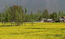 | |
|---|---|---|
| Valleys | ||
| Cities | ||
| Towns |
| |
| Rivers | ||
| Glaciers | ||
| Lakes | ||
| Mountains | ||
| Hill stations and Mughal gardens | ||
| Protected Areas | ||
| See also | ||